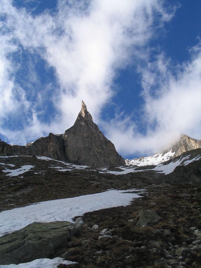
The Aiguille Dibona, formerly called (Aiguille du) Pain de Sucre du Soreiller (3,130 m (10,269 ft)) is a mountain in the French Alps, in the Massif des Écrins, notable for its "astonishing triangular granite spear."
Because of its singular shape, the ease of access, and the exceptional quality of its granite the mountain is very popular among climbers. The many routes on the mountain are among the most popular in the Écrins. Formerly called Pain de Sucre du Soreiller, it was renamed for Angelo Dibona, the Dolomites guide and mountaineer, who made the first ascent on 27 June 1913 with Guido Mayer. At the foot of the mountain is the refuge du Soreiller, accessible in 3h30m from the village of Étages.
The nearest mountain hut is Refuge du Soreiller located 734m/2 407ft SSE of the summit.
We use GPS information embedded into the photo when it is available.
3D mountains overlay
Adjust mountain panorama to perfectly match your photos because recorded by camera photo position might be imprecise.
Move tool
Rotate tool
Zoom
More customization
Choose which peak labels should make into the final photo and what photo title should be.
Next
Photo Location
Satellitte
Flat map
Relief map
Latitude
Longitude
Altitude
OR
Latitude
°'''
Longitude
°'''
Apply
Register Peak
Peak Name
Latitude
Longitude
Altitude
Register
Teleport
PeakVisor
This 3D model of Sagarmatha National Park in Nepal was made using the PeakVisor app topographic data. The mobile app features higher precision models worldwide, more topographic details, and works offline. Download PeakVisor maps today.
Download OBJ model
PeakVisor
The download should start shortly. If you find it useful please consider supporting the PeakVisor app.
PeakVisor for iOS and Android
Be a superhero of outdoor navigation with state-of-the-art 3D maps and mountain identification in the palm of your hand!