
Scan the QR code and open PeakVisor on your phone
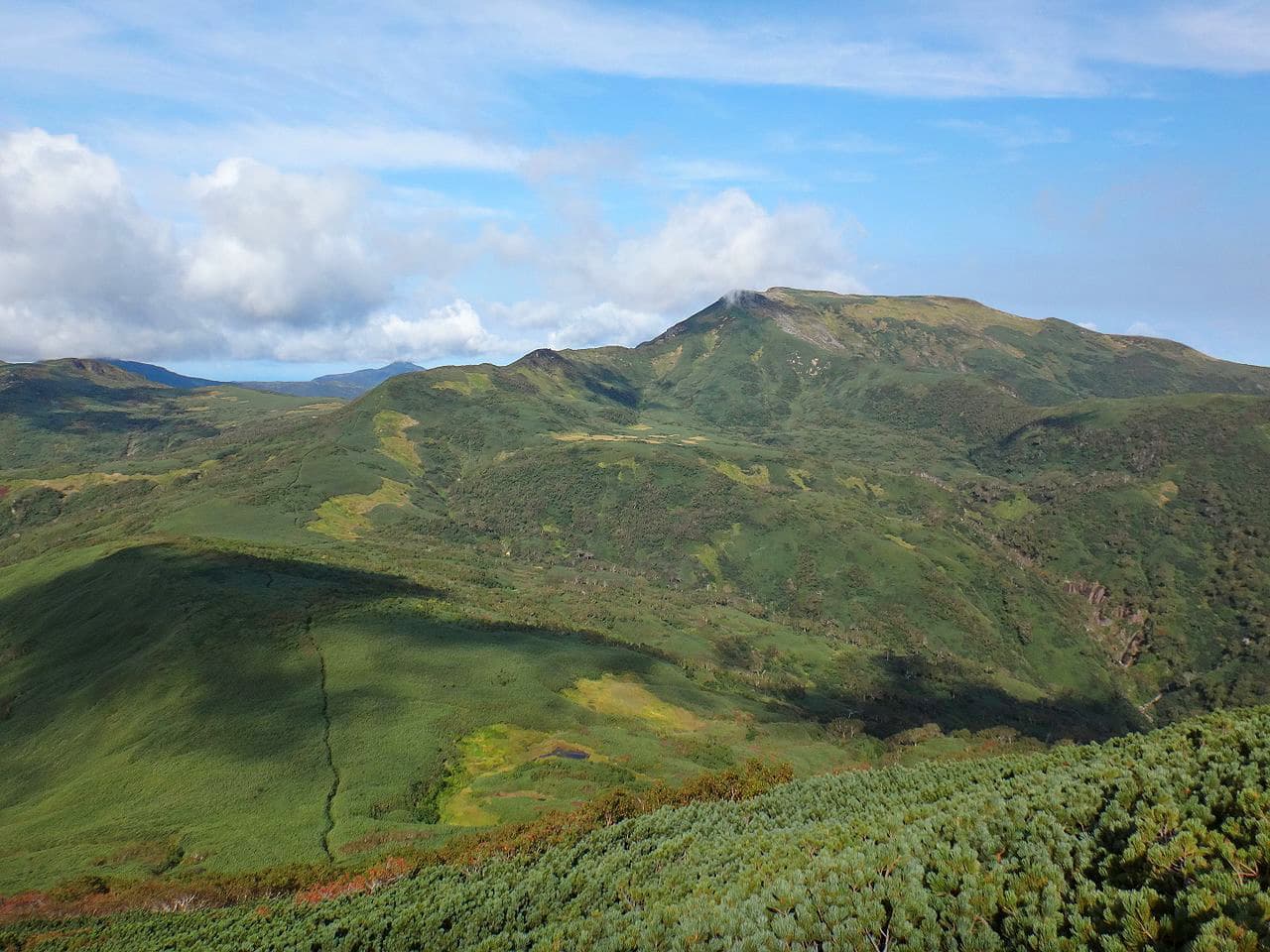
There are 22 named mountains in the Mashike Mountains (増毛山地). The highest and the most prominent is Shokanbetsu Dake. The Mashike Mountains are a group of volcanic peaks of moderate height divided into two sections: the Shokanbetsu Mountains and the Kabato Mountains. Mt. Minami Shokan (1,257m), Mt. Gunbetsu (692m) and Mt. Etai (1,010m) make up a triangle that surrounds the Uryunuma-Shitsugen Wetland. The Mashike Mountains are adjacent to the Japanese Sea, which gives the area a peculiar climate characterized by cloudy winters and heavy snow storms. However, when the sky is clear the mountains sparkle in the sun and the Mashike peaks are clearly visible from Sapporo creating a dreamland-like atmosphere.
Mt. Shokanbetsu (1,491m) offers three trails:
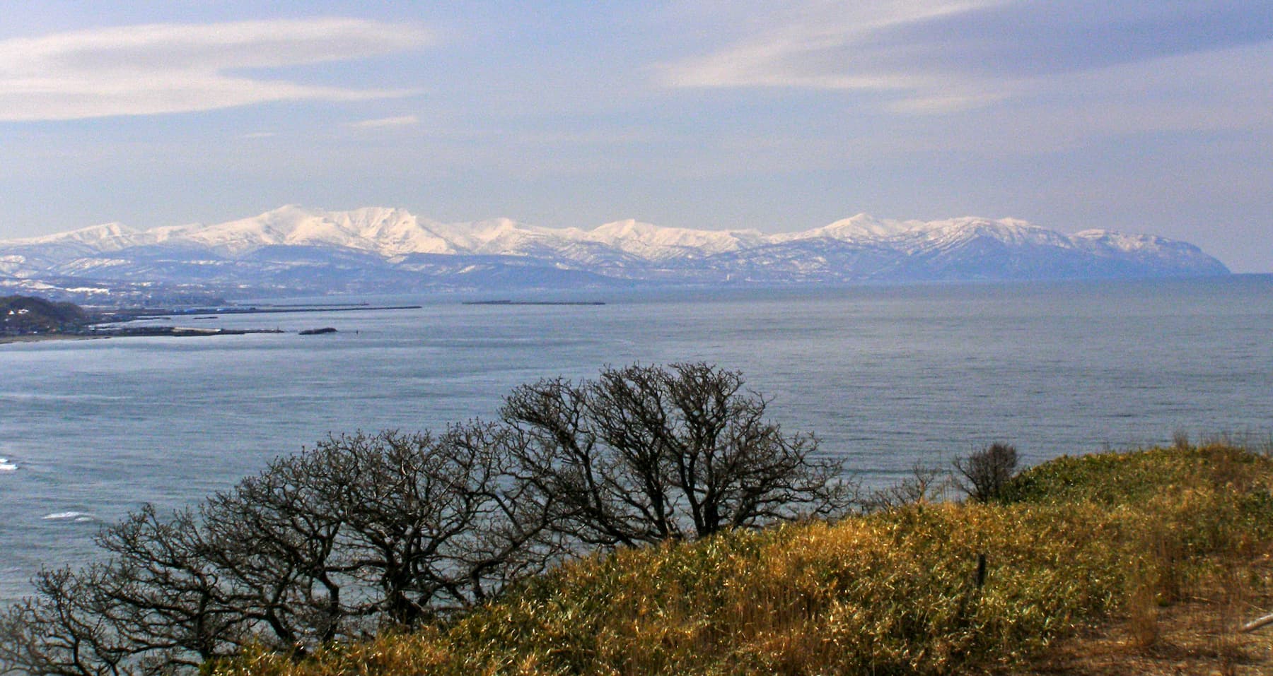
Hosting over 100 species of beautiful alpine plants, the area is not limited to wildflowers and botanist’s delight only. It also offers breathtaking views of the surrounding areas. When the ski is clear, it is possible to see the Sea of Japan, Mount Daisetsu, Mount Rishiri, Mount Hamamasu and other beautiful mountains.
On each route, there is a hut where hikers can make a stop and stay if they are planning a long hike. Also, there is a box here where you can register your hiking intentions just in case you get lost or for any emergency. However, this is a peak recommended to fearless and tireless hikers.
The nearby Shokanbetsudake Ski Resort offers ample opportunities to practice winter sports. There are 5 different ski runs of easy, intermediate and difficult levels and a run specially for snowboarders.
Despite the moderate elevation, Mt. Ogonzan (739m) is also called Hamamasu Fuji because the view is clear for a long distance from the summit. Also, its shape is quite irregular, with cliffs and huge precipices. The ascent is relatively short, only 4,5km feasible in 2h40m. The moderate difficulties, the walking time and the short distance from Sapporo (about 1h), makes this mountain a popular destination for beginners and people who want to take a stroll during the weekend. There is an Old Trail and a New Trail. The new one is easier to climb, especially if you suffer from dizziness because there are no narrow passages among the cliffs.
Mt. Hamamasu (浜益岳 1,143m) and Mt. Hamamasugoten (浜益御殿846m) offer better entertainment in winter because the terrain is full of ups and downs, which makes it particularly suitable for skiing and snowshoe walking. They are far less crowded in summer and, except for local people, they are not particularly popular among hikers who barely know about their existence. Hikers can start in the northern part of Ishikari city. The trails are not always well-marked and the entire ridge is wide, so if you don’t have a trained eye of the PeakVisor app, you may get lost. It takes about 4h from Mt. Hamamasugoten to reach Mt. Hamamasu . If you are strong enough to make the descent in 30m, you can also plan to drop at Mt. Ofuyu (雄冬山), which will take about 1h10m and then proceed to Mt. Hamamasu . There aren't any signposts, so it is easy to get lost if you are not an expert, even if you are using a GPS device.
Kabato Sanzan (樺戸三山) actually indicates a group of three peaks:
Judging by their names, these peaks were probably respected and worshipped as holy mountains in ancient times. Mt. Pinneshiri is a particularly rugged mountain with two climbing routes: Shintotsukawa Route and Dōmin no Mori Route. Both trailheads are located near the Shintotsukawa Sotchidake Ski Area but the latter route is shorter and feasible in about 1h30m. Mt. Kamuishiri is visible from Mt. Pinneshiri summit. There is a junction trail on Mt. Pinneshiri leading to Mt. Kamuishiri, yet do not be deceived, it is not accessible anymore.
The main routes to climb Mt. Kamuishiri are three and all feasible in about 2h. Though the summit does not reach 1000m, the precipitous ridgeline gives an impression of a more majestic peak.
The most convenient way to reach Mt. Machine is to take the Sakinsawa Route (砂金沢) from Mt. Pinneshiri, a 6km trail feasible in 2h. Since there aren’t any signposts, hikers must pay attention not to get lost. However, at the foot of these mountains, hikers can find small boxes where they can write their hiking plan in case they get lost local authorities can come to rescue them.Mt. Chiraidake (654m) – Mt. Okutoppu (1,346m) - Mt. Gunbetsu(692m) - Mt.Minamishokanbetsu (1,257m) – Mt. Otaki (946m) is a long trail that traverses 5 minor mountains of the range. It takes 14h to be completed by ski in winter. Expert hikers may try to complete the route in one day starting from Toppu Dam. This is not an official trail, so it is not well-marked and hikers must be well equipped to face the challenge. A point of interest on this route is the mysterious ice structures known as “ice bamboo”. “Ice bamboo” is a sort of ice stalagmite found primarily in caves in this area.
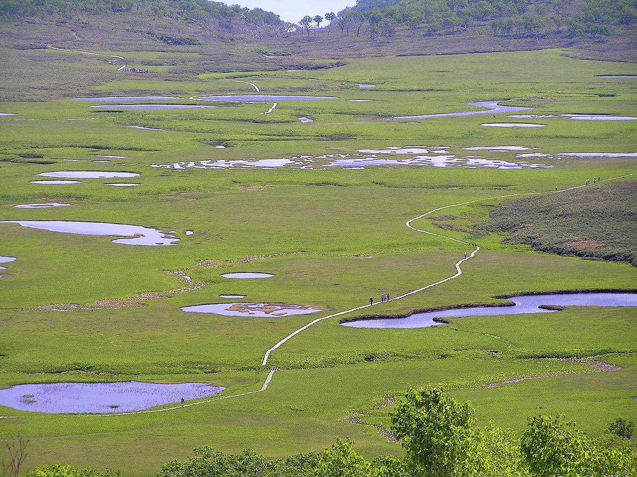
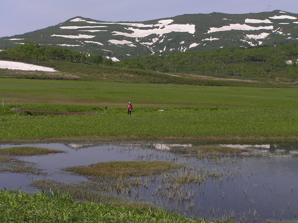
The Uryunuma-Shitsugen Wetlands are one of the numerous Hokkaido’s wetlands, originated thousands of years ago as a result of volcanic activities. What is peculiar though is the fact that these Wetlands are located approximately at 850m above sea level. They extend for about 100 hectares and host more than 100 small and large ponds besides numerous species of flowers and other endemic plants. The wetlands are located inside a park and they can be reached after two hours of climbing.
Mashike area combines the typical atmosphere of a mountainous region with a fresh scent given by the short distance from the sea. Peaks like Mt. Shokanbetsu lie on the shore of the Sea of Japan thus creating the steep cliffs of the Ofuyu Coast.
The sea plays an important role in the region. In fact, more than for its mountains, Mashike is known as one of the oldest fishing towns of the entire Japan. It takes about 2h to reach the area from Sapporo but public transport is so untypically not efficient in this part of the island, therefore, renting a car to reach the nearest area to your hiking route is probably the best option to save time and enjoy this part of Hokkaido full of regional tastes, historical and natural beauty.
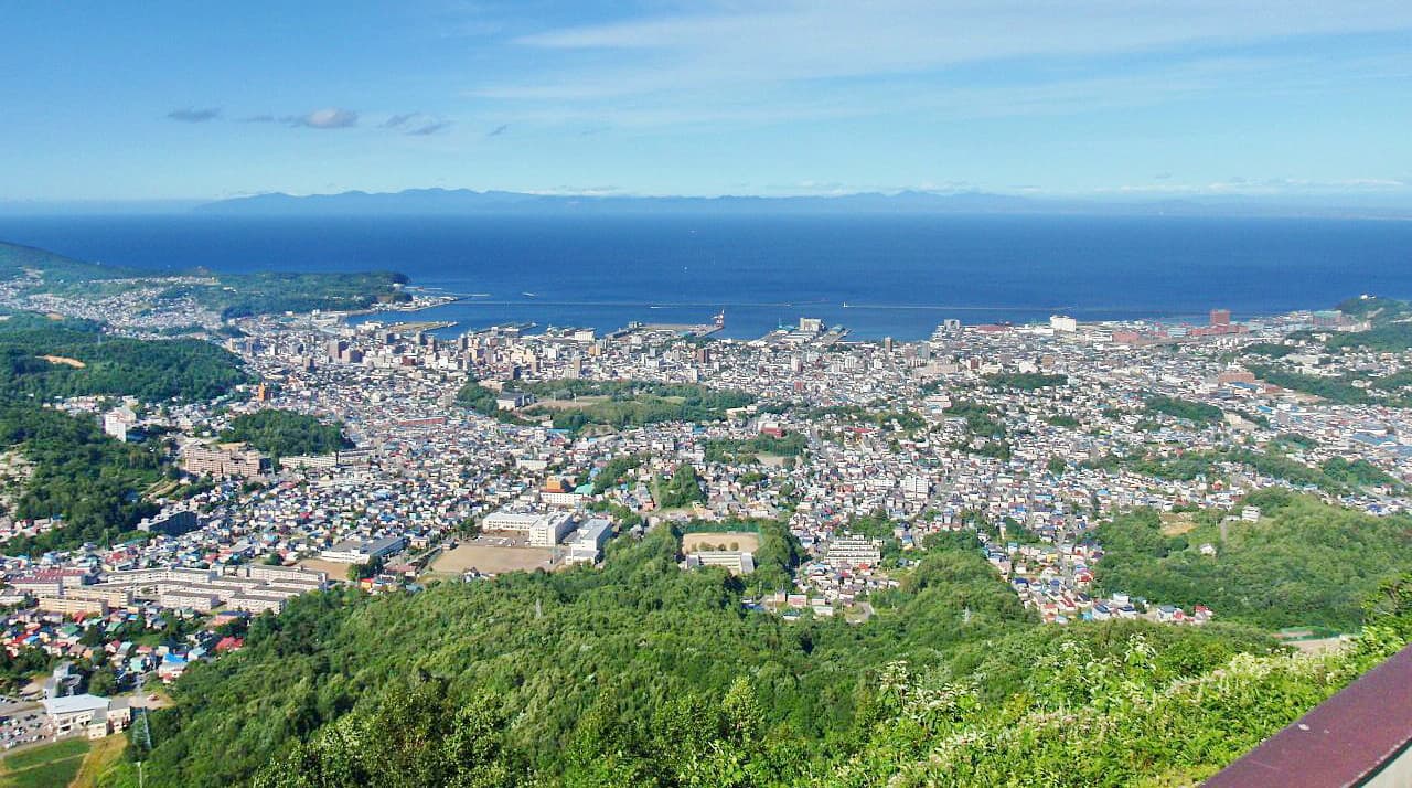
The cities of the area include:


_2009-04-08.jpg)