
Scan the QR code and open PeakVisor on your phone
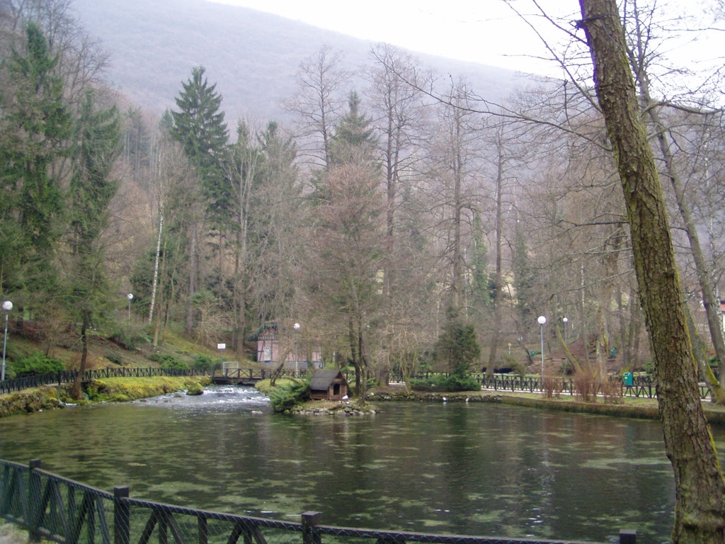
The Bosnia Spring Natural Monument lies on the outskirts of Sarajevo. The family-friendly park is perfect for locals and visitors alike, with clear water, beautiful walkways, and forests.
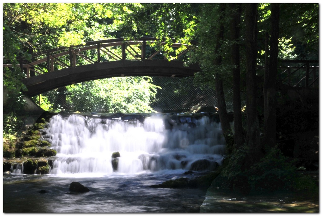
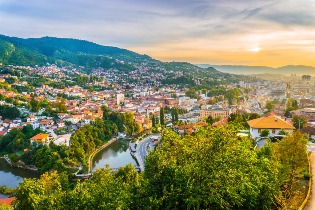
Situated on the outskirts of Sarajevo, the capital city of Bosnia and Herzegovina, Vrelo Bosne, or Bosnia Spring Natural Monument, is renowned for its stunning springs and the meandering River Bosna.
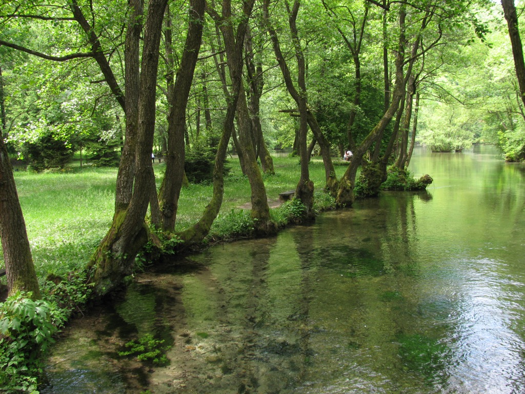
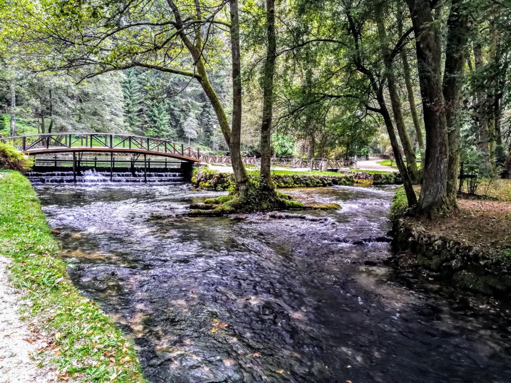
The park covers an area of 550 ha (1,359 ar) and boasts a diverse array of flora and fauna, encompassing several small islands interconnected by charming bridges. Visitors can explore the park's myriad walking trails, weaving through forests and tracing the river's banks.
On May 25, 2006, the Law Declaring the "Vrelo Bosne" a Natural Monument was ratified. In alignment with the degree of protection, two designated zones were established: the nucleus and the buffer zone. The first zone encompasses the source of the Bosna River and its surroundings, spanning 54.5 ha (134.6 ar), while the second zone covers a more extensive area.
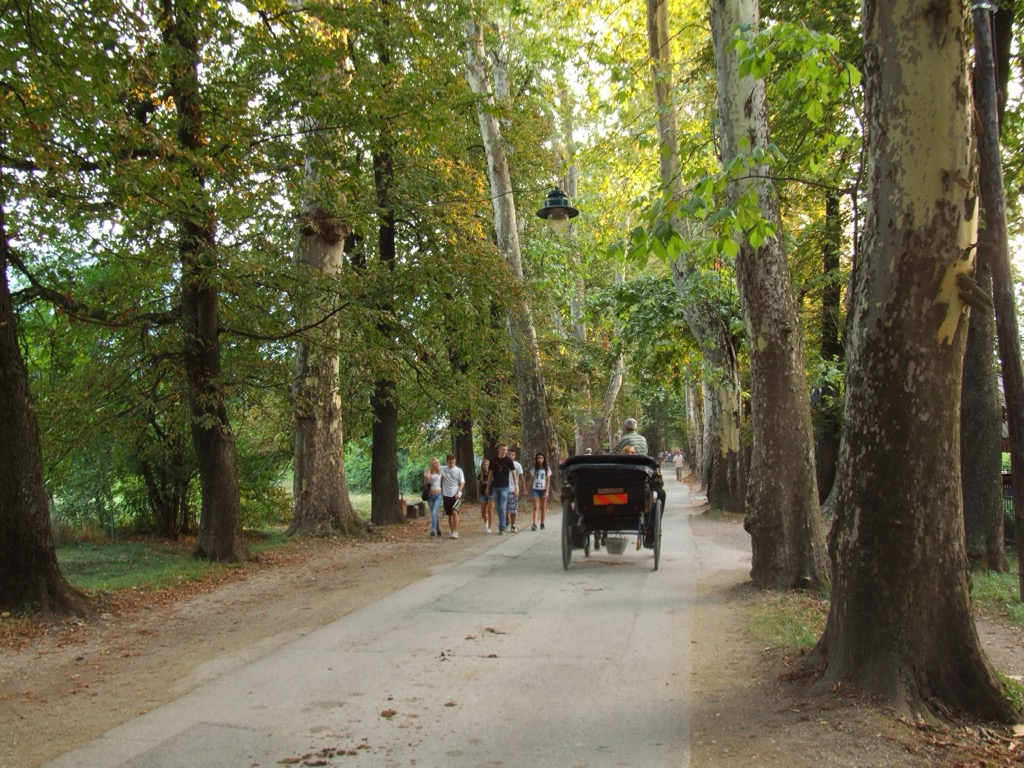
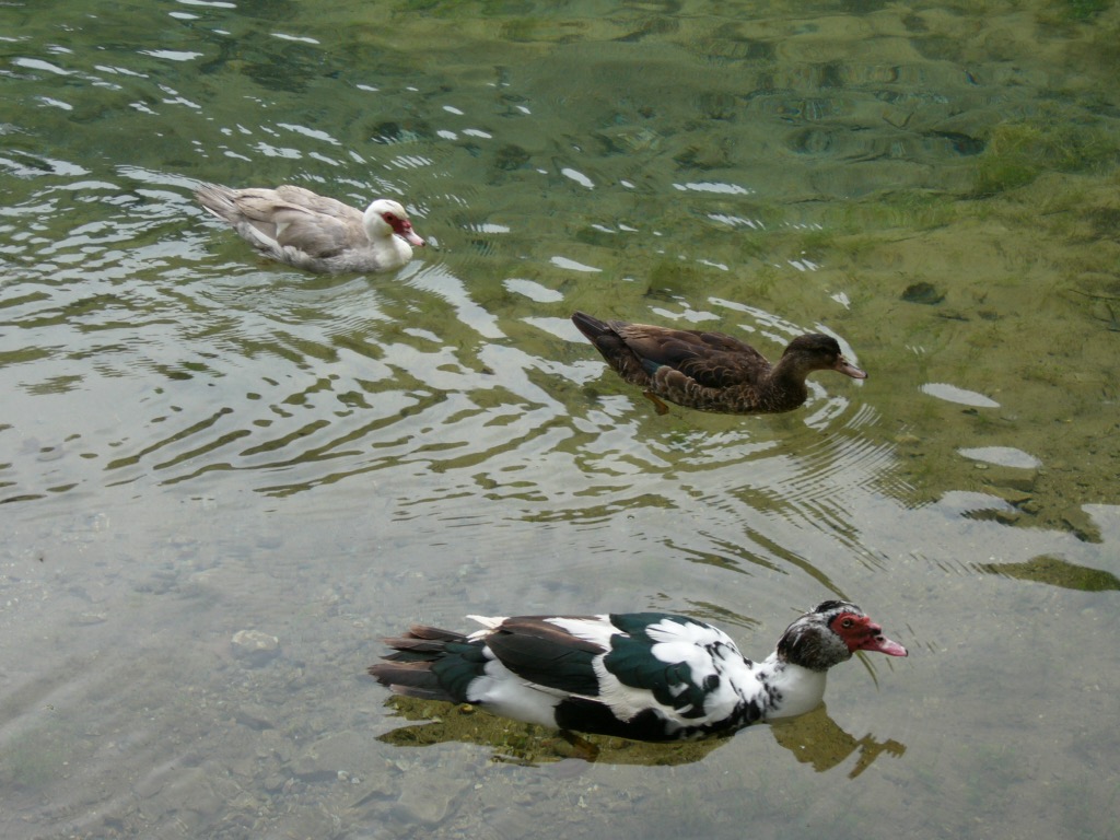
Today, Vrelo Bosne is a tourist attraction for both international visitors and nearby residents seeking solace in nature. Comprising numerous small streams that form the river, the park is home to various animals, including ducks and swans. Additionally, the park offers attractions such as horse-drawn carriages and restaurants.
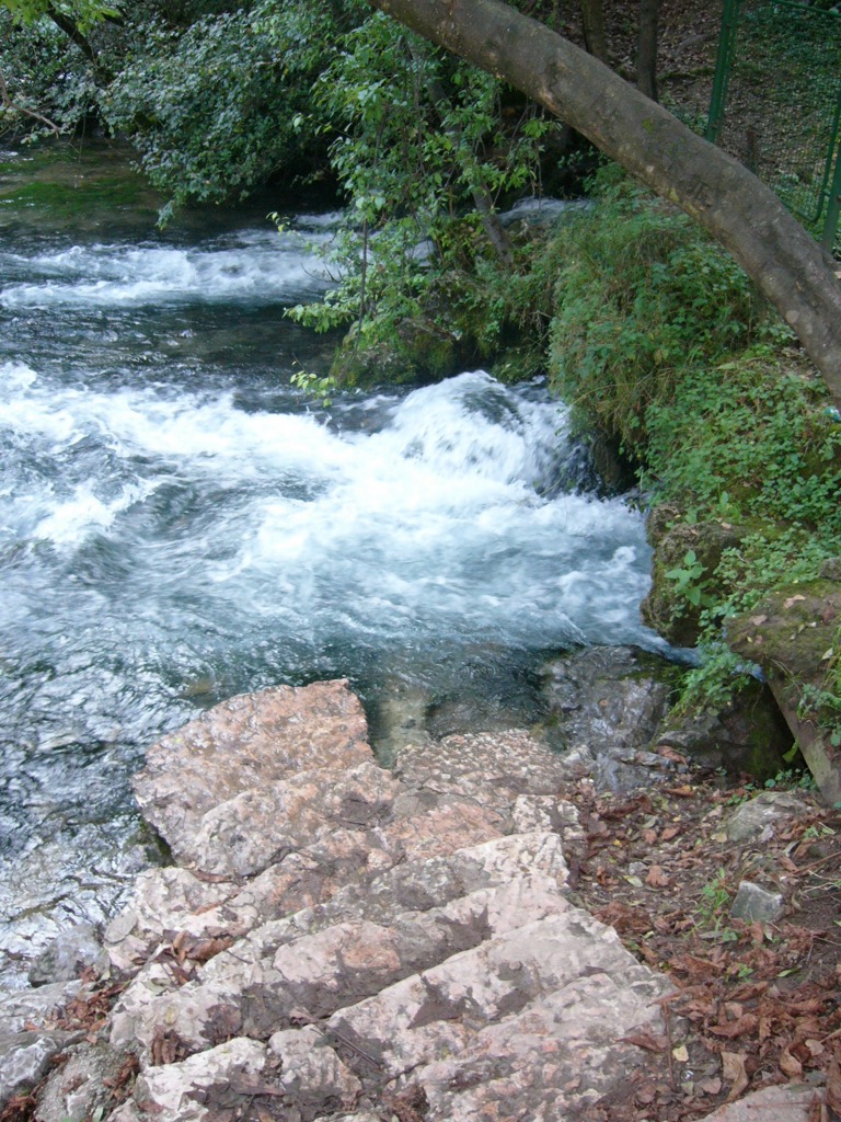
The spring of the Bosna River is a crucial water source for Sarajevo. Vrelo Bosne emerges just a short distance - 12 km / 7.5 miles - from the bustling city.
The Mala Bosna, the initial segment of the Bosna River, originates from the Vrelo Bosne spring, situated at 520 m (1,710 ft). The Vrelo Bosne is on Sarajevo's outskirts at Mount Igman's base. The Igman and Bjelašnica mountains define the catchment area of the spring. The area around Vrelo Bosne serves as the primary source of potable water, "Bačevo," for Sarajevo.
The Bosnia River is the longest in Bosnia and Herzegovina; the river traverses 270 km across the central part of Bosnia before joining the Sava River near Bosanski Šamac.
The broader region surrounding Vrelo Bosne exhibits significant biodiversity. More than 26 distinct plant communities have established themselves in this area, some with human intervention. The tree composition is predominantly influenced by cultivated and planted species in parks and alleys, interspersed with segments featuring wild species.
The animal population in both aquatic and terrestrial environments correlates with the rich diversity of plant cover. As per the latest data, 20 mammal species have been identified, with some having connections to the slopes of Mount Igman.
Indigenous brown trout dominates the fish population, particularly in the area from Little Bosnia to Plandište, alongside non-native California trout and grayling, which have successfully adapted to this watercourse section.
The slopes of Stojčevac are linked to Vrelo Bosne through a Grand alley featuring trees like pedunculate oak and linden trees. The area bordered by Mount Igman's slopes boasts 49 tree species, complemented by wild roses, raspberries, and blackberries.
According to population density records, Ilidža, a municipality with historical roots dating back to the Neolithic period, is the oldest settlement in the central part of Bosnia. In Roman times, Ilidža was known as Aquae S. The Turkish-origin name "Ilidža" itself translates to a spa, reflecting the historical organization of fairs and excursions around the spring of Bosnia.
A site of archaeological significance is Stojčevac, with a pre-Romanesque church dedicated to St. Stephen in the second half of the ninth or the first decades of the tenth century. Over the centuries, the church underwent reconstruction and eventual demolition, giving rise to a necropolis with around 80 stećak tombstones in and around its ruins.
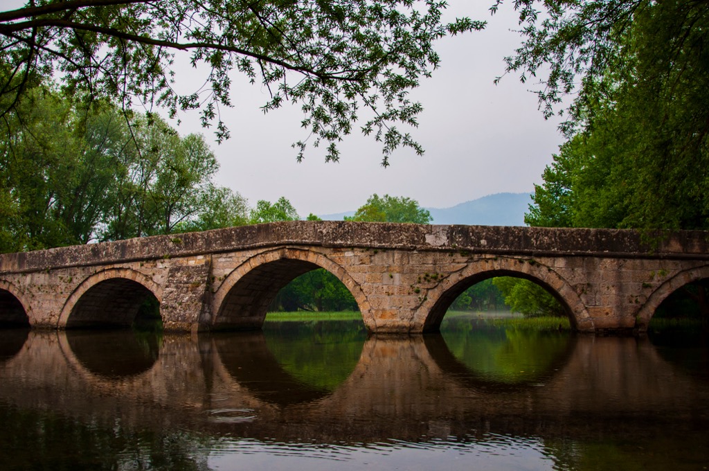
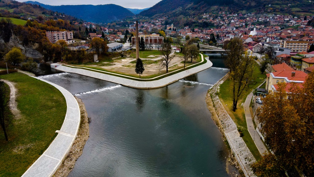
The Roman Bridge, located near Vrelo Bosne in the Ilidža municipality, was reconstructed between 1530 and 1550 using original Roman stones and remnants. The bridge, often called the bridge at Plandište, still boasts Roman masonry details, making it a protected cultural monument.
The present-day appearance of the Ilidža area, including Vrelo Bosne, was shaped during Austro-Hungarian rule. A pivotal moment in Ilidža's spa development occurred in 1885 when the Provincial Government assumed control, fostering the growth of the spa complex and the broader Ilidža surroundings. This period saw the emergence of recreational sports in the Vrelo Bosne area, including hunting, fishing, horseback riding, boating, excursions, and hiking.
Notable establishments like hotels and villas were constructed. Over the past 50 years, this region has evolved into a favored picnic spot for Sarajevo citizens.
The hike from Vrelo Bosne to the Roman Bridge is approximately 5 km (3.1 mi). The trail commences at the picturesque Vrelo Bosne and meanders through lush grasslands.
As you set out, the path from the entrance leads you along the banks of the River Bosna. The Roman Bridge, a historical gem, awaits at the trail's end.
This hike is easy, with a moderate trail of approximately 3 km (1.86 mi). One can start at Vrelo Bosne, leading you along the charming paths that follow the course of the River Bosna to Stojćevac.
The trail offers a mix of gentle ascents and descents, making it accessible to hikers of varying experience levels.
Above the Bosnia Spring Natural Monument park is Igman, a mountain covered in dense forest, obscuring distant vistas even from its highest peak, Crni Vrh, at 1,647 m (5,400 ft).
Those seeking panoramic views can descend 400 m (1312 ft) to Golo Brdo at 1246 m (4085 ft), where the lower point offers stunning vistas of Sarajevo and its surroundings, specifically Bosnia Spring. Begin the 6 km (3.73 mi) journey at the Brezovača mountain hut, conveniently situated on the route from Hadžići to Igman.
Sarajevo is the capital city of Bosnia and Herzegovina. It blends east and west, commemorating the region's historical past. It hosts around 300,000 people and is a bustling university city, known for hosting the 1984 Winter Olympics and as a victim of the Bosnian War of 1992-1995.
Ilidža, a municipality within the Sarajevo metropolitan area, offers a serene contrast to the bustling city center. With a population of around 70,000, this tranquil enclave is known for its spa heritage and lush greenery. Ilidža's charm lies in its Ottoman and Austrian-era architecture and location along the Bosna River.
Visoko, a town with a rich historical tapestry, is located in central Bosnia and Herzegovina. Home to approximately 40,000 residents, Visoko is renowned for its medieval fortress and archaeological sites of the so-called Bosnian Pyramids. One can enjoy the remnants of its past, evident in the impressive Old Town and parks like Ravne.


.jpg)
.JPG)