Scan the QR code and open PeakVisor on your phone
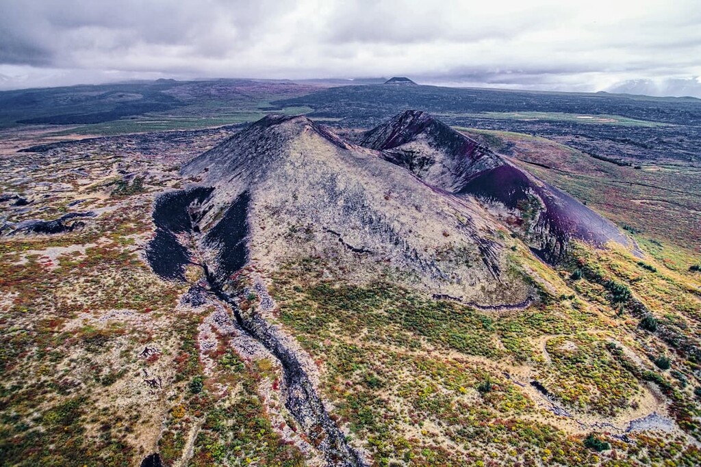
Established in 2001, Tuya Mountains Provincial Park is a spectacular alpine tundra mountain landscape that protects internationally significant and rare volcanic subglacial landforms, or tuyas. Tuyas resemble flat-topped cinder cones and are created through volcanic eruptions underneath a glacier.
Tuya Butte, located in the Tuya Range within the park, is widely regarded as one of the best examples of these unique volcanic landforms outside of Iceland and Antarctica. Located in the Tuya Icefield, Tuya Butte has no summit crater or obvious vent, suggesting that the volcano was fed by a fissure.
The park also protects vulnerable plant communities, high-quality caribou and grizzly bear habitat, and an important arctic grayling population in Butte Lake.
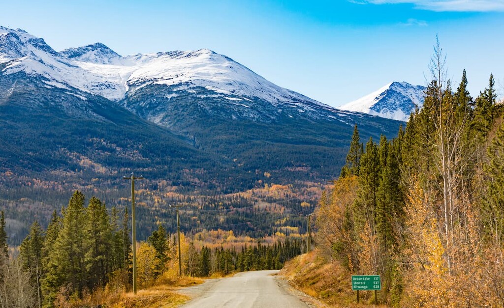
Tuya Mountains Provincial Park lies south of the Yukon border and northwest of Dease Lake, covering roughly 44,479 acres of the Tuya River headwaters in northern British Columbia. The park cannot be reached by boat or road, so visitors looking to explore the region’s incredible natural features must travel for several days on foot. Floatplane and helicopter travel from Dease Lake are also common means of access to the park.
Tuya Mountains Provincial Park presents outstanding backcountry recreation opportunities, as well as excellent hunting and fishing recreation opportunities. Proper gear, transportation arrangements, and maps are a prerequisite when visiting the park. There are no supplies of any kind in Tuya Mountains Provincial Park and visitors are expected to possess the appropriate backcountry skills to safely travel throughout the region.
Though little is known or documented about the cultural heritage of the region, Tuya Mountains Provincial Park lies within asserted traditional territories of the Tahltan First Nation, the Kaska Dene First Nation and the Teslin Tlingit First Nation.
Tuya Mountains Provincial Park does offer hiking, fishing and canoeing/kayaking recreational opportunities. However, there is currently no information on designated trails or routes in the region. The park’s primary purpose is to conserve the region’s internationally significant glacial landforms – recreation is secondary.
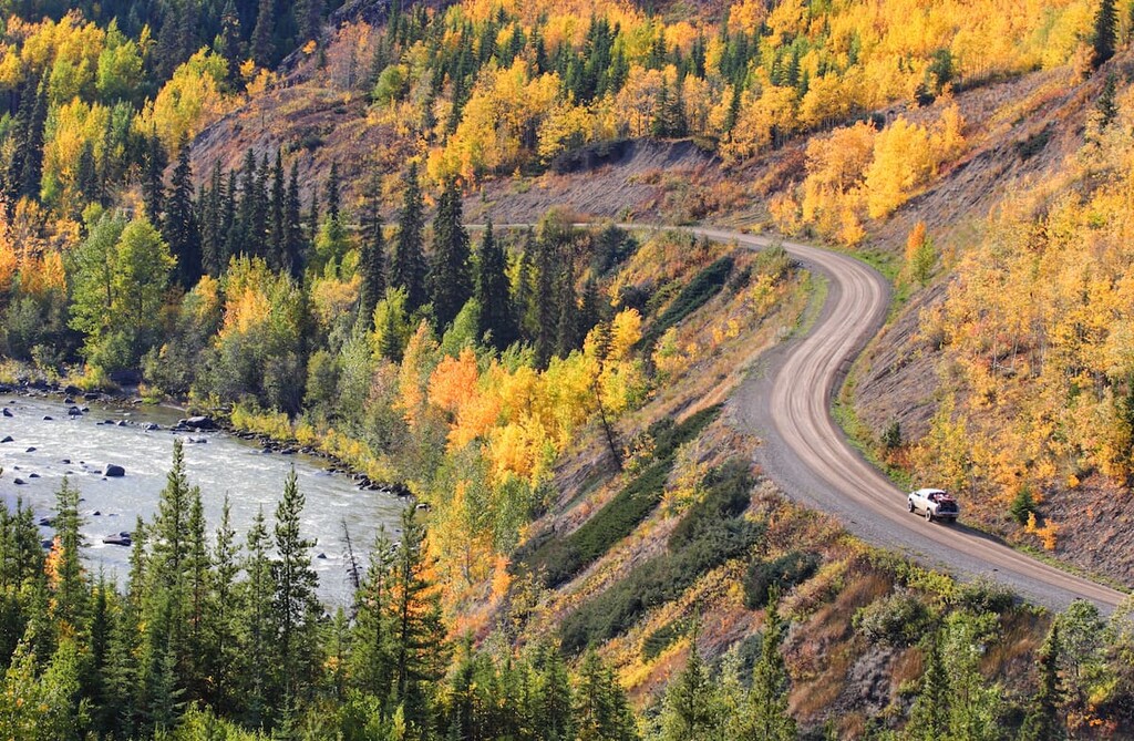
Several protected areas lie 60 miles to the south, including Spatsizi Plateau Wilderness Park, the Gladys Lake Ecological Reserve, Mount Edziza Provincial Park, Tatlatui Provincial Park and Stikine River Provincial Park.
Along Highway 37, Boya Lake Provincial Park also offers camping opportunities. These parks all offer a variety of backcountry outdoor recreation opportunities.
The park also contains two moderately large lakes, Butte Lake and High Tuya Lake, and borders Tuya Lake in the south and Ash Mountain (another tuya) in the north.
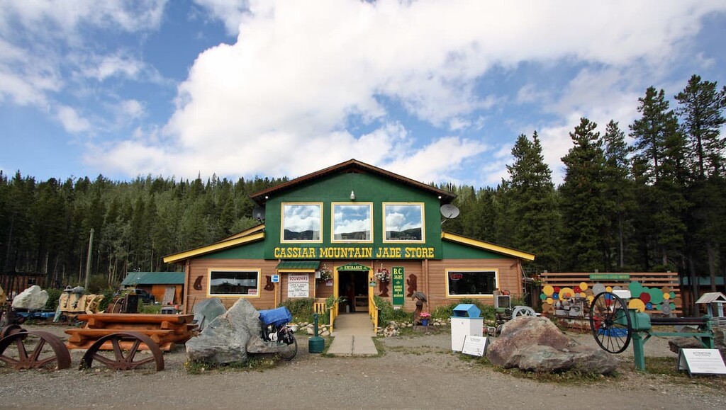
Located along Highway 37, west of Good Hope Lake, Jade City is a small town named for its jade deposits found to the east of the community. The tiny town hosts a Jade Store, post office, a 40-site RV campground, and a highway maintenance camp. Though amenities are scarce in this region, Jade City lies directly within a huge expanse of unspoiled wilderness. Explorers looking to spend time off the grid will appreciate the town’s isolation, as well as the complimentary coffee and wifi.
Once a major transportation route in the north for traders and trappers, Dease Lake was established as a Hudson Bay trading post in 1838. The town, which is located along Highway 37 at the junction to Telegraph Creek, was once a center of the gold rush on Dease and Thibert Creeks. Today, the tiny town hosts a population of just 475, and serves as a government service and supply center for the northwest region. Dease Lake is also a popular departure point for adventures into British Columbia’s most remote and rugged wilderness.