Scan the QR code and open PeakVisor on your phone
Located in western central Spain, lies Reserva Natural Garganta de los Infiernos, which translates to Hell’s Thorat Nature Reserve; a stunning outdoor recreation destination located at the western end of the Sierra de Gredos mountain range. The park contains 27 named mountains. The tallest peak is Canchal de los Ballesteros which stands at 2,342 m (7,684 ft) and the most prominent peak is Canchal de la Panera that has 335 m (1,099 ft) of prominence.
Reserva Natural Garganta de los Infiernos is situated in the western central region of Spain, in the Valle del Jerte (Jerte Valley) region that lies north of the Cáceres province. The park spans 7,226 hectares (17,856 acres) across Spain.
The landscape of the reserve is similar to the surrounding Valle del Jerte. The protected region lies between two mountain ranges that are part of the Gredos massif. The Sierra de Tormantos lie to the south while the Traslasierra and Sierra de Bejar lie to the northwest.
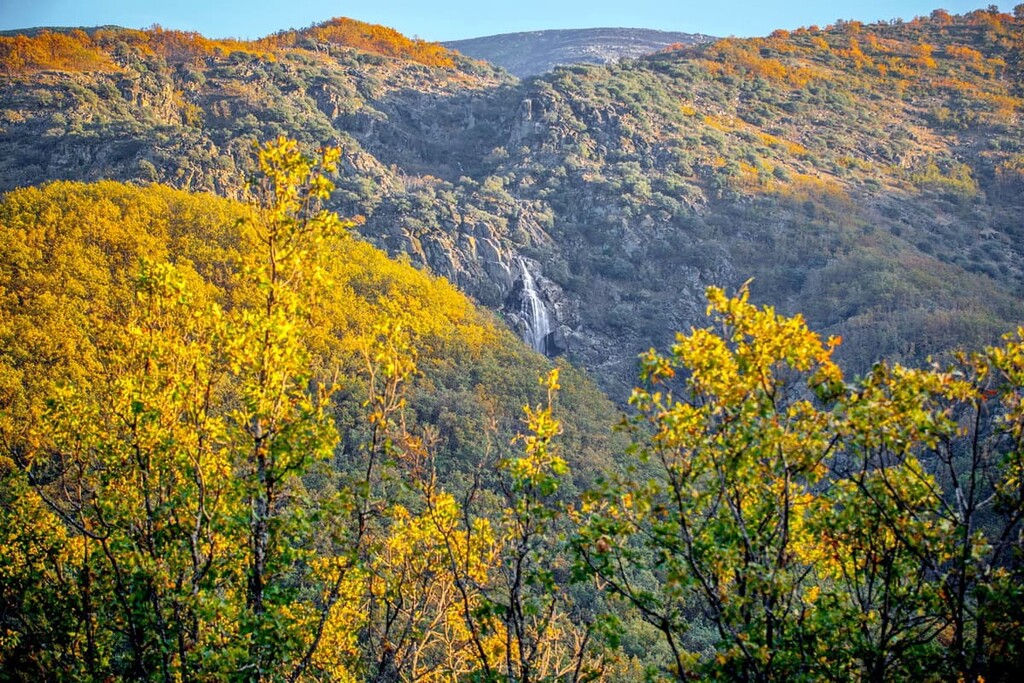
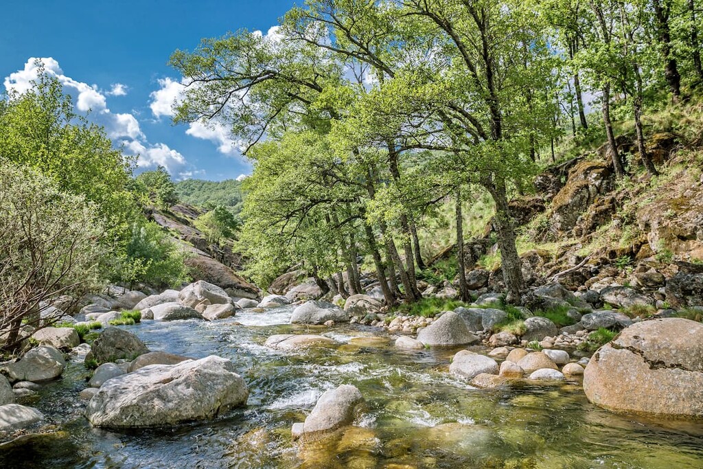
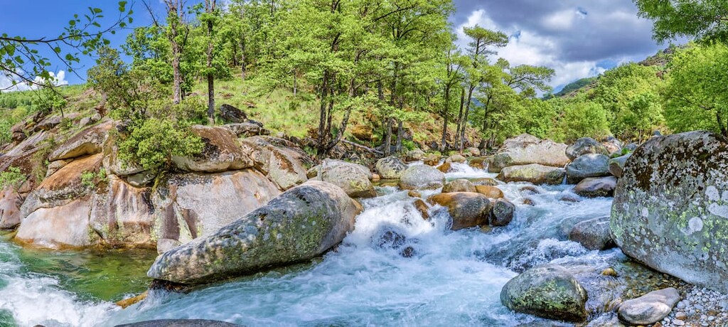
The reserve is known for its vast network of waterfalls, rivers, streams, and deep pools that wind their way throughout the valley. The water erosion has left the distinct smooth rock beds along the river floor. Due to the high humidity of the reserve, vegetation thrives at all elevations.
Temperatures aren’t extreme within the reserve though many of the higher peaks regularly receive snowfall during the winter months. Rainfall in the reserve averages around 1500 mm (59 inches) annually.
Additionally, Reserva Natural Garganta de los Infiernos is surrounded by other popular outdoor recreation areas. The Parque Natural de las Batuecas y Sierra de Francia (Natural Park of Las Batuecas- Sierra de Francia) lies to the northwest while Parque Nacional de Monfragüe (Monfragüe National Park) lies to the south.
Similar to the mountains of western Spain, the rock within the reserve is primarily granite and gneiss. The granite in the reserve is mostly quartz, feldspar, and mica.
The peaks within the reserve, and surrounding valley began forming during the Primary Era, over 350 million years ago. A large body of water once covered the region and the layers of sediment accumulated along the seafloor. As the tectonic plates shift, the layers of sediment began to fold and the Sierra de Gredos emerged from the seafloor.
For millions of years the granite formations began to erode from the elements and the introduction of waterways. Today the erosion has left behind rolling hills, smooth channels, and iconic riverbeds distinct to the region.
Major peaks within the park include Canchal de los Ballesteros, Canchal de la Panera, Alto de Castilfrio, and Risco de la Buitrera.
Due to varying altitudes in the park, along with the humid environment, there is a diverse amount of vegetation throughout the reserve. The deciduous forests within the reserve consist primarily of oak, hawthorn, chestnut, and cherry trees.
Ribera forests can be found in the more humid parts of the reserve, often near waterways. These sections of forest are often filled with alder, willow, ash, yew, holly, and birch trees. While forests are found throughout much of the reserve, higher elevations are home to alpine pastures where heather and mountain saffron grow.
The varying elevations in the park also allow for a wide range fauna to thrive. Wild cats and genet are often difficult to spot though both of their populations thrive within the region. Other animals include mountain goat, otter, and desman.
The skies are home to a wide array of birds. These species include blackbird, golden eagle, eagle owl, goshawk, buzzard eagle, griffon vulture, and the rare black stork.
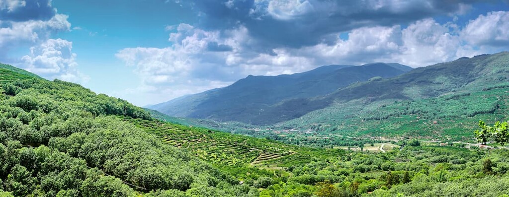
The Valle de Jerte (Jerte Valley) is known for than just the beautiful reserve. The valley itself is known for its cherries. The cherries that grow in the valley are known on both a national and international level, a rich history for the region. Though the Reserva Natural Garganta de los Infiernos was established in November of 1994, humans have been inhabiting the region for thousands of years.

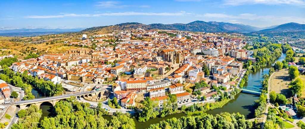
The nearby city of Plasencia was founded in 1186 though artifacts show that humans have been living in the region long before. The walled city lies along the Silver Route, helping contribute its success. Aqueducts, the city walls, and cathedrals date back hundreds of years, encapsulating the vast history of both the city and the region.
The fertile plains nestled in the foothills of the park are also thought to have been inhabited for thousands of years. Today small villages and communities can be found along the outskirts of the park. The humid climate, intermixed with the vast network of waterways allows for agricultural practices to flourish.
Reserva Natural Garganta de los Infiernos is home to numerous trails. Here are some of the top hiking areas to visit in the park:
This 15.3 km (9.5 miles) hike has 689 m (2,260 ft) elevation gain. The loop trail starts near the city of Jerte traveling through a wide range of fauna. The trail climbs up lightly forested hills offering views of the valley below before descending back down to the Rio Jerte (Jerte River). Small creeks can be throughout the trail with spots to stop and swim.
Also starting near the city of Jerte is this short 5.5 km (3.4 miles) hike that has 217 m (711 ft) elevation gain. The trail climbs steadily up the hillside while following Los Pilones. Throughout the hiking are numerous spots to witness the smooth walls of the riverbed as well as multiple lagoons to swim in.

For a more forested hike, this route totals 11 km (7 miles) with 381 m (1,250 ft) elevation gain. The loop trail passes through shaded forested sections before connecting with Los Pilones and ending at the Rio Jerte (Jerte River).
Looking for a place to stay near Reserva Natural Garganta de los Infiernos? Here are some of the best cities and villages to check out in the region:
Located to the northwest of the reserve lies the city of Béjar. The city has a population of around 15,000 and the region has been inhabited since around 400 BC. Further established during the Roman Hispania, some of the ancient city walls are still standing today.
When the city is visited by tourists, it is often because of its close proximity to the reserve and the surrounding mountains. The Ducal palace is also located in the city which dates back to the 16th century as well as the bullfighting ring from 1711. The city is also in close proximity to the Sierra de Béjar la Covatilla ski resort.
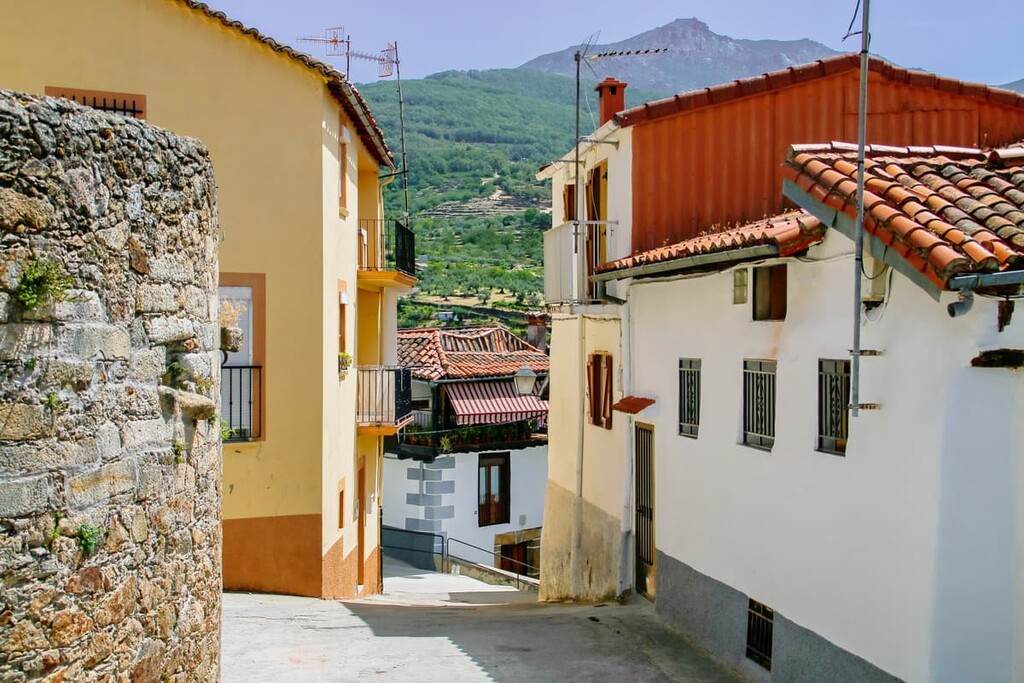
Plasencia lies west of the Reserva Natural Garganta de los Infiernos. The walled city has a population of around 41,000 residents. Some of the main sights of the city include the Vieja Romanesque, Cathedral Nueva, and Puerta de Trujillo o de La Salud.
The Palace of Mirabel contains artifacts dating back to Roman times, showcasing the long history of the region. After hiking in the surrounding valley and mountains, a trip to the old district is sure to deliver delicious food and local artisan shops.