
Scan the QR code and open PeakVisor on your phone
Reserva de Recursos Manejados (Managed Resources Reserve) Ybytyruzú is a protected region in Paraguay. Located primarily in the department of Guairá in the country's southeastern region, the Ybytyruzú reserve spans 60,000 acres of dense, rugged jungle, with waterfalls, mountains, and several archaeological sites, caves, shelters, and rock paintings. The Cordillera Ybytyruzú, the mountain range within the reserve, is crowned by Cerro Tres Kandú (2,762 feet), the tallest peak in Paraguay.
The Ybytyruzú reserve is primarily heavily-forested and mountainous, representing an edge of the Paraná Basin. The Paraná River drains this sprawling river basin (371,200,000 acres)—the second longest on the continent—which stretches from Brazil down to Argentina, emptying into the Atlantic as the Río de la Plata.
The reserve is most notable for containing the eponymous Cordillera Ybytyruzú mountain range, the highest in the country. However, the “mountains” here are much smaller than those in neighboring Argentina, Bolivia, and Brazil, with even the tallest barely stretching above 2,500 feet.
In addition to Cerro Tres Kandú, there are several other hills above 2,500 feet in the Ybytyruzú reserve, including Cerro de Acatí (2,362 feet) and Cerro Ponta Porá (2,297 feet). Some sources cite Mount San Rafael, a peak in the nearby range of Cordillera de San Rafael, as the country’s highest (ostensibly at 2,788 feet, 26 feet taller than Tres Kandú—although this is generally considered inaccurate). Tres Kandú is the country’s generally accepted high point, and most surveys and sources hold to this opinion.
Tres Kandú was long considered a place of strategic importance for the Armed Forces of Paraguay and served as the location of their principal communications tower, in addition to the radio communication tower for Paraguay’s national electrical company. Both sites are now abandoned in a small clearing near Tres Kandú’s summit.
The rock in the Reserva de Recursos Manejados Ybytyruzú is primarily Tholeiitic basalts, formed by lava flows from the Early Cretaceous age. Minerals found in these hills include apatite, biotite, calcite, chromite, diopside, geikielite, hematite, ilmenite, leucite, magnetite, phlogopite, pyrophanite, quartz, richterite, and sanidine. Readers can find more in a 2017 University of São Paolo study.
Approximately 75% of the Reserva de Recursos Manejados Ybytyruzú is forested, with a high percentage of non-deciduous species. These forests are part of South America's overarching Atlantic Forest biome, a subtropical forest. This biome is characterized by tall trees, thick vegetation, and high plant species diversity. Some common plant species include the urunday tree, guatambú, pink lapacho, peterevy (cordia trichotoma), and Brazilian rosewood.
Reserva de Recursos Manejados Ybytyruzú is also home to a rich array of fauna. Mammals like jaguars, pumas, and ocelots have historically made up the reserve’s top predators. However, few remain today due to hunting, deforestation, and the pressure of human occupation.
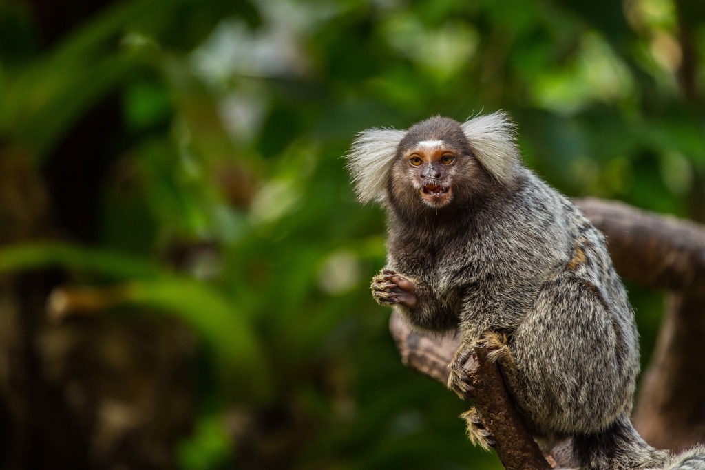
Several primate species inhabit the reserve, including howler and capuchin monkeys, as well as marmosets. Other notable animals in Ybytyruzú include tapirs, anteaters, water squirrels, and armadillos. The reserve is also one of Paraguay's most important bird conservation areas. There are over 300 species of birds, including toucans, parrots, and the rare black-fronted piping guan (also known as the jacutinga).
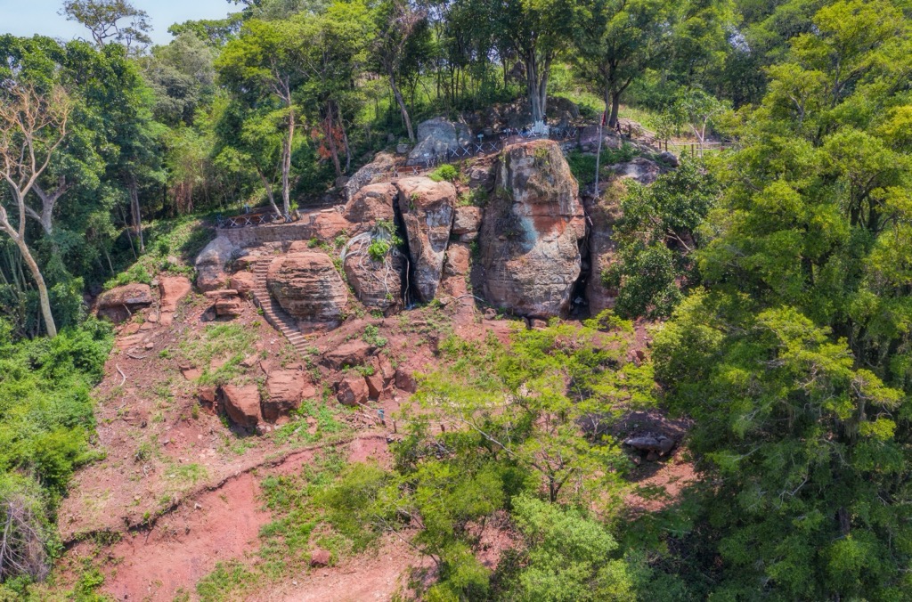
Indigenous peoples have inhabited the Ybytyruzú region for hundreds (if not thousands) of years before the colonization of the South American continent. These peoples were skilled hunters and gatherers, and several archaeological sites throughout the reserve show evidence of their presence, including prehistoric cave inscriptions in Itá Letra.
In the 16th century, the Spanish arrived in present-day Paraguay, bringing European diseases that decimated the indigenous populations. The Europeans also introduced cattle and other domesticated animals, which began to compete with native wildlife for resources.
The Spanish established the nation’s capital, Asunción, in 1537. Over the centuries, the region changed hands several times as various colonial powers fought for control. In 1811, Paraguay gained its independence from Spain, beginning to develop an independent native economy. This rapid development led to increased deforestation and hunting, as well as the introduction of more non-native species like cattle, horses, and pigs.
The Reserva de Recursos Manejados Ybytyruzú was initially proposed as a national park in May 1990. However, due to the park’s establishment on multiple private properties, residents protested the region being declared public land throughout the 1990s, organizing under the Ybytyruzú Ecological Association. Ultimately, the region was officially rededicated as a “Managed Resources Reserve” in 2001, giving indigenous peoples greater freedom and autonomy to remain on and manage the land.
Today, the reserve is recognized as one of Paraguay's most important protected areas. This country has experienced significant deforestation in the last 50 years, mainly due to substantial concessions granted by the Paraguayan government in the 1970s and 80s to agribusiness companies for soybean cultivation. By the early 2000s, Paraguay had one of the highest rates of deforestation in the world.
In recent years, there has been progress in reducing deforestation through increased enforcement of environmental laws, the creation of protected areas like Ybytyruzú, and support for sustainable land use practices. Still, an estimated 600,000 acres of forest are lost each year. Reserves like Ybytyruzú help push back against that loss and also serve as an essential source of income for local communities via sustainable activities such as ecotourism and organic agriculture.
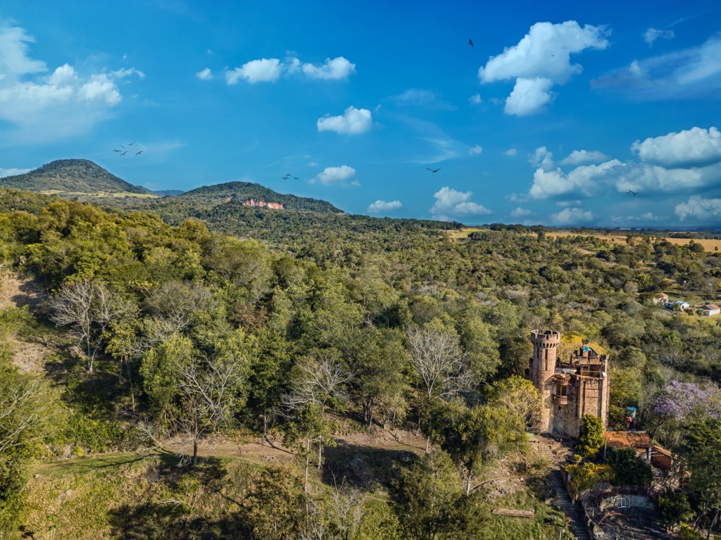
As the tallest peak in the country, Cerro Tres Kandú is one of the best high points to visit while in the Reserva de Recursos Manejados Ybytyruzú. Located just north of the village of General Eugenio Alejandrino Garay, Tres Kandú is accessible via a seven-mile (round trip) trail with an elevation gain of 1,925 feet. Though relatively short, the trail is extremely steep and muddy, especially after rains (which are frequent), and several sections are equipped with fixed hand lines to help hikers pull themselves up. Watch out for snakes and spiders while on the trail, including the highly venomous coral snake.
The high point is a clearing in the middle of a dense jungle, distinguishable only by a small sign, but a quarter-mile beyond this sign is a large clearing and overlook with spectacular views of the plains below. The land is on private property, so it costs approximately $2 to park at the trailhead and hike the peak. Camping is also available for a small fee, both at the trailhead and on the summit.
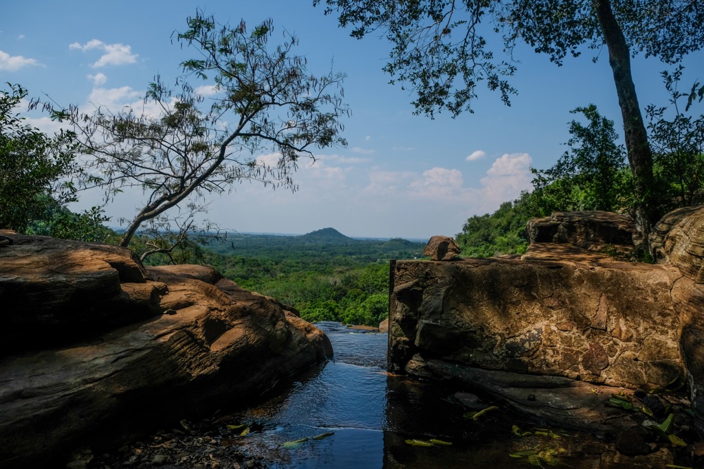
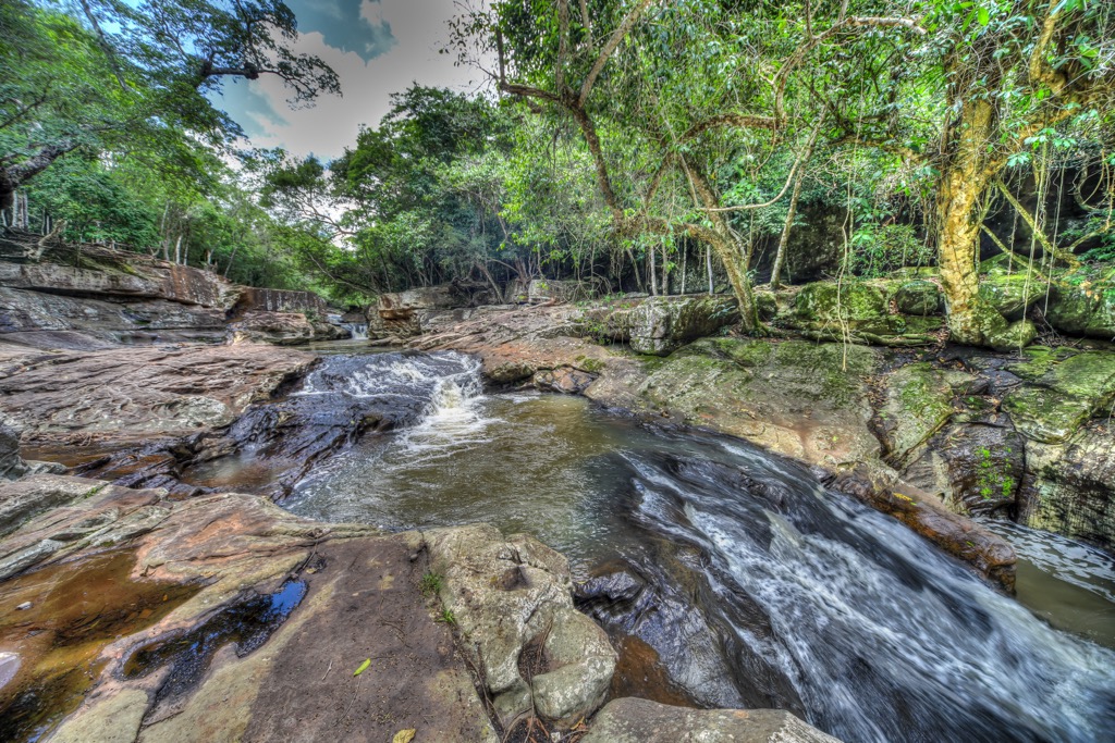
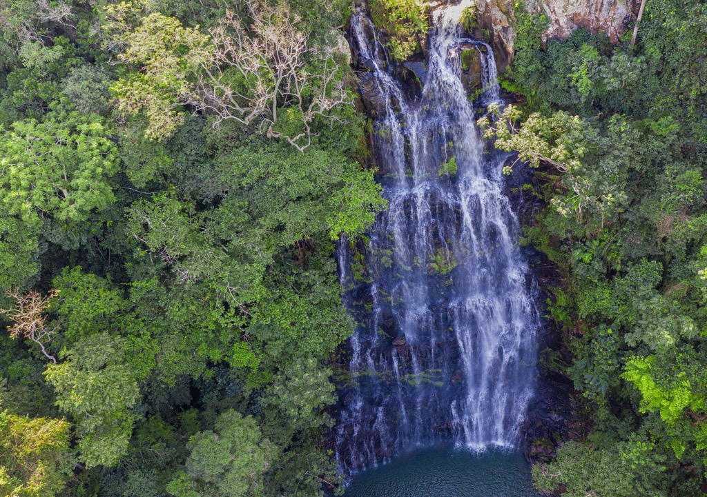
The region has many pristine waterfalls, including Salto Suizo, Salto Paí, and Salto Cantera. Salto Cristal, in the far west of the Ybytyruzú, is perhaps the best of them all. Salto Cristal is on the western border of the Guairá Department, technically in the Paraguairá Department, but it’s well worth the short trip, whether coming from Villarica or even Asunción. This enormous waterfall is accessible with a quarter-mile hike, with dozens of smaller falls and surrounding pools to swim in. The family who owns the land also offers rappelling, ziplining, and camping.
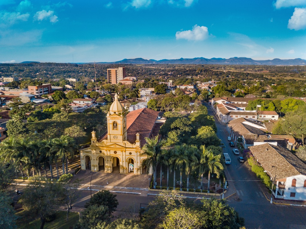
The capital of the Guairá Department, Villarica, is the largest city in the region. Founded in 1570, the city is home to several historic colonial landmarks. A sizeable Franciscan church, the Roman Catholic Diocese of Villarrica del Espíritu Santo, is worth a visit. Tourists may also appreciate the Cathedral of St. Claire, constructed in 1891 with grounds dating to the 17th century.
Villarica is home to many European immigrants and is known nationally as a hub for education and the arts. The Mburucuyá Hotel Boutique, just north of the city center, is the best hotel in town, offering comfortable, expansive rooms and a sumptuous breakfast.
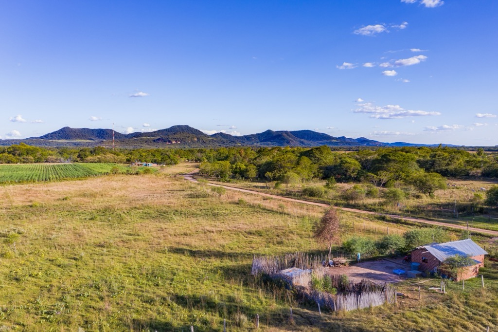
General Eugenio Alejandrino Garay is the village closest to Tres Kandú. There is not much for tourists in this small settlement of 900 people, but it does provide quick access to the peak, where camping is available. The trailhead of Cerro Tres Kandú is approximately 10 minutes from town by car. Many acres of wild jungle surround the village to the north, and it’s the best base to explore other high hills of the Ybytyruzú.


