
Scan the QR code and open PeakVisor on your phone
The Quabbin Reservoir is the largest body of water in the US state of Massachusetts and the primary water supply for the city of Boston. There are 38 named mountains in the reservation, the highest of which is Packard Mountain (1,266 ft/386 m) and the most prominent of which is Webb Hill (1,070 ft/326 m). While the reservoir and surrounding area feature a number of trails, much of the watershed lands are closed to the public. So, plan accordingly!
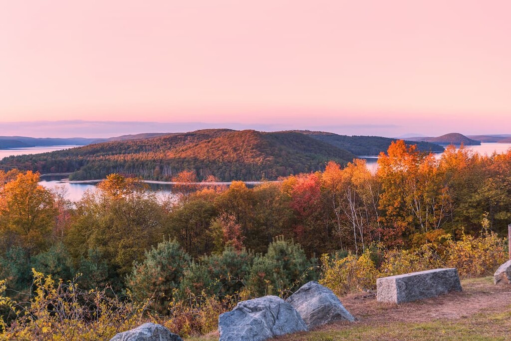
Located in the central part of the US state of Massachusetts, the Quabbin Reservoir Watershed Reservation is a large protected area designed to preserve the lands around the state’s largest inland body of water. It is located along the intersection of a number of the state’s counties, including Franklin, Worcester, and Hampshire counties.
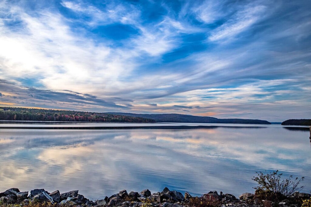
The Quabbin Reservoir covers an area just under 39 sq. mi (101 sq. km) and it boasts some 181 miles (291 km) of shoreline. While the reservoir was originally filled with water from the Swift and Ware rivers, it now relies mostly on runoff and groundwater to replenish its water levels.
Furthermore, the Quabbin Reservoir is surrounded by the Quabbin Reservation, which includes the reservoir as well as much of the surrounding hills, mountains, and forest. The reservation covers a total of some 45,000 acres (18,210 ha).
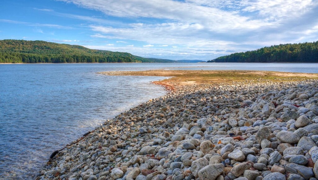
As a reservoir and watershed, most of that area is closed off to the public, but visitors can still access certain loop trails and cycling paths that surround the reservoir. There is also a 3,000-acre public park, called Quabbin Park, on the southern tip of the reservoir. It includes a number of trails, the historic Winsor Dam, and other outdoor amenities that are open to the public.

While the Berkshire Mountains to the west of the Quabbin Reservoir are among the oldest in the world—dating back some half a billion years—the geological features in and around the Quabbin Reservoir are much younger. The terrain of central Massachusetts is dominated by domes formed since the beginning of the Cambrian period some 500 million years ago. All of these rolling hills can be combined into one large region known as the New England Upland, which stretches from Connecticut in the south all the way to Maine in the north.
The Quabbin Reservoir is situated some 15 miles (24 km) east of the Connecticut River Valley—a 400-mile (644 km) long river that cuts through the center of New England.
As the ancient supercontinent of Pangea began to split apart some 200 million years ago, the Connecticut River Valley and the Middleton Basin of northeastern Massachusetts started to form. As the valleys filled with sediment, dinosaur footprints were preserved. In fact, the discovery of dinosaur tracks in the valley during the early nineteenth century were among the first of their kind in North America.
Major high points in the reservation include Packard Mountain, Pine Hill, East Hill, Prescott Hill, Webb Hill, and Quabbin Hill.

As an artificial body of water, the Quabbin Reservoir is often considered an “accidental wilderness.” Nevertheless, the animal populations of the Quabbin Reservoir and watershed benefit from its protected status.
The region is largely protected from human disturbance, resulting in a fairly diverse habitat with an abundance of wildlife. Wild turkeys and white-tailed deer are among the more common animals in the area. Rodents and birds provide ample food for predatory funa, including foxes, bobcats, coyotes, and hawks. Loons, black bears, moose, and bald eagles have also been spotted, although they are less common.
The Massachusetts Department of Conservation & Recreation (DCR) maintains a catalog of rare plants or endangered animal communities. Mass Audubon has identified the wood turtle and triangle floater (a freshwater mussel) as species of special concern for DCR.

The region in and around what is now the Quabbin Reservoir has been inhabited by humans since time immemorial. Indeed, the region is the ancestral homelands of the Nipmuc Nation, Pocumtuc, and the Wabanaki Confederacy, among countless others.
Peoples of European descent began colonizing the region in the seventeenth century. There is evidence of members of the Pynchon family of Springfield fame, including John Pynchon, having settled near what is now the reservoir in what is now known as the town of Amherst in 1658. The nearby town of Hadley was also incorporated in 1661 and Springfield itself was established much earlier in 1636.
However, the history of the reservoir is much more recent. The reality of the water demand outstripping supply in Massachusetts, particularly in Boston, dates back to the early nineteenth century. A series of aqueducts and reservoirs provided temporary relief, but as the state population continued to grow throughout the 1800s, ever bolder solutions were sought to permanently remedy the problem of water supply.
As early as 1895, engineers eyed the Swift River Valley as a possible home for a massive reservoir. With its shallow hills and broad lowlands, the valley served an ideal site. In 1922, an official study endorsed the Swift River Valley as the next extension of the state water system, and in 1927 the commonwealth passed the Swift River Act, which set aside money to build the reservoir.
The move was not without considerable opposition. Lying in the heart of the valley were the farming communities of Dana, Enfield, Prescott, and Greenwich—home to some 2,500 people. The construction of the valley would require the complete removal of structures, vegetation, houses, and people.
Despite local opposition, the state mandate prevailed, and construction began in 1927. All homes and factories were purchased by the state and then razed. More than 7,600 bodies were exhumed from 34 cemeteries and reburied at Quabbin Park Cemetery. In 1938, all four towns were disincorporated.
The reservoir itself was formed by damming the Swift River and Beaver Brook. Dam construction began in the mid-1930s, and the diversion tunnel that served as a temporary pathway for the Swift River was sealed in 1939.
The reservoir slowly formed over the next seven years, swallowing up all but the peaks of 60 hills and mountains. The reservoir transformed Prescott Ridge into Prescott Peninsula, and in 1946, the reservoir reached peak capacity for the first time.
Quabbin Reservoir is surrounded by 60 hills and mountains, 38 of which are named. While much of the territory remains off-limits to people, there are still more than 50 trails open to the public.
Among the most popular destinations in the reservation are Soapstone Hill, the Rabbit Run Rail Bed, Quabbin Park, the Quabbin Overlook, and Winsor Dam. Tourists and history buffs might also consider visiting the Prescott Church Museum or Whitaker-Clary House in New Salem.
Do note, however, that dogs are not allowed on the reservation nor are they allowed near the reservoir. So, a visit to the Quabbin Reservoir is one that’s best done without your pup in tow.
One of the highest points in the Quabbin Reservoir Watershed is Soapstone Hill. With an 883-foot (253 m) peak accessible from north or south, the peak offers an impressive view of the entire reservoir. For a breezy, 2.7-mile (4.3 km) out-and-back journey, take the Monson Turnpike west until you reach the Soapstone Mountain Trail, then follow that to the summit.
That same access point of the Monson Turnpike, which you can reach by taking Route 122 west from Petersham, connects to a variety of other trails in the region. For a long loop trail, follow the Monson Turnpike all the way past Soapstone Hill until you reach the reservoir at the junction with the Rabbit Run Rail Bed.
Take this trail north about 0.5 miles (800 m) until you reach a fork. Veer right onto the forest trail and continue for a third of a mile (480 m) until you reach the next junction (four-way). Turn right and continue for a half-mile (800 m) until you reach the Soapstone Mountain Trail. Take the trail to the summit of Soapstone Hill, then continue south to link back up with the Monson Turnpike.
The Rabbit Run Rail Bed is—not surprisingly—a former rail bed that travels through some of the Quabbin watershed wetlands. While parts of the trail can form a loop with the trails around Soapstone Hill, the entire 8.3-mile (13.4 km) stretch of Rabbit Run is out-and-back, traveling north-to-south along the northeast shore of the reservoir.
The northern stretch of the Rabbit Run trail connects a variety of trails around Bassett and Fairview Hills, although there are no official trails to the peaks of those hills.
From the north, take Route 122 to Old North Dana Road, then follow until you get to the trailhead. From the south, take the Monson Turnpike all the way west until you reach the reservoir’s shore and the junction with Rabbit Run. You’ll find the Old North Dana Depot here as well, offering plenty of photo opportunities.
One of the best views of the reservoir is a casual, wheelchair-accessible 10-minute walk from the road. The Quabbin Overlook is found to the northwest of the reservoir in the town of New Salem. Drivers can park in the driveway next to the New Salem Fire Station, then take a short hike to the ridgetop with a beautiful view of the reservoir and its islands.

A few more strenuous trails can be found to the southeast of the reservation. Among the more difficult ones is the 7-mile (11.3 km) out-and-back trail known as Gate 47. This lengthy hike begins at higher elevation and then descends to pass along the reservoir shoreline. The gate does not form a loop, but can be accessed off of Fiske Road west of Gilbertville.
Further south, just off of Ware Enfield Road, is Gate 50—access to an 8-mile (12.9 km) trail with a few steep inclines that run along the southeastern shore of the reservoir before connecting with Gate 47.
Along the western edge of the reservoir, right off of Route 202 in the town of Pelham, is the trail leading from Gate 11. This loop features a steady decline to reach a small inlet along the shore, with a full view of the Prescott Peninsula. It then traverses back west through a steady incline before connecting with Bohmer Road and, eventually, Route 202.
As one of the highest peaks in the region, Quabbin Hill is favored for its impressive views from the south rim of the reservoir. The area around Quabbin Hill is known as Quabbin Park, and features plenty of parking, access to trails, picnic tables, scenic lookouts, photo opportunities, and walks along the Winsor Dam, which formed the Quabbin Reservoir.
This out-and-back trek can be accessed off of Route 9 via Windsor Dam Road. Take the Observation Tower Trail 1.5 miles (2.4 km) north to reach the peak of Quabbin Hill. (Alternatively, drive to the peak via Windsor Dam Road.)
Here you’ll find some nice views of the Winsor Dam, and a variety of park amenities and information. Then, if you’d like, continue north to reach the Enfield Lookout, with more stunning views of the reservoir, as well as roads, trails, and paths to the shoreline.
What used to be Prescott Ridge is now Prescott Peninsula, and it now forms a major body of land that juts out into the reservoir from the northwest. Hikers can access a huge network of trails onto the peninsula Route 202 in Cooleyville.
These trails include a number of mountain summits as well, including Mount Pleasant (1,099 ft/ 334 m), Prescott Hill (1,102 ft/336 m), and Lighthouse Hill (1,056 feet/321 m). However, the most southern roads and trails remain off-limits to the public.
Camping is prohibited on all lands maintained by the Department of Conservation and Recreation or which are a part of the watershed reservation. However, some state parks and forests in the region, such as the Federated Women's Club State Forest, may offer camping access.
Although a number of small towns surround the Quabbin Reservoir and Watershed, the largest are the towns of Orange, Athol, Ware, and Belchertown. Each of these towns offer a host of hotels, restaurants, and tourist amenities.

Orange and Athol to the north are a wise access point for visitors interested in some of the watershed’s northern attractions, including Prescott Peninsula, Soapstone Hill, and most of the historical attractions.
If you’re interested in visiting Quabbin Park, Quabbin Hill, or the Winsor Dam, you may be more interested in the towns of Belchertown and Ware.


