Scan the QR code and open PeakVisor on your phone
Nature Park Zagoria is a relatively new park in southern Albania, nestled amongst mountains, streams, and grasslands. There are 26 named mountains in Parku Natyror i Zagorisë; the highest and the most prominent is Maja e Lalucit (2,155 m / 7,070 ft).
Zagoria, also known as Zaguria or Zagurii in Aromanian, used to be its own municipality in Gjirokastër County of southern Albania. Since 2018, this area has been the focal point of the expanded Zagoria Nature Park.
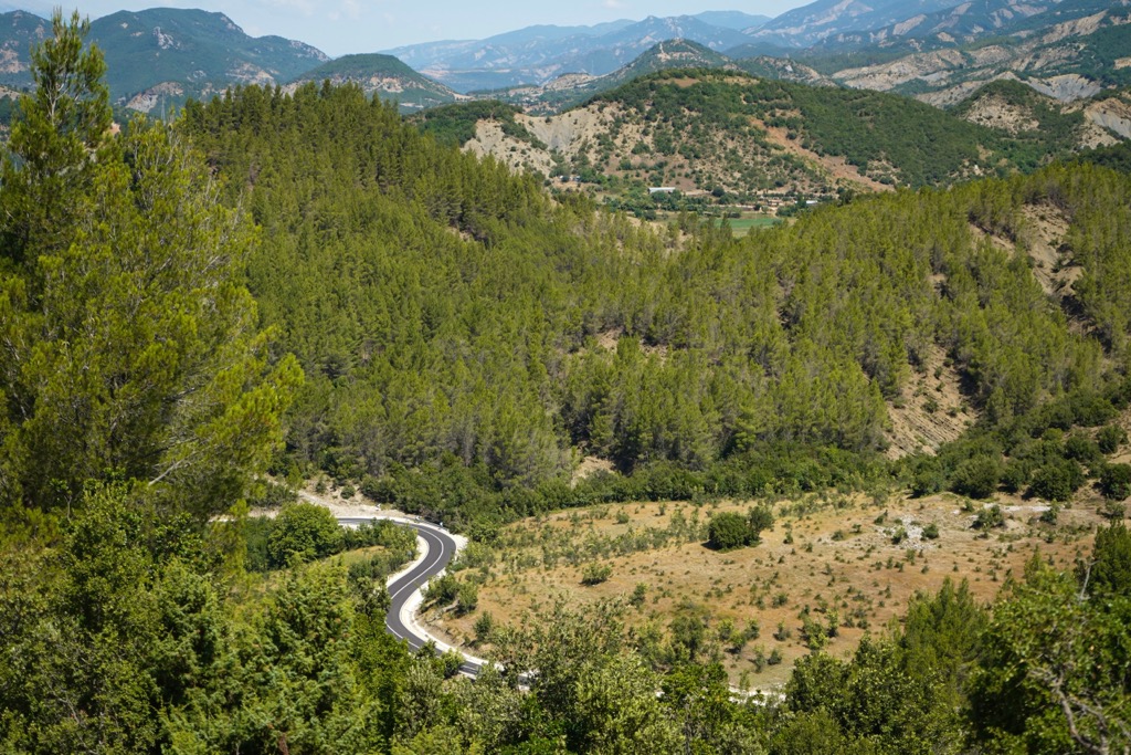
The Zagoria Nature Park (Parku Natyror i Zagorisë in Albanian) sits among several mountain ranges, which are the most significant in southern Albania: Shëndëlli, Lunzhëri, Bureto, Trebeshinë, Dëmbël, and Nemerçkë. This park spans about 25,000 ha (61,775 acres) and combines mountainous landscapes, charming villages, natural and cultural heritage sites, and diverse plant and animal life.
The park boasts notable sites like Çajupi fields, Çajupi Mountain, and the twenty-meter-high (65 ft) Waterfall Doshnica. The region's defining feature is the 27-km-long (16.7 mi) Zagoria Valley, with a watershed spanning 171 sq. km (66 sq. mi). It includes both the highest point - Maja e Lalucit (2,155 m/ 7,070 ft) - and areas as low as 350 m (1,148 ft).
This park encompasses urban areas, mixed agricultural and forest land, shrubs, and water surfaces. It is divided into two subareas: a central sub-zone primarily for conservation and a sub-zone of traditional use, allowing certain activities like agriculture and grazing.
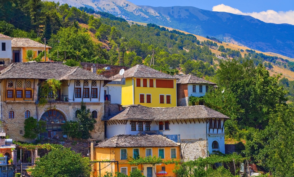
Zagoria is recognized as a unique "ethnographic region" consisting of ten traditional settlements: Sheper, Nivan, Ndëran, Topovë, Konckë, Hoshteve, Lliar, Vithuq, Doshnicë, and Zhej. The municipality of Zagoria has a majority of Orthodox Albanians and a minority of Aromanians. In 2011, Zagoria’s population was 411.
The name "Zagoria" likely comes from the Slavic word "Zagore," meaning "beyond the mountains." Interestingly, the name Zagoria also exists in regions of Greece and Bulgaria with similar meanings.
Zagoria Nature Park is situated in the Southern Mountain Province Region. The surrounding mountain ranges mainly consist of Paleogene and, to a lesser extent, Cretaceous limestone.
Zagoria refers to the valley nestled within these mountains. It boasts a narrow bottom and steep walls, with the Zagoria River (a tributary of the Vjosa River) flowing through it, accompanied by karst springs. The river irrigates agricultural lands and features well-developed river terraces, with a narrow and shallow bed in certain areas. Erosive-accumulative terraces are observed in this valley, presenting 2-3 levels.
Extensive karst formations characterize the landscape. Features like cirques and periglacial deposits formed during the quaternary period still exist in the mountains' highest zones.
Crucial mountain passes include Qafa e Çajupi in the center of Lunzheria, Qafa e Dëmbeli (1,468 m / 4,816 ft) between the peaks of Dëmbeli and Nemerçka, and Qafa e Kiçokut (675 m / 2,214 ft) north of Mount Trebeshina.
Zagoria is in the southern part of the country, where rugged terrain blends Mediterranean and mountain climates. The unique environment supports a high biodiversity of habitats and species.
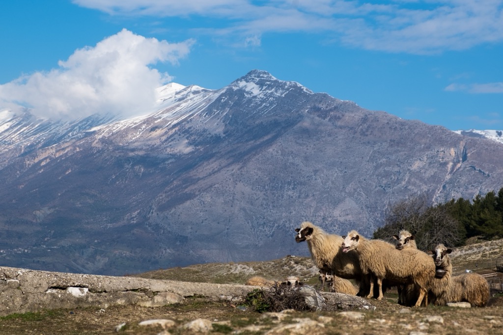
Zagoria is characterized by a cold winter climate with frequent snowfall, especially in the upper elevations. Bitter down-valley winds often bring frost to the valley floor. Summers are typically Mediterranean, with plenty of sun and heat.
The landscape varies across four vertical zones. Due to widespread limestone formations, rugged terrain, steep slopes, and limited vegetation, creating a substantial soil layer is challenging.
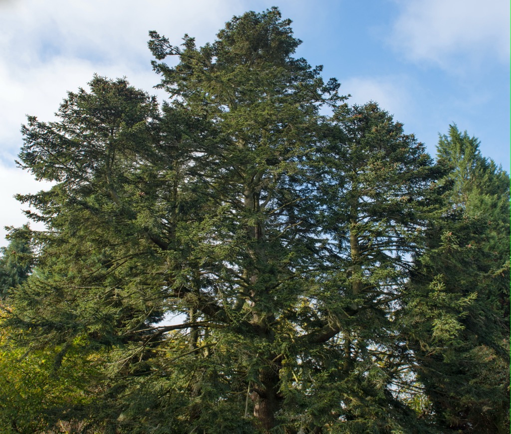
Oak trees, wild hazel, horse chestnuts, maple, and ash all form the park’s forests. Notably, the area is known for its King Boris fir (Abies borisii-regis), an essential component of the ecological landscape endemic to the Balkan Peninsula. Vegetation is not dense in the valley; large forested areas have been cleared for agriculture over the centuries.
Higher elevations are home to coniferous trees like white fir and black pine, typically between 1,100 m (3,609 ft) and 1,900 m (6,234 feet). However, their distribution can vary depending on the specific topography and microclimate.
Alpine pastures cover limited areas at altitudes exceeding 2,000-2,200 m (6,562-7,218 feet) (e.g., Nemërcke and Lunzhëri). Additionally, the region is abundant in medicinal, aromatic, and honey plants.
Some rare animals in this area include brown bears, wild cats, lynxes, and wolves, while foxes, wild goats, coots, wild boars, rabbits, and badgers are more common. Avian residents include eagles, mountain partridges, wild turkeys (rarely), wild pigeons, and turtledoves.
The region was originally called Ζαγόρια in Greek and Загорїа in Old Bulgarian translation.
Around 1304, historical texts mention a group or family known as the "Zenevias," likely the Zenebishi. Gjon Zenebishi, a notable member, was born in Zagoria and played a significant role in the area.
From 1319 to 1414, the region was known as "Great Zagori" and was part of the Despotate of Epirus, with Ioannina as its capital. In 1399, the Greek-speaking population of Great Zagori allied with the Despot of Epirus, Esau, in a campaign against various Albanian tribes. Later, the Ottomans took control of the region, and some family members fled to Morea while others held positions in the Ottoman hierarchy. Gjon Zenebishi's descendants continued to live in the mountains of Zagoria but gradually faded into history. Gjon founded the Principality of Gjirokaster (1373–1418), which included Zagoria.
By 1431-1432, the population had grown to 1,600, increasing to 3,300 by 1583. The growth was primarily due to migrations into Zagoria from various regions driven by religious persecution, personal conflicts, or foreign threats.
In the seventeenth century, Greek elementary schools were established in the villages and monasteries of the region, sponsored by Orthodox communities and guilds of Orthodox craftsmen. During the eighteenth century, the Christian Albanian-speaking areas, including Zagoria, strongly resisted conversion efforts to Islam. Thus, the region remains Orthodox today.
In the mid-nineteenth century, Zagoria had a population of 4,300 and faced challenges such as limited space, scarce natural resources, and bread shortages. A significant wave of emigration from Zagoria characterized the period; from the eighteenth to the twentieth centuries, 80% of males from Zagoria worked abroad, a custom known as kurbet.
The first significant wave of permanent emigration occurred in the early twentieth century, with destinations including Istanbul, Greece, and Egypt, followed by increased migration to America, Canada, and other parts of Albania.
During World War II, Zagoria served as a base for Albanian partisans within Gjirokaster County. The war saw significant destruction of houses in Zagoria, but many were rebuilt after the Partisans' victory. In 1880, Aromanian communities were part of Zagoria's population, especially in specific villages. During the Communist era, some Aromanian families settled in Zagoria as part of resettlement policies. In 2018, the Albanian government finally declared the region a National Park.
The best hikes in Zagoria Nature Park include:
The valley route is approximately 11 km (6.8 miles) long and takes about five hours. Start your hike through open woodland, ascending to a pass that unveils the vast valley flanked by majestic mountains. Traverse terraced fields, reaching the almost deserted village of Kala, with its remarkable Ottoman stone bridge over the river. Limar offers remnants of a cobbled caravan path and stunning views of Strakavec (1,959 m / 6,427 ft).
This hike is 17 km (10.5 mi) long and has an elevation gain of 750 m (2,460 ft). It treks between villages via footpaths, passing through hamlets and visiting the Doshnica waterfall.
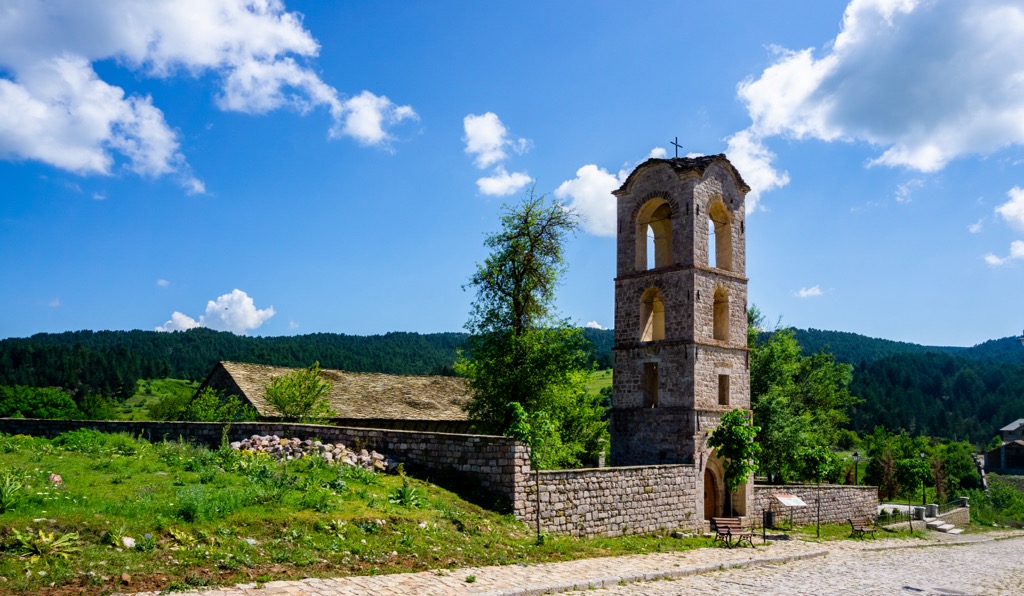
Depending on the water level, it’s possible to follow the river or take the meadows route to Hoshteve. Learn about local livelihoods, their challenges, and the returning diaspora's inspiring story. Don't miss the Church of the Holy Apostle, an architectural marvel showcasing Orthodox heritage.
Hikers can traverse the Dhembel-Nemercke Range in just 10 km (6.2 miles). This challenging yet rewarding route offers unparalleled views of Maja Cajupi (1,537 m / 5,042 ft) and a glimpse into the lives of shepherds from distant corners of Albania.
The Dhembel Pass (1,450 m / 4,757 ft) boasts panoramic views across Greece and the city of Permet below. Descend through rocky terrain, culminating in the enchanting stone village of Leuse.
The biggest cities near Zagoria Nature Park include:
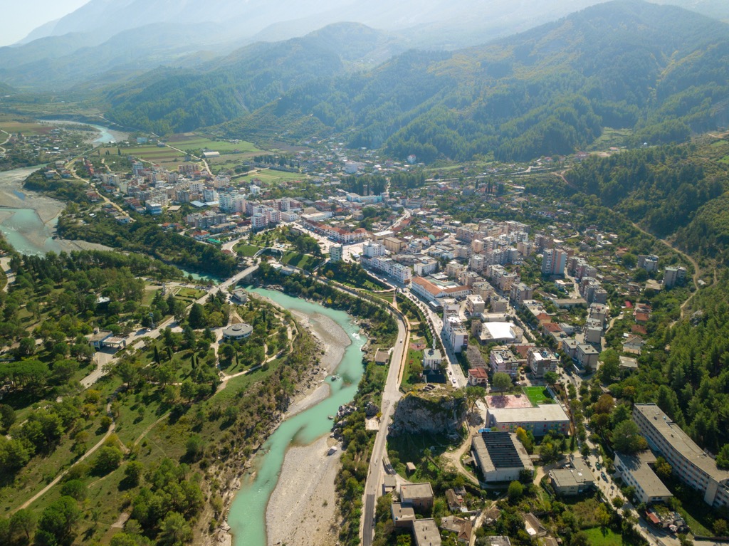
Permet is in Gjirokaster County and is a charming town in southern Albania. With a population of around 25,000, it is known for its pleasant climate and thermal springs. The town is situated along the Vjosa River, providing a scenic backdrop. Permet is celebrated for its traditional cuisine, particularly the locally produced raki (a fruit brandy). The area is also famous for its vibrant folk music and dances.
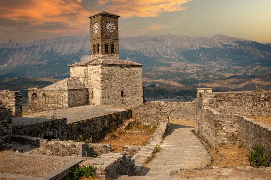
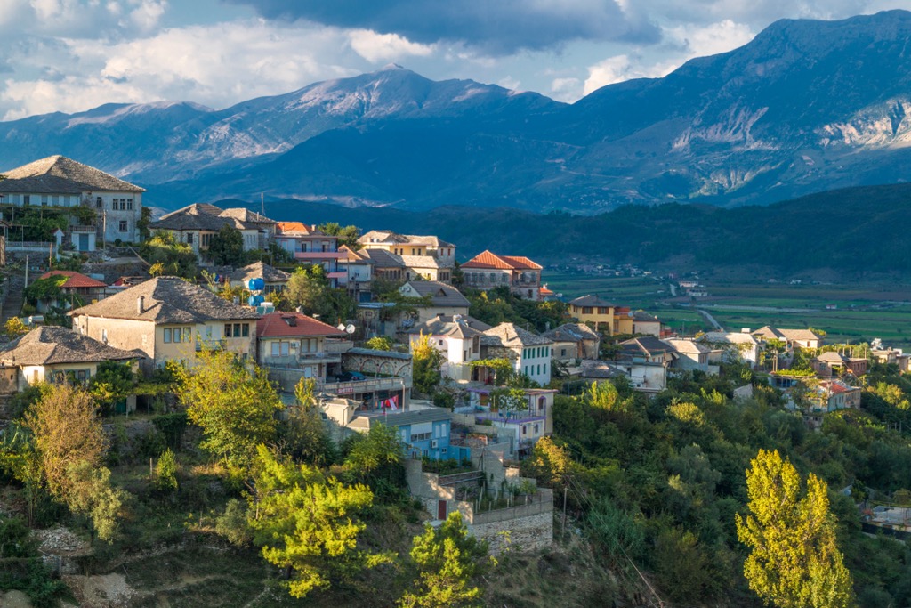
Gjirokaster, often called the "City of Stone," is a UNESCO World Heritage Site in southern Albania with a population of approximately 61,000. Gjirokaster is famous for its well-preserved Ottoman architecture, featuring stone houses and cobblestone streets. The Gjirokaster Fortress, dating back to the twelfth century, is a prominent landmark offering panoramic city views. The birthplace of former Albanian dictator Enver Hoxha is now a museum showcasing the country's history.
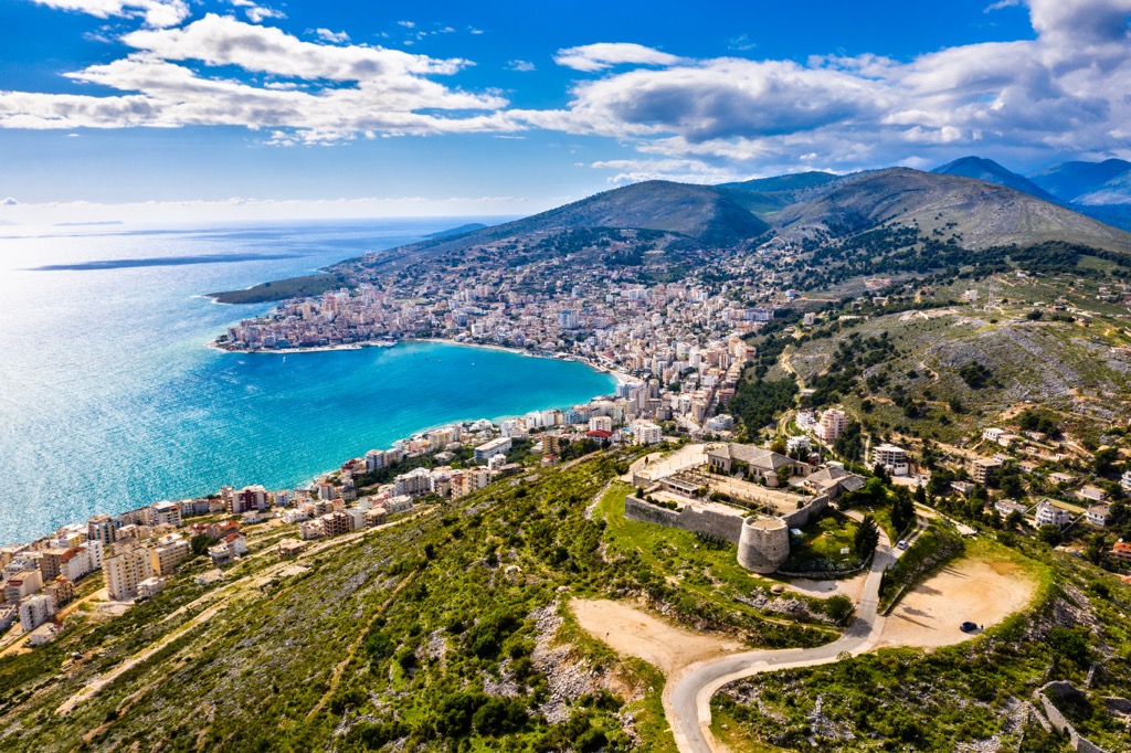
Saranda is a coastal town in southern Albania, nestled along the Ionian Sea. With a population of approximately 41,000, Saranda is a vibrant tourist destination known for its beautiful beaches and crystal-clear waters, attracting visitors worldwide, especially during the summer. Tourists can swim, sunbathe, and engage in various water activities.