
Scan the QR code and open PeakVisor on your phone
The Fataga ravine was one of the last places where the Canarian aborigines could resist the Castilian attacks to achieve the conquest of the Island. It is located in the municipality of San Bartolomé de Tirajana.
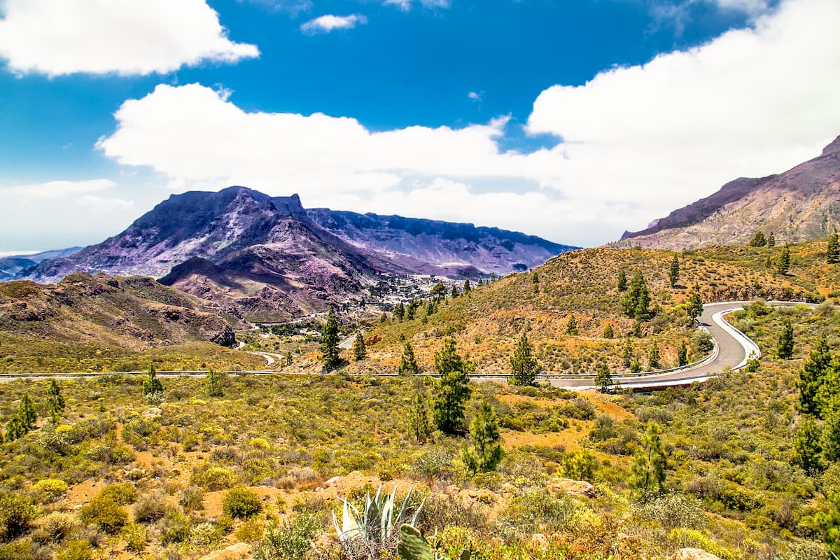
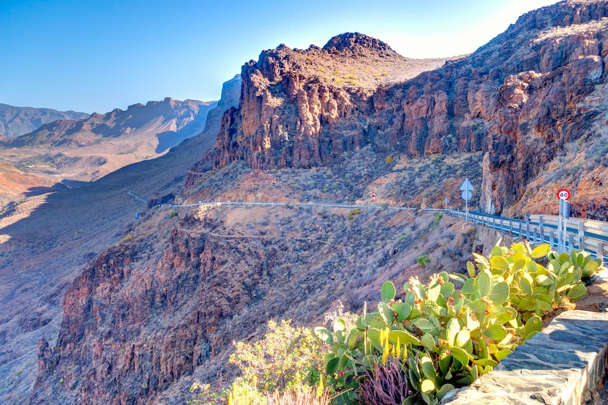
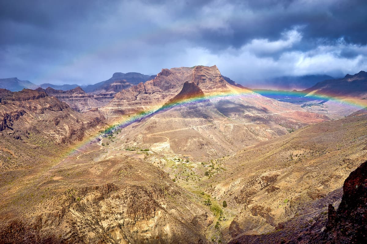
The protected area is a large open ravine in the south of the Island. It has been greatly affected by erosion processes since its building blocks belong to the oldest volcanic series. This has generated a very particular landscape with steep slopes rising over a wide channel that is sometimes boxed in.
The Fataga houses natural habitats in a good state of preservation such as the magnificent palm groves that grow along the riverbed, and the habitats of the escarpments, the home to some rare and threatened plants such as the immortelle or the rue. It constitutes a peculiar geomorphological unit due to its characteristics and high scenic value, it configures a landscape of great beauty. The Fataga is a semi-natural area that enjoys an important route connecting the southern tourist area with the centre of the island. The area includes two population centres: Fataga and Arteara.
The geology of the Fataga protected landscape is defined by the predominance of materials that originated during different eruptive periods of Cycle I where phonolithic eruptions abound. However, the gravitational landslide deposits are another element of the basin that occupies a large part of the ravine.
The Fataga ravine is located in the macro unit called Paleocanaria characterized by the predominance of basaltic materials, hilly forms, quaternary volcanoes and residual reliefs. Erosive-sedimentary morphologies stand out in the basin, with the exception of some structural morphologies such as interfluves.
It is hard to overestimate the cultural importance of the Fataga protected area, there are pre-Hispanic era reminders generously strewn around the place. There are natural and artificial caves, dry stone structures, burial mounds, etc. With its prolific network of sites, the Fataga is an intrinsic part of the sophisticated heritage the entire municipality of San Bartolomé de Tirajana can boast of.
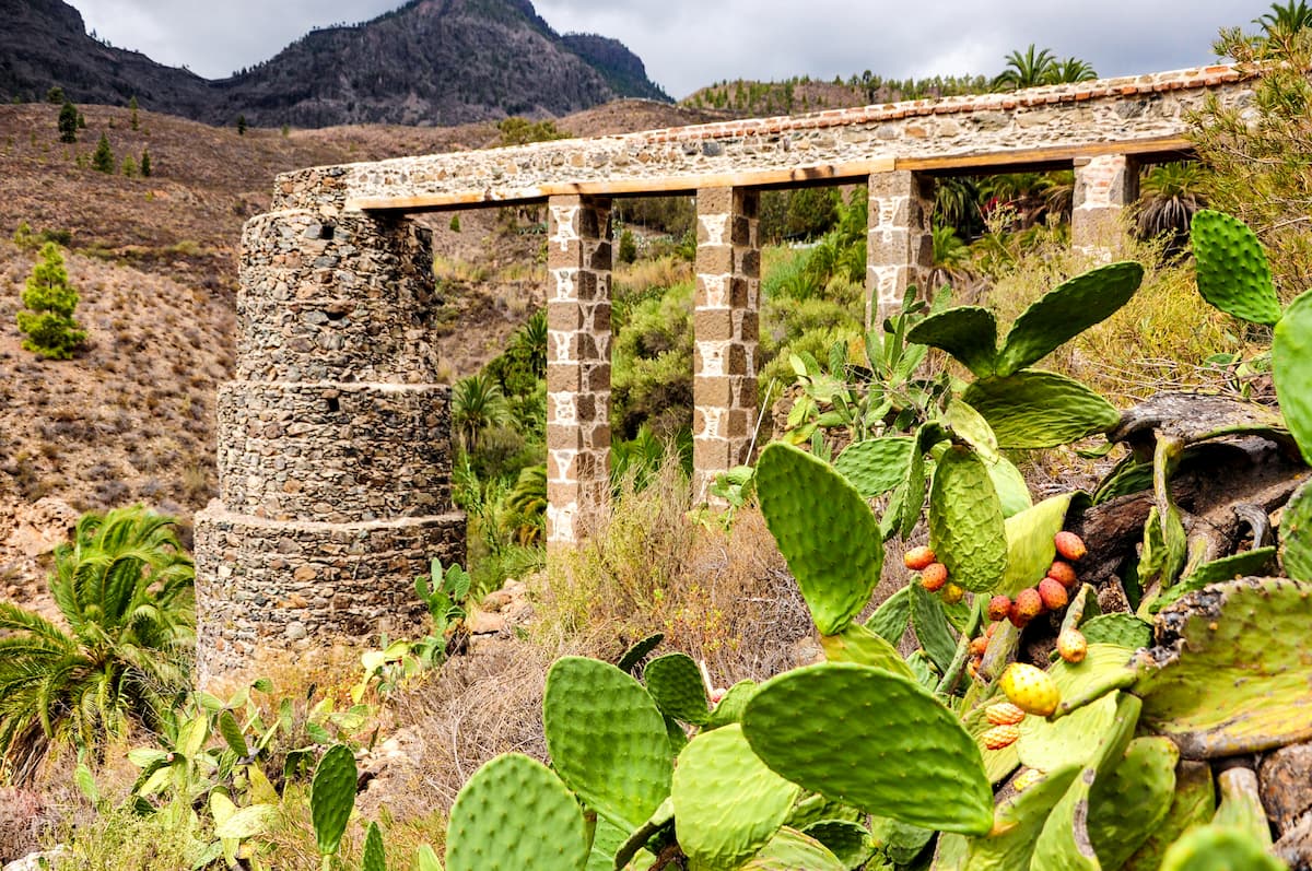
Due to its high ethnographic value, the Molino de Cazorla, currently categorized as a Monument, is an asset of great cultural interest in this area.
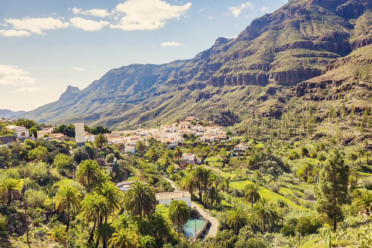
Discover the charm of a small town snuggly tucked between ravines. The beautiful mountains that can be seen from the road on the way to Fataga. The charm of this small town in the south of Gran Canaria goes beyond the picturesque. This is a quiet and lovely corner of well-preserved white houses, small and narrow streets and flowers that adorn this village perched on top of the valley with the same name and surrounded by ravines, pine trees as well as a leafy and unique palm grove.
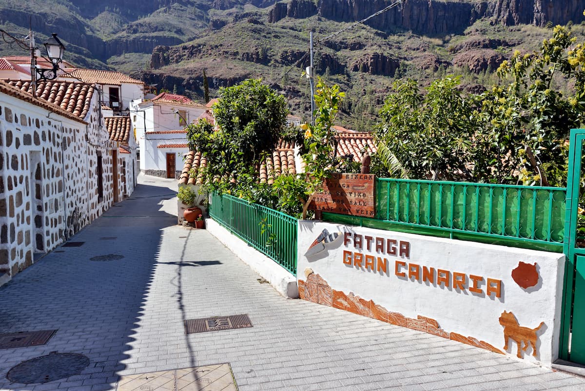
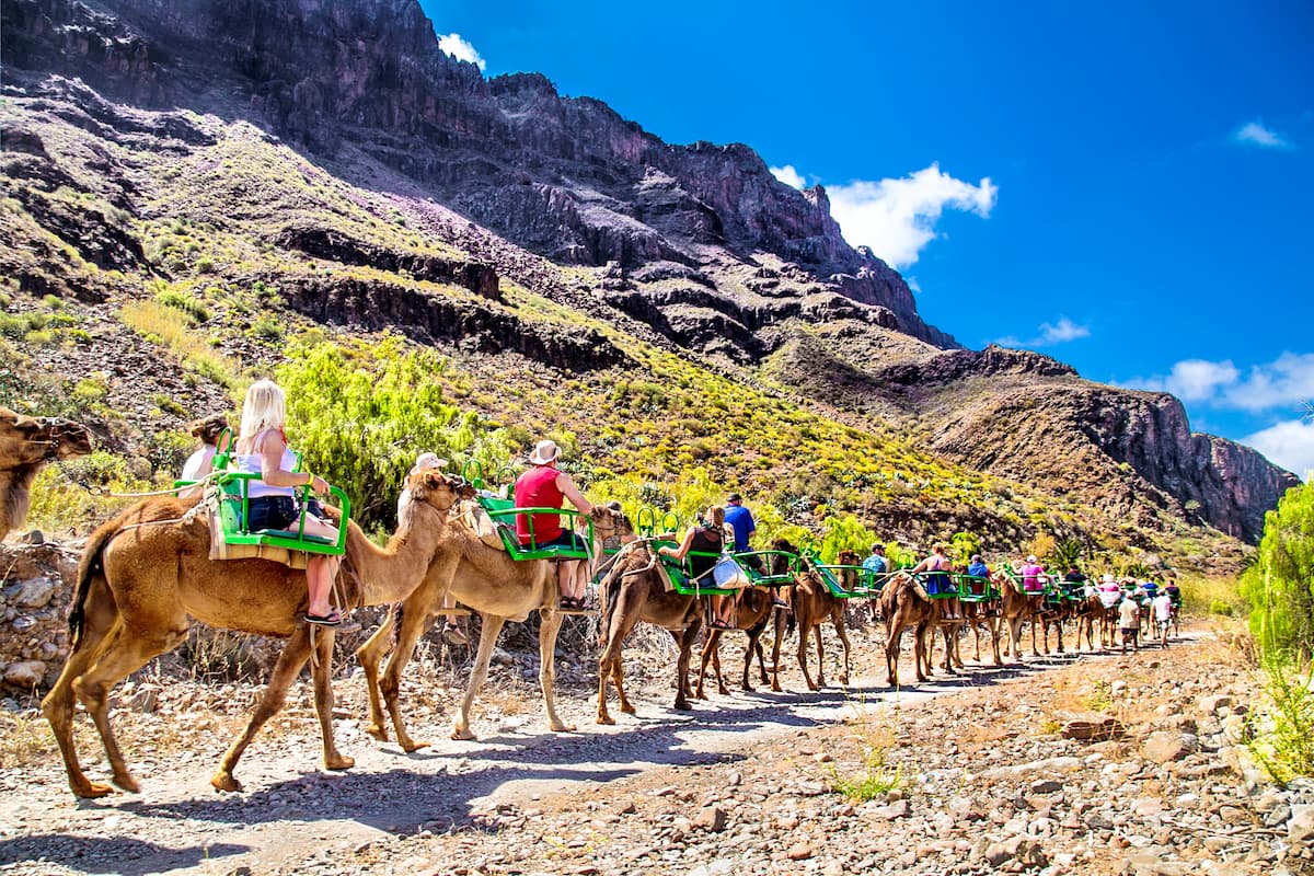
Roof tiles, palm trees, wooden balconies and fertile lands appear in the middle of an evocative landscape where life is slow, almost as it used to be many years ago. If you want to be surrounded by this tranquil atmosphere you should get lost in its cobbled streets, visit Fataga’s only church, that of San José, its museum or its old water mill. More touristy are its restaurants and souvenir shops and the camel ride through its ravine, also known as the valley of Las Mil Palmeras. Enjoy an exotic excursion in a landscape with breath-taking views.
A town with steep streets and unique corners, Tunte is the capital of the most touristic municipality of Gran Canaria, San Bartolomé de Tirajana. It is a small town at the gates of the top of the island. You are sure to get lost in bliss while wandering among the beautiful facades of the houses, the church and its squares. The magnificent views from the Mirador de la Orilla, the neighbouring town of La Hoya de Tunte and the recreational area are other possibilities to explore this unknown region.
Some call this area the Grand Canyon of Gran Canaria. From the Las Yeguas viewpoint, you will first see the Maspalomas coast, with the foreground of the road that rises from it. And secondly, you will observe Barranco de Fataga with palm oases in a distance, which is why it is also known as the valley of the thousand palms.
Located in the southern half of the island of Gran Canaria, practically in its central part, the Pilancones Natural Park covers some 5,794 hectares. It is situated entirely in the municipality of San Bartolomé de Tirajana.
El Molino de Agua (water mill) is located in Fataga. It is a farm that offers an organic garden, a restaurant, a swimming pool and a guesthouse with fourteen rooms where you can stay overnight, or spend a day or simply have a drink or something delicious to eat.
There is the Los Cazorla Mill nearby as well, it has been declared a Site of Cultural Interest a. The mill was built in 1880 by Sebastián Cazorla Jiménez according to the canons of traditional rural architecture.
Its characteristics have made it an icon of the Gran Canaria cultural landscape, being the subject of photographs and the interest of the thousands of visitors who each year pass by the road that goes from the south to the centre of the island, through Fataga and Tunte.
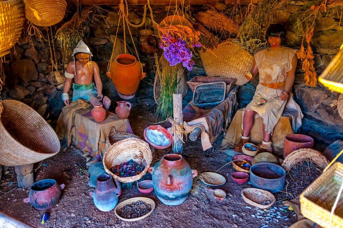
This open-air museum brings you closer to what the daily life of the aborigines of Gran Canaria was like. For this, in Mundo Aborigen, more than a hundred figures are used recreating environments and scenes that take you back in time some 2,000 years ago. Imagine the daily conditions of the first inhabitants of the island!
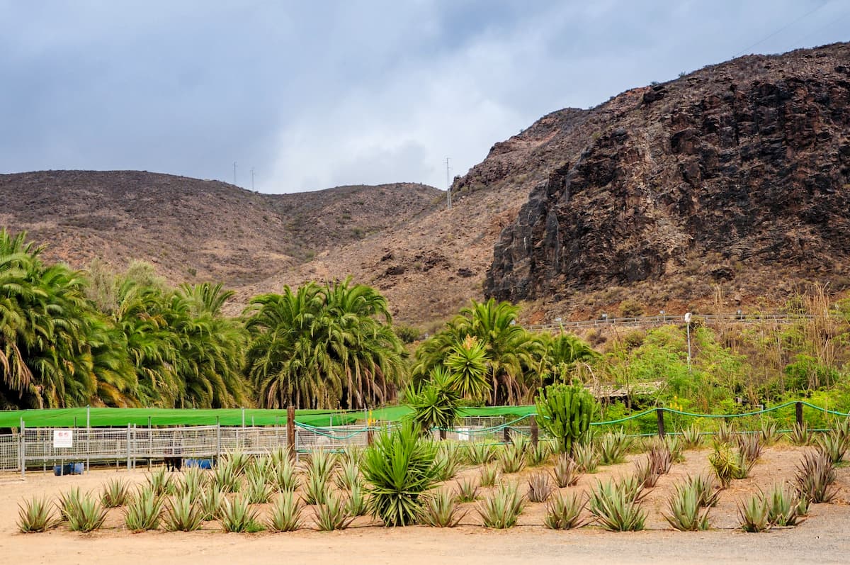
Inside the Barranco de Fataga, there is also this farm that has more than 20,000 aloe vera plants. A plant with countless healing properties and benefits that are used in this place to create all kinds of products: soaps, creams, sunscreen and even juices. You can also visit the plantations of this precious vegetable.
Very close to the palm grove is the Necropolis of Arteara, the largest aboriginal cemetery in Gran Canaria. Not only in size but also for the amount of burial mounds with more than 800 graves. It is impressive how well this archaeological site is preserved. If you want to visit it, you can take the circular route that begins at the Interpretation Centre.
In this funeral space, nothing is random. In fact, you can find samples of the incredible knowledge of astronomy of the Canarian aborigines. For example, the King's Tomb is located in the exact place where a ray of the Sun illuminates it every year on the days of the equinox.
Opening hours: Tuesday to Sunday from 10 a.m. to 2 p.m.
For those who love hiking, it is a luxury to traverse the routes crossing these ravines that reveal countless secrets to walkers. Secrets as always are well reserved for exploring travellers.
Some of the hiking routes that you can do through the Barranco de Fataga are:
- Tunte’s circular trail (medium difficulty - duration 4.5h - distance 14km) is one of the most popular routes due to the ease of starting and ending in the same town. During this walk, you will be able to enter the Pilancones Natural Park, one of the most remote places on the island.
- Tunte-Fataga-Arteara trail (medium difficulty - duration 4h - distance 11km) is a downhill route from Tunte through the entire Fataga ravine. On the trail, you will be able to enjoy the best views of the cliffs, the palm trees and the pines that dominate the landscape.
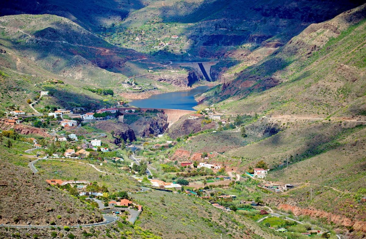
- Chira Dam Circular trail (medium difficulty - duration 2 hr 45 min. - distance 7km) starts in Cercados de Araña, the town located next to the dam completely surrounded by Canarian pines.
One of the favourite enclaves for practicing sport climbing in the Canary Islands is in this beautiful natural setting, in particular, in the Valley of the Thousand Palms where the green of the vegetation contrasts with the reddish basalt of some very characteristic rocky walls. Its great variety of degrees of difficulty have made it one of the favourite areas for climbing aficionados.
Despite not having a large number of routes (there are around 75,) its good maintenance and the possibility of being able to climb almost all year round have made the Fataga ravine one of the most popular places for climbers on the islands. It is advisable to ascend it in the less hot months, but the afternoon shade in summer also allows you to tackle its flat-edged basalt routes whose maximum height reaches 30 meters.
How to get there
It’s advisable to visit the Fataga by car, especially if you want to make stops throughout the ravine.
You can also travel by bus, take line 18 from the Maspalomas Lighthouse, stop in the town of Fataga or Arteara and do the hiking route along these beautiful paths.
Where to eat
- El Albaricoque Restaurant
Here you can try homemade local food at a reasonable price. We recommend the Canarian salad with Fataga avocado and Tejeda cheese and the vegetable stew from the garden. Also, for dessert you can't miss the pumpkin pancakes with apricot jam, also grown here.
Where to stay
- Finca Tomás y Puri: GC 60, Km 35 Capaón 30 derecha, 35106 Fataga
- Casa Agustín: Paseo Los ovejeros. 5, 35108 Fataga
- El Molino de Agua: Fataga General Road, Km. 31
35018 Fataga


