
Scan the QR code and open PeakVisor on your phone
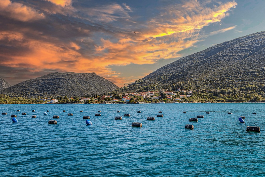
Malostonski zaljev (Bay of Mali Ston) and Malo more (Little Sea) comprise a coastal Nature Park in southern Croatia, near the Pelješac Peninsula. The park protects a brackish marine ecosystem and traditional oyster and mussel farming in the town of Mali Ston, which has built a reputation for high-quality shellfish. As a bay, Malostonski zaljev is protected from the open sea and is ideal for aquaculture and traditional salt production. Moreover, the ancient defensive walls surrounding Mali Ston—the longest in Europe—add a medieval flair. There are 60 named mountains in Malostonski zaljev i Malo more; Smrdan Grad (463 m / 1,519 ft) is the highest, while Kula (347 m / 1,138 ft) is the most prominent.
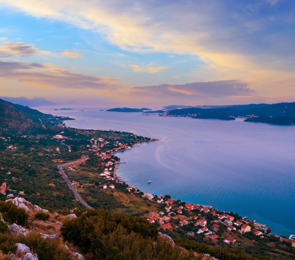
Malostonski Zaljev i Malo More is located on the Adriatic Sea along the southern Dalmatian coast of Croatia, directly adjacent to the Pelješac Peninsula and 60 km (37.3 mi) northwest of Dubrovnik. The bay sits at the end of the Neretva Canal, where the Neretva River flows into the Adriatic Sea. It stretches from Zaton Dola and Mali Ston in the southeast to the mouth of the Neretva in the northwest.
The bay is protected as a nature reserve; it covers approximately 48 ㎢ (18.5 sq. miles) and has two main sections: Mali Ston Bay, known for its protected waters and aquaculture, and Malo More, a narrow sea channel separating the Pelješac Peninsula from the mainland.
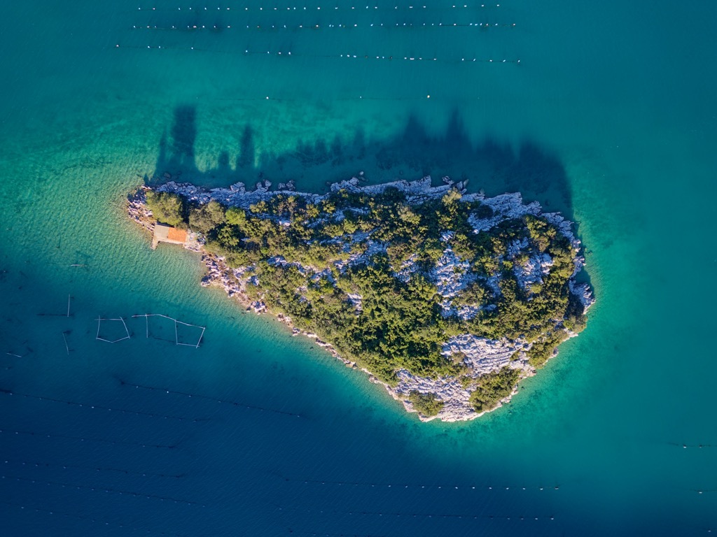
The surrounding terrain is predominantly karstic, which is characteristic of the Dinaric Alps. The limestone composition has produced a highly indented coastline with numerous coves and small islands. The karst geomorphology has also created ideal conditions for aquaculture, particularly the cultivation of European flat oysters (Ostrea edulis) and mussels (Mytilus galloprovincialis).
The relatively shallow waters, generally not exceeding 30 meters (100 ft), are influenced by freshwater inputs from karstic springs and saline waters from the open Adriatic Sea. The result is a distinctive brackish environment - saline gradients vary but are less than the Adriatic’s. Generally speaking, ecological conditions are influenced by land-based factors, with a lesser impact from the open sea.
The coast is interspersed with Mediterranean vegetation like native maquis shrubland, as well as cultivated olive groves and vineyards. Like most Mediterranean climes, the park experiences wet, mild winters and hot, dry summers, with at least three times more precipitation in the wettest month of winter than in the driest summer month.
The geology of Nature Park Malostonski Zaljev i Malo More is defined by its karst landscape, referring to limestone that has been eroded by dissolution. The park forms part of the broader Dinaric Karst, highly porous rock formations that allow water to percolate and create underground drainage networks. In fact, the Dinaric Alps are one of Europe’s most extensive karst systems.
The karst hydrology is defined by both surface and subterranean water flows, with numerous freshwater springs emerging at the coastline due to pressure from underground aquifers. These freshwater inflows are largely responsible for the brackish water. Additionally, the bay is influenced by freshwater inflow from the Neretva River, though the extent depends on water levels and wind direction.
In addition to karstic features, the coastal sedimentation processes play a role in building the seabed and shorelines. Fine-grained sediments, predominantly composed of calcareous material from the surrounding karst region, accumulate in sheltered bays and estuaries, providing suitable substrates for oyster and mussel farms.
Ecological conditions in the bay are mainly influenced by land-based factors, with lesser influence from the open sea.
Mali Ston Bay supports a variety of habitats, including seagrass meadows, rocky reefs, and sandy bottoms, which form a complex and highly productive ecosystem. The seagrass beds, primarily composed of Posidonia oceanica and Cymodocea nodosa, stabilize sediment and provide a nursery habitat for fish and invertebrates.
The bay is the largest producer of European flat oysters and Mediterranean mussels in the Adriatic Sea. The brackish waters, stable temperatures, and high nutrient availability create an ideal environment for shellfish farming. These shellfish are not only economically significant but also contribute to the bay's ecological health by filtering water.
Malostonski Zaljev is also home to a variety of fish species, including commercially important stocks like sea bream (Sparus aurata) and sea bass (Dicentrarchus labrax), as well as numerous smaller fish that contribute to the food web. Sponges, sea urchins, and crustaceans thrive in the microhabitats created by rocky substrates and seagrass beds.
Birdlife is notable, with several species of waders, gulls, and terns frequently observed along the coast. The mudflats and salt pans are particularly important for migratory birds that use the area as a stopover.
The bay is a naturally eutrophicated system, meaning it’s fairly rich in nutrients. The rise in organic material during spring can lead to phytoplankton blooms, complicating oyster farming. Additionally, illegal trawling harms fish populations; large quantities of sardine larvae and juveniles are being overfished. Uncontrolled harvesting of sea snails is also an issue.
The region around Malostonski Zaljev i Malo More has been inhabited since at least the Neolithic period (10,000 - 2,000 BCE). Salt production has been a staple for millennia, with the Ston saltworks being one of the oldest in Europe. The salt pans are still operational today using the traditional methods of salt extraction, which have remained essentially unchanged.
In addition to salt production, aquaculture has been important for over 2,000 years, with records indicating the cultivation of oysters since Roman times. Traditional aquaculture practices here rely on natural filtration and nutrient cycling within the bay, minimizing environmental impacts compared to more intensive forms of aquaculture.
The Dubrovnik Republic (Republica de Ragusa in Latin) was an aristocratic maritime republic in southern Croatia. It flourished between 1358 and 1808, reaching its commercial peak before being annexed by Napoleon’s French Empire. The republic had a population of about 30,000.
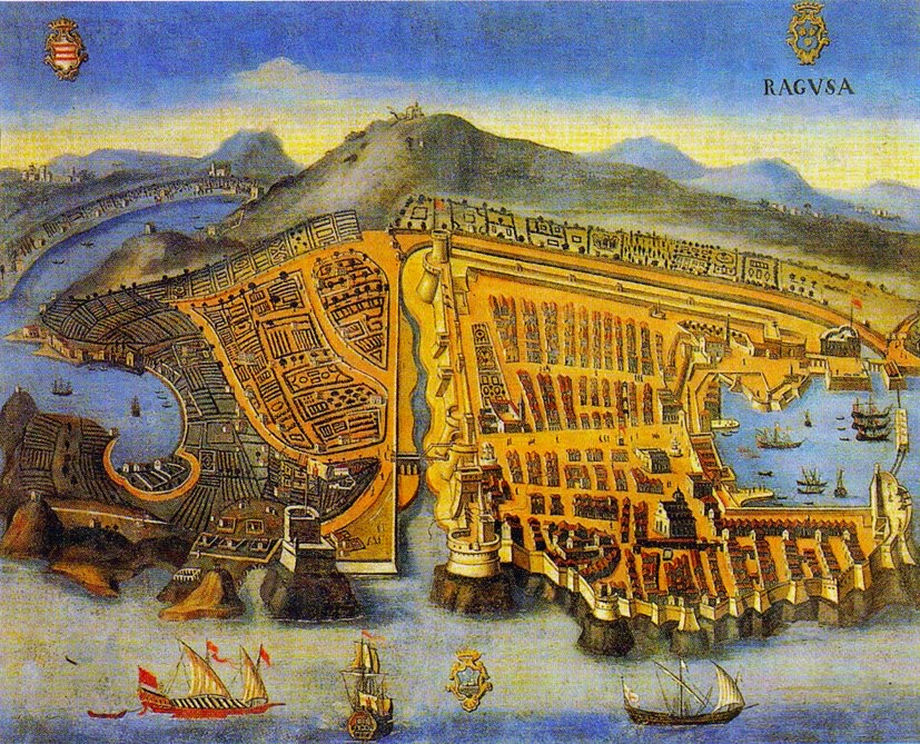
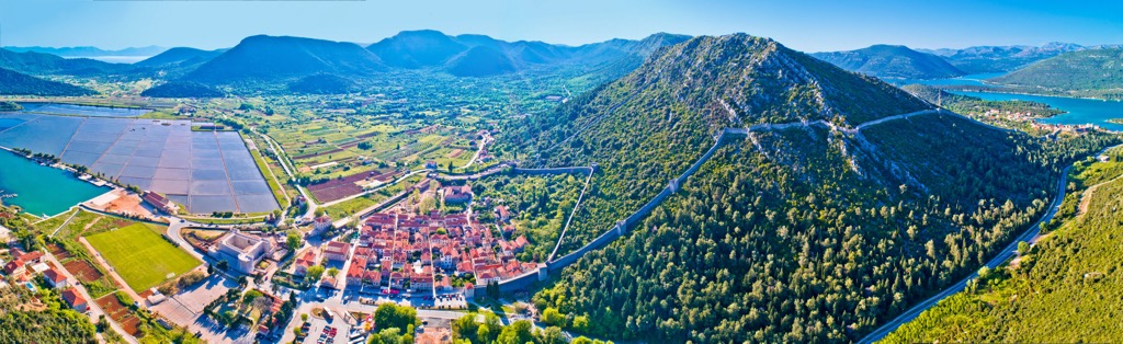
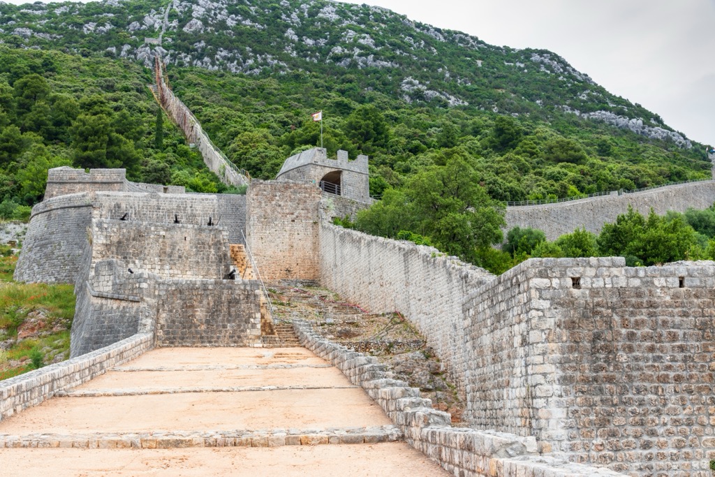
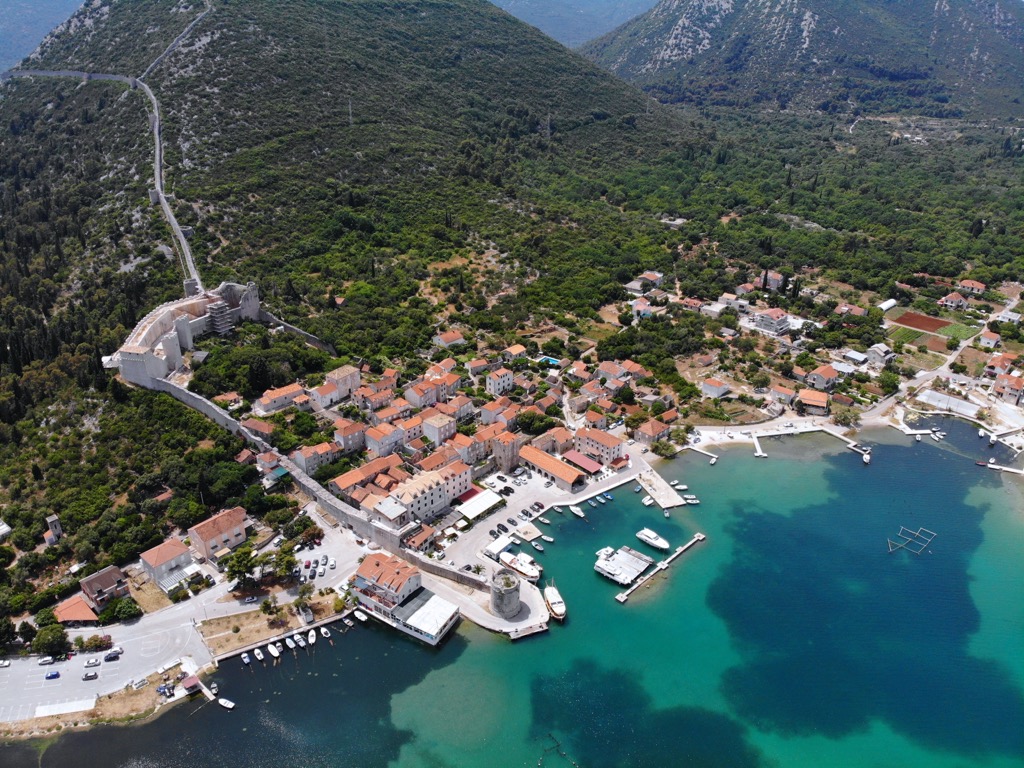
The town of Ston is the park’s most historically significant. Originally an Illyrian settlement, Ston became a Roman colony in 167 BC. The town may have had a bishop as early as the seventh century. During the medieval period, the Dubrovnik Republic established the town's impressive defensive walls to protect the salt pans and control access to the bay. The walls are 5 km (3.1 miles) long, making them the longest defensive structure in Europe (they once reached 7 km but were dismantled for their stone following the collapse of the Republic of Ragusa).
The park was declared a special marine nature reserve in 1983. Since 2020, the European Union has recognized and registered Mali Ston oysters as a "protected designation of origin." In addition to shellfish and salt, the area around Mali Ston has numerous wine trails, as the Pelješac Peninsula is renowned for wine production.
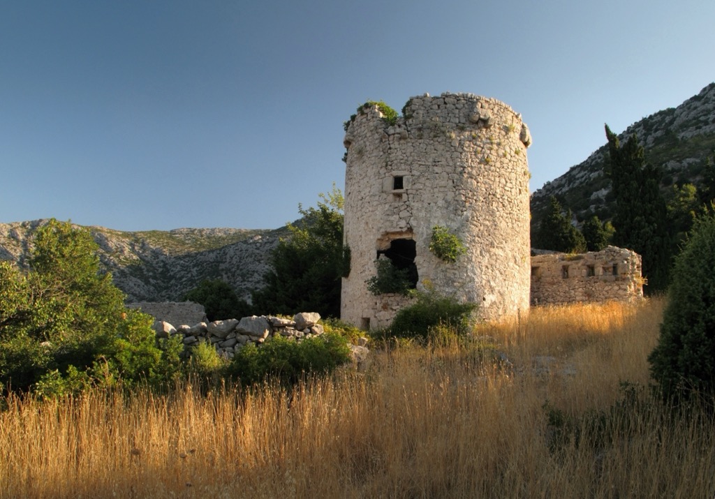
Smrdan Grad (also Smrden Grad) is a fortress above Klek, along the old route connecting the Neretva Valley to the Dubrovnik coastline. It also happens to be the highest point in the park, at over 450 meters.
The current fortress was built in the late seventeenth century, replacing a medieval fort captured by the Venetians from the Ottomans in 1689. The fortress’s name derives from a legend about the unpleasant smell of Ottoman corpses left after a failed siege. This easy hike is around 5 km (3 mi), starting in Klek and passing by a chapel and then the medieval fortress.
The Walls of Ston are one of the most impressive medieval structures in all of Europe. They’ve been restored throughout the 20th century, and it’s now possible to walk along the top and gaze out on views of the charming town of Ston, the expansive salt pans, and the Adriatic coastline. Starting from Ston, the walk along the walls is around a 5 km (3 mi) round trip.
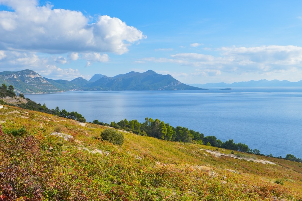
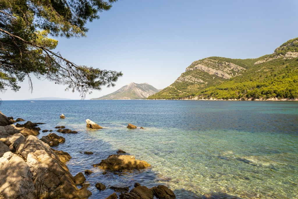
The Malo more is surrounded by small mountains stretching about 350 meters (1,000 ft) out of the sea.
The Pelješac features a network of trails along the central ridge. These challenging trails traverse the Peninsula, offering expansive views of the Adriatic Sea, Malo More, and the islands of Korčula and Mljet. The routes mainly pass through Mediterranean scrubland and rugged karst terrain. You can start in Ston or drive further out along the Peninsula; a trailhead is never far.
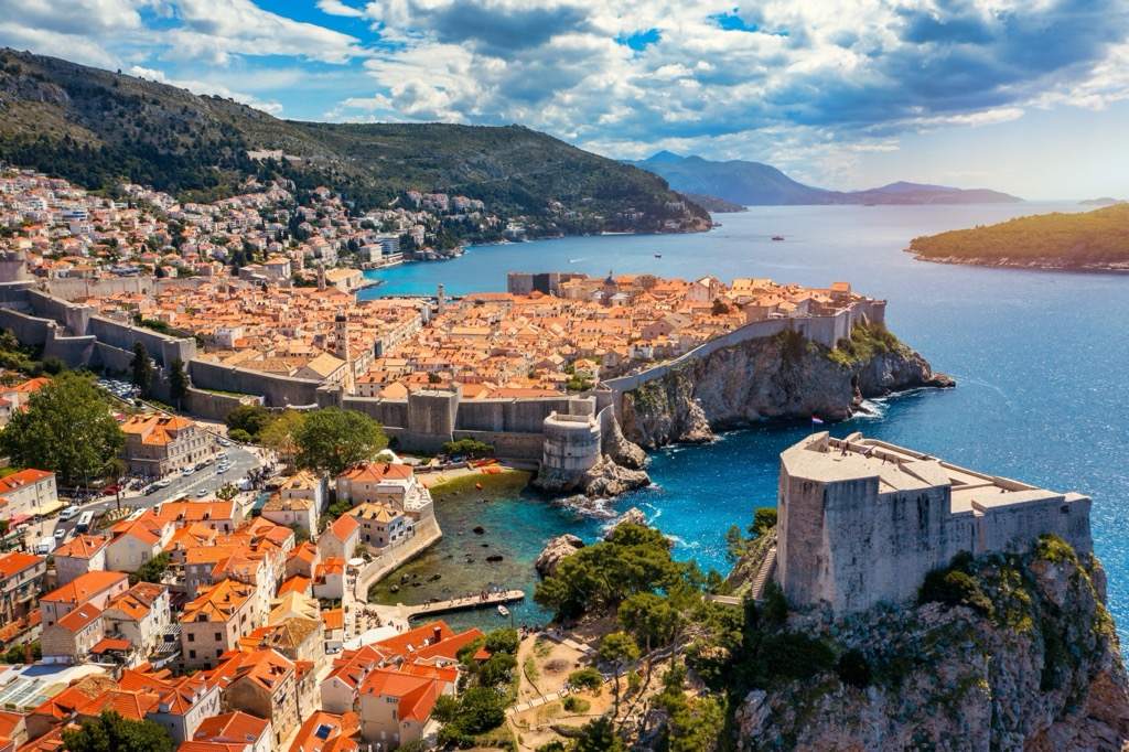
Dubrovnik is a stunning city on Croatia’s southern Adriatic coast. The city is encircled by massive stone walls built between the 11th and 17th centuries (though not as large as those of Ston). Dubrovnik's Old Town is a UNESCO World Heritage Site with limestone-paved streets and the impressive Rector's Palace. The city's strategic coastal perch made it a powerful trading hub within the Mediterranean and the Ottoman Empire.
Dubrovnik was damaged during the tragic Croatian War for Independence (1991-95) and has spent the last decades recovering. Dubrovnik is about 60 km southeast of Ston and the surrounding park.
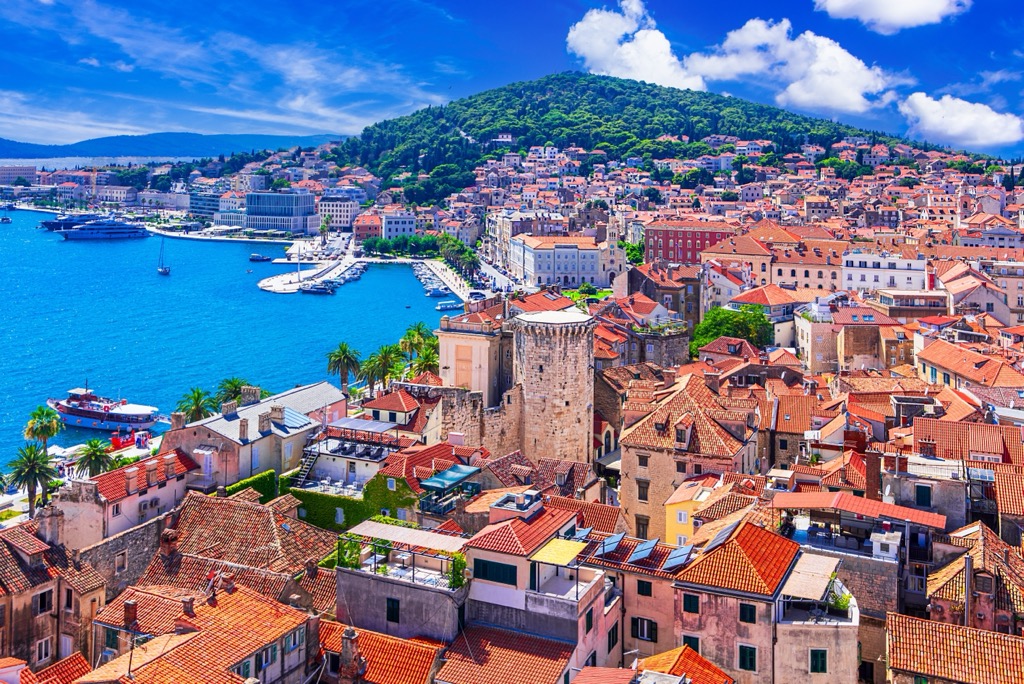
Most visitors to the park will pass through Split, the second-largest city in Croatia. Split is about two hours northwest of Ston.
At its heart lies the historic Diocletian’s Palace, a sprawling Roman complex built in the 4th century by Emperor Diocletian as his retirement residence. The city is framed by Marjan Hill, a forested park with excellent views, and the vibrant Riva promenade, which lines the waterfront.
Pelješac is not one town but rather a region consisting of scores of small towns and villages. The scenic peninsula surrounds the park’s southern border, from Ston out to the mouth of the Malo more. Pelješac is known for its Mediterranean landscapes and rich wine-making tradition.


