Scan the QR code and open PeakVisor on your phone
The Huaytapallana Regional Conservation Area (Spanish: Regional Conservation Area Huaytapallana) is a protected area located in the Junín region of Peru. The region works to protect the biological diversity of the Huaytapallana mountain range. The tallest and most prominent peak in the conservation area is Waytapallana (also known as Huaytapallana) at 5,557 meters (18,232 ft) tall with 1,574 meters (5,164 ft) of prominence.
The Huaytapallana Regional Conservation Area lies in the Junín division in south central Peru. The protected region covers 22,407 hectares (55,369 acres) of land within the Huaytapallana mountain range.
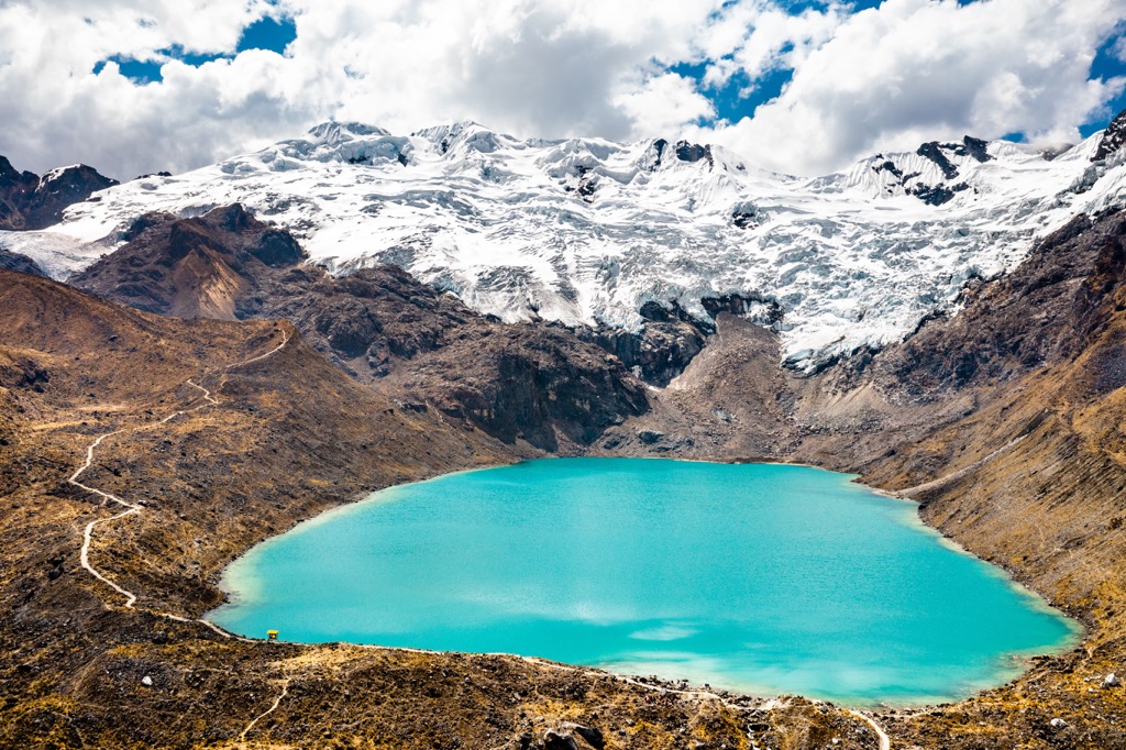
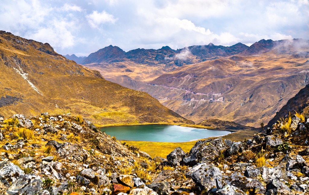
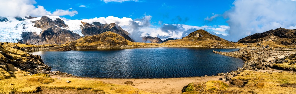
The mountain range for which the conservation area was named after, is the prominent feature within the landscape. The towering snow-capped mountains rise steeply from the foothills. Alpine lakes and wetlands are scattered throughout the mountainous terrain which generate water for the surrounding communities.
The conservation area was established in 2011 in an effort to protect the biological diversity of the region. Lower elevations are marked by sweeping grasslands that quickly transform to the prominent mountains.
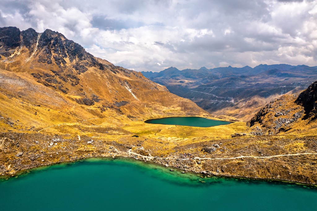
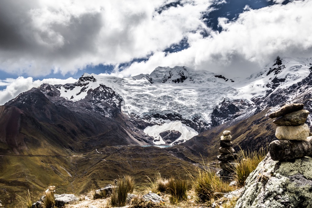
Amidst the rugged peaks lie six major lagoons. The Chuspicocha and Lazo Huntay feed into the Sullcas River which acts as a main water source for the surrounding region. The Cocha Grande and Carhuacocha feed into the Yaracyacu River, while the Ancapuachanan and Pumacocha lagoons join to form the Chiapuquio River.
The Huaytapallana Regional Conservation Area is surrounded by other protected areas in the country. The Reserva de Biosfera Bosques de Neblina-Selva Central lies to the north while the Reserva de Biosfera Avireri-Vraem extends to the north, east, and south. The Reserva Paisajistica Nor Yauyos-Cochas is situated to the west.
The peaks within the Huaytapallana Regional Conservation Area are part of the Huaytapallana Mountains. These peaks mark a small subrange of the larger Andes that extend along the western coast of South America.
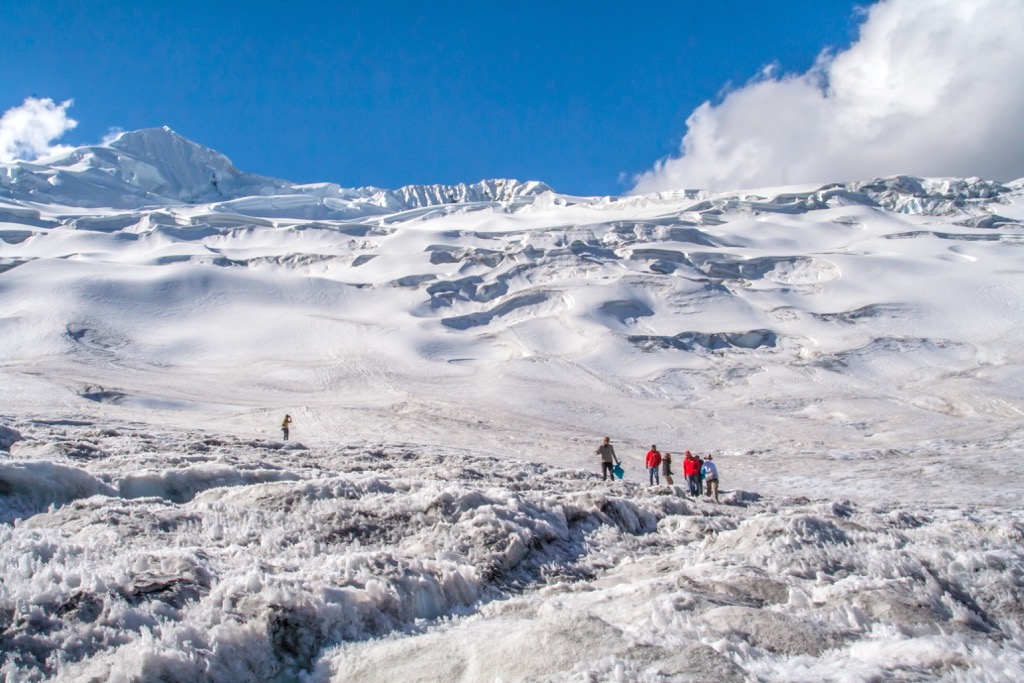
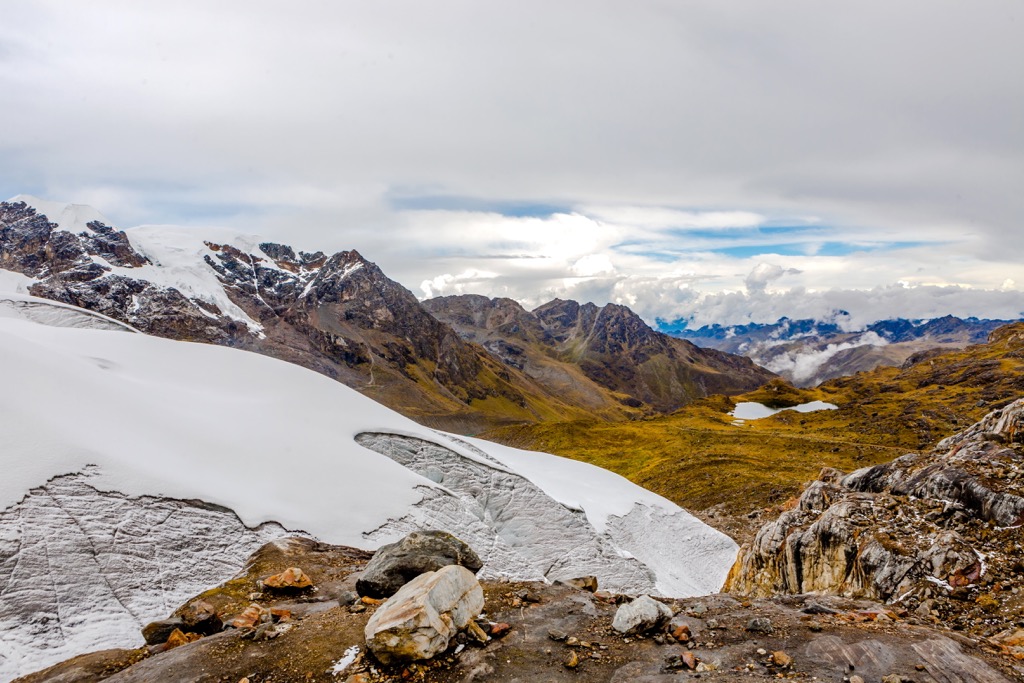
The entire subrange extends around 17 kilometers (10.5 miles) north to south, extending beyond the boundaries of the regional conservation area. Glacial retreating has drastically shaped the landscape, leaving behind glacial cirques, alpine lakes, and massive glaciers which cover the peaks.
This subrange, along with the rest of the Andes, began forming during the Cenozoic Era, around 65 million years ago. Global shifting of tectonic plates, subducted the oceanic crust beneath the South American Plate.
This immense pressure thrust the range upwards, giving rise to the range and its dramatic changes in elevation. Widespread volcanic activity occurred as the range was uplifted even further.
Glaciation and rivers have further carved out the landscape, leaving behind the deep valleys and sweeping meadows amidst the rugged ridgelines. Today the main departure point for mountaineers in the Huaytapallana range is Virgen de las Nieves (Virgin of the Snow), which offers two primary routes for reaching the summit of Waytapallana.
Major peaks located within the Huaytapallana Regional Conservation Area include Waytapallana, Chupicalle, Tillu, Yana Uqsha, and Cerro Sorapata.

The flora and fauna found in the regional conservation area is similar to that found throughout the Peruvian Andes. The biodiversity of the region is one of the main reasons the area became protected in 2011.
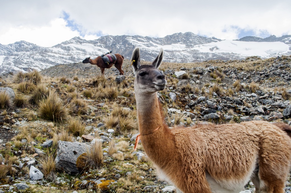
Common animals in the surrounding region include condors, pumas, and various species in the camelids family. The endangered Andean bear has been spotted in the surrounding region, with its population steadily on the rise due to protected areas such as this one.
Orchids can be found just outside the park, often at slightly lower elevations. The foothills in the region are often covered with humid montane forests. A majority of the area features alpine terrain with low growing grasses and small shrubs. The tallest peaks in the park are covered in snow and free of flora.
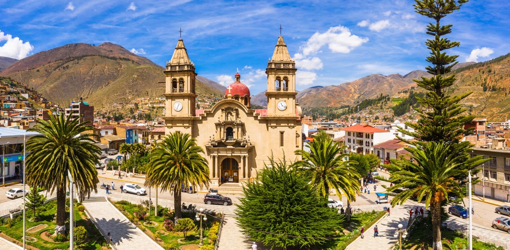
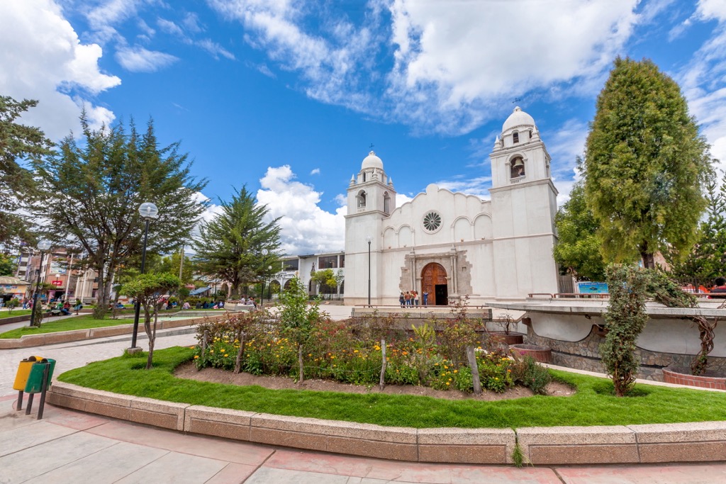
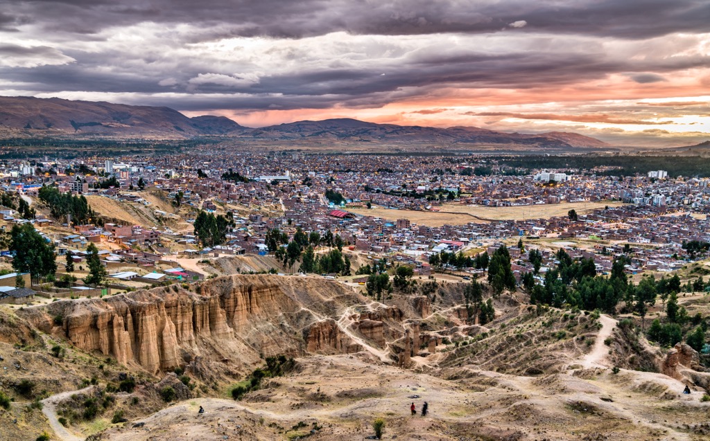
Humans have inhabited the land within and surrounding the regional conservation area for thousands of years. The closest major city to the protected area is Huancayo, which today marks the capital of the Junín region.
The city of Huancayo lies within the Huancayo Province, nestled within the Mantaro Valley. The Huancas people began inhabiting the region around 500 BCE, and are a part of the Indigenous Quechua peoples of present day Peru.
For hundreds of years the Indigenous people lived harmoniously with the land. In 1460 CE, the Huancas were overthrown by the Parachautec, which forced them to become part of the Inca Empire.
Beginning around 1200 CE, the Inca civilization dominated much of the surrounding region. Under the guidance of King Pachacuti, the Incas went on to build the city of Cusco and other major settlements whose remnants are still visible today.
Despite being part of the Inca Empire, the Indigenous peoples way of life was not drastically affected. In 1534 CE, the Spanish colonized the region and overthrew the Inca Empire. This shift in power also led to a drastic change for the Indigenous people who were forced to cease production of their native crops and instead grow crops for the Spanish.
Nearby cities began to grow more rapidly than Huancayo but the town was eventually established in 1572. Huancayo continued to grow and in 1813 the city celebrated the establishment of the Constitution of Cadiz.
Following decades of fighting, the country of Peru gained its independence from Spain in 1820 and the city’s cathedral began being constructed shortly after in 1831. A prominent statue in the city marks the end of slavery in Peru in 1854.
Today the city of Huancayo is a center of commerce for the region, known for its festivals, markets, and surrounding mountain towns. A major railway connects the city to nearby Lima. The Huaytapallana Regional Conservation Area was established in July of 2011 in an effort to protect the biodiversity and water sources within the surrounding mountain range.
The Huaytapallana Regional Conservation Area is home to minimal amounts of hiking trails. Here are some of the most popular hiking areas in the conservation area:
This route takes hikers to a viewpoint of the Huaytapallana mountain range. The route is also known as the Ruta de las Lagunas, or the Huaytapallana Trek. The circular route follows around the shores of Laguna Carhuacocha and Hatunqucha, along with various smaller alpine lakes.
Hikers have stunning views of the glacier capped peaks including Waytapallana and Yana Uqsha. Hikers taking this route should note that they are at high elevation and weather can change quickly.
The entire loop trail is 9.3 km (5.8 miles) long and features 563 m (1,847 feet) of elevation gain.
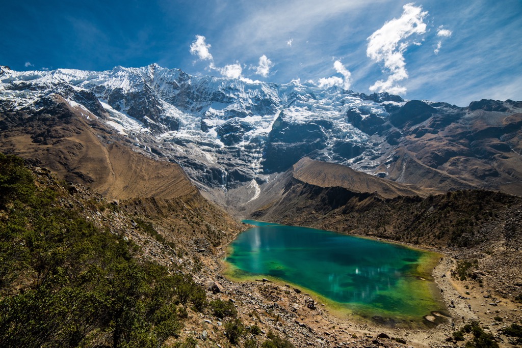
Humantay Lake is one of the most picturesque sites in the entire regional park. The route begins at the same trailhead as Mirador Huaytapallana. The trail climbs steadily for the first few kilometers before descending down to the lake. The Huaytapallana peaks towers above on the other shoreline of the lake.
Hikers should note that the route back to the trailhead also features climbing and can often take just as long as the hike to the lake. The out and back route is 14 km (8.8 miles) and has 320 m (1,050 ft) of total elevation gain.
Looking for a place to stay near the Huaytapallana Regional Conservation Area? Here are some of the best cities and villages to check out in the region:
Huancayo is the closest major city to the regional conservation area. The city is the capital of the Junín region as it lies in the central highlands of Peru. Situated in the foothills of the Andes, Huancayo has over 450,000 residents, making it the fifth most populous city in the country.
The location of the city has made it the cultural and financial center for the Peruvian Andes r. The city offers visitors a look into authentic Andean culture, full of crafts, festivals, ruins, and trekking the beautiful scenery.
Each week the city hosts the La Feria Dominical, a fair which features hundreds of local vendors selling their crafts and products. Just outside the city limits lie the Torre Torre, towering rock formations that stand over 100 feet tall.
North of Huancayo lies the city of Tarma, home to around 43,000 residents. The city is the capital of the Tarma Province within the Junín region. Situated within a fertile valley, Tarma has been inhabited by humans for thousands of years.
The small city offers visitors a destination off the beaten path. Here the community is surrounded by the stunning landscape of the Andes, lying between the central coast, the Andean provinces and the Central Forest. Popular sites include the Plaza de Armas and El Senor de Muruhuay.