
Scan the QR code and open PeakVisor on your phone
Gargano National Park has 81 named peaks. The highest is Monte Calvo at 1,056 m. Other notable peaks include Montenero, Monte Spigno and Murge Lunghe.
With its ancient forests, rugged mountains, and glistening waters, Gargano National Park is one of Italy's hidden hiking gems. There are 81 named summits in Gargano National Park. The highest and the most prominent mountain in the park is Monte Calvo (1,056 m/3 465 ft).
Gargano National Park (Parco Nazionale del Gargano) is a national park in the Apulia (Puglia) region of southern Italy.
Located in the province of Foggia, Gargano National Park covers an area of approximately 1,181 sq km (456 sq mi) across the Gargano Promontory. The Gargano Promontory is a headland that juts out of Italy's eastern coastline into the Adriatic Sea and is commonly referred to as the spur of Italy.
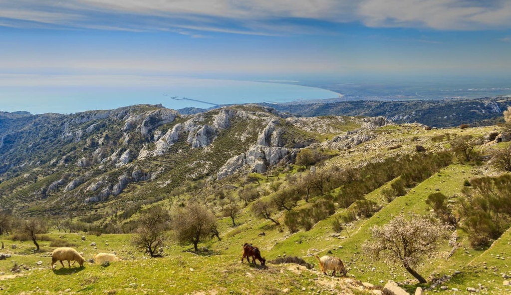
Gargano National Park can be split into three regions. The park's main feature is the Monte Gargano massif, a series of limestone mountains that rarely exceed 1,000 m (3,280 ft) above sea level.
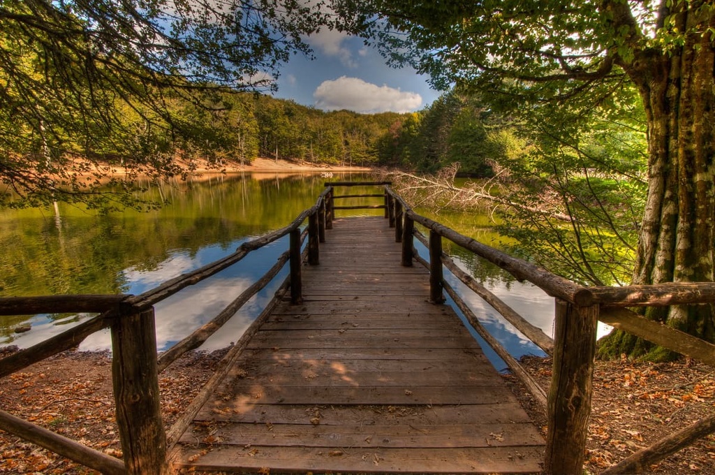
To the east of Monte Gargano is Umbra Forest (Foresta Umbra). This woodland covers approximately 105 sq. km (41 sq. mi) of land and is the only significant stretch of ancient forest left in Italy. It forms part of the Umbra Forest Nature Reserve (Riserva Naturale Foresta Umbra).
The Tremiti Islands (Isole Tremiti) is an archipelago located approximately 22 km (13.5 mi) north of the Gargano Promontory. The archipelago consists of five islands: San Domino, San Nicola, Capraia, Cretaccio, and Pianosa. San Domino is the largest island in the archipelago at 2 sq km (0.8 sq mi) in area.
Another prominent feature of the Gargano Promontory are the wetlands located along the cape's northern coastline. These areas contain marshland habitats that are rare in southern Italy.
You'll find two significant lakes along the promontory's northern coastline, Lago di Varano and Lago di Lesina. They are the seventh and ninth-largest lakes in Italy, respectively. There are no significant rivers within Gargano National Park as most waterways in the park run underground due to the region’s karst topography.
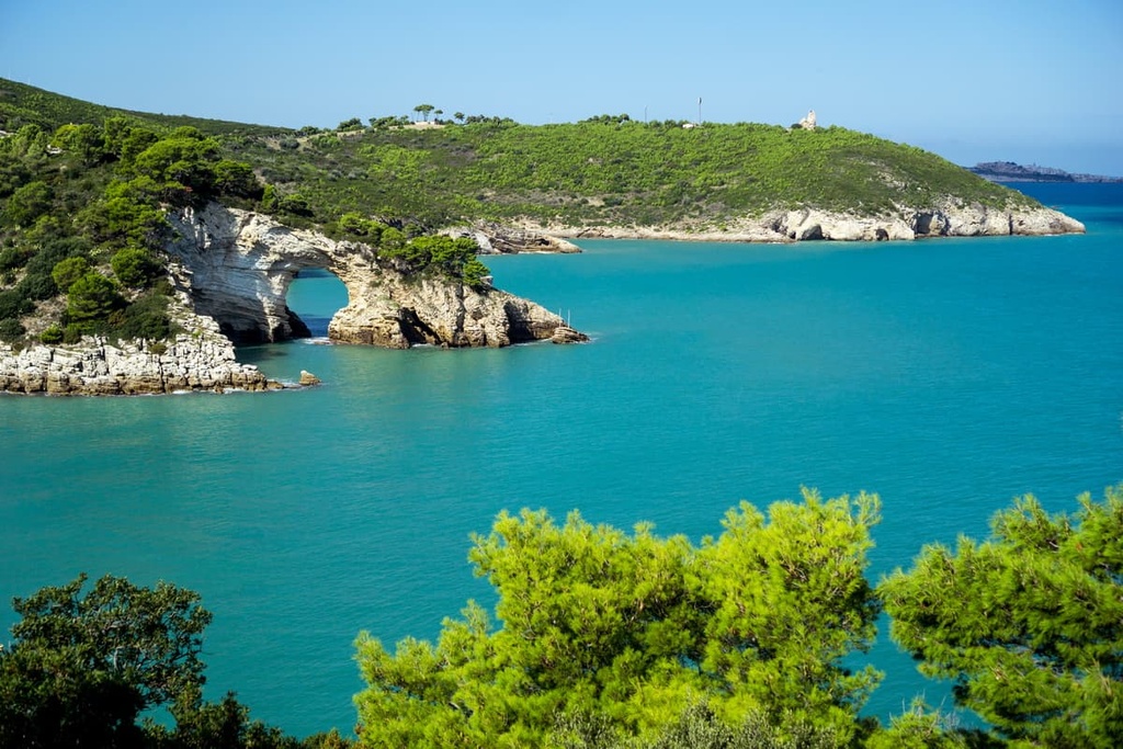
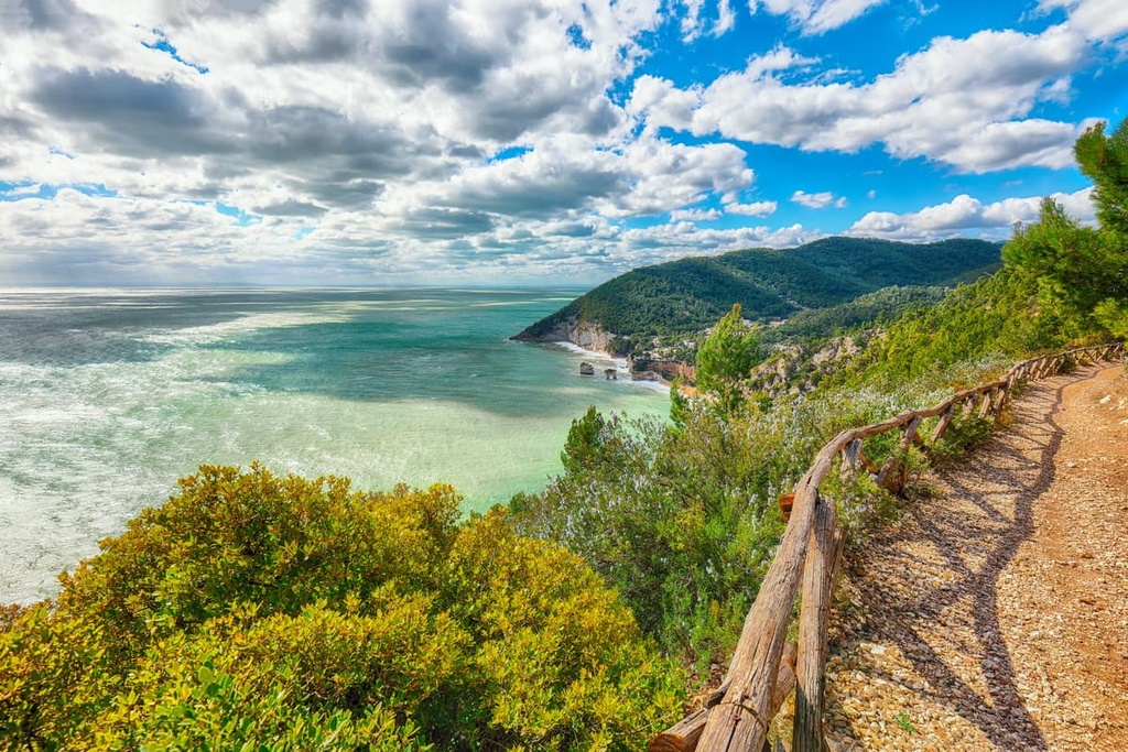
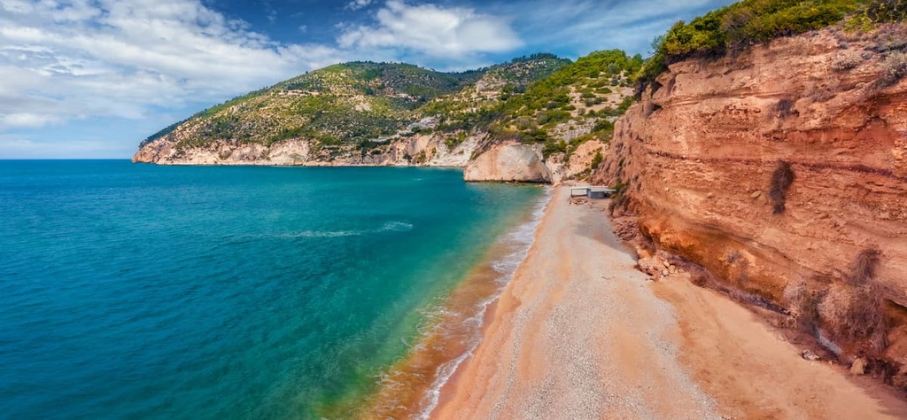
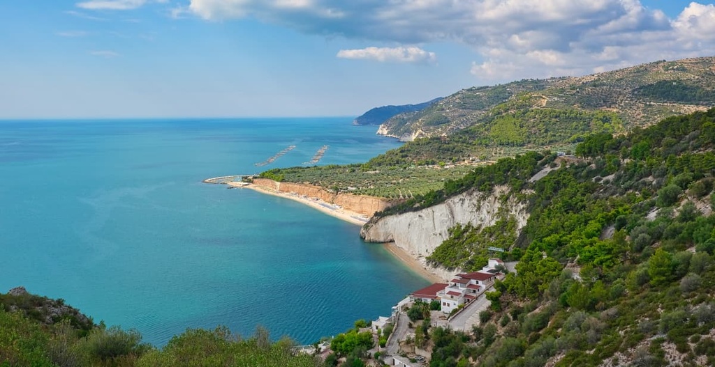
The coastline of Gargano is famous for its crystal-clear waters and towering limestone bluffs. The park's coastal beauty makes it popular with tourists. As a result, it is home to seaside resort towns such as Vieste, Manfredonia, and Peschici.
Notable inland settlements in the general region include Monte Sant'Angelo and San Giovanni Rotondo. The nearest major city to Gargano National Park is the provincial capital Foggia, which is located approximately 40 km (25 mi) to the southwest.
The entirety of the Gargano Promontory is composed of limestone. The region formed between 252 to 66 million years ago during the Mesozoic Era.
The headland is notable for its ancient karst landscape, a topography where the erosion and dissolution of soluble sedimentary rock creates caves, sinkholes, and underground drainage systems. There are roughly 600 sea caves on the Gargano Promontory, as well as rock formations such as coastal stacks (faraglioni).
The Gargano Promontory is of great interest to archeologists. Gargano was once an island due to higher sea levels that occurred during the Late Miocene to Early Pliocene (between 2 and 4 million years ago).
During this period, many of the island's animals evolved separately from their mainland relatives, resulting in island gigantism. Examples of species with island gigantism on Gargano include fossilized murine rats that had 20 cm (8 in) long heads.

Today, the Gargano Promontory is notable for its varied coastline and central mountain massif, which includes Monte Gargano. The massif consists of mountains that are mostly under 1,000 m (3,280 ft) in elevation.
There are three summits over 1,000 m (3,280 ft) in the massif: Monte Calvo (1,056 m/3,465 ft), Montenero (1,015 m/3,330 ft), and Monte Spigno (1,010 m/3,314 ft). Monte Calvo is also the most prominent mountain in Apulia.
As it is home to several rare habitats, including the last remaining stretch of ancient forest in Italy, Gargano National Park is a true bastion for biodiversity in the region.
Gargano is also of particular ecological interest as it forms a biogeographical link between the Balkans and the Mediterranean, with similarities between flora and fauna in both regions.
Common large mammals seen within Gargano National Park include Podolica cattle, roe deer, and wild boars. Other mammals in the area include badgers, red foxes, and European wildcats.
Numerous bird species inhabit the Gargano Promontory, especially to the park's north in wetland areas, where you can spot great cormorants, avocets, and greater flamingos.
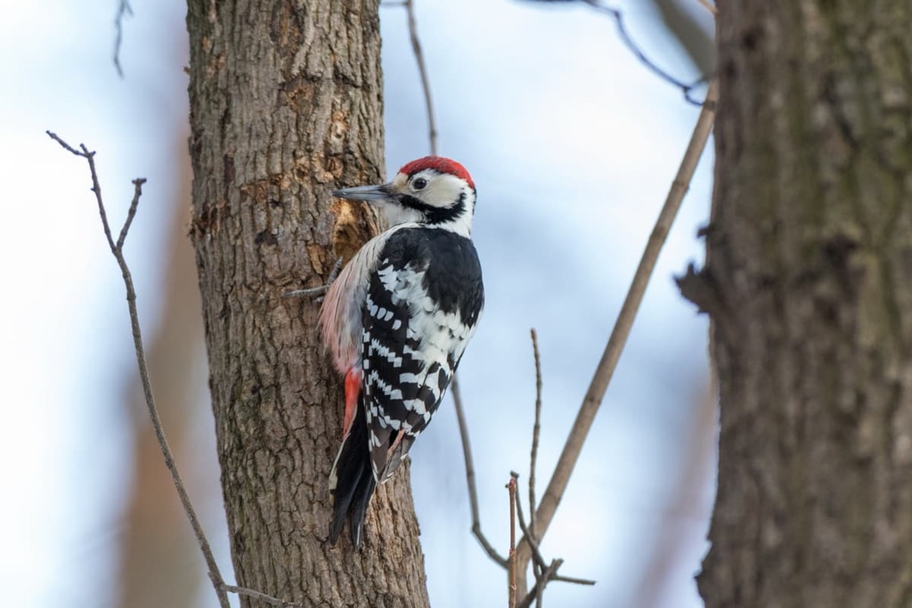
The park's forests are home to several woodpecker species. The most notable species is the rare Lilford's woodpecker, which lives only in protected areas.
Other interesting bird species include European bee-eaters, golden orioles, and little bustards. Birds of prey include red kites, osprey, and peregrine falcons.
Interestingly, several insect species in Gargano are found nowhere else in Italy but can be found within the Balkans, highlighting the biogeographical link between the regions. There's an exceptionally diverse range of butterflies inhabiting Gargano, including silver-washed fritillaries, Adonis blues, and Meleager's blues.
Roughly a dozen reptile species inhabit Gargano, most of which are snakes. Reptile species native to Gargano include Italian wall lizards, green-whipped snakes, and Italian three-toed skinks.
Gargano National Park protects one of Italy's most important woodland habitats, Umbra Forest. Due to Umbra Forest's importance, its central area is closed to the public.
Forests cover roughly 33 percent of Gargano National Park and consist primarily of beech trees, as well as turkey oaks and holm oaks. Other common tree species include yews, maples, and hollies.
One of the most common tree species on the Tremiti Islands is the Aleppo pine. Some Aleppo pine specimens in Gargano National Park are over 500 years old.
The northern coastline of Gargano is famous for its olive and citrus groves, while the southern coastline is famous for its vineyards that produce rich red wine.
Gargano is home to the most diverse range and the highest concentration of orchids in Europe, with over 60 recorded species. Examples include green-winged orchids, naked-man orchids, and lady orchids.
There are approximately 2,000 plant species on the Gargano Promontory. Notable species include Apennine anemones, Iris pseudopumilas, and Lamium garganicums.
Humans have lived in Gargano National Park for tens of thousands of years. Thanks to the region's cave systems and naturally occurring flint deposits, prehistoric humans thrived on the Gargano Promontory.
The oldest evidence of humans inhabiting Gargano National Park is the cave paintings in Pagliacci Grotto near Rignano Garganico, which date back approximately 15,000 years.
By the ninth century BCE, Dauni tribes belonging to the Illyrians had settled on the Gargano Promontory. The Daunians built agricultural and defensive structures, and they left behind well-preserved tombs, which now serve as evidence of some of the region’s earliest human settlements.
The Romans arrived on the Gargano Promontory by the fourth century BCE and built several cities, including Vieste.
The most notable ancient architecture in Gargano results from the construction of the Via Sacra Langobardorum by the Longobards. Many ruinous churches sit along this road, including one of the park's most famous attractions, the Sanctuary of the Archangel Michael (Santuario di San Michele Arcangelo).
Monte Gargano is known as the Montagna Sacra, or Holy Mountain, due to legends surrounding the appearance of Archangel Saint Michael in the town Monte Sant'Angelo during the fifth century CE. Another reason the area is popular with pilgrims is due to the Capuchin Friary of San Giovanni Rotondo, where Padre Pio, a modern saint, friar, and stigmatist, lived for 50 years.
Gargano National Park was established in 1991 to protect the region's varied habitats, endemic wildlife, and unique culture. In addition, the park is part of a UNESCO site, which contributes to the "un Bosco per Kyoto," a program that partners with schools to provide education about environmentally conscious tourism.
Gargano National Park is a large park with many isolated areas. Therefore, hikers should come prepared with topographical maps, supplies, and appropriate clothing. Hikers that aren't familiar with the Gargano should consider hiring a licensed tour guide.
Routes in Gargano National Park follow the Swiss Alpine Club's (SAC) trail scale, which is as follows:
Read on to learn more about some of the best hiking areas in Gargano National Park.
Monte Calvo (1,056 m/3 465 ft) is the tallest and most prominent mountain on the Gargano promontory. It's located in the southwestern part of the park, just north of the town of San Giovanni Rotondo. Monte Calvello (950 m/3,117 ft) flanks Monte Calvo to the east.
Monte Calvo is popular with tourists looking for hiking options after their pilgrimage to the Sanctuary of Saint Pio of Pietrelcina. The bald summit of Monte Calvo provides sweeping vistas of the dense forests surrounding the mountain.
The best way to scale Monte Calvo is along the T1 Cima di M. Calvello-Cima di M. Calvo-Rifugio Casino trail.
Montenero (1,015 m/3,330 ft), or Black Mountain, is the second-tallest mountain in Gargano National Park. Montenero is located approximately 7.3 km (4.5 mi) to the west of Monte Calvo (1,056 m/3 465 ft). The nearest mountain to Montenero is Coppa Romitorio (943 m/3,094 ft), which is located roughly 4.4 km (2.7 mi) to the northeast.
The most famous feature of Montenero isn't its summit, but its karstic cave system. Located at 975 m (3,198 ft) above sea level, the Montenero Grotto is a 400 m (1,312 ft) long cave known for its many rooms and stunning cave formations. Philosopher Michelangelo Manicone first described the Montenero Grotto in the late eighteenth century.
The slopes of Montenero are covered in dense beech and oak forests. There's a marked trail that leads to the summit.
Monte Sacro (872 m/2,861 ft) highlights the religious significance of the Gargano Promontory. Monte Sacro is the third most prominent mountain in Gargano National Park and the highest summit in eastern Gargano past the town of Mattinata.
Monte Sacro was originally named Monte Dodoneo. It was inhabited by pagans who worshiped Jupiter. Following the alleged appearance of Saint Michael in Monte Sant'Angelo, local religious leaders destroyed the pagan shrines and renamed the mountain.
Christians built the Abbey of Monte Sacro, a Benedictine monastery between the sixth and thirteenth centuries. The ruins of the monastery are popular with tourists.
There is a T1 trail that leads to the summit of Monte Sacro.
Monte di Mezzo (725 m/2,379 ft), along with the small hilltop town of Rignano Garganico, provide some of the best panoramas on the Gargano Promontory. Nicknamed the "balcony of Puglia," Monte di Mezzo is located at the heart of Gargano's high ground. Rignano Garganico is located on the same ridge as Monte di Mezzo.
Hikers can plan a leisurely walk from the center of Rignano Garganico to Via Belvedere. This observation point encircling the town center boasts views as far as Monte Cornacchia (1,151 m/3,776 ft) in the Dauni Mountains to the west and Manfredonia to the south.
Monte Saraceno is one of the best places to experience Gargano's stunning limestone coastline. Located between Manfredonia and Mattinata, Monte Saraceno is a towering cliff that rises approximately 260 m (853 ft) above sea level.
From Monte Saraceno, hikers get to enjoy views of the glistening Adriatic Sea to the west, the cliffs near Manfredonia to the southeast, the silhouette of Monte Sacro (872 m/2,861 ft) to the north, and the Carbonara Valley to the east.
As well as providing sweeping vistas, Monte Saraceno holds historical significance. The clifftop is home to the Necropolis of Monte Saraceno, a Daunian archeological site featuring approximately 500 tombs.
As the last remaining area of ancient forest left in Italy, Umbra Forest is well worth exploring. Umbra Forest is all that's left of the "Nemus Garganicum," a forest that once covered the entirety of the Gargano Promontory.
Despite shrinking considerably over the centuries, Umbra Forest is still one of the largest broad-leaved forests in Europe. The highest point in Umbra Forest is Monte Iacotenente (838 m/2,749 ft).
The forest contains one of the most famous trees in Gargano, the Leccio of Vico del Gargano. This 15 m (49 ft) tall tree stands in front of the Capuchin Monastery and was planted over 300 years ago.
Fifteen marked trails run through Umbra Forest. You can get information on the trails from the visitor's center near Laghetto Falascone d'Umbra. You can also pick up food to feed the friendly local deer population.
One of the best ways to explore the forest is on the T2 Monte Iacotenente-Grava di Marianna-Foresta Umbra Trail.
Thanks to the cape's stunning coastline and numerous resort towns, Gargano National Park is a popular vacation destination for Italians. Read on to learn about the main cities and towns in Gargano National Park.
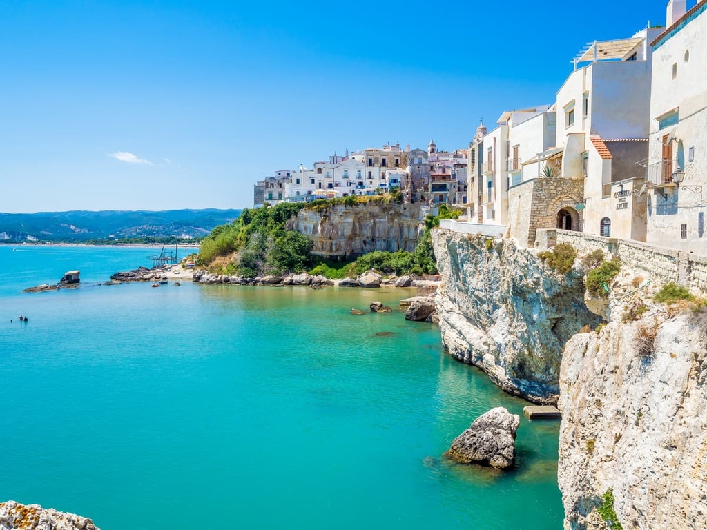
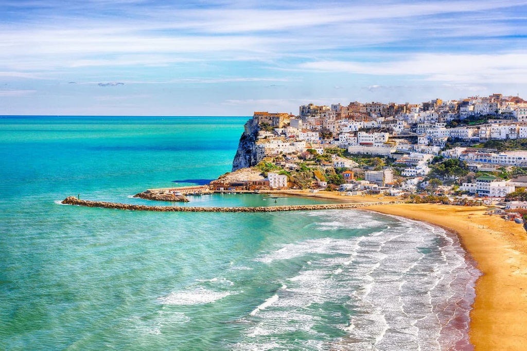
Perched on the eastern tip of the Gargano Promontory is Vieste. Founded by the Romans, Vieste has been one of Gargano's main resorts for centuries, with tourists attracted by its pristine beaches and limestone cliffs.
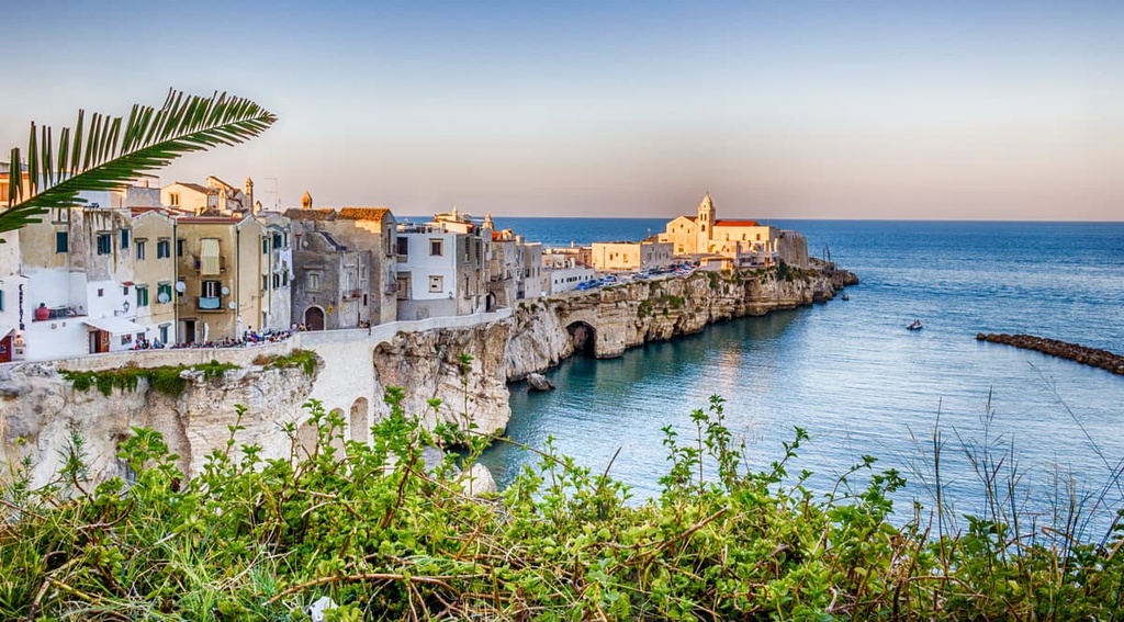
The coastline near Vieste is dotted with dozens of fascinating rock formations, like the rock arch at Baia San Felice. When you're not exploring the coast, head inland for a walk through Umbra Forest. Popular hotels in Vieste include Hotel Sciali and Village Baia Turchese.
Manfredonia is the largest coastal town on the Gargano Promontory. Located on the southern coastline overlooking the Gulf of Manfredonia, Manfredonia is the ideal base from which to explore Monte Gargano.
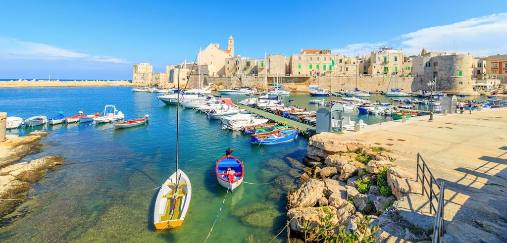
Manfredonia is an ancient settlement founded over 2,000 years ago and is home to fascinating historical attractions like the twelfth-century Basilica of St. Mary of Siponto or Manfredonia Castle. If you're looking to stay in Manfredonia, book a room at Regiohotel Manfredi or La Dolce Vista.
Monte Sant'Angelo sits high up on a long ridge that features Monte Degli Angeli (882 m/2,894 ft). It's the highest significant settlement on the Gargano Promontory at an elevation of 796 m (2,612 ft).
Monte Sant'Angelo is one of the most popular tourist destinations in Gargano National Park as it's home to the thirteenth-century Sanctuary of Monte Sant'Angelo. The Sanctuary of Monte Sant'Angelo is the oldest shrine to St. Michael in Western Europe and is a UNESCO World Heritage Site.
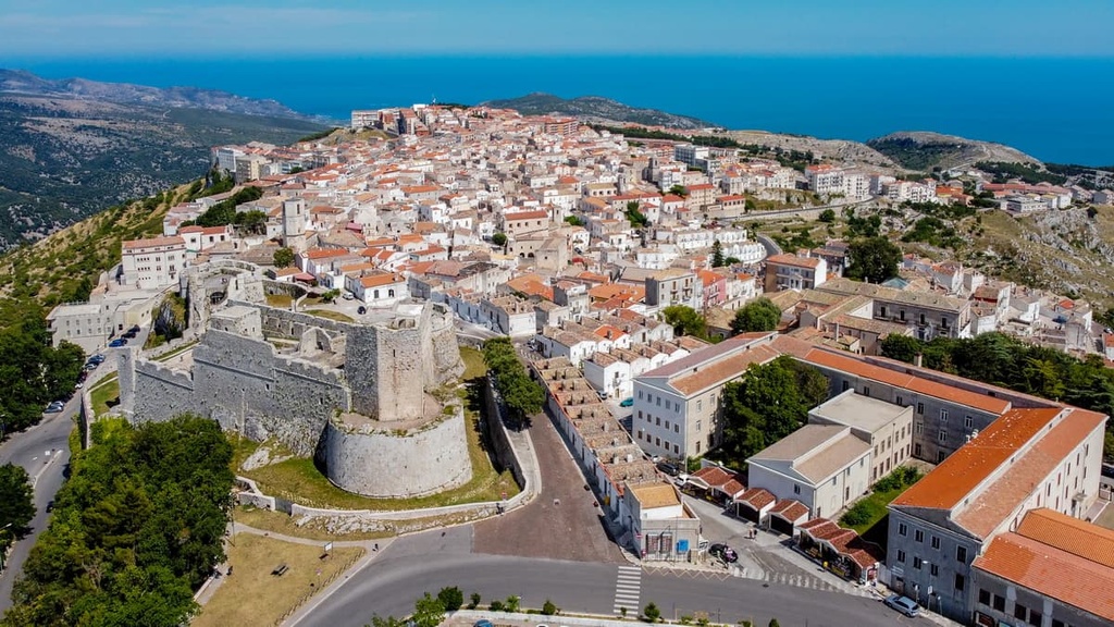
Popular hotels in Monte Sant'Angelo include Hotel Santangelo and Palace Hotel San Michele.
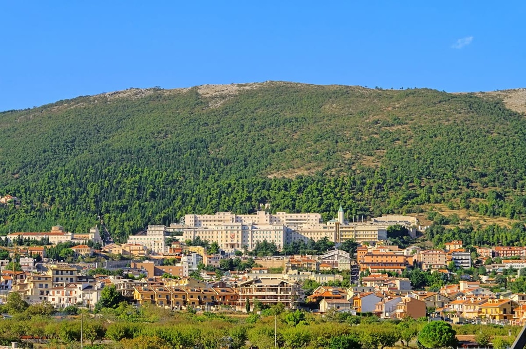
San Giovanni Rotondo is the largest inland settlement in Gargano National Park. San Giovanni Rotondo is significant as it was home to Saint Pio of Pietrelcina from 1916 to 1968. The Padre Pio Pilgrimage Church is an essential stop for Christian pilgrims.
San Giovanni Rotondo is the perfect base for hikers planning to scale the highest summits in Gargano National Park, with Monte Calvo (1,056 m/3 465 ft) and Montenero (1,015 m/3,330 ft) less than 10 km (6 mi) away. Hikers looking to spend the night in San Giovanni Rotondo should check out Hotel Vittoria or Hotel Gran Paradiso.
You'll find many beautiful coastal towns on the Gargano Promontory, but few are as incredible as Peschici. Resting on a small rocky spur on Gargano's north coastline, Peschici is renowned for its spotless white buildings and sandy beaches.
When you're not soaking up the sun on Spiaggia di Procinisco or Baia Zaiana, take a tour of the ruinous eleventh century Abbazia di Santa Maria di Kàlena or plan a road trip to the "village of love," Vico del Gargano. Popular hotels in Peschici include Hotel Valle Clavia and Hotel Incontro Peschici.


The highest peak in Gargano National Park is Monte Calvo, at 1,056 m.
Notable peaks in Gargano National Park include Monte Calvo, Montenero, Monte Spigno, Murge Lunghe and Monte Croce.


