Scan the QR code and open PeakVisor on your phone
Divjaka-Karavasta National Park is a protected area governing wetlands, beaches, rivers, and estuaries and is a prime bird habitat. There are 11 named mountains in Divjaka-Karavasta National Park; the highest and most prominent is Mali Mali i Madh (182 m / 597 ft).
The Divjaka-Karavasta National Park (also known as Parku Kombëtar Divjakë-Karavasta in Albanian) lies in Albania, near the Adriatic Sea, covering 222 sq. km (86 sq. mi). The park is in Fier County, and the town of Divjaka is close to the park's entrance. Lushnje is the nearest significant city. The park is rich in features like wetlands, forests, and estuaries. Due to its unique birds and plants, it's considered internationally significant. Its coastline, approximately 35 km (22 mi), stretches from the Shkumbin River's mouth to the Seman River.
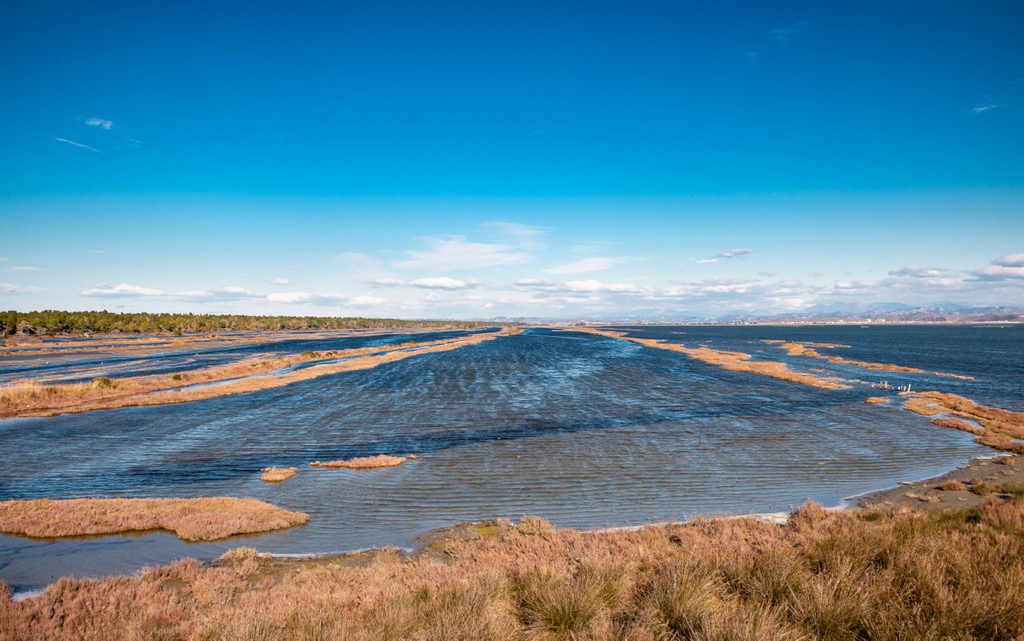
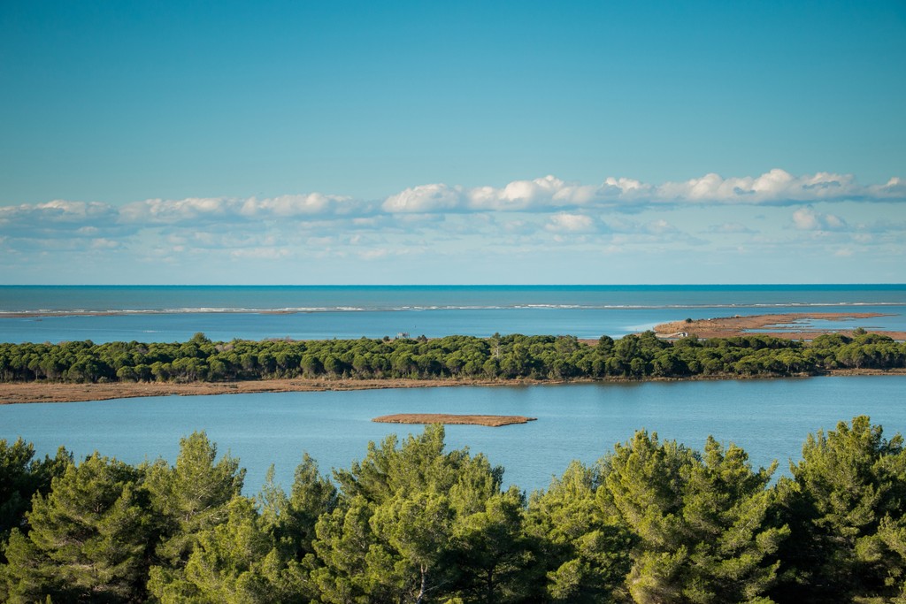
Karavasta Bay is Albania's most extensive bay and among the largest in the Mediterranean. It's separated from the Adriatic Sea by a sand barrier, and features pine forests and small sand islands. Karavasta Bay is internationally recognized as a Ramsar wetland.
Within this complex, there are three distinct protected areas: the strictly natural reserve of Karavasta Lagoon (covering 42 sq. km / 16 sq. mi), the Mediterranean pine forest encompassing Divjaka (spanning 12.5 sq. km / 4.8 sq. mi), and Kulari (covering 8.5 sq. km / 3.3 sq. mi).
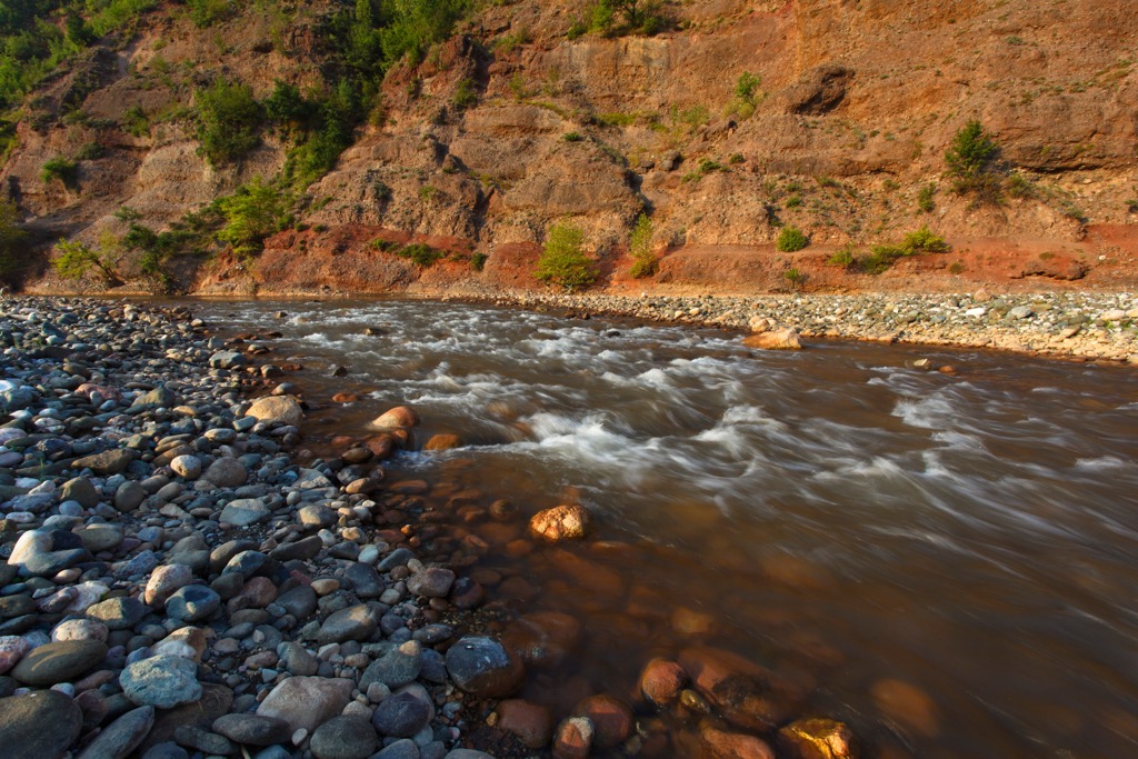
The rivers (Shkumbina and Seman) affect the park's water bodies by depositing sand, silt, and shells, forming islands and spits. These deposits cause the lagoons to have lower salt content, higher biomass, and unique colors.
Shkumbin River starts from the mountains in Korçë County, traveling through the Skanderbeg Mountains to the Adriatic Sea in the park's northern area. Similarly, the Seman River starts from Korçë County at the joining point of the Osum and Devoll Rivers.
The lagoon is encircled by fertile agricultural land that has been drained, primarily dedicated to cultivating vegetables, fruits, fodder, cereals, and sunflowers. As such, agriculture serves as the primary means of subsistence for the local population. Livestock also plays a crucial role, including sheep, buffalos, pigs, horses, goats, geese, turkeys, and chickens.
The Karavasta – Divjaka wetlands extend across the Myzeqe plain (covering an area of 1,800 sq. km / 695 sq. mi) in the central portion of the Adriatic Western Coastal Lowland. These wetlands form a part of the expansive Big Myzeqe plain.
The topography of the Myzeqe plain is characterized by exceptionally low elevations, generally not surpassing 20 m (65 ft), and gently slopes westward. Some areas even lie below sea level, contributing to drainage challenges during the wet season.
Geologically, the region comprises Miocene and Pliocene molasses overlaid with Quaternary marine and alluvial deposits in the upper layers. Gas reserves are present along the coastal area, with a significant portion being utilized by the fertilizer factory located in Fieri.
Furthermore, apart from the east-west gradient of the plain, there exists a pronounced depression situated between the adjacent riverbeds. The banks of the rivers typically stand higher than the plain between these two rivers due to the substantial sediment deposition that has occurred over time.
The area hosts the ecoregion of Illyrian deciduous forests, which is part of a larger biome called the Palearctic Mediterranean forests. Documented species includes 228 types of birds, 25 types of mammals, 29 types of reptiles, and 29 types of amphibians.
This park is particularly famous for birdwatching. Some resident species are visible all year round, while others migrate between Europe and Africa. Some of these birds are at risk of disappearing, with about 15 species classified as globally endangered. The park's wetlands and coastal areas are vital stopping points for these birds during their long journeys across the Adriatic region.
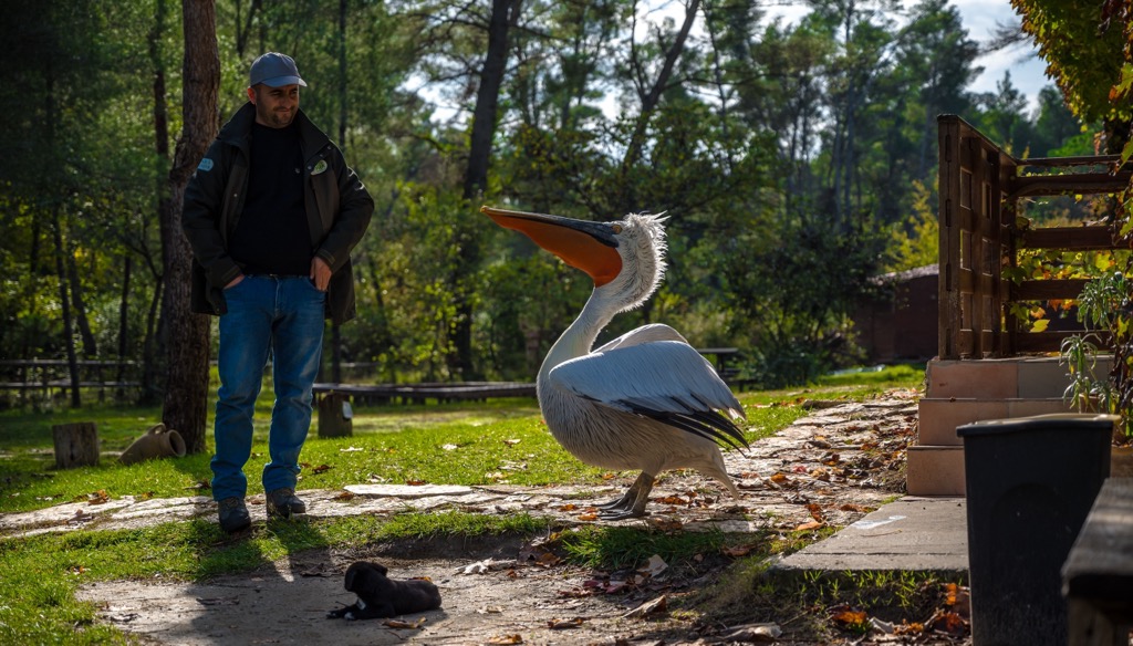
A rare bird called the Dalmatian pelican (Pelecanus crispus) lives in the park, which is home to 5% of the world's population. The park's lagoon is the only place along the Adriatic and Ionian Seas where they breed on the coast.
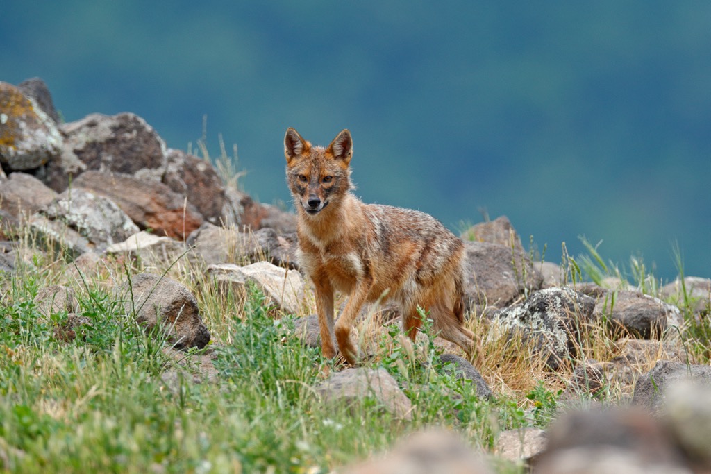
The wetlands and swamps in the park are full of algae and thick, visible grasses. These different habitats offer homes to many mammals, like the red fox, golden jackal, and roe deer.
The coastal areas are great places to inspect local plants. These areas have grasses that can tolerate salty conditions and help stabilize the dunes. As the dunes become more stable over time, the grasses become denser.
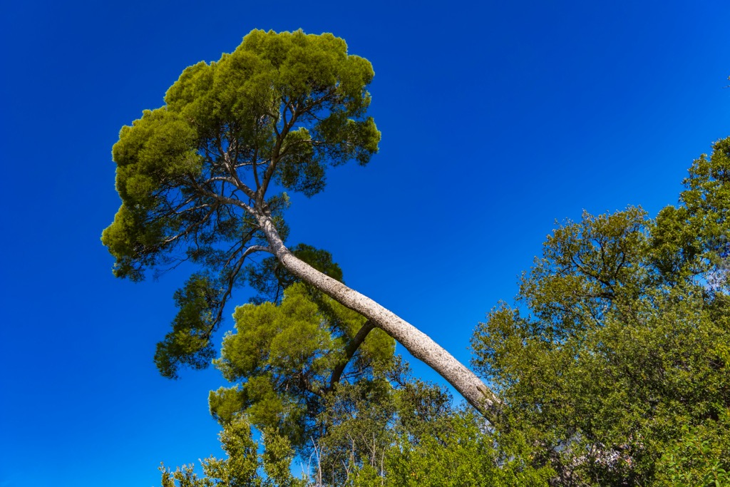
Many of the tree species grow in the northern part of Karavasta, between the sandy beaches and the mouth of the Shkumbin River. Pine trees are common, including Aleppo and stone pine. Other trees in the park include junipers, willows, oak, alder, elm, and ash.
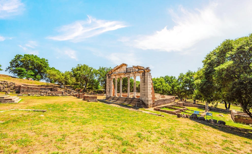
Divjaka has ancient origins. A settlement in Bishtçukasi dates from the fourth century BC and remnants of the city of Babunja date back to the Iron Age.
Evidence suggests the Divjaka hills have long been inhabited. The Illyrian tribe of the Taulants once lived here, between Durres and Apollonia and the ancient road, Via Egnatia, passed through this region.
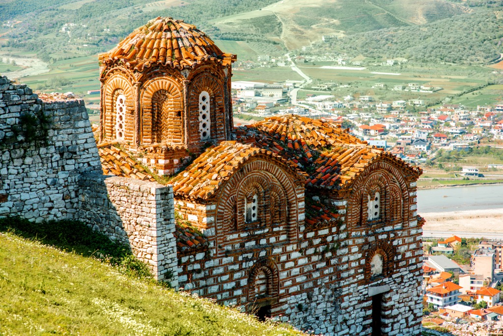
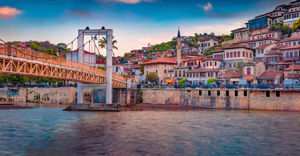
The Ardenica monastery dates back to the thirteenth or fourteenth century and is near Lushnja. It houses the Church of Saint Virgin Mary and was constructed during the Epirus governance. The town of Berat, just 35 km (21 mi) from Lushnja, was declared a UNESCO World Cultural Heritage site in 2008.
In 15th-century Divjaka, locals then had to pay heavy taxes and were subject to other hardships due to their Christian faith. Today, Islam is the most popular religion in Fier County (48%) with Christianity second.
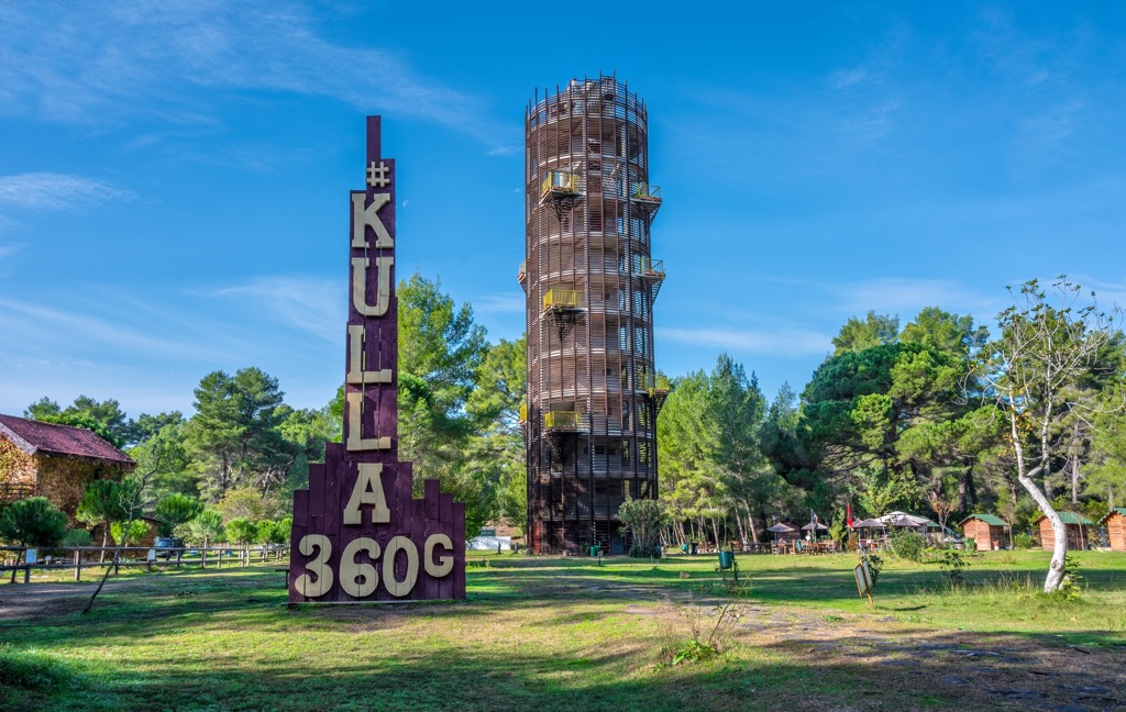
In 1966, the Divjaka Pine Forest was designated as a Strictly Protected Reserve, spanning 7 km (4.3 mi). Recognizing its unique qualities, the Albanian government took the step in 1994 to proclaim the entire Karavasta - Divjaka wetland complex, which covers an area of 145 sq. km (56 sq. mi), as a specially protected natural ecosystem.
In 2007, the Karavasta – Divjaka National Park along the Adriatic coast in Central Albania was designated as an expanded national park. The construction giant Mabetex, owned by Kosovo-Albanian entrepreneur Behgjet Pacolli, has suggested a new resort development within the park. This proposal has met strong resistance from environmentalists and local officials.
The initial segment of this trek goes through a thick forest, yet the trail is clear and easy to spot. The latter half of the hike involves the Vahu Canal, linking the Adriatic Sea to the Karavasta Lagoon, followed by a walk through the sand dunes and along Divjaka beach.
The hike begins at one of the southern forest entrance points. The trail then heads SW, passing through the forest on a clearly marked path for about 1.5 km (0.9 mi) until you reach a split: one path goes to the left, and the other continues straight.
Following the route forward, you'll move through the dense forest until you arrive at the Vahu Canal bridge. From there, turn NW with the forest to your right and the sea to your left. The journey then takes you north along the beach.
This scenic hike takes you through the park's thick pine forest. On this route, you can visit two of the park's natural attractions – the Old Pine and Godulla e Pishes Lagoon. Start your hike at the blue gate adjacent to the main road, about 1.5 km (0.9 mi) before the main park entrance.
For about 2 km (1.2 mi), head north on the distinct path through the dense pine trees until you reach a junction where you'll turn left, heading west. After roughly 5 min, take another turn north at the next intersection. Continue north to find the Old Pine.
Once you've seen the Old Pine, rejoin the main path and continue northward. When you reach the Emisari i Terbufit canal, you'll notice several fishing cabins along its length. Here, the trail heads west with the pine forest to your left and the canal on your right for about 1 km (0.6 mi). It offers a panoramic view of the Godulla e Pishes Lagoon.
Start your journey at the Divjaka forest's entrance. If you're coming from Divjaka to the National Park via the regular car road, your starting point will be the forest's first entrance. Continue north on a well-marked path until you reach the Tërbufi Canal. Take a right turn eastward and cross the canal.
Walk about 400 m (1,312 ft) with the Shkumbin River to your right and agricultural fields to your left. This region, known as Kulari, was once a thriving village but was abandoned due to recurrent flooding from the Shkumbin River. You’ll eventually reach the river’s mouth and enjoy panoramic views of the Kulari Islands.
The biggest cities near Divjaka-Karavasta National Park include:
Lushnje is a picturesque town in the heart of Albania, serving as a vital crossroad between the coastal and interior regions. The population is about 84,000, making it the largest city in proximity to the park.
Rich in historical significance and brimming with local traditions, Lushnje presents a genuine Albanian experience. The town is known for its agricultural heritage and is surrounded by verdant fields and landscapes.
This city is a tapestry of history, where ancient civilizations once thrived and left their indelible marks. Today, Fier is a bustling urban center, rich in culture and commerce. It acts as a gateway to some of Albania's archaeological wonders while offering modern attractions and amenities.
Berat, often called the "City of a Thousand Windows," is a UNESCO World Heritage site nestled alongside the Osum River in Albania. This historical gem is known for its white Ottoman houses, creating a beautifully unique skyline. Berat has a storied history spanning over 2,400 years and features iconic landmarks such as the Berat Castle and several Byzantine churches and Ottoman mosques.