
Scan the QR code and open PeakVisor on your phone
Caldera de Taburiente National Park has 40 named peaks. The highest is Roque de los Muchachos at 2,426 m. Other notable peaks include Cruz del Fraile, Fuente Nueva and Roque Chico.
The Caldera de Taburiente National Park, located in the center of the island of La Palma, is the main tourist attraction of the so-called Isla Bonita (beautiful island) appointed as Unesco Biosphere Reserve. Here, the geological and biological diversity is mind-blowing.
The island of La Palma is located in the northwestern area of the archipelago and has an area of 706 sq.km. The population is around 85,000 inhabitants, spread over 14 towns. The maximum height of the isle is Roque de Los Muchachos, with its 2,426 meters above sea level.
La Palma was the first among the Canary Islands to have a biosphere reserve. On June 30th, 1983, UNESCO declared 511 hectares of the farm El Canal y Los Tiles a biosphere reserve. At the plenary session of the UNESCO International Coordinating Council, held in Paris on November 6th, 2002, the approval of the expansion of the Los Tiles Biosphere Reserve to the entire island territory was approved and the new name ran as La Palma Biosphere Reserve.
Like the rest of the Canary Islands, La Palma has its origin in the numerous volcanic eruptions that occurred on the ocean floor. The national park presents geological formations of high interest. It exhibits the places where the ancient lava of the basal complex and the most modern series of vertical walls emerge. The dominant material in the park is basalt, dark in color and with the presence of crystallized minerals such as olivine and pyroxene. The large slopes and rocky walls, the presence of numerous dykes, rocks, ridges and ravines, different flows, the great depression of La Caldera and the existence of a multitude of waterfalls, have led to a large number of science research not only in geology, but in other sciences as well.
During the last 150,000 years, volcanic activity has moved to the southern sector of the island due to the migration of the magmatic focus more to the south. The last volcanic eruption was of Teneguia Volcano and took place in 1971.
Throughout history, different theories have been formulated about the origin of La Caldera. In the 19th century, the hypothesis of the uprising was postulated on the basis of which the formation was due to the thrust exerted by the magma in depth on previous castings and a subsequent collapse. In the 1980s, a theory was developed based on periods of activity interspersed with erosion and landslides. Finally, in the 1990s the formation of La Caldera was assumed to be done mainly through giant landslides.
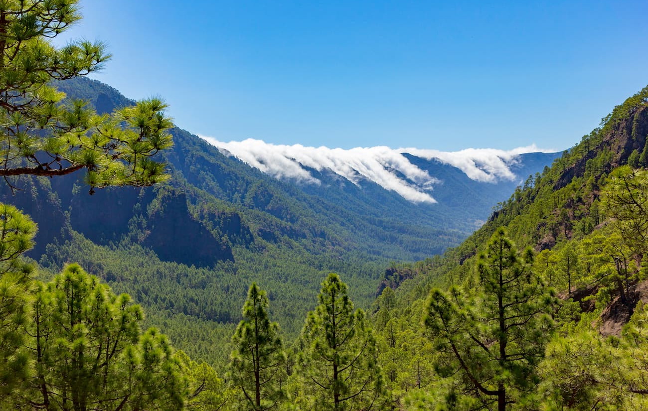
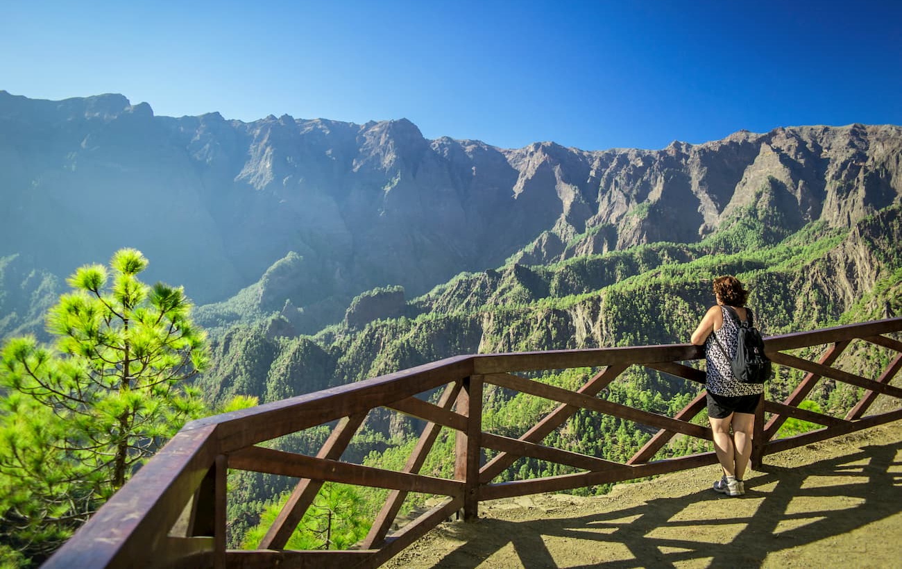
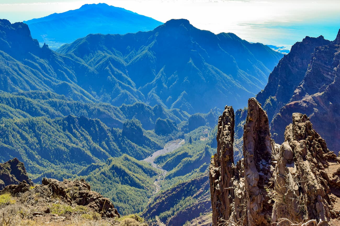
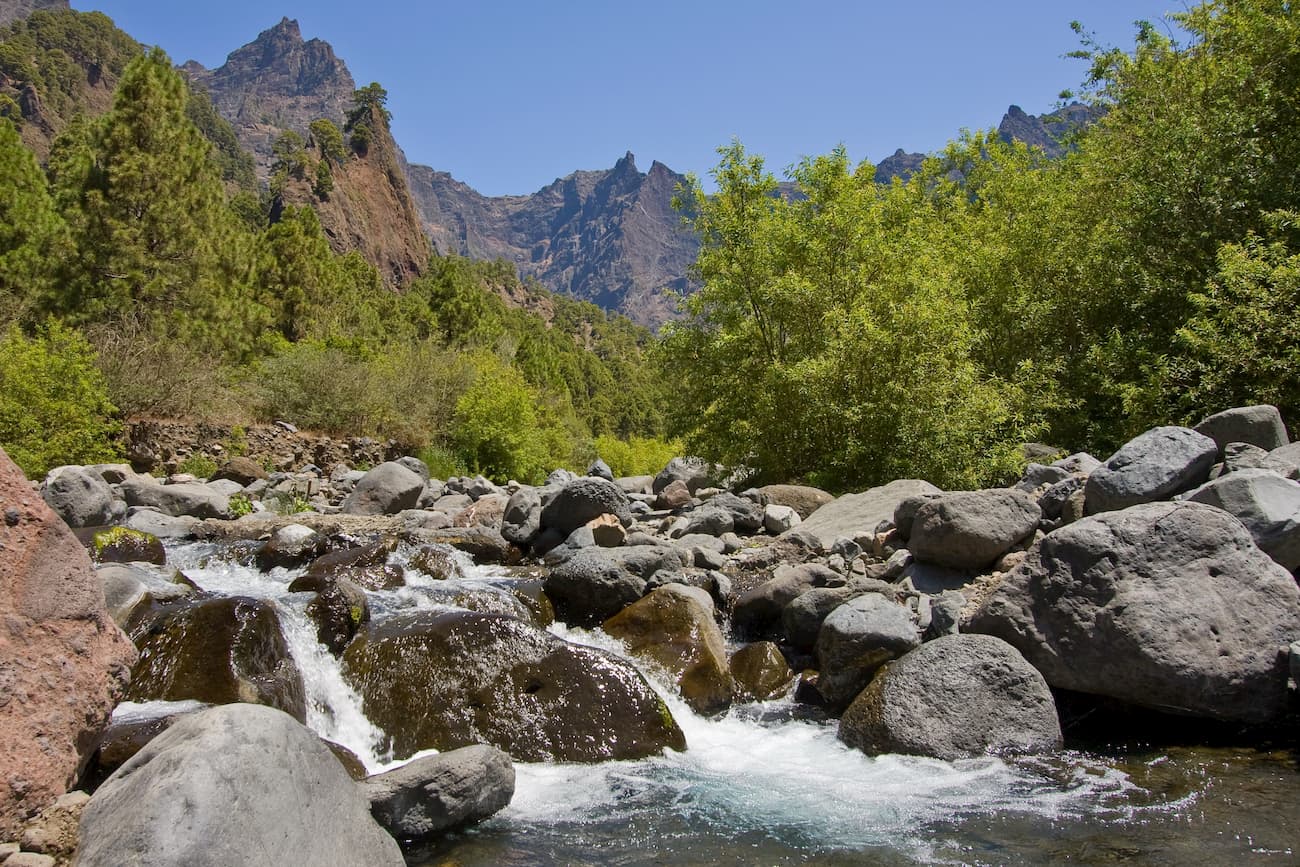
The park's geology is made up of an extraordinary cirque of more than 8 kilometers in diameter with the shape of a caldera from which it takes its name. From the summits, such as Roque de los Muchachos or La Cumbrecita, at the bottom of the Caldera, the ever-present water rushes into a multitude of streams and waterfalls, along a gap that sometimes reaches 2,000 meters. In addition to its impressive landscapes, it’s worth noting the presence of a great diversity of animal and plant species, many of which are only exclusive to the habitats of the Canarian archipelago.
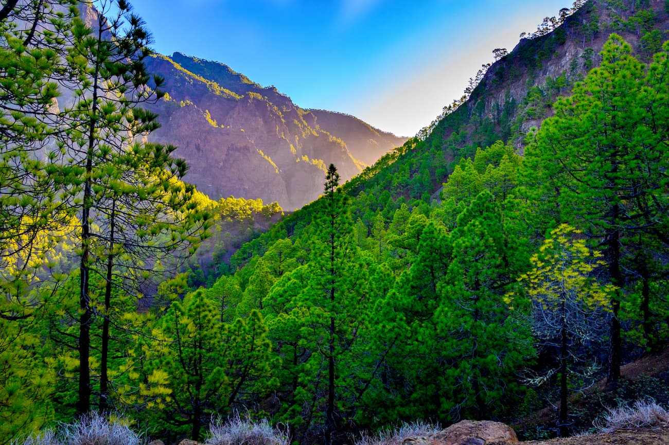
The spectacular nature of this cleft covered with dense Canarian pine forests and furrowed by deep ravines is not well appreciated in photos, you have to see it in person.
Tours to see the night sky, trails that run over the open bowels of the island, baths under colorful waterfalls, the list of activities available is very long. Of course, to learn the secrets of Taburiente national park you have to put on your boots and enter the park through one of its steep paths between monumental pines. Or visit the modern facilities of the El Paso Visitor Center and then look out over the edge of the caldera from the privileged viewpoint of La Cumbrecita.
We highly recommend starting at the El Paso Visitor Center which is located outside the La Caldera National Park, in the town of El Paso. The Center offers useful information. Its exhibition halls, audiovisuals, library and staff will help and guide you on your visit. From its perfect model of the island of La Palma to its audiovisual projection on the origin of the caldera, all the interpretive elements are easy to understand and very illustrative. The gardens of the Visitor Center will show you a representation of the existing flora in the park with specific information on the most representative species.
The Center explains the park's geology, fauna and flora, emphasizing the unique value of its many endemisms, species that are not found anywhere else in the world. It also tells how the caldera played an important role in water management and in the island's economy. And how it was a key place in the conquest of the Canary Islands by the Spanish in the 15th century.
Open every day from 9am to 6pm.
Address: Ctra. General de Padrón, nº 47, 38750-El Paso (La Palma).
Phone: 922 922 280
Among its main attractions we find Roque de los Muchachos, which is a peak of about 2,426 meters high and of course, it is the highest summit on the entire island. Roque de los Muchachos hosts the famous Roque de los Muchachos Astrophysical Observatory, a place where you will be able to observe a multitude of telescopes and domes where various studies of outer space are carried out by scientists from all over the world. It comprises a collection of more than 10 large instruments for solar and night observation. This impressive place is not only beautiful but there you will learn much about the scientific advances and discoveries on this subject. Located at almost 2,400 m. a.s.l, next to the northern edge of the Caldera de Taburiente National Park, this UNESCO World Heritage Site is a fascinating place, both from the outside and on a guided tour inside.
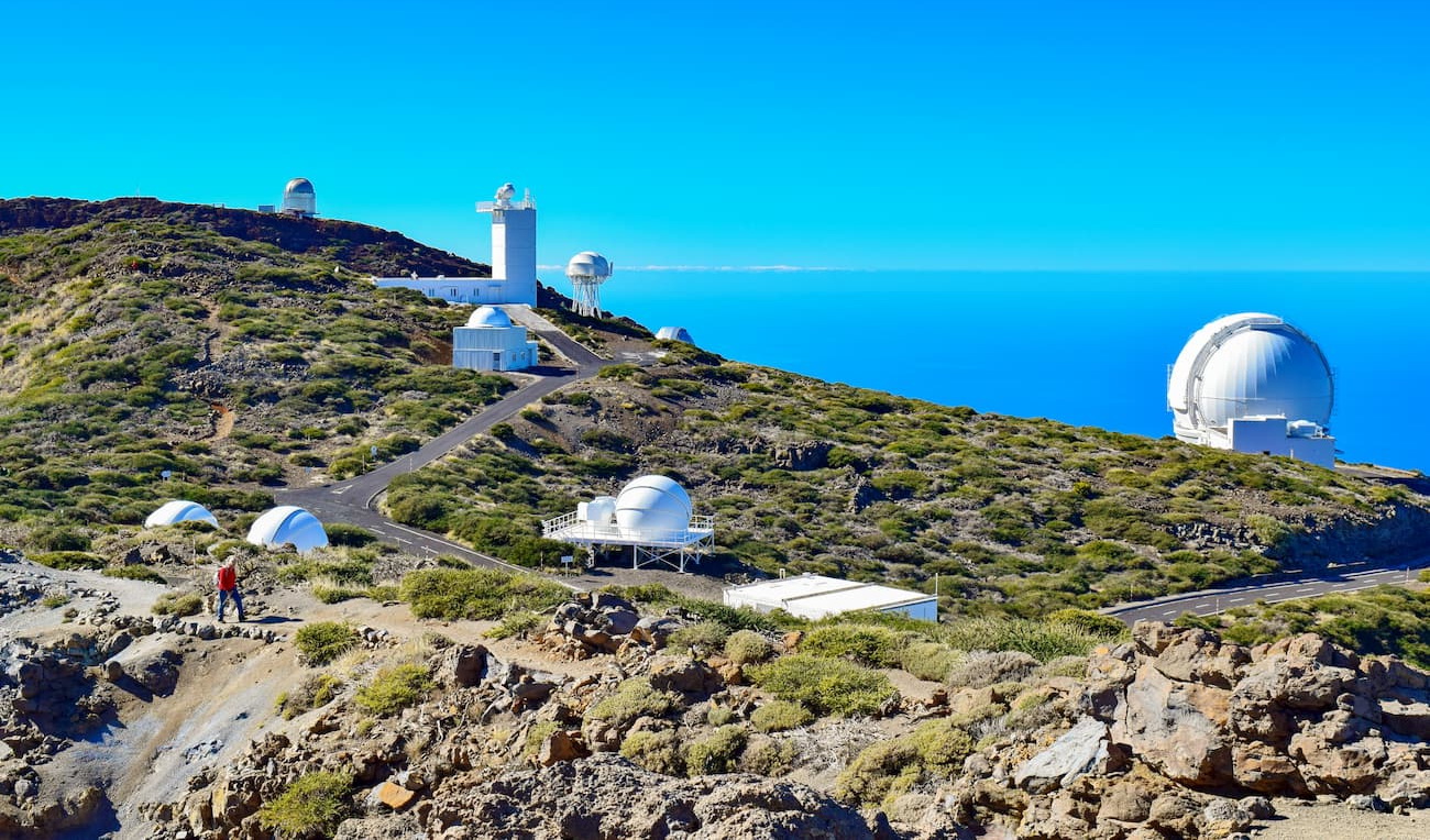
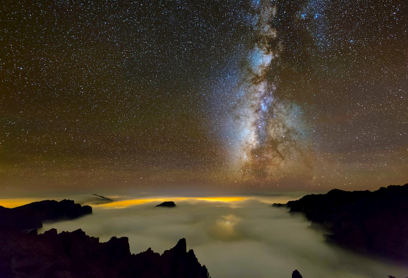
The observatory is near the LP-4 road, an hour and 20 minutes drive from the island's capital, Santa Cruz de La Palma. The facilities which include the world's largest optical telescope, the Grantecan, can be visited in groups during daylight hours and upon reservation. There are also private companies that conduct astronomical tours to this Observatory and other astronomical observation points of La Palma, an island that is Starlight certified for the exceptional quality of its skies.
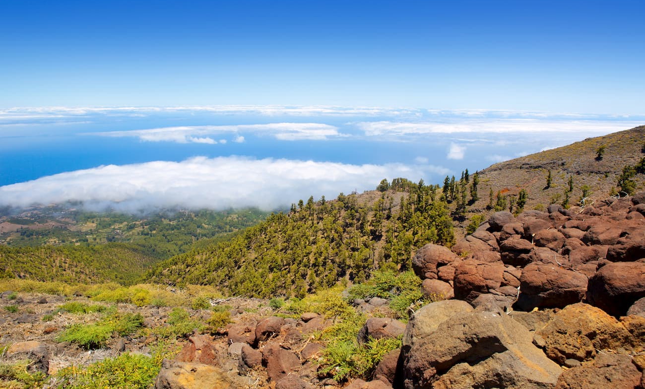
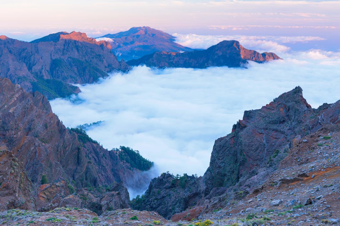
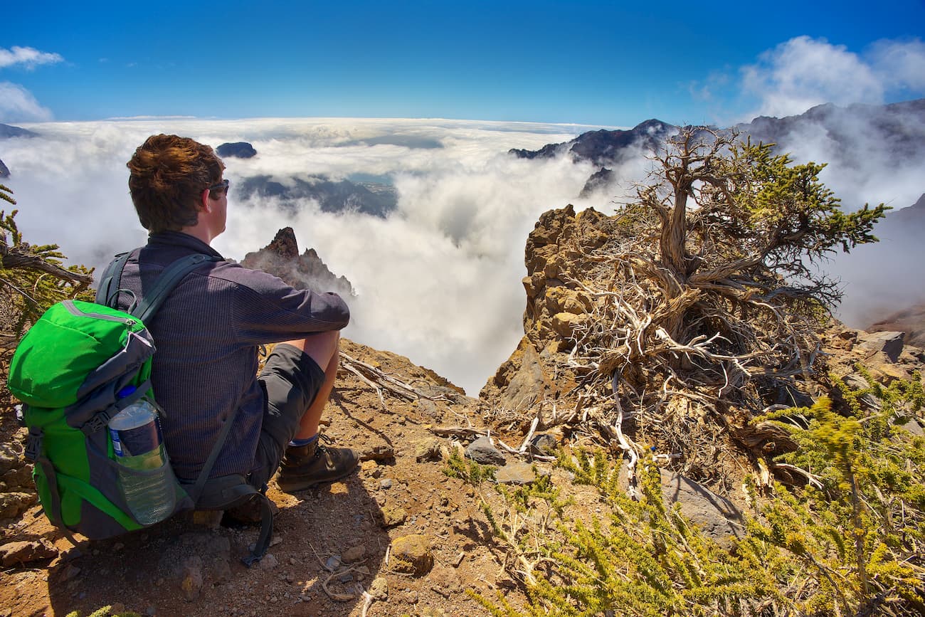
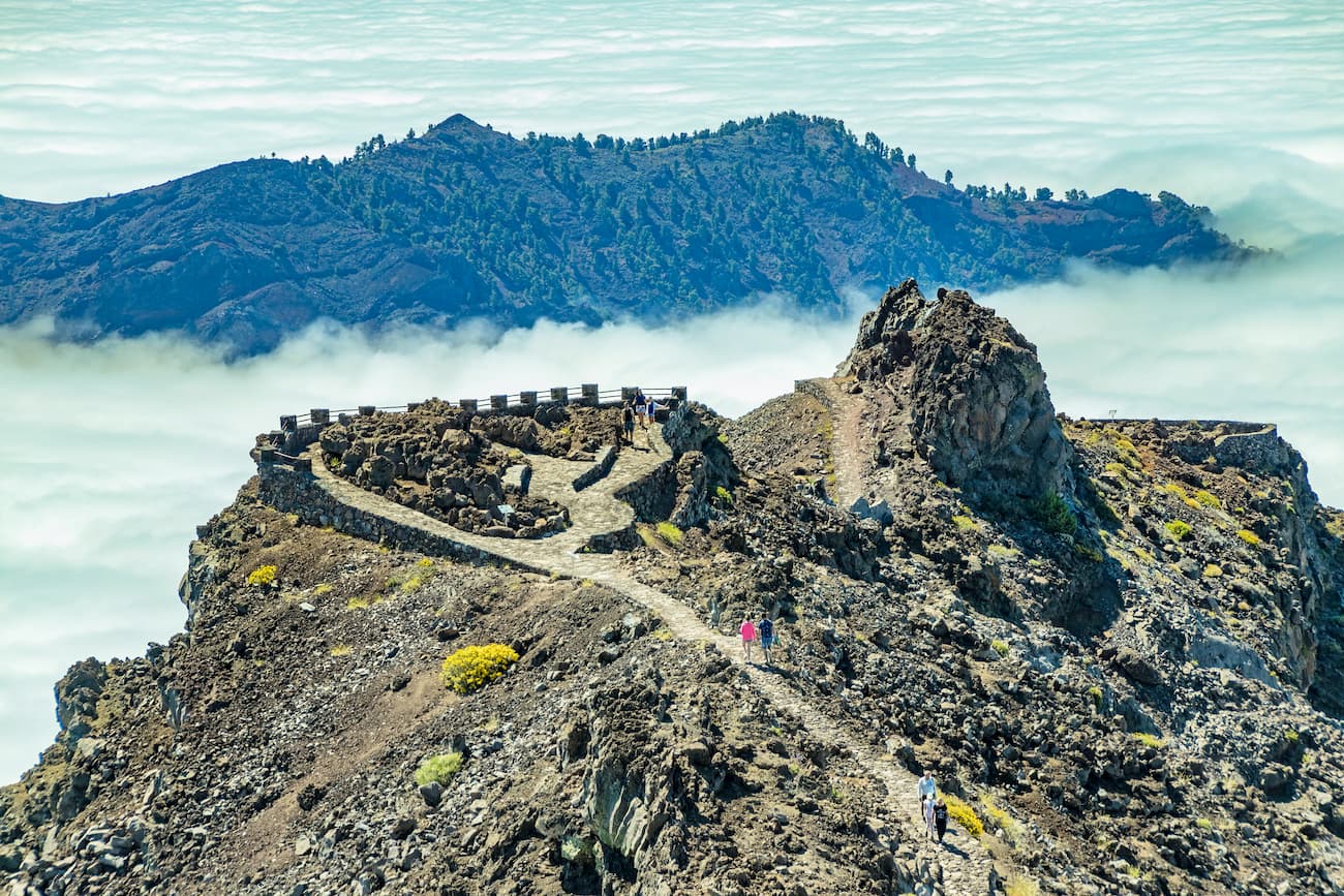
Roque de los Muchachos viewpoint is on the top of the island of La Palma. At its feet, there is an impressive view of a gigantic 1,500 meter deep volcanic caldera covered with trees, whimsically shaped volcanic rocks and the notorious national park. Its visit is a must. If you suffer from vertigo, we recommend you prepare for the magnitude of the visual spectacle. If there are no clouds, you will be able to take a photo of Tenerife, La Gomera and El Hierro looming over the sea.
Inside the Caldera de Taburiente National Park you can only walk, there are no roads or tracks that cross it, hence it has a truly enviable network of trails with optimal markings and excellent maintenance. There are two main entrances to the park: the La Cumbrecita viewpoint, which is a 15-minute drive from the El Paso Visitor Center, and Los Brecitos, an hour from the town of Los Llanos de Aridane. Don’t forget to reserve a parking space if you want to enter before 4pm. Different routes and itineraries on foot adapt to the expectations and physical conditions of any visitor, both in length and duration and difficulty. Taking these routes will allow you to come into direct contact with the park's geology, flora and fauna.
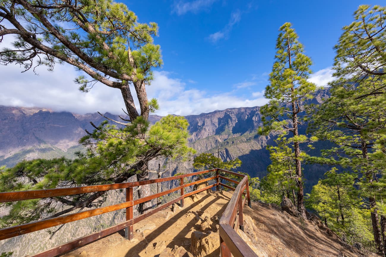
Starting from the Visitor Center, you can directly access the paved viewpoint of La Cumbrecita, the most visited in the park as it offers one of the best views of La Caldera. From this point, there is a circular trail that can be done comfortably on foot and that will allow you to enjoy the many topographical features of La Caldera and the impressive view of the Canarian pine forest.
Broadly speaking, the network consists of a long route, the GR-131, which skirts the caldera and reaches the top of the island of La Palma, Roque de los Muchachos (2,426 meters); and the multiple options of the short route PRLP-13, which run between ravines furrowed with water and covered with pine trees. The most popular is the one that zigzags down slowly from Los Brecitos and crosses the winding ravine of Las Angustias.
If you practice trekking assiduously and if you’re an experienced walker, you will be able to choose more complex routes such as the one proposed from the Lomo de Las Chozas to La Cancelita. It is approximately 5 hours long and allows observing pronounced ravines and walls in addition to excellent views of the interior of La Caldera.
Route 1: Cumbrecita-Lomo de las Chozas (return through the Mirador de los Roques)
It is a short route of wide perspectives through half of a pine forest in the middle of a slope, on a highly complex and eroded volcanic substrate.
Route 2: Los Brecitos-Camping Area
This one is winding through a mature pine forest with small ravines, some of them have streams, it descends almost down to the centre of the Caldera.
Route 3: Camping Area-Hoyo Verde
From the willow of the Taburiente stream, it climbs up through the pine forest to its upper limit at the source of the Hoyo Verde, you will see panoramic views of the most beautiful rocks and waterfalls in the Park.
Route 4: Camping Area-Barranco de Las Angustias
Walk through a pine forest of low areas and then enter a ravine with such dominating geological elements as dykes, ferruginous waters, rocks, padded lava, etc.
Route 5: La Cumbrecita-Camping Area
It crosses pine forests next to large cliffs with rocky plants, small streams and a set of hydraulic works (galleries and channels.)
Route 6: Pista de Valencia-Pico Bejenado
This route ascends between an open pine forest of small size and poor undergrowth, along with cordate lavas, volcanic tubes and archaeological remains, until reaching the top of the peak, one of the best viewpoints in the Park.
Route 7: Pista Pico de la Nieve-Ermita de la Virgen del Pino
The route has good natural viewpoints among pine forests, monteverde and archaeological remains, it ends in a huge pine grove next to the hermitage.
Route 8: Pista Pico de la Nieve-Roque de los Muchachos
This tour offers wide panoramic views of the highest peaks of the Park. It runs through thickets dominated by the laburnums accompanied by beautiful plants exclusive to the island, some of them in danger of extinction.
Route 9: Roque de los Muchacho-Espigón del Roque
It’s the highest part of the island with magnificent panoramic views over the sea of clouds and rare plants in the summit scrub.
Route 10: Roque de los Muchachos-Torre del Time
The trail descends from the highest point of the island, passing first through an elbow and then a dry pine forest, bordering the National Park by the spectacular Time divide.
Route 11: Cumbrecita-Roque de los Cuervos-Pico Bejenado
It is a short but intense ascent route, with wide panoramic views towards the Riachuelo valley and the Caldera in the lower part, and the Aridane valley from the summit to the sea in the upper part. It crosses clear pine forests, shady cliffs and it is possible to see cordate lavas here. On the way back, in addition to La Cumbrecita, you can take two different itineraries that end in the Pista de Valencia.
Route 12: Cumbrecita-Ermita de la Virgen del Pino
You will see pine forests with remains of rain-fed fruit crops at the foot of large cliffs where several galleries have been drilled for the extraction of water. You will observe the trees felled by the wind from the tropical storm Delta that severely affected the Canary Islands in November 2005 causing some devastating damage.
Route 13: Lomo de las Chozas-Mirador de La Cancelita
The route covers the northern skirt of Pico Bejenado, bypassing pine forests, walls, fountains, ravines and rocky areas, with excellent panoramic views of the interior of the Caldera de Taburiente.
Taburiente’s beach: Inside the Caldera de Taburiente National Park, far from the coast of the island of La Palma, you will find a special type of a beach. There are blankets of pebbles and rounded gravel that mark one of the few continuous waterways in the Canary Islands: the Taburiente stream. Here, you can delight in the murmur of the water while looking at the spectacular crags of the caldera looming in the background.
To access the Taburiente beach, you must descend the Los Brecitos trail to the camping area. The route runs for two hours on the slopes covered with Canarian pines, some of them simply monumental. At the end, the cold waters of the Taburiente appear, they meander between bizarrely shaped rocks and sun-lit green riverside groves. Within walking distance you can find the camping area and its service center.
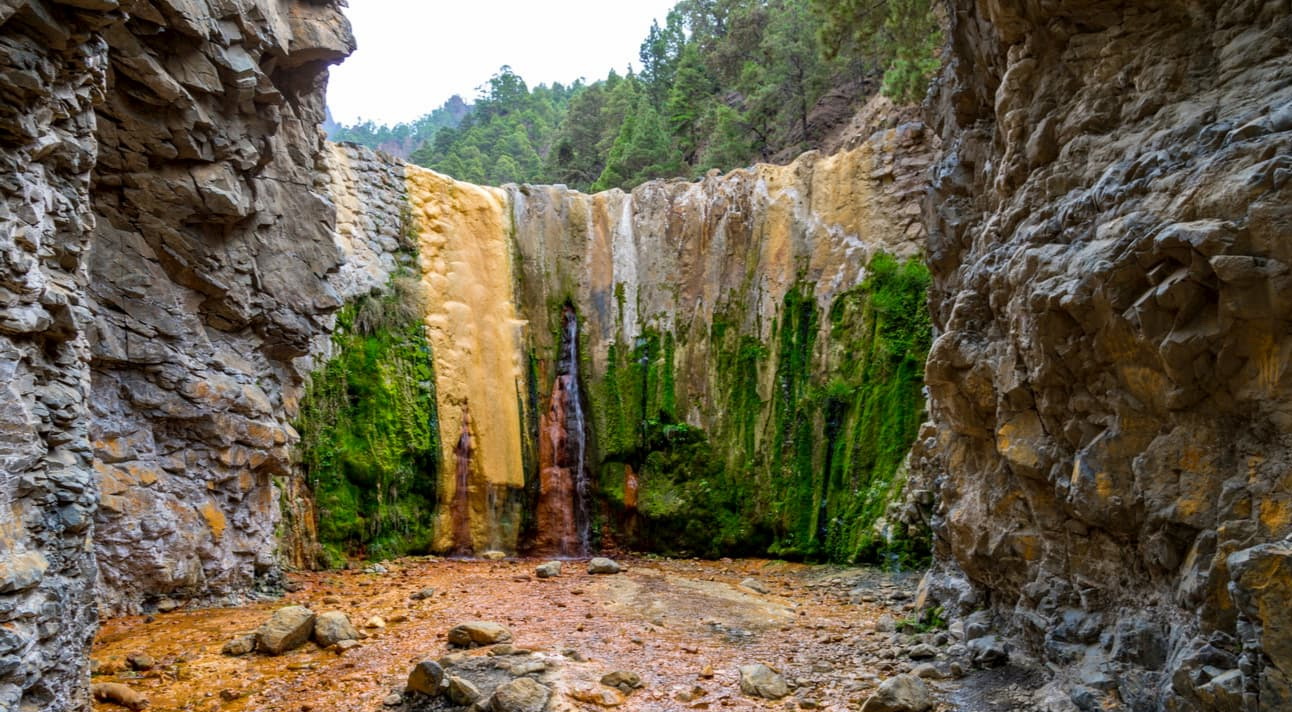
The Colored Waterfall of Las Angustias: One of the greatest attractions of the Caldera de Taburiente National Park is the charming Cascada de Colores, a semi-natural waterfall almost hidden in a small nook hiding off the trail of the Barranco de las Angustias. At a bend in the Rivanceras ravine, there appears a wall of about six meters high, it is naturally painted in multiple shades of green, yellow and orange. Water oozes through it all year round.
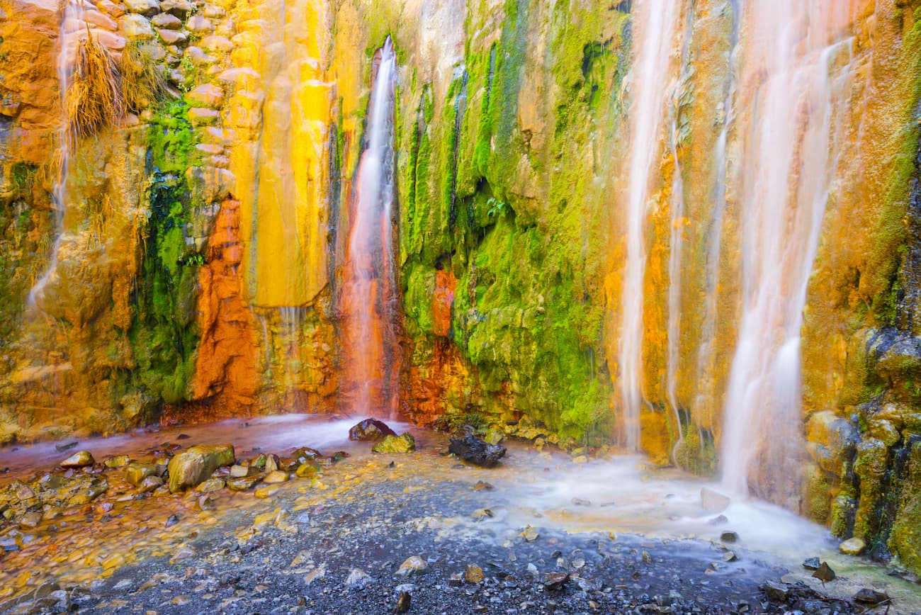
Its yellow and orange colors come from the iron dissolved in the waters of the ravine, one of the most ferruginous on the island of La Palma. Greens are provided by algae and mosses. The result is a palette of tones that changes with the time of year and the flow of the water. To enjoy this feast for the eyes, all you have to do is follow the marks while walking the access trail to this hidden corner of the park.

Bear in mind that a barrier has been installed to control the traffic accessing the interior of the national park. There is a small parking area in La Cumbrecita limited to 18 spaces, and its access is controlled from 08:30 to 16:00 to avoid congestion. You can reserve your place online at www.reservasparquesnacionales.es
You can use the bus line 300 which runs between Santa Cruz de la Palma and Los Llanos de Aridane. There’s a stop at the Visitor Center, 7 km from the Mirador de La Cumbrecita.
Please note there are no restaurants or areas equipped for picnicking within the park, but there are some nice places to eat around the area.
Balcón Taburiente: European and Spanish food. Calle Cantadores, 2 38759 La Palma. Phone: +34 922 40 21 95
Las Piedras: Spanish food. Carretera Cumbre 56 38750 La Palma. Phone +34 685 15 03 42
Camping area in the Caldera de Taburiente: The camping area located in the very center of the Caldera de Taburiente National Park is the only lodging option inside this natural space and the best way to feel its wild essence. The flora and fauna of the island of La Palma are practically harmless, so spending a night in a tent or bivouac in this open space and under the majestic pine trees of Taburiente is a very safe and life-giving experience.
The stay is free, but it’s necessary to reserve a place in advance. Access is via a 5.5-kilometer trail that starts from Los Brecitos and ends at the Taburiente stream. The area's services include wooden tables, running water, toilets and showers, as well as security staff. Next door is the circular building of the Taburiente service center, which offers information about the trails and about the park's natural values.


The highest peak in Caldera de Taburiente National Park is Roque de los Muchachos, at 2,426 m.
Notable peaks in Caldera de Taburiente National Park include Roque de los Muchachos, Cruz del Fraile, Fuente Nueva, Roque Chico and Pico de La Cruz.


