Share

Scan the QR code and open PeakVisor on your phone
Scan the QR code and open PeakVisor on your phone
Located directly southeast of Jasper, in Jasper National Park, the Maligne Range is a small subrange of the larger Canadian Rockies The range covers an area of nearly 320 square miles and runs southeast between the Athabasca River and the Maligne River.
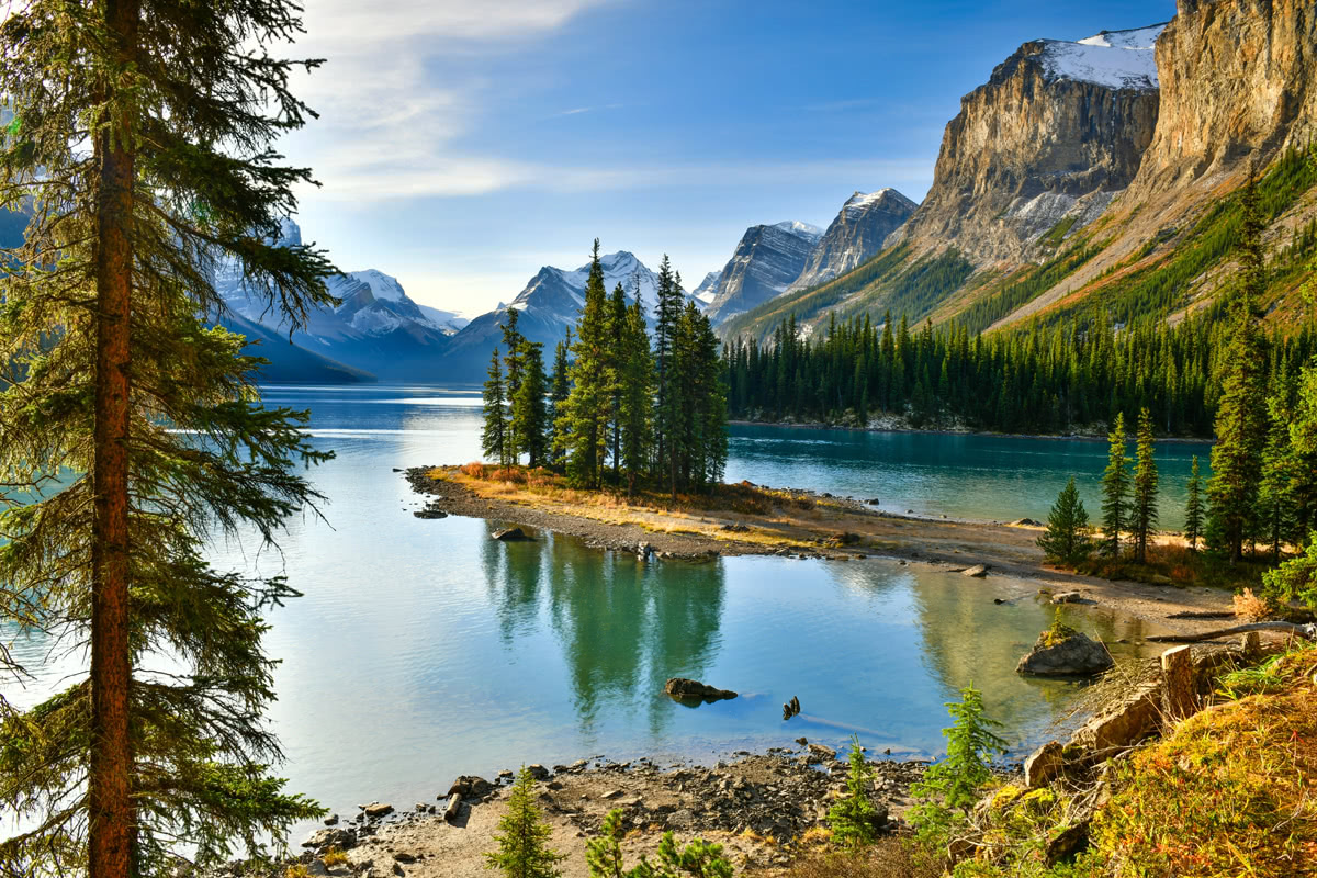
Maligne Range
Most visitors to Jasper National Park will travel along the Icefields Parkway photographing and admiring iconic Maligne Range Peaks like Mount Kerkeslin, the highest peak in the range, Mount Hardisty, and Mount Tekarra.
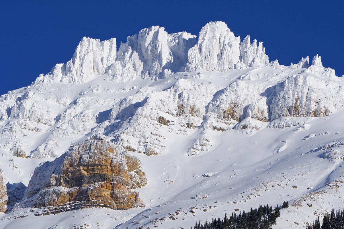
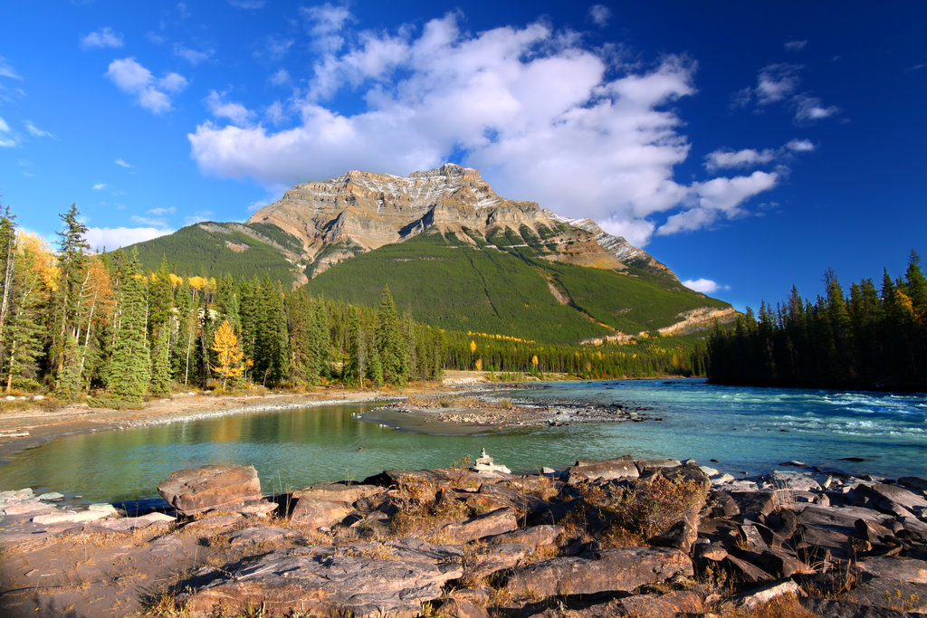
Mount Kerkeslin
In fact, one of the most impressive mountains in the Maligne Range, Signal Mountain, is home to Signal lookout, which offers some of the best skiing in the area during winter months and is a popular hiking destination in the summer.
The Maligne Range sits on the west side of the Maligne Valley, which is over 36-mile long, heavily glaciated, and spans the largest icefield in the Front Ranges of the Canadian Rockies, the Brazeau Icefield. In contrast to mountains found on the east side of the valley, the Maligne Range, which was carved out by glaciers, is composed mostly of Cambrian and Precambrian quartzite and shale.
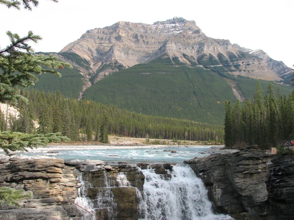
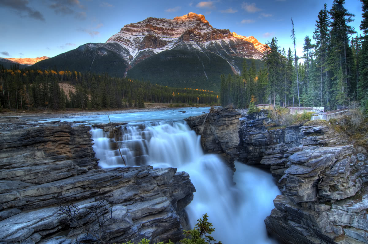
One of the most popular stops along the Icefields Parkway, Athabasca Falls offers visitors the unique opportunity to stand above and feel the spray of the powerful Athabasca River as it thunders through the canyon below. The falls can be safely viewed from a variety of hiking trails and various scenic platforms. Although Athabasca Falls isn’t necessarily known for its height, the sheer power and force of the water is incredible to witness. Along several short footpaths you can see Mount Kerkeslinin the distance, looming over the floodplain.
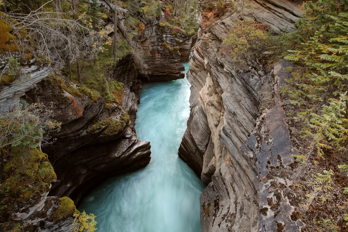
Athabasca Falls
Sunwapta Falls, a pair of pristine waterfalls along the Sunwapta River, originate from the Athabasca Glacier. This area is another popular stopping point along Icefields Parkway and offers hikers the opportunity to trek along several footpaths to different vantage points of the falls, as well as nearby alpine likes like Fortress Lake. Although most visitors will stop at the upper falls, arguably the best view of Sunwapta Falls is a quick trek below the viewing bridge. A short .8 mile hike will take you down through a lodgepole pine forest to the lower falls. Here, you’ll experience three waterfalls spread over the Sunwapta River.
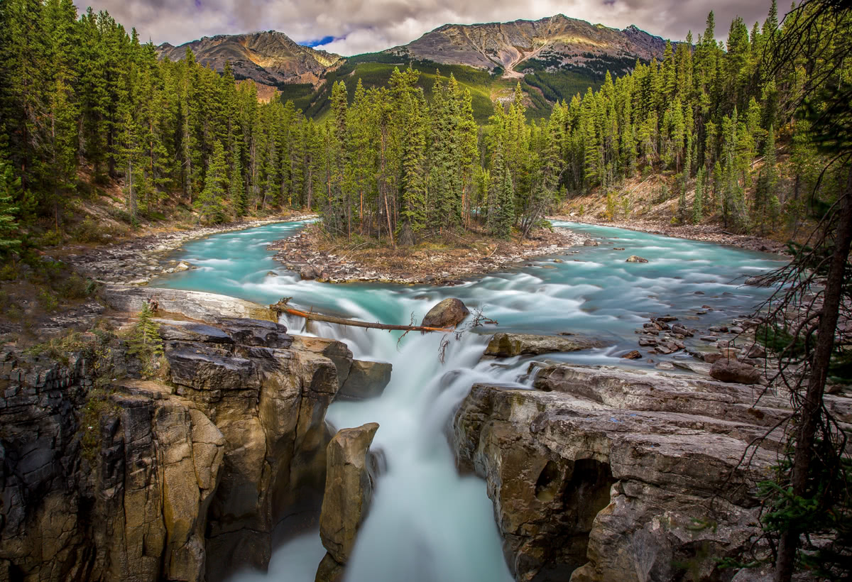
Sunwapta Falls
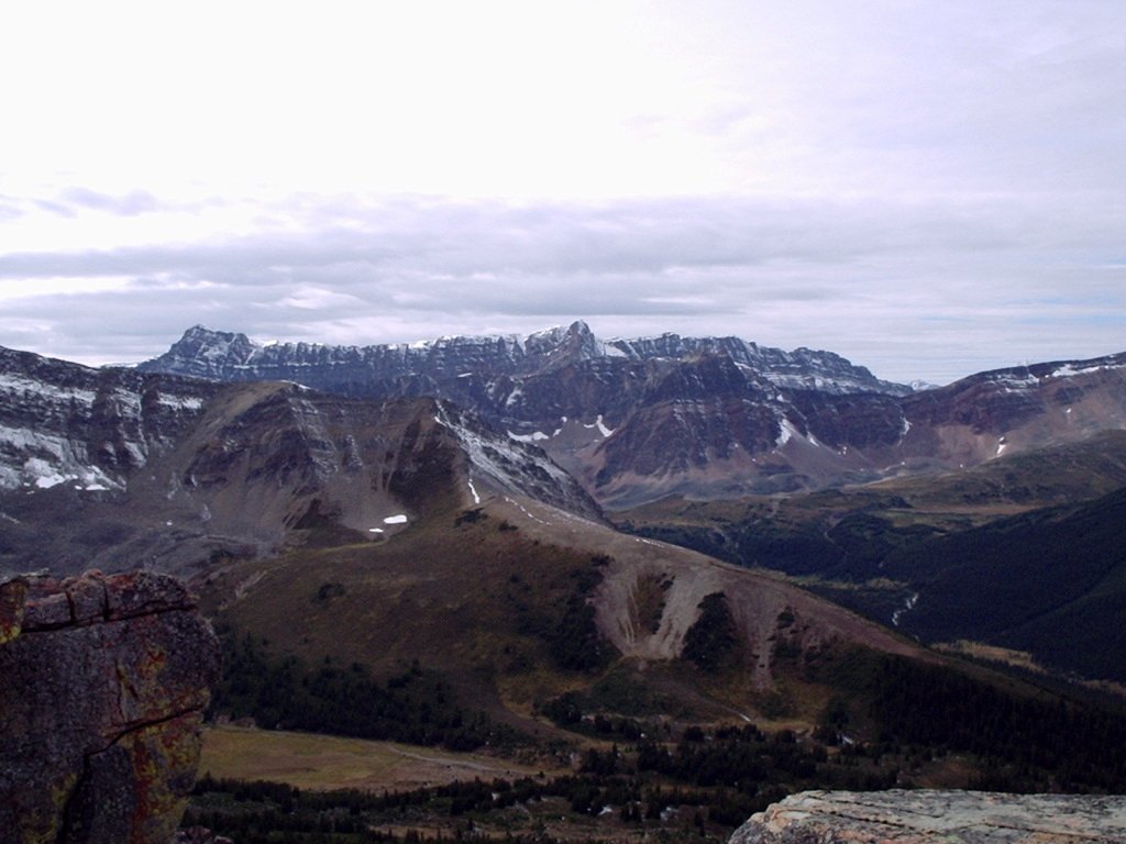
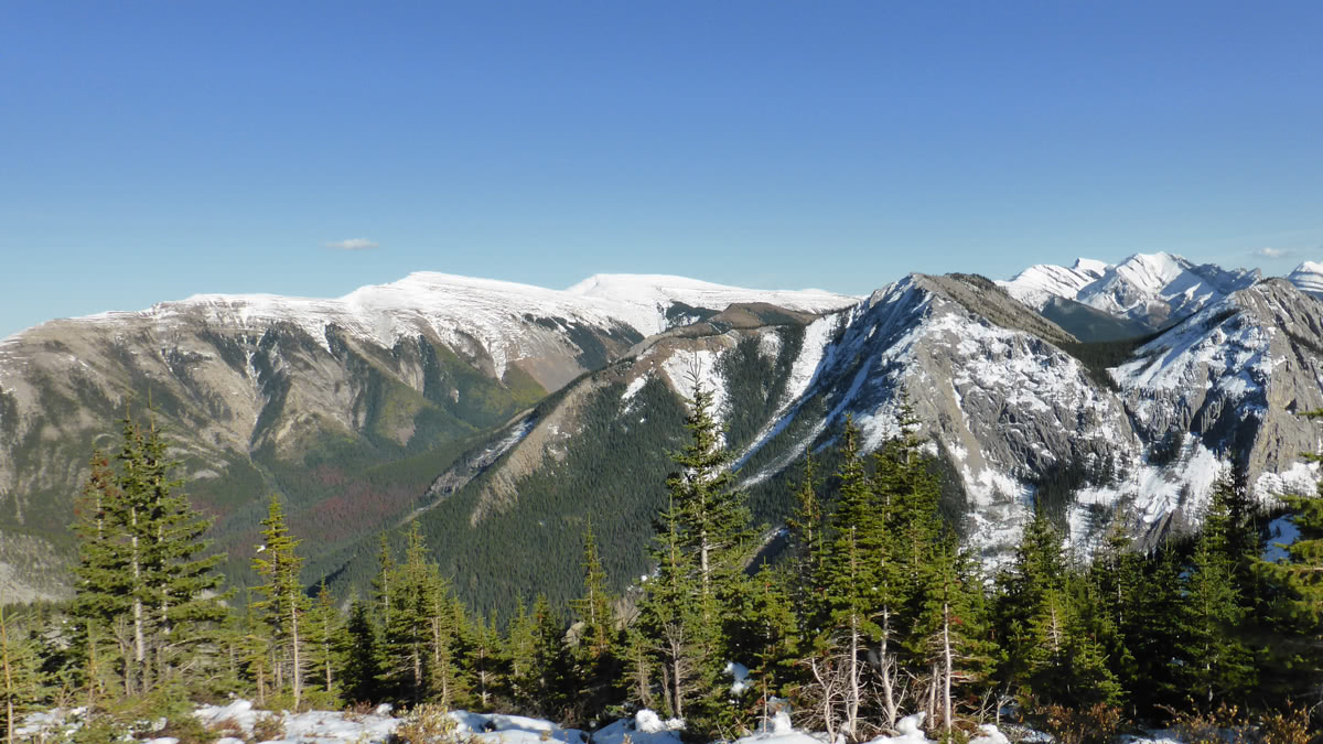
The Watchtower Trail is a long 8-mile (one way) day hike or backpacking trek located in the Malign Mountain Range region of Jasper National Park. The trail travels along the Watchtower Creek before crossing the Malign River and ascending 3,000 feet in elevation to The Watchtower, a 9,157-foot colossal peak within the Malign Range. The route is considered moderately strenuous, but is known for being muddy and not well marked. Approximately 3 miles into the trail, hikers will enter the Watchtower Basin, which is surrounded by beautiful, pristine wilderness and towering peaks.
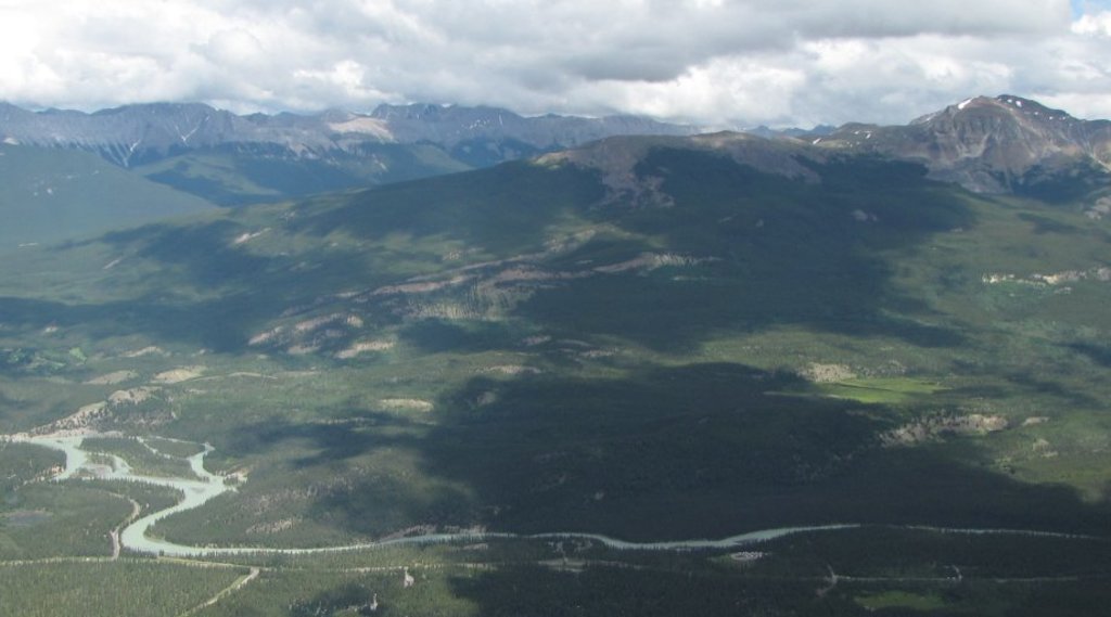
Malign Mountain Range view
The Skyline Trail is considered to be one of the most remarkable and rewarding multi-day trails in the Canadian Rockies. Offering over 15 miles of trail above treeline and crossing three impressive mountain passes along the Maligne Range, the Skyline Trail is not only Jasper’s highest trail, but is arguably the most scenic. In fact, the Skyline trail is Jasper’s most popular backcountry hiking trail, and can only be hiked in summer months (July to early October) due to unpredictable and harsh weather conditions. However, hikers that trek along this footpath will be rewarded with incredible glacial-fed lakes, alpine tarns, and endless mountain vistas. Generally, hikers begin at Maligne Lake and finish at Signal Mountain and the trail takes 2 to 3 days to complete.
Skyline Trail
Jasper, which sits on the outskirts of the Maligne Range, is not only the closest city to the range, but is the ideal basecamp for an adventure to Jasper National Park. This idyllic, friendly community is recognized as a four-season vacation destination and is surrounded on all sides by shimmering glaciers, abundant wildlife, crystalline lakes, cascading waterfalls, evergreen forests, and towering, rugged peaks. Despite high visitation in summer months and world-class accommodations, Jasper maintains a quaint mountain town ambiance. Jasper not only offers easy access to major Rocky Mountain attractions, trails, and activities, but also has a plethora of accommodations and amenities to choose from.
Located within Jasper National Park, the iconic Fairmont Jasper Park Lodge, which was first established in 1915 as a ‘tent city,’ is a 700 acre year-round luxury mountain resort that wraps around the shores of lake “Lac Beauvert.” The resort not only offers a charming village of cedar chalets and luxury cabins, but also offers various special events and activities like the Jasper Dark Sky Experience, which allows guests to observe constellations from the center of the world’s second largest Dark Sky Preserve and experience a state-of-the-art Dark Sky Planetarium.
Jasper Park Lodge
Explore Maligne Range with the PeakVisor 3D Map and identify its summits.