
The farther we get from the civilization the more rewarding adventure usually is. Luckily, you don’t have to travel far to get away from the hustle even in one of the most developed Alpine regions. In our experience, the weaker cellular signal, the prettier scenery is. Here we will tell you how to get your 3D maps ready for getting off the beaten track and still benefiting from the immersive knowledge of the PeakVisor mobile app.
PeakVisor offers a high precision landscape model. It is the most precise model available on mobile phones, as a matter of fact. There’s only one downside of that, it requires more space on your mobile phone. But it is simple to overcome this issue by downloading just the maps you need on the next hike. Instead of the whole Alps you might download a tiny part of them. There’s no limit on the amount of downloads or storage time of 3D maps.
Use this to your own advantage in order to keep PeakVisor small and available offline.
How to Download 3D Maps for Offline Use
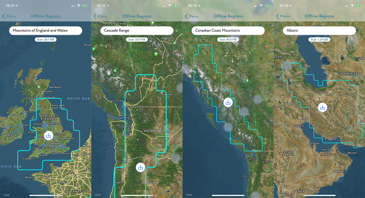
- In order to manage offline maps open the “Map Coverage” item in the main app menu.
- Use maps to choose the area you are going to have adventures in. Depending on a zoom level you will be able to choose either a large area,e.g. the Alps, or a tiny custom region.
- At the top of the map you can always see the name of the selected area and its size required on your device.
Whenever PeakVisor downloads 3D maps, it provides information about the progress in the main statusbar. Finally, we suggest using WiFi for maps downloading because some mountains are very huge!
In the next versions the app will tell you how many summits, sights, and hiking trails there are in the selected area.