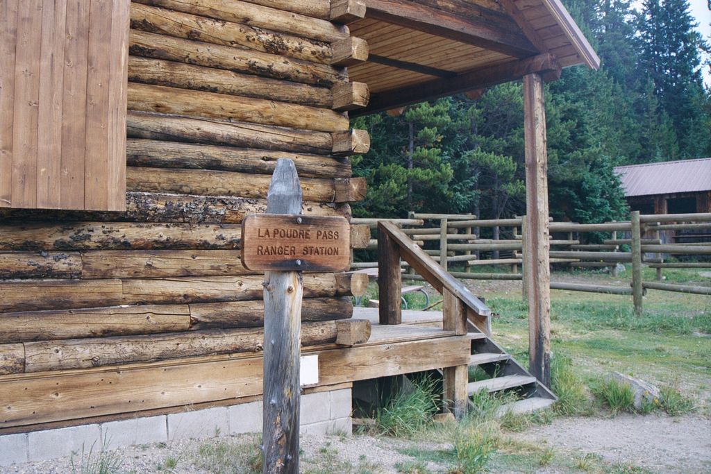
La Poudre Pass (elevation 10,184 ft (3,104 m)), a high mountain pass, is located in the Rocky Mountains of northern Colorado in the United States. The pass straddles the Continental Divide, and separates the headwaters of La Poudre Pass Creek, which joins the Cache la Poudre River and eventually empties into the Gulf of Mexico, from the headwaters of the Colorado River, which drains into the Gulf of California. At the pass, the Continental Divide is the boundary between Grand and Larimer counties, and is also the northern boundary of Rocky Mountain National Park. The pass itself is a broad, flat, swampy area. In the wet meadow just south of the divide, the Colorado River begins its course as a tiny stream emerging from this area which includes the small La Poudre Pass Lake. The Rocky Mountain National Park La Poudre Pass Ranger Station is also located in the pass. The pass is traversed by a hiking trail, by the Grand Ditch as it carries water from the Never Summer Mountains into the Cache La Poudre River, and by a private, gated, maintenance road for the Grand Ditch. To access the pass, visitors should follow Long Draw Road south from its junction with State Highway 14 in Poudre Canyon, just east of Cameron Pass. Long Draw Road is unpaved, but can be traveled by regular passenger automobiles. After passing Long Draw Reservoir, the road ends at the La Poudre Pass Trailhead parking area. It's a very short walk from here to the pass, which is marked by the entrance sign to the Rocky Mountain National Park. This sign is also located on the Continental Divide.
We use GPS information embedded into the photo when it is available.
3D mountains overlay
Adjust mountain panorama to perfectly match your photos because recorded by camera photo position might be imprecise.
Move tool
Rotate tool
Zoom
More customization
Choose which peak labels should make into the final photo and what photo title should be.
Next
Photo Location
Satellitte
Flat map
Relief map
Latitude
Longitude
Altitude
OR
Latitude
°'''
Longitude
°'''
Apply
Register Peak
Peak Name
Latitude
Longitude
Altitude
Register
Teleport
PeakVisor
This 3D model of Sagarmatha National Park in Nepal was made using the PeakVisor app topographic data. The mobile app features higher precision models worldwide, more topographic details, and works offline. Download PeakVisor maps today.
Download OBJ model
PeakVisor
The download should start shortly. If you find it useful please consider supporting the PeakVisor app.
PeakVisor for iOS and Android
Be a superhero of outdoor navigation with state-of-the-art 3D maps and mountain identification in the palm of your hand!