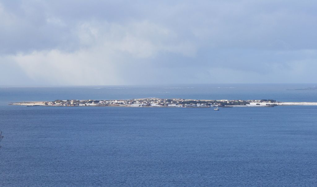
Giske is an island in Giske Municipality in Møre og Romsdal county, Norway. It covers an area of 2.67 square kilometers (1.03 sq mi). It is flat, with the highest point 23 meters (75 ft) above mean sea level. The island is connected by the Giske Bridge to the neighbouring island of Valderøya to the east and by the Godøy Tunnel to the island of Godøya to the southwest. Giske Church, dating back to the 12th century, sits on the southern coast of the island. The small island contains the 0.75-square-kilometre (190-acre) village also named Giske. The village has a population (2018) of 800 and a population density of 1,067 inhabitants per square kilometre (2,760/sq mi). The rest of the island's residents are spread out around the village on farms.
We use GPS information embedded into the photo when it is available.
3D mountains overlay
Adjust mountain panorama to perfectly match your photos because recorded by camera photo position might be imprecise.
Move tool
Rotate tool
Zoom
More customization
Choose which peak labels should make into the final photo and what photo title should be.
Next
Photo Location
Satellitte
Flat map
Relief map
Latitude
Longitude
Altitude
OR
Latitude
°'''
Longitude
°'''
Apply
Register Peak
Peak Name
Latitude
Longitude
Altitude
Register
Teleport
PeakVisor
This 3D model of Sagarmatha National Park in Nepal was made using the PeakVisor app topographic data. The mobile app features higher precision models worldwide, more topographic details, and works offline. Download PeakVisor maps today.
Download OBJ model
PeakVisor
The download should start shortly. If you find it useful please consider supporting the PeakVisor app.
PeakVisor for iOS and Android
Be a superhero of outdoor navigation with state-of-the-art 3D maps and mountain identification in the palm of your hand!