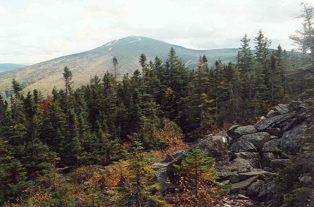
Sugarloaf Mountain is a mountain located in Franklin County, Maine. It is the third highest peak in the state, after Mount Katahdin's Baxter and Hamlin peaks. Sugarloaf is flanked to the south by Spaulding Mountain.
The northeast and west sides of Sugarloaf drain into the South Branch of the Carrabassett River, which flows into the Kennebec River, and into the Gulf of Maine. The southeast side of Sugarloaf drains into Rapid Stream, then into the West Branch of the Carrabassett River.
The Appalachian Trail (AT), a 2,170 mi (3,490 km) National Scenic Trail from Georgia to Maine, passes within a mile of the summit, skirting the peak to the west, and the summit is reached by a 0.6 mi (0.97 km) side trail. This side trail, and a trail down the east side of Sugarloaf, were originally part of the AT, which has been relocated down the north side of the mountain to the west of the ski slopes. Sugarloaf, a major ski resort is located on the north side of the mountain.
There's a trail called Sugarloaf Side Trail leading to the summit.
By elevation Sugarloaf Mountain is
# 1 out of 209 in Franklin County # 9 out of 2903 in Maine # 9 out of 683 in the Longfellow Mountains
By prominence Sugarloaf Mountain is
# 1 out of 209 in Franklin County # 2 out of 2903 in Maine # 12 out of 39823 in the Appalachian Mountains # 2 out of 683 in the Longfellow Mountains
We use GPS information embedded into the photo when it is available.
3D mountains overlay
Adjust mountain panorama to perfectly match your photos because recorded by camera photo position might be imprecise.
Move tool
Rotate tool
Zoom
More customization
Choose which peak labels should make into the final photo and what photo title should be.
Next
Photo Location
Satellitte
Flat map
Relief map
Latitude
Longitude
Altitude
OR
Latitude
°'''
Longitude
°'''
Apply
Register Peak
Peak Name
Latitude
Longitude
Altitude
Register
Teleport
PeakVisor
This 3D model of Sagarmatha National Park in Nepal was made using the PeakVisor app topographic data. The mobile app features higher precision models worldwide, more topographic details, and works offline. Download PeakVisor maps today.
Download OBJ model
PeakVisor
The download should start shortly. If you find it useful please consider supporting the PeakVisor app.
PeakVisor for iOS and Android
Be a superhero of outdoor navigation with state-of-the-art 3D maps and mountain identification in the palm of your hand!