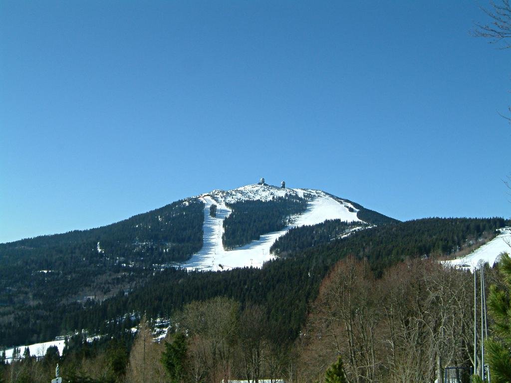
Großer Arber (German for Great Arber, Czech: Velký Javor) is the highest peak of the Bavarian-Bohemian-mountain ridge, with an elevation of 1,455.5 metres (4,775 ft). Although geographically belonging to the Bohemian Forest, it is often referred to as "King of the Bavarian Forest". It is one of Germany's most famous skiing resorts besides the Bavarian Alps.
Großer Arber and the woodlands down to Bayerisch Eisenstein are in the possession of the Prince of Hohenzollern.
As early as 1939, large parts of the area were put under protection, in order to save its uniqueness.
Großer Arber is the only peak of the Bavarian-Bohemian-Mountain Ridge above the climatic timberline.
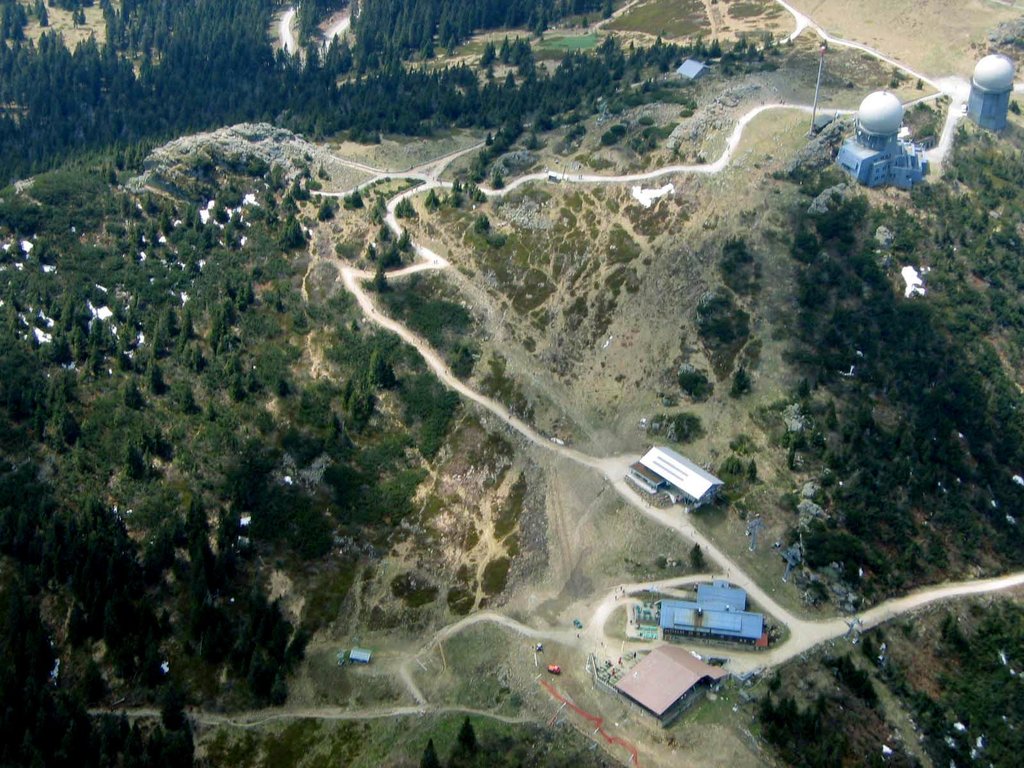
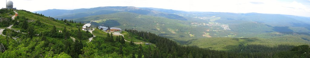
On top were two military radar stations, built during the Cold War as the mountain is very close to the Czech border. They are still operational at a reduced scale, serving both civilian and military purposes.
Near the Großer Arber is a smaller mountain, the Kleiner Arber ("klein" = small).
In Czech Velký Javor means Great Maple.
There's a hiking trail (T1) leading to the summit. Großer Arber is one of the 143 peaks along the multi-day Goldsteig.
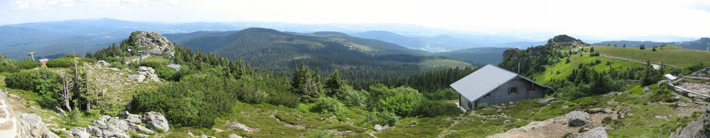
The nearest mountain hut is Zwieseler Hütte located 62m/203ft SW of the summit.
By elevation Großer Arber is
# 1 out of 16 in Wildschutzgebiet für Auerwild "Arber" # 1 out of 2 in Großer Arber und Arberseewand # 1 out of 288 in Naturpark Bayerischer Wald # 1 out of 139 in Landkreis Regen # 13 out of 23540 in the Bohemian Ranges
By prominence Großer Arber is
# 1 out of 16 in Wildschutzgebiet für Auerwild "Arber" # 9 out of 8134 in Bavaria # 1 out of 2 in Großer Arber und Arberseewand # 1 out of 288 in Naturpark Bayerischer Wald # 9 out of 37308 in Germany # 1 out of 139 in Landkreis Regen # 2 out of 23540 in the Bohemian Ranges
We use GPS information embedded into the photo when it is available.
3D mountains overlay
Adjust mountain panorama to perfectly match your photos because recorded by camera photo position might be imprecise.
Move tool
Rotate tool
Zoom
More customization
Choose which peak labels should make into the final photo and what photo title should be.
Next
Photo Location
Satellitte
Flat map
Relief map
Latitude
Longitude
Altitude
OR
Latitude
°'''
Longitude
°'''
Apply
Register Peak
Peak Name
Latitude
Longitude
Altitude
Register
Teleport
PeakVisor
This 3D model of Sagarmatha National Park in Nepal was made using the PeakVisor app topographic data. The mobile app features higher precision models worldwide, more topographic details, and works offline. Download PeakVisor maps today.
Download OBJ model
PeakVisor
The download should start shortly. If you find it useful please consider supporting the PeakVisor app.
PeakVisor for iOS and Android
Be a superhero of outdoor navigation with state-of-the-art 3D maps and mountain identification in the palm of your hand!