Owl's Head is a 4,025-foot (1,227 m) mountain in Franconia, New Hampshire. It lies between the Franconia Branch of the Pemigewasset River (to its east) and Lincoln Brook (to its west and south), in the Pemigewasset Wilderness of the White Mountain National Forest.
It is best known as one of the 48 White Mountains "four-thousand footers", and stands out among them mostly for what it lacks:
In height, it is 43rd of the 48.
It is the only one of the 48 without an officially maintained path to the summit, although an unofficial, unmaintained herd path comes within 0.2 miles (300 m).
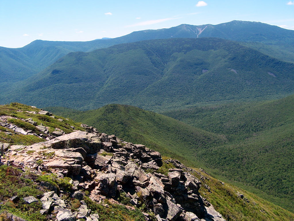
The trees at its summit block (except when deep snow has fallen) any view beyond themselves. (There are, however, nice views from the Owls Head Slide while climbing up the unmaintained path to the summit.)
It is remote from approaches by road, due to
the East Branch of the Pemigewasset River, between it and the Kancamagus Highway to the south,
Franconia Ridge (and its steep and tall east face), between it and Interstate 93 to the west,
Garfield Ridge, between it and U.S. Route 3 to the north, and
the Twin Range and Willey Range, between it and U.S. Route 302 to the east.
Probably for these reasons, it receives (as does Mount Isolation) a disproportionately frequent role as the last 4000-footer waiting to be climbed by those about to complete the list of 48.
In the fall of 2005, it was discovered that the traditional summit of Owl's Head (reached by the unmaintained beaten path) is actually a lower peak, and the true summit is approximately 0.2 mi north along the ridgeline. For now, the 4,000-footer committee is accepting climbs to the false summit.
There's a trail called Owls Head Path leading to the summit.
By elevation Owls Head is
# 42 out of 393 in Grafton County # 80 out of 428 in White Mountain National Forest # 81 out of 1985 in New Hampshire # 82 out of 844 in the White Mountains (New Hampshire) # 27 out of 89 in the Franconia Mountains
By prominence Owls Head is
# 40 out of 393 in Grafton County # 49 out of 428 in White Mountain National Forest # 81 out of 844 in the White Mountains (New Hampshire) # 13 out of 89 in the Franconia Mountains
We use GPS information embedded into the photo when it is available.
3D mountains overlay
Adjust mountain panorama to perfectly match your photos because recorded by camera photo position might be imprecise.
Move tool
Rotate tool
Zoom
More customization
Choose which peak labels should make into the final photo and what photo title should be.
Next
Photo Location
Satellitte
Flat map
Relief map
Latitude
Longitude
Altitude
OR
Latitude
°'''
Longitude
°'''
Apply
Register Peak
Peak Name
Latitude
Longitude
Altitude
Register
Teleport
PeakVisor
This 3D model of Sagarmatha National Park in Nepal was made using the PeakVisor app topographic data. The mobile app features higher precision models worldwide, more topographic details, and works offline. Download PeakVisor maps today.
Download OBJ model
PeakVisor
The download should start shortly. If you find it useful please consider supporting the PeakVisor app.
PeakVisor for iOS and Android
Be a superhero of outdoor navigation with state-of-the-art 3D maps and mountain identification in the palm of your hand!