
Share

Scan the QR code and open PeakVisor on your phone
Scan the QR code and open PeakVisor on your phone
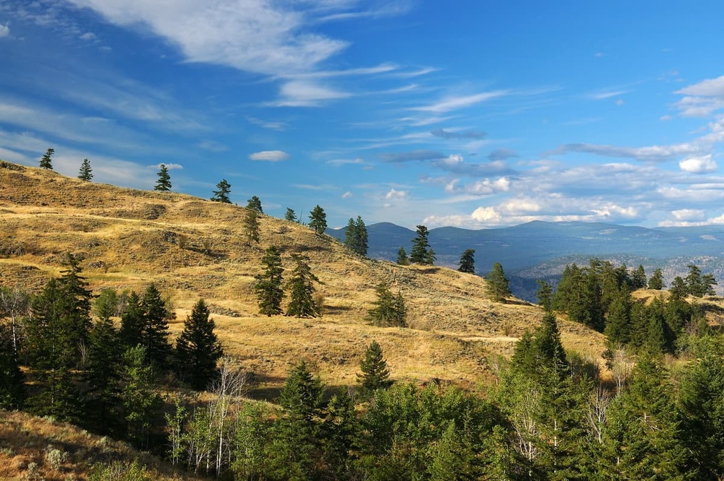
South Okanagan Grasslands Protected Area is an outdoor recreation destination located in southern British Columbia, Canada. The protected area includes several non-contiguous parcels of land located around Mount Kobau, Mount Kruger, Black Mountain, and Barber Mountain. Of the three peaks within the protected area, Mount Kobau (1,873 m/6,145 ft) is the tallest and most prominent.
Located along the southern edge of British Columbia, Canada in the Regional District of Okanagan-Similkameen, the South Okanagan Grasslands Protected Area consists of four parcels of land that encompass about 93 square kilometers (36 square miles) of grassland. The four sites in the protected area are called Mount Kobau, Kilpoola, Chopka East, and Chopka West.
The South Okanagan Grasslands Protected Area was established in 2001 to protect the region’s dry grassland and open forest. These areas represent one of Canada’s four most endangered ecosystems.
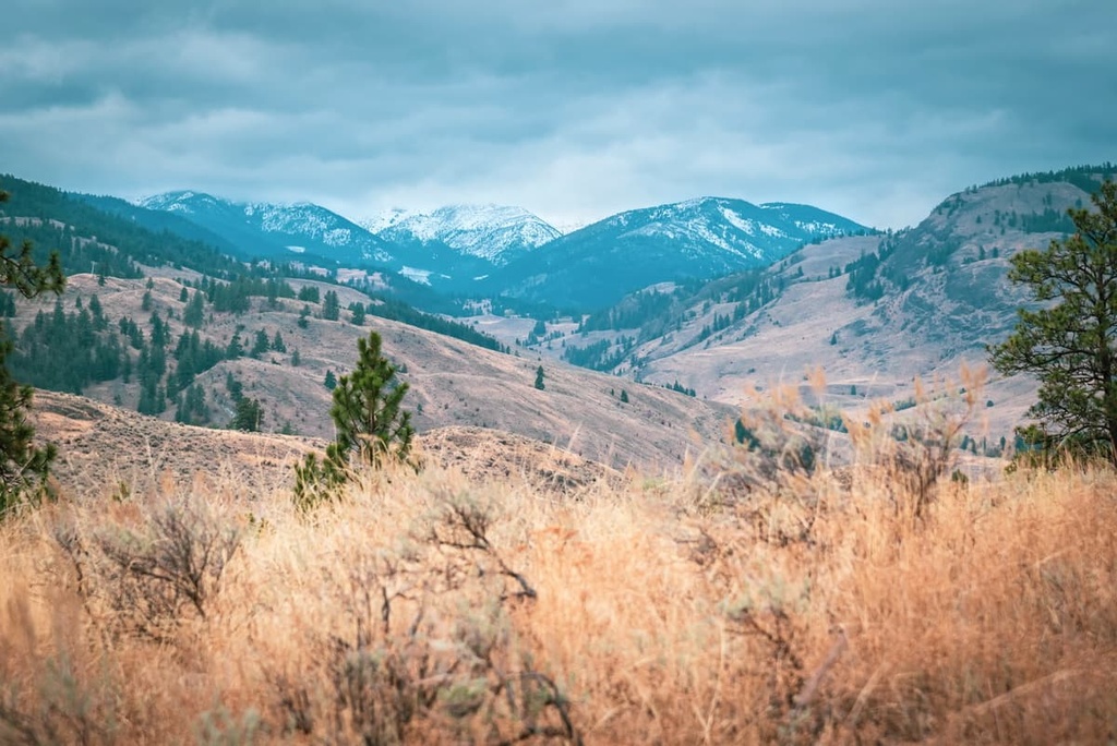
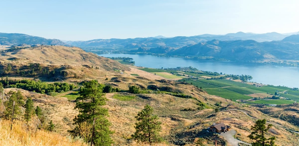
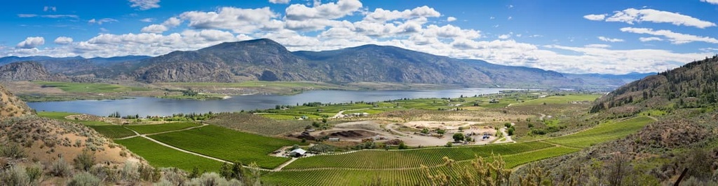
The grasslands are located on the southern end of the Thompson Plateau. They are adjacent to the Okanagan Range of the Cascade Mountains, both of which are located to the west, and the Okanagan Highland, which is located to the east.
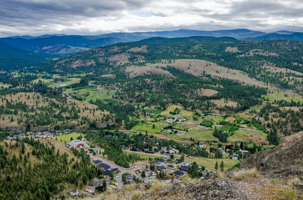
The main road access to the park is via Highway 97, which runs along the east side of the protected areas. Meanwhile, Highway 3 runs through the protected area from east to west. The city of Osoyoos is located near the protected area, too, along the shores of Osoyoos Lake.
Additionally, there are several other protected areas and provincial parks located near the South Okanagan Grasslands Protected Area. Nearby parks and protected areas include:
The South Okanagan Grasslands Protected Area covers part of the Thompson Plateau, which is the most southerly of the plateau areas in Interior British Columbia. The plateau contains a variety of rocks that formed under different environmental conditions and at different times.
Most of British Columbia formed through the accretion of exotic terranes onto the west coast of North America. The terranes formed as volcanic island arcs and microcontinents in what is now the Pacific Ocean. These exotic terranes accreted to the west coast from about 180 to 60 million years ago as oceanic tectonic plates subducted beneath North America.
The terranes of the Thompson Plateau have granitic intrusions into layers of sedimentary rock that originally formed during the Paleozoic. Volcanic eruptions occurred about 50 million years ago and covered significant portions of the plateau. The lavas from these eruptions obscured large areas of older rocks to create the large areas of unbroken plateau that we see in the region today.
During the Pleistocene, the entire plateau was covered with ice. This caused significant erosion to the low peaks of the South Okanagan Grasslands Protected Area. As the glaciers retreated, they left behind a thick, relatively uniform layer of rocks and gravel over the bedrock.
The region’s rare ecology is the reason that the South Okanagan Grasslands Protected Area was initially established. The general ecological zones of the protected area are part of the Interior Douglas-fir, Bunchgrass, and the Ponderosa Pine ecologies.
Here’s a quick overview of the ecological features in each zone of the protected area:
About 6,000 years ago, along the southwest coast of British Columbia, the Salish culture emerged from a proto-Salish culture. Approximately 4,000 years ago, members of the Salish culture traveled inland.
In some areas of what is now Interior British Columbia, the Salish culture supplanted an older culture that may have lived in the region since the land first became habitable after the Pleistocene.
The Salish culture flourished in interior British Columbia and eventually became a distinct culture in their own right known in English as the Interior Salish. Indeed, approximately 3,000 years ago, an estimated 12,000 people of the Interior Salish culture inhabited the Okanagan Valley and surrounding areas.
The region that is now part of the South Okanagan Grasslands Protected Area is part of the traditional territory and ancestral homelands of a number of First Nations, including the Syilx Okanagan Nation and the Nlaka'pamux Nation Tribal Council.
There are indications of non-Indigenous travelers in the area as early as the 1500s. It’s also believed that Spanish conquistadors traveled as far north as Kelowna in their search for the legendary El Dorado.
However, the first recorded non-Indigenous person in the area was David Stuart, who established Fort Okanagan at the confluence of the Okanagan and Columbia Rivers in 1811.
In the last few centuries, orchards, ranching, farming, and other industries have flourished throughout the Okanagan Valley. Nevertheless, the region’s grasslands have remained relatively undisturbed. It’s likely that, at some point, cattle grazed in the grasslands, too. However, no other major industry besides some limited mining occurred in the grasslands in recent centuries.
The South Okanagan Grasslands Protected Area was established in April 2001 as a result of the Okanagan-Shuswap Land & Resource Management Plan. It is managed by BC Parks alongside other provincially protected areas.
There are many opportunities to lookout upon beautiful scenery, locate rare and endangered plants, see rare and endangered wildlife, or just get some fresh air in South Okanagan Grasslands Protected Area.
Visitors to the grasslands are strongly encouraged to remain on established trails so as not to disrupt the region’s delicate ecosystems. The following are some of the popular trails in South Okanagan Grasslands Protected Area:
The South Okanagan Grasslands Protected Area is one of the hottest and driest places in Canada. This also makes it an ideal vacation spot for many Canadians. The following are some of the main towns and cities near the South Okanagan Grasslands Protected Area that are worth checking out:
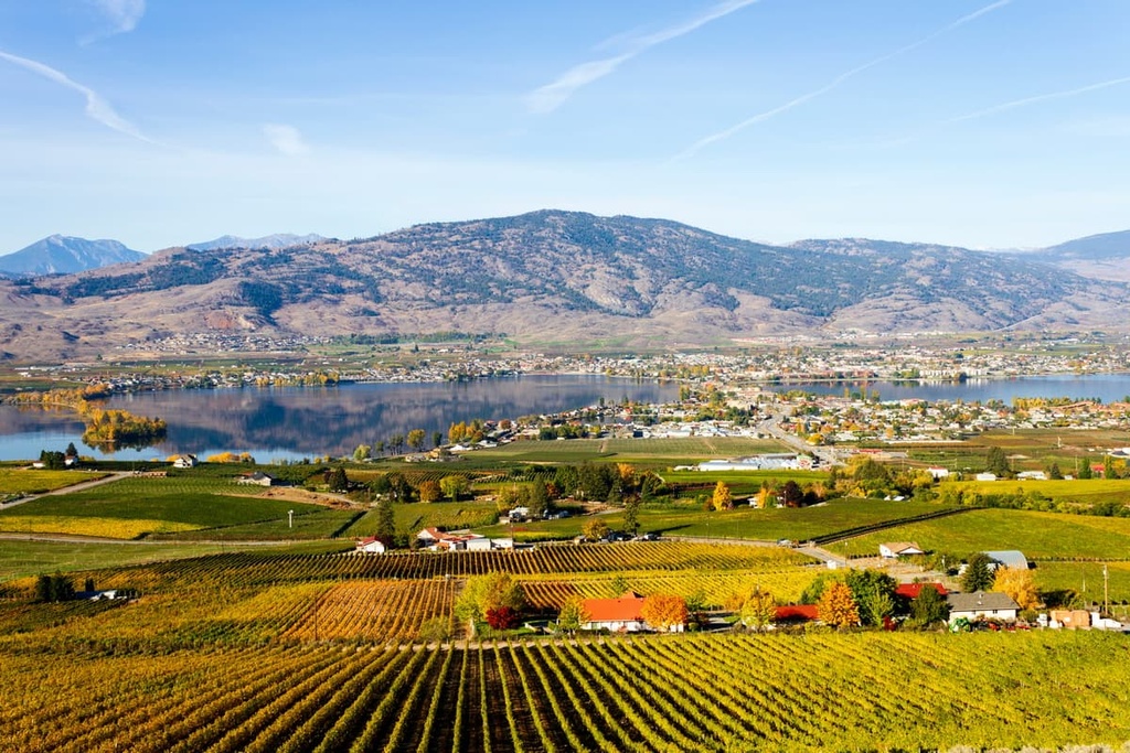
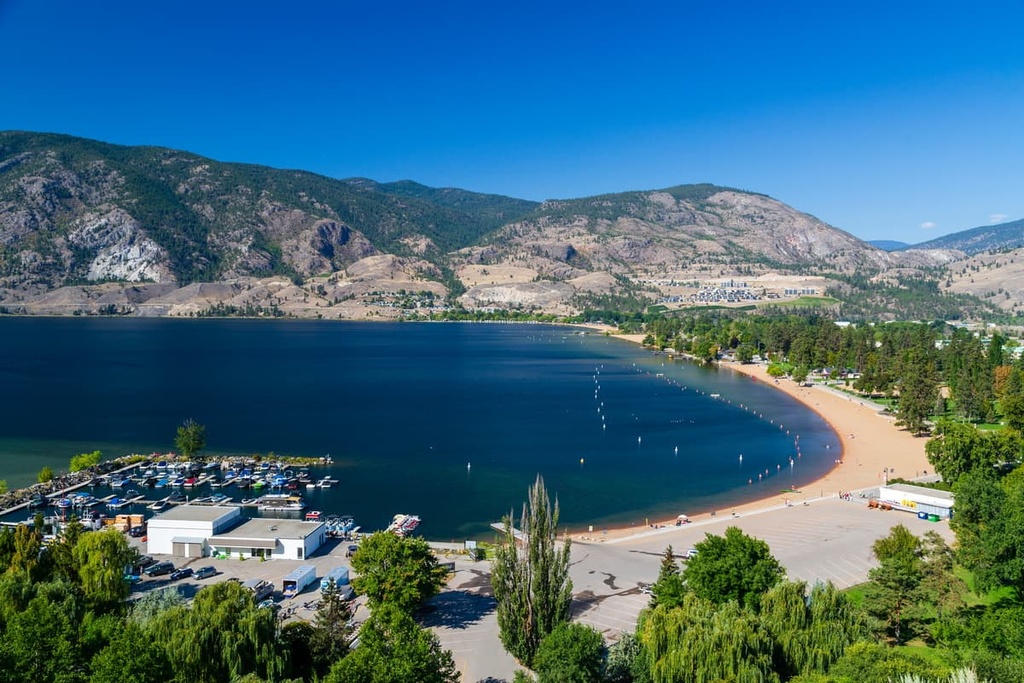
The town of Osoyoos is located immediately to the east of the South Okanagan Grasslands Protected Area. It has all the amenities a traveler would need for a wonderful vacation. The town is a popular summer destination, too.
Tourism and agriculture are the major drivers of the town’s economy, and there is a growing segment of landowners converting their orchards to vineyards.
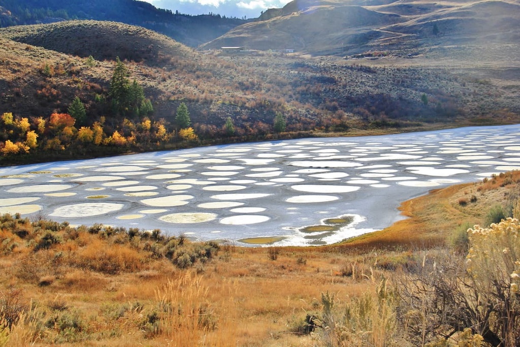
One of the attractions of Osoyoos includes Osoyoos Lake, which is among the warmest freshwater lakes in Canada. There is also Spotted Lake, which is a saline endorheic alkali lake, the Osoyoos Desert Centre, and the Nk’mip Desert Cultural Center.
In Osoyoos, there are ample accommodation options ranging from campgrounds to hotels; however, most locations will fill up quickly during the summer and on nice weekends in the spring and fall.
While staying in Osoyoos, you may want to check out White Lake Grasslands Protected Area, Vaseux Protected Area, and Anarchist Protected Area to discover some other unique places in the region.
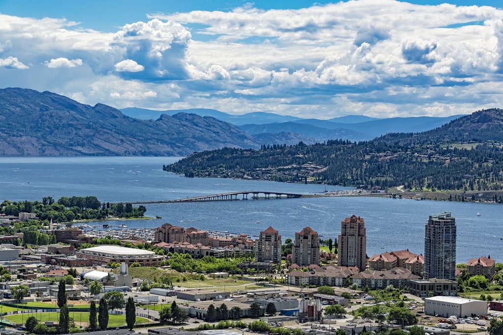
Penticton is situated about 80 km (64 mi) to the north of the South Okanagan Grasslands Protected Area. It is located at the south end of Okanagan Lake in the Okanagan Valley. The major industries in Penticton are agriculture and tourism, with agriculture focused on orchards and vineyards. Penticton is the largest city in the Regional District of Okanagan-Similkameen.
Most visitors come to Penticton to enjoy the beach and the relatively warm waters of Okanagan and Skaha lakes. While visiting Penticton, other activities to enjoy include cycling the Kettle Valley Railway Trail, rock climbing at Skaha Bluffs, skiing at Apex Mountain Resort, or playing a round or two at one of the city’s many golf courses.
Kelowna is considered the capital of the Okanagan. It is the largest city in the region and is located just 140 km (84 mi) to the north of South Okanagan Grasslands Protected Area. The city is located on the eastern shore of the beautiful Okanagan Lake, and it has a wide range of accommodations and attractions available.
The city fills in the summer months with people from across British Columbia and Canada, who flock to the region to enjoy its warm and dry weather. That said, while the city’s beaches and lake are always tempting, there are also some great hiking areas near Kelowna, too.
Okanagan Mountain Provincial Park and Myra-Bellevue Provincial Park are among the most popular hiking areas for locals; however, there are many other things to do in the valley. The Kettle Valley Railway has many popular attractions to check out, and the valley also has over 200 wineries and countless orchards to visit.

Explore South Okanagan Grasslands Protected Area with the PeakVisor 3D Map and identify its summits.


