
Share

Scan the QR code and open PeakVisor on your phone
Scan the QR code and open PeakVisor on your phone
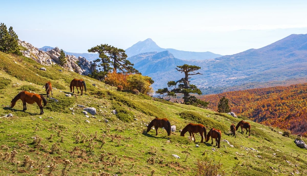
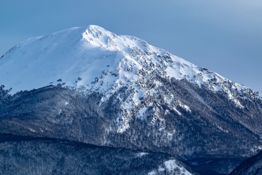
Discover Italy's largest national park and scale the highest peaks of the southern Apennines at Pollino National Park. There are 395 named summits in Pollino National Park. The highest and the most prominent mountain in the park is Serra Dolcedorme (2,267 m/7437 ft).
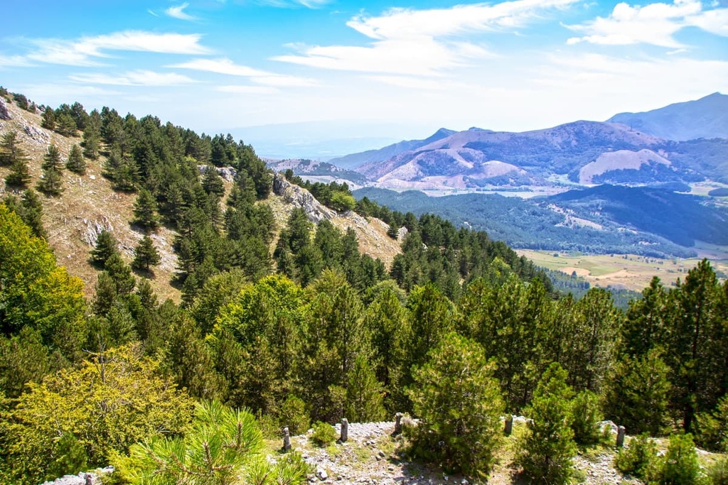
Pollino National Park (Parco Nazionale del Pollino) is an area of protected countryside in southern Italy.
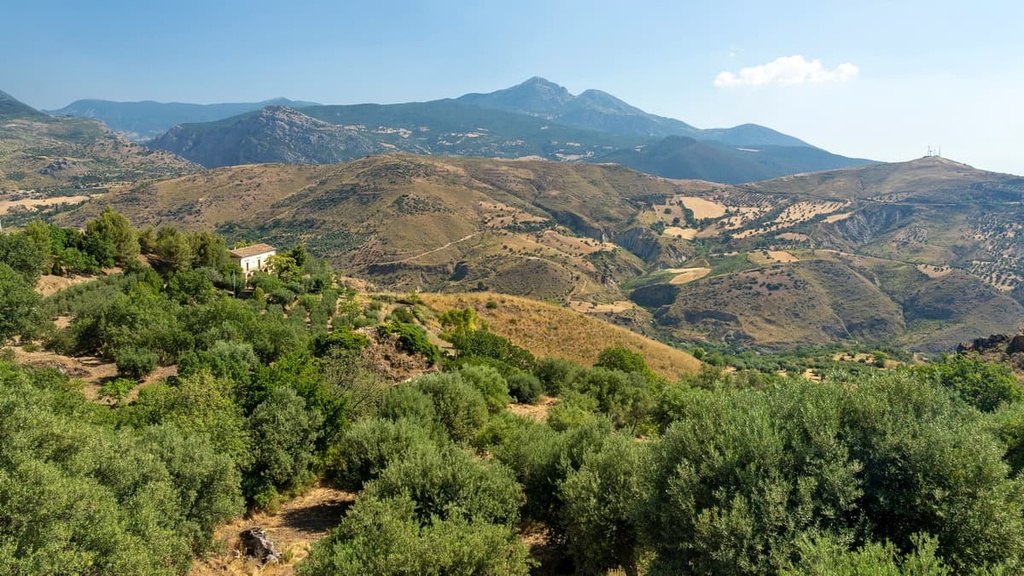
The park covers an area of 1,925 sq km (743 sq mi) on the border between the regions of Basilicata and Calabria within the provinces of Cosenza, Matera, and Potenza. Pollino National Park is the largest national park in Italy and one of the 50 biggest national parks globally.
The park takes its name from the Pollino (Massiccio del Pollino), a massif that’s part of the Lucanian Apennines. The Lucanian Apennines are a region of the Apennines, a mountain range that runs for 1,200 km (750 mi) down the spine of Italy. The Pollino massif is the park's main feature and it forms a natural border between Basilicata and Calabria.
The Pollino massif consists of five summits over 2,000 m (6,561 ft), including Serra Dolcedorme (2,267 m/7437 ft) and Monte Pollino (2,248 m/7,375 ft). Serra Dolcedorme is the highest peak in southern Italy excluding Mount Etna (3,329 m/10,921 ft), which is located on the east coast of Sicily.
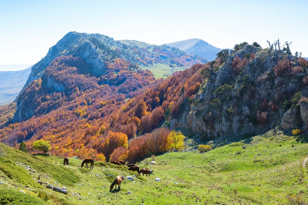
Another notable feature of Pollino National Park is the Orsomarso Mountains (Monti di Orsomarso). Also part of the Lucanian Apennines, the Orsomarso Mountains are located in the southwest of the park near the Tyrrhenian coast.
The Orsomarso Mountains don't exceed 2,000 m (6,561 ft) in elevation, but they still contain several significant summits like Cozzo del Pellegrino (1,987 m/6,519 ft) and Monte La Mula (1,935 m/6,248 ft).
Another minor mountain range in Pollino National Park is the Spina-Zaccana Mountains (Monti la Spina–Zaccana). It's located in the northwest of the park and consists of Monte Zaccana (1,439 m/4,721 ft) and Monte la Spina (1,652 m/5,419 ft).
Several significant rivers and lakes flow through Pollino National Park. The most important waterway is the Sinni River, which starts from high in the Lucanian Apennines and runs for 94 km (58 mi) across Basilicata.
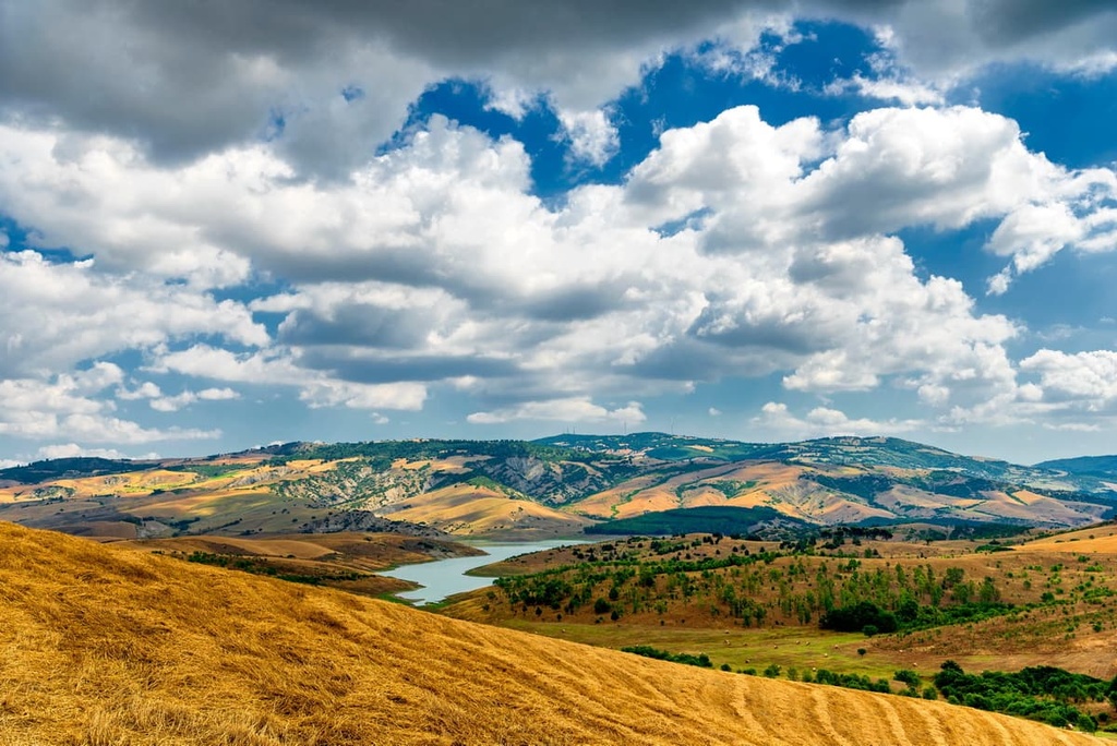
To the north of the park is the largest earthwork dam in Europe, Diga di Monte Cotugno. The dam was constructed across the Sinni, forming the Lago Monte Cotugno, the largest lake in the park.
You'll find many other protected landscapes near Pollino National Park. There are three other national parks nearby including Sila National Park (Parco Nazionale della Sila) to the south, Appennino Lucano-Val d'Agri-Lagonegrese National Park (Parco Nazionale dell'Appennino Lucano-Val d'Agri-Lagonegrese) to the north and Cilento, Vallo di Diano and Alburni National Park (Parco Nazionale del Cilento, Vallo di Diano e Alburni) to the northwest.
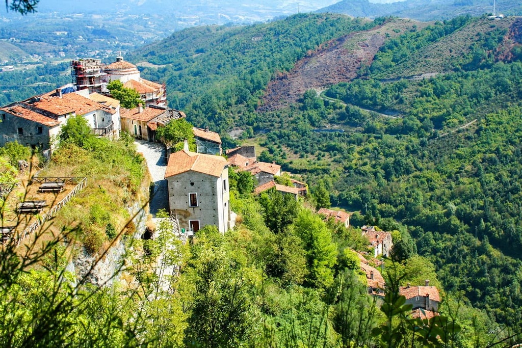
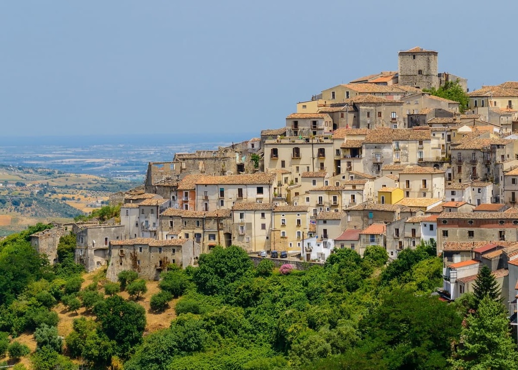
Pollino National Park is home to several notable hillside towns and villages, including Castrovillari, Rotonda, Morano Calabro, and Cerchiara di Calabria. Nearby major cities include Potenza, the capital of Basilicata, which is located 125 km (78 mi) to the north, and Cosenza, the capital of the Province of Cosenza, which is located 88 km (55 mi) to the south.
Pollino National Park is an area of great interest to geologists, and it is part of the Pollino UNESCO Global Geopark. Geologists come to the park to study the relationship between the Peloritano-Calabrian Arc and the southern Apennines. The Peloritano-Calabrian Arc forms a part of one of the world’s oldest oceanic crust segments.
The touching point between the southern Apennines and the Peloritano-Calabrian Arc is known as the Fault Sangineto, and it is located just south of the Orsomarso Mountains. This fault allows geologists to work out the main characteristics of the area's orogen.
The mountains of Pollino National Park and the rest of the Apennines formed during a mountain-building event called the Apennine orogeny during the Cenozoic era some 65 million years ago. The orogeny reached its peak during the Miocene and Pliocene epochs between 23 and 2.6 million years ago.
The region consists mostly of sedimentary rock, primarily limestone. This limestone formed in the now-closed Tethys Sea during the Mesozoic approximately 250 to 65 million years ago.
During this time, sediment from dead marine creatures was deposited on the seafloor and compressed into rock over millions of years. Then, the convergence of the African and European plates folded the landscape into the Apennines.
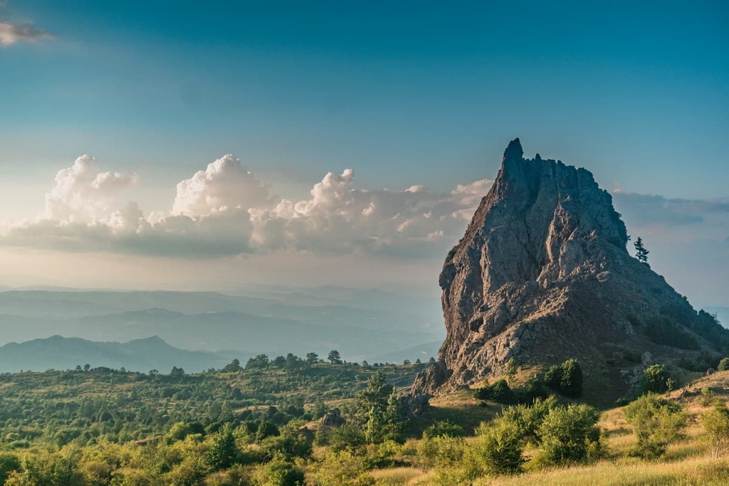
The Pollino massif and the surrounding mountains have been eroded significantly over the years, with many caves or grottoes forming in the mountainsides. One notable example is the Romito Cave (Grotta del Romito) in the Lao Valley, which is 54 m (177 ft) long.
Today, Pollino National Park is home to many of the highest summits in South Italy. Away from the park's highest peaks, popular mountains include Monte Alpi (1,906 m/6,253 ft), Serra di Crispo (2 054m/6 739 ft), and Monte Caramolo (1,827 m/5,994 ft).
The rare ecology of Pollino National Park is one of the main reasons the area is protected. The park was set up partly to protect the area's unique ecosystems and endangered flora and fauna.
Mammals are common across Pollino National Park, and the area provides a snapshot of the mammals present across the southern Apennines.
Carnivorous mammals found in the park include Italian wolves, European wildcats, European pine marten, skunks, and otters. Other common mammalian species include boars, roe deer, forest dormice, Apennine hares, and porcupines. Calabrian black squirrels are one of the park's endemic mammal species.
There are dozens of notable bird species that inhabit Pollino National Park, including red-billed choughs, rock partridges, and black woodpeckers. Twelve predatory bird species call Pollino National Park home, including peregrine falcons, golden eagles, and red kites.
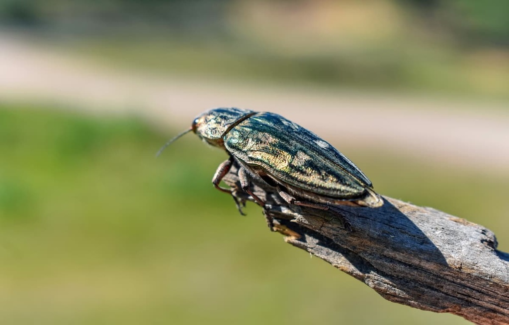
Pollino National Park is an essential habitat for several insect species, especially the goldstreifiger, one of the rarest beetles in Europe. The vulnerable rosalia longicorn, with its vibrant blue and black markings, is also present in the park. Other notable insects and arachnids species include Italian marbled white butterflies and Mediterranean black widows.
In the waters of Pollino National Park, you'll find a number of fascinating amphibians and crustaceans. One of the strangest examples is the Chirocephalus ruffoi, a crustacean that is only found in temporary pools at high altitudes and is considered an indicator of good water quality.
Notable reptile and amphibian species include European pond turtles, Apennine yellow-bellied toads, and Italian crested newts. In addition, multiple snake species, including asps and leopard snakes, inhabit Pollino National Park.
Pollino National Park is home to some of the rarest plants in the world. The park's flora is varied, with certain species thriving at different altitudes.
To the east of the park near the Tyrrhenian coast, at about 800 m (2,624 ft) in elevation, junipers, strawberry trees, Montpellier maples, and downy oaks are common. In drier areas of the park, where rock and sand form the landscape, you'll find aromatic species such as thyme, wall germander, and cistus.
High up on the mountainsides, beech trees dominate the terrain. Interspersed between the beech trees are chestnuts, Turkey oaks, and maples. Beech trees are incredibly hardy and will grow out of the solid rock at anywhere between 2,200 m (7,217 ft) and 500 m (1,640 ft) in elevation.
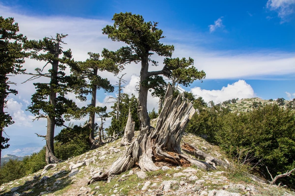
The most popular trees in Pollino National Park are Heldriech's pines, which are native to southern Italy and the Balkans. Also known as Bosnian pines, they are a symbol of the park. The park is home to what is believed to be one of the oldest trees in Europe, a Heldreich's pine thought to be over 1,230 years old.
Flowers and other plants commonly found high on the mountain plateaus include great white saffron, yarrow, great yellow gentian, and various orchids.
Pollino National Park is of great historical significance, with many important archeological sites and structures dotted across the park's landscape.
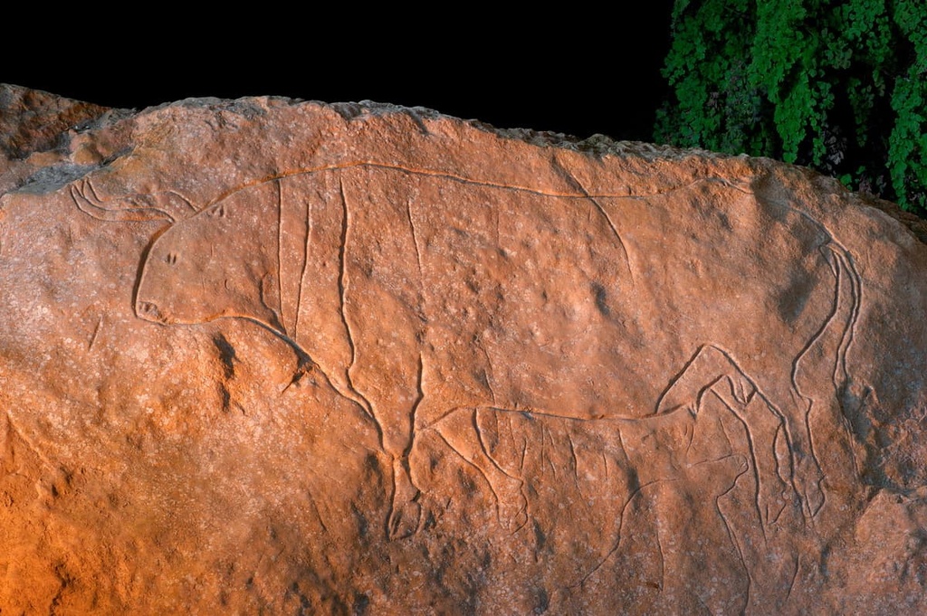
There's evidence that shows humans have been living in the area that's now Pollino National Park for thousands of years. The park contains one of Europe's most important archeological sites, the Romito Cave (Grotta del Romito).
Located in Papasidero, the Grotta del Romito features a carving of aurochs cattle dating back to the Late Stone Age, roughly 17,000 years ago. The carving is considered the most important example of Paleolithic realism in the Mediterranean. In addition, archeologists found several graves, including the remains of the earliest known human with dwarfism.
Other prehistoric archeological sites have also been found at Timpone della Motta and Macchiabbate near the town of Francavilla Marittima. The site at Timpone della Motta dates back to the Middle Bronze Age and is believed to have been a large settlement belonging to the ancient Oenotrian people.
Modern-day Pollino National Park, along with the rest of South Italy, has a rich culture shaped by interactions with some of the greatest ancient civilizations in history. The Normans, Greeks, Romans, Byzantines, and the Lombards all influenced life in southern Italy.
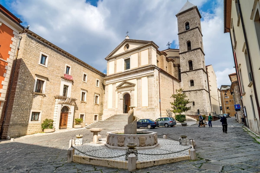
Religion has played a central role in Pollino National Park's human history, with many of the area's main villages and towns built around churches and sanctuaries.
One early example is located near San Donato di Ninea. The Grotta di Sant'Angelo is a church built in a cave in the fifth century that was decorated with frescoes and contained a ceremonial axe dedicated to the Greek goddess Hera.
Many churches and fortresses scattered across Pollino National Park date back hundreds of years. Some of these buildings were built in picturesque locations and are well-preserved.
For example, the sanctuary of Santa Maria delle Armi, in Cerchiara di Calabria was constructed out of solid rock and dates back to the Middle Ages.
Another popular religious building is the Madonna del Pettoruto in San Sosti. Located high in the Orsomarso Mountains, this sanctuary was first built by the monks of Acquaterrosa Abbey in 1274 but had to be reconstructed in the eighteenth century following an earthquake.
Several notable fortresses are also dotted across the area, the most famous of which is the Castello Aragonese in Castrovillari, which dates back to the late fifteenth century.
One of the most interesting cultural aspects of Pollino National Park is the strength of the region’s ethnically Albanian communities. Known as the Arbëreshë people, these communities originally arrived in Italy in the fourteenth and fifteenth centuries after being driven out of their homes by the Ottoman Turks.
The culture and history of the Arbëreshë people are well-preserved, and many Arbëreshë people still speak Arbëresh, a mix of Tosk Albanian dialects and regional Italian. There are thought to be around 100,000 Arbëreshë people in Italy. Notable Arbëreshë communities located in and around Pollino National Park include Acquaformosa, Civita, San Paolo Albanese, and Lungro.
Pollino National Park was established in 1994 to protect the area's natural habitats and highlight its geological importance. In fact, the park was first founded on a designated level in 1986 but didn't gain national recognition until nearly ten years later. The Ministero dell'Ambiente manages the park.
Pollino National Park is the largest national park in Italy and is, therefore, one of the country's most remote areas. Hikers in Pollino National Park should map out their route, bring a topographic map of the area, and inform others of their itinerary.
Trails in Pollino National Park are graded according to the Italian Alpine Club's (Club Alpino Italiano) hiking system:
Before setting out on a hike, pay attention to these designations and ensure the trails suit your skill and fitness levels. If you are unsure about a route, hire a local guide.
Read on to find out about some of the best hikes in Pollino National Park.
Serra Dolcedorme (2,267 m/7437 ft) is the highest summit in southern Italy (excluding Mount Etna on Sicily) and the crown jewel of the Pollino massif. The mountain likely takes its name from the fact that its north side resembles a woman sleeping.
Located in Calabria, Serra Dolcedorme is flanked by two lesser summits, Timpa del Pino di Michele (2,072 m/6,797 ft) and Timpa di Vallepiana (2,159 m/7,083 ft). The approach to and descent from Serra Dolcedorme are much longer than other mountains in the massif, so hikers will need to prepare for a long trek.
Serra Dolcedorme is easily one of the most popular mountains in Pollino National Park, with several hiking trails that lead to the summit. One of the most popular trails leads from the Valle Piana (900 m/2,952 ft) near Castrovillari.
From Valle Piana, follow the CAI (Club Alpino Italiano) trail towards Timpone Campanaro (1,491 m/4,891 ft), before diverging to the Scilla e Cariddi, two rock gendarmes (pinnacles) overlooking a gully. Eventually, you'll get to the Crestone dei Loricati (1,900 m/6,233 ft), Serra Dolcedorme's southern ridge that leads to its summit.
The return leg runs along the Celsa Bianca ridge, through the Pollinello woodlands, and down to the Varco del Pollinello (1,700 m/5,577 ft). The Celsa Bianca ridge overlooks the mountain's imposing southern wall, offering one of the best views in the park. This is an EE-rated trail with an elevation gain of approximately 1,400 m (4,593 ft).
An even more challenging way of reaching the summit of Serra Dolcedorme is via the Gola del Turbine. The route starts from Valle Piana and leads along the Valle Cupa pass (1,317 m/4,320 ft) to the Crestone dei Loricati.
To reach the summit, this trail follows the Gola del Turbine, a very steep and very narrow path between two stone walls. To descend, head into the Faggio Grosso valley back to the Valle Cupa pass and follow the path back to your starting point. This is an EEA-rated trail with an elevation gain of approximately 1,400 m (4,593 ft).
Monte Pollino (2,248 m/7,375 ft) is the second-highest mountain of the Pollino and is the massif's namesake. It's located southeast of Serra Dolcedorme (2,267 m/7437 ft), just past Timpa di Vallepiana (2,159 m/7,083 ft). Serra del Prete (2,181 m/7,155 ft) flanks Serra Dolcedorme to the northwest.
It's possible to scale Monte Pollino and Serra Dolcedorme on the same trail from near Colle Dell'impiso (1,609 m/5,278 ft). The hike is around 20 km (12.5 mi) long but is well worth the effort to see some of the park's best landscapes.
From Colle Impiso, follow the dirt road to Piano di Vaquarro. Then, rejoin the dirt path you left until you reach Colle Gaudolino (1,684 m/5,524 ft). Here, you'll get to see some of the park's iconic Heldreich's pines, which teeter on the edge of the rugged ridge.
The path runs along Monte Pollino's south side to the summit. Then you'll walk along the southwest ridge and onto the saddle between the mountains to reach Serra Dolcedorme's summit.
To descend, you'll walk from the saddle to Piano di Pollino and back to your starting point. This is an EE-rated trail with an elevation gain of 767 m (2,516 ft).
A slightly shorter route that avoids Serra Dolcedorme leads along Monte Pollino's north ridge. From the Colle Impiso, follow the path to the upper Piano di Vaquarro and then to Piano Gaudolino. Keep left on the edge of woods and head to the Piani di Pollino.
The path out of Piani di Pollino onto Monte Pollino's north ridge is hard to locate, so map your route carefully. Follow the ridge to the summit of Monte Pollino.
There are a few ways to descend from Monte Pollino, including along the west ridge. This is an EE-rated trail with an elevation gain of 687 m (2,253 ft). The Bivacco Colle Gaudolino (1,699 m/5,574 ft) is accessible along this route.
Serra di Crispo (2,054 m/6,738 ft) is one of the tallest mountains in the Pollino massif and is a favorite among hikers. It's one of the easiest mountains to climb in the massif, with its gentle slopes and stunning views across the surrounding valleys.
Serra di Crispo's crest was once described as "the Garden of the Gods" by author Giorgio Braschi due to the area's otherworldly pine trees. Timpa del Castello (1,862 m/6,108 ft) flanks Serra di Crispo to the northeast.
One of the most popular ways of climbing Serra di Crispo is from the Madonna di Pollino refuge. Follow the clear path that leads gently uphill and through two picturesque clearings.
Then you'll walk downhill to the Fosso Iannace stream and across the west side of the Piano di Iannace. There's no set trail as you head uphill through woods to the summit of Serra di Crispo, so map your route. You'll descend along the same route. This is an E-rated trail with an elevation gain of 503 m (1,650 ft).
Encircled by some of the highest peaks in the Pollino massif, Piano Ruggio is a must-see for most visitors to Pollino National Park.
This plateau is located above 1,500 m (4,921 ft) in elevation, with views of Timpone di Viggianello (1,779 m/5,836 ft), Coppola di Paola (1,919 m/6,295 ft), and Serra del Prete (2,181 m/ 7,155 ft), the third-highest summit in the Pollino massif. Piano Ruggio also leads to Colle Impiso, where many of the park's hikes start.
The best way to experience the plateau is by hiking to the summit of Serra del Prete. From the Rifugio De Gasperi (1,530 m/5,019 ft), cross the Piano Ruggio to reach woodlands at the foot of Serra del Prete. The woods here are especially beautiful and are home to a range of vibrant flora.
There's no trail here, so climb the mountainside at a 45-degree angle while keeping right until you exit the woods into a clearing. Then, hike onto the Serra del Prete's southwest ridge. The walk to the summit of Serra del Prete from the ridge is straightforward. This is an E-rated trail with an elevation gain of 681 m (2,234 ft).
Cozzo del Pellegrino (1,987 m/6,519 ft) is the highest summit in the Orsomarso Mountains. Located in the southwestern part of the park, Cozzo del Pellegrino is an impressive mountain with a pyramidal summit and rugged cliffs.
Cozzo del Pellegrino is surrounded by other significant summits, with Cozzo dell'Orso (1,576 m/5,170 ft) to the northwest, La Calvia (1,910 m/6,266 ft) to the southeast, and Serra la Vespa (1,767 m/5,797 ft) to the northeast.
One of the best ways to climb Cozzo del Pellegrino is from the rifugio Piano di Lanzo (1,352 m/4,435 ft). The walk starts by following the CAI path north, climbing steeply uphill until you reach a plateau with a statue of the Madonna.
You'll then need to walk along the eastern slopes of Cozzo di Valle Scura (1,824 m/5,984 ft), eventually climbing onto the mountain's ridge. Walk through a steep gully and a beech forest before arriving on one of the most spectacular ridges in Pollino National Park. From the ridge, walk to the summit of La Calvia.
The rest of the walk involves navigating through dense forests and exposed ridges to reach the summit of Cozzo del Pellegrino. You return to your starting point by walking into the Valle Lupa and then to the Piano Puledro. This is an EE-rated trail with an elevation gain of 1351 m (4,432 ft).
There are numerous fascinating settlements to visit in and around Pollino National Park, ranging from traditional Arbëreshë villages to regional capitals. Read on to find out about the main settlements in Pollino National Park.
A provincial capital, Cosenza is a cultural hub and home to one of the oldest centers of literary studies in Europe, the Cosentian Academy. During your stay, ensure you pay a visit to the eleventh-century Norman Castle and the National Gallery of Cosenza.
Cosenza is located approximately 90 km (56 mi) south of Pollino National Park, making the park easy to reach by car. Popular hotels in Cosenza include Hotel Europa, Italiana Hotels Cosenza, and Hotel Majorana.
Located approximately 125 km (77.5 mi) north of Pollino National Park is the capital of Basilicata, Potenza. Sat overlooking Basento River within the Apennines, Potenza is the highest regional capital in Italy at 816 m (2,687 ft) in elevation. When you're not off exploring Pollino National Park, plan a hike up Monte Vulture (1,326 m/4,350 ft), a nearby extinct volcano.
Other popular sights in Potenza include the eighteenth-century Potenza Cathedral and San Francesco, a church founded in the thirteenth century. If you’re planning to spend the night in Potenza, consider booking a room at Grande Albergo, Le Gemme del Centro Storico, and Hotel Residence Santa Loja.
Located at the heart of Pollino National Park is the hillside town of Rotonda. Rotonda is popular with hikers as it's the national park's headquarters and is one of the best places to pick up local maps and information on hiking itineraries.
Rotonda is home to the Museo Naturalistico e Paleontologico, which features exhibits on local fossils, including a 500,000-year-old elephant skeleton. Popular accomodation options in Rotonda include Hotel Santa Filomena and Il Castello.
Located on the park's southern boundary is the town of Castrovillari. With a population of over 20,000 people, Castrovillari is one of the largest towns near Pollino National Park. Its position on the Calabria/Basilicata border means visitors to Castrovillari will have easy access to the Pollino massif, with Serra Dolcedorme (2,267 m/7437 ft) and Monte Pollino (2,248 m/7,375 ft) located approximately 10 km (6 mi) away.
Castrovillari is home to several interesting local attractions, like the Museo Archeologico di Castrovillari and the fifteenth-century Castello Aragonese. You should also plan a day trip to Morano Calabro, one of the most beautiful villages in Calabria. Popular hotels in Castrovillari include Hotel Jolly and La Locanda di Alia.
There are several picturesque coastal towns near Pollino National Park, and one of the highlights is Maratea. Nicknamed "the pearl of the Tyrrhenian coast," Maratea is famed for its stunning coastline, 44 churches, and Medieval town center. During your stay, ensure you hike up to see Maratea's 21 m (70 ft) tall Christ the Redeemer, which sits atop Monte San Biagio (642 m/2,106 ft).
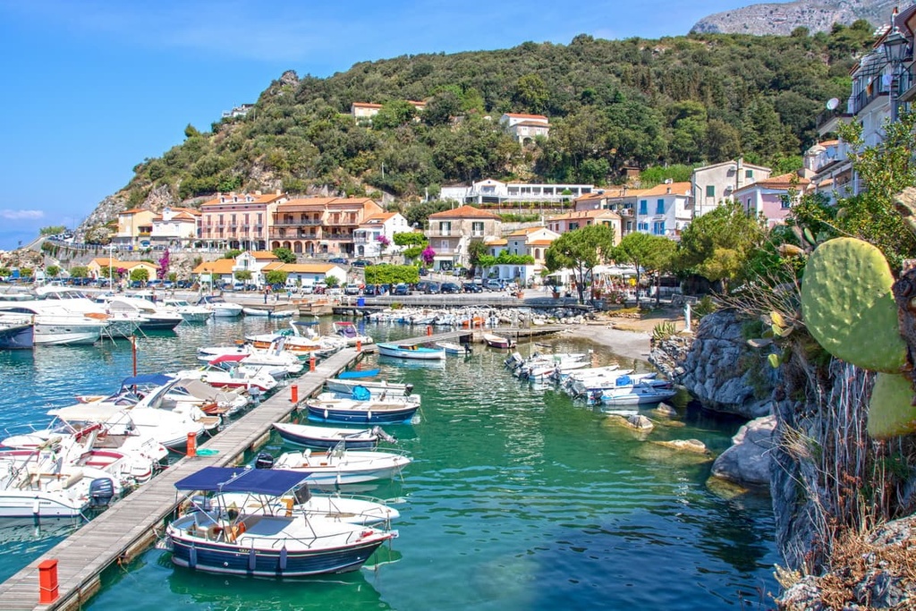
Maratea is located approximately 44 km (27 mi) from Pollino National Park, making it easy to reach by car on a day trip. Hotels in Maratea include Hotel Murmann and Hotel Ristorante Borgo La Tana.
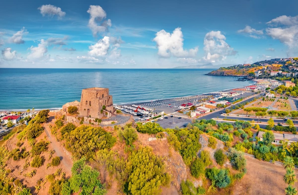
If you're looking to stay somewhere with plenty of sun and sand, consider Scalea. Located just down the coast from Maratea, Scalea is one of the largest coastal towns in the province of Cosenza. It is known for its terraced layout, ancient city walls, and pristine beaches.
Spend your days in Scalea soaking up the sun on Spiaggia di Scalea or exploring the Ruderi del Castello Normanno. Scalea is located approximately 45 km (28 mi) from the center of Pollino National Park, and it provides easy access to the Orsomarso Mountains. Popular hotels in Scalea include Hotel Scalea, InCentro Scalea B&B, and Grand Hotel de Rose.

Explore Pollino National Park with the PeakVisor 3D Map and identify its summits.


top50
ultra
apennine-2000
italy-ultras
top50
ultra
apennine-2000
italy-ultras

