Share

Scan the QR code and open PeakVisor on your phone
Scan the QR code and open PeakVisor on your phone
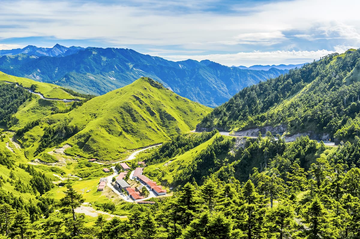
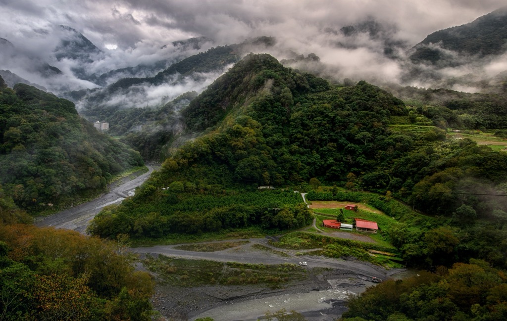
Central Taiwan’s largest mountainous nature reserve is the alpine Ruiyanxi Major Wildlife Habitat (瑞岩溪野生動物重要棲息環境). Hehuanshan (合欢山) is the tallest and most prominent of the 10 named mountains in the wildlife sanctuary, measuring 3,416 meters (11,207 ft).
Ruiyanxi Major Wildlife Habitat lies at an elevation of 1,210 to 3,416 meters (3,970 to 11,207 ft) in Ren’ai Township (仁愛鄉) of Nantou County (南投县). Covering 2,574 ha (6,360 ac) of land, Ruiyanxi’s reserve is situated in the southern half of the Ruiyan River basin. Ruiyanxi’s land also overlaps the southeastern territory of Taroko National Park (太魯閣國家公園).
Other well-known and equally hilly areas that lie in close range to Ruiyanxi Major Wildlife Habitat are Shei-Pa National Park (雪霸國家公園) to the northwest, Danda Major Wildlife Habitat (丹大野生動物重要棲息環境) to the south, and Basianshan Forest (八仙山國家森林遊樂區) to the west.
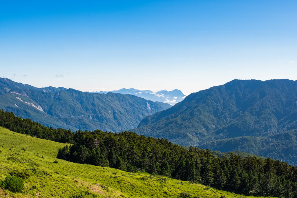
This area of Taiwan is mountainous, as the Central Mountain Range (中央山脈) runs its lofty sierra along the terrain. Thus, the flora and wildlife are varied and diverse due to the different forest zones and habitats.
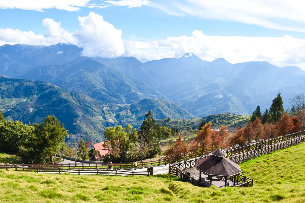
Every year, the fertile land receives a high annual rainfall of 3,000 to 4,000 mm (118 to 157 in). Together with the fog forest belt above 2,000 meters (6,562 ft), Ruiyanxi’s vegetation thrives in this area and is a suitable habitat for many animals.
Human disturbance is also at a minimum due to the high elevation. Thus, the region is an untouched piece of paradise with lush foliage and views showing miles of Taiwan’s rugged backcountry.
While Hehuanshan is the highest peak, there are many other tall mountains in the surroundings. Hehuanshan South Peak (合歡山南峰), Meisongshan (梅松山), Yuan Feng (鳶峯), and Yingyingfeng (櫻櫻峰) are all above 2,800 meters (9,186 ft).
Ruiyanxi Major Wildlife Habitat’s hills belong to the Central Mountain Range, Taiwan’s longest massif. Spanning 270 km (168 mi) from southern Pingtung County (屏東縣) to northern Yilan County (宜蘭縣), it includes 1,249 hills.
The mountain’s rock strata comprise the Miocene epoch’s Lushan layer of slate mixture and phyllite.
According to different elevations, you’ll find four forest zones in Ruiyanxi Major Wildlife Habitat. From 1,210 to 2,000 meters (3,970 to 6,562 ft), a broadleaf forest mainly comprises Fagaceae and Lauraceae plants. The broadleaf trees begin to mix with coniferous arboreals as the elevation rises from 2,000 to 2,400 meters (6,562 to 7,874 ft). The main tree species are Taiwan yew and juniper.
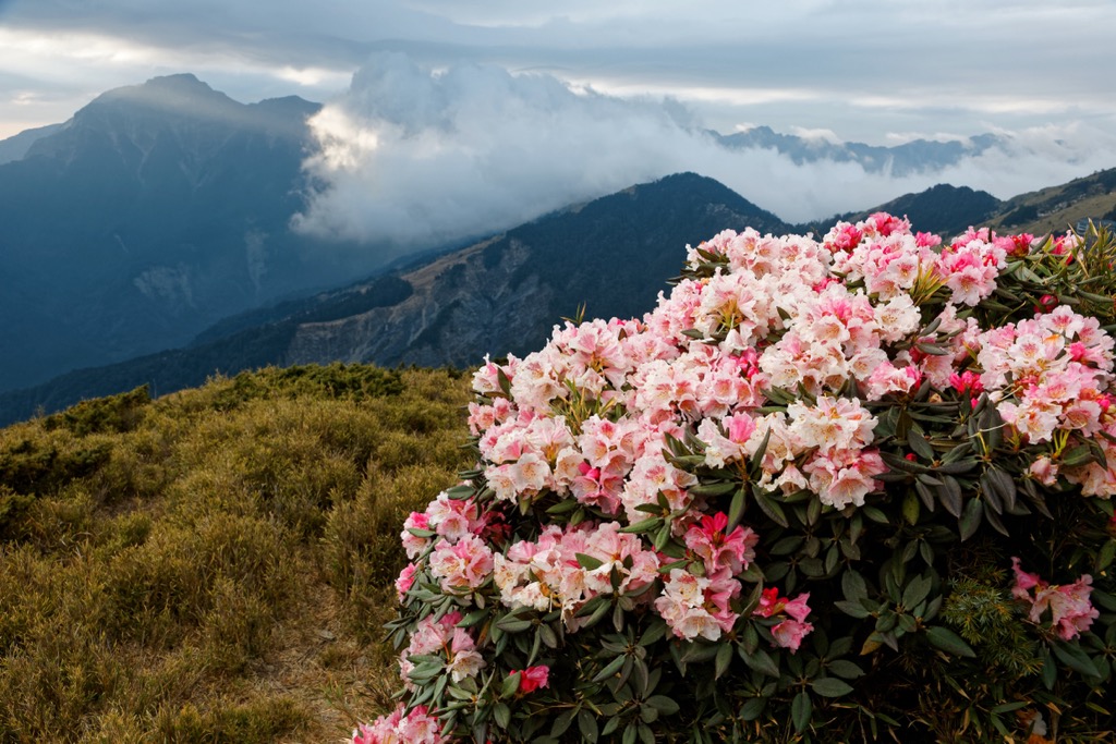
From 2,400 to 3,000 meters (7,874 to 9,843 ft), conifer trees dominate the vegetation, with Taiwan hemlock and Taiwan fir a common feature. Then from 3,000 meters (9,843 ft) and above, you’ll find alpine shrubbery, like Yushan arrow bamboo and Rhododendron japonica.
Like the flora, the wildlife is diverse, and many animals inhabit the forest. Large mammals like the Taiwan black bear and tiger coexist with smaller mammals like the white-faced flying squirrel. Birdlife thrives in the area, with the Taiwan blue magpie and blue-bellied pheasant the main bird species, while you’ll also find butterflies and amphibians there.
Perhaps the most historical event that occurred in Ren’ai Township is the Wushe Incident. This involved Japanese colonialists and the indigenous Seediq tribe. The Japanese treated Taiwan’s tribes as inferior to them, with little to no rights.
During the Japanese Occupation Era, armed Japanese troops battled against unprepared Seediq people. Despite this, they fought bravely for 60 days but eventually surrendered as they were outnumbered by Japan’s 2,000-person army.
As revenge on the Japanese, the Seediq planned a coup whereby they stole ammunition from empty police stations. They then descended upon a sporting event, killing 130 Japanese. A few days later, the Japanese again battled the Seediq, slaughtering over 600 people in retaliation.
To protect the Japanese people from another attack, 2,000 Japanese soldiers sailed to Taiwan, heading inland to Ren’ai Township. This caused the Seediq to flee into the mountains, where the Japanese dropped bombs on them.
The unfortunate killings of the Wushe Incident did, however, change the perception and laws towards indigenous people. Taiwan’s tribes were now handed the same status as other of Taiwan ethnic groups.
Ruiyanxi Major Wildlife Habitat’s major hiking trails and areas are:
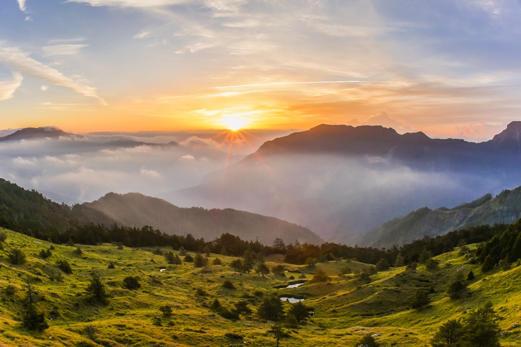
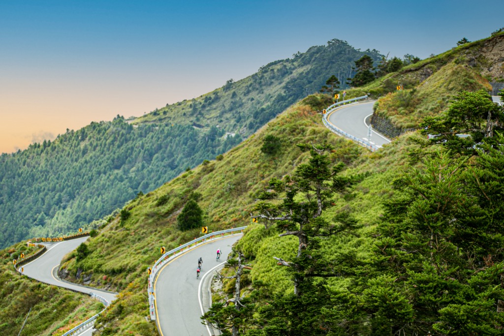
Climbing Hehuanshan, one of Taiwan’s 100 tallest mountains, is less challenging than you might imagine. As Ruiyanxi Major Wildlife Habitat lies at a level of 1,210 meters (3,970 ft), you’re already halfway to the summit once you begin to climb. This makes it the most accessible Baiyue in Taiwan.
Another feature that draws hikers to this trail is its seasonal beauty. Summertime showers of Yushan rhododendron, Yushan rose, and Yushan juniper blossom on the verdant hill, while Alishan gentian and Taiwan lady bells in late summer bring an additional colour.
In the autumn, the leafy greenery turns crimson, creating warm hues of burgundy and golden foliage. The fallen dried leaves create a crunchy forest floor. In the colder months, Hehuanshan is a winter wonderland as a white snow blanket covers the peak and its landscape.
A short 1.8 km (1.1 mi) hike leads you to Hehuanshan’s summit. From there, you can see Taiwan’s other nearby Baiyue, such as Nenggao Shan (能高山), Nanhu Dashan (南湖大山), Zhongyang Jianshan (中央尖山), and even as far as Yushan (玉山).
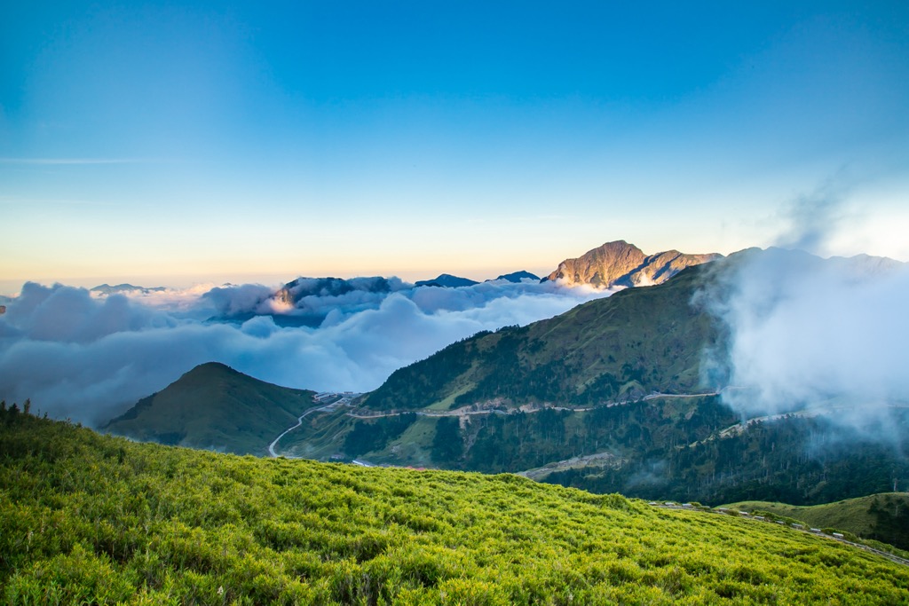
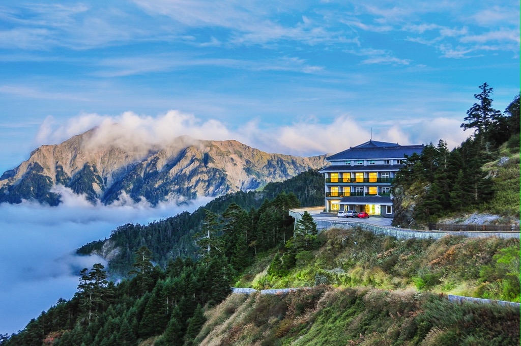
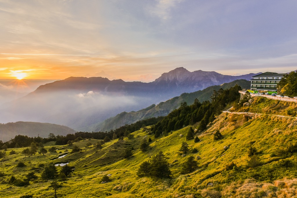
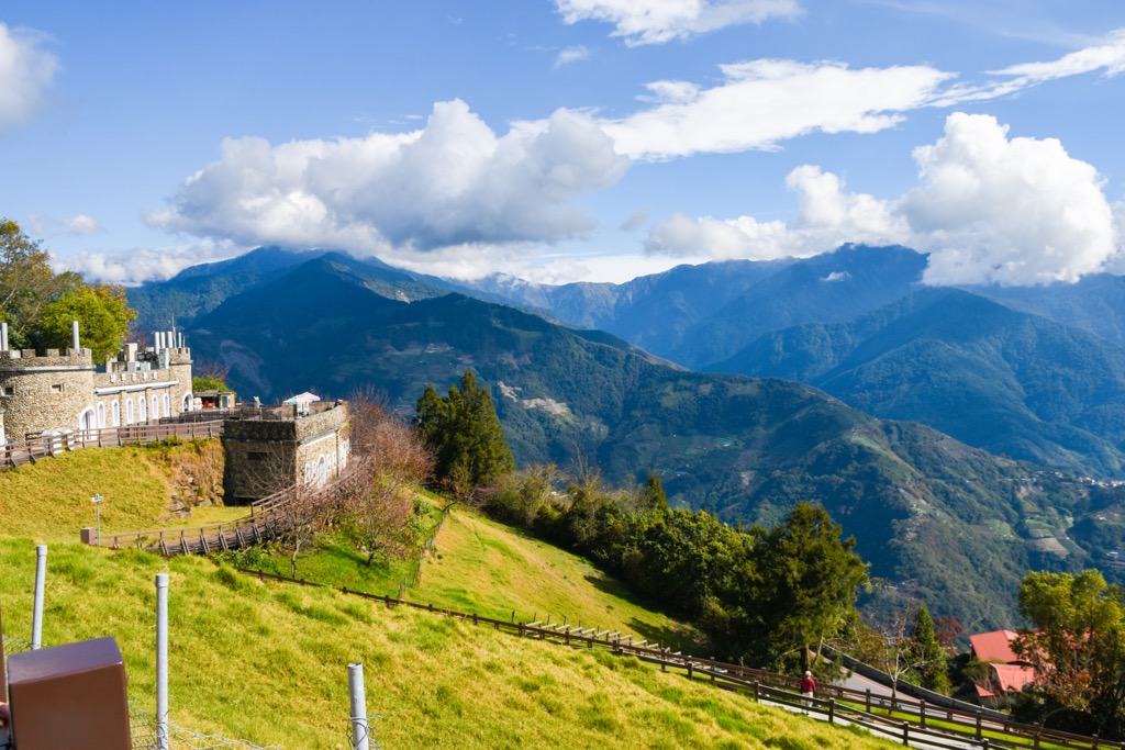
A popular mountain retreat, Qingjing Farm (清境農場) is a picturesque base for hikers tackling Ruiyanxi’s hills. As it's situated at an elevation of 1,750 meters (5,741 ft), the scenery is breathtaking, with jagged pinnacles serving as a dramatic backdrop. In fact, the Qingjing Farm is known as ‘Little Switzerland’ for its mountainous scenery. An ethereal sea of clouds descends upon the land in the morning and afternoon, creating a dreamy scene.
While you can relax in the beautiful bliss of Qingjing Farm, there are also many things to do if you wish to explore. Walk the cobblestone paths where European-style architecture contrasts against the blue mountains. You can buy fodder and get up and close to nature to feed the grazing sheep. Then make your way to the food market where delicious Taiwanese and Yunnan specialities are served.
Perhaps the cherry on the top is walking the skywalk, the highest elevated bridge in Taiwan. As you stroll along the wooden boardwalk, you’ll get a wide panorama from different angles of Taiwan’s inner country. You can admire the mountain forests and shaded valleys and see steaming hot springs below. It’s a stunning sight to see.
After ascending Hehuanshan, you can begin the trek to Meisongshan. The 10 km (0.6 mi) journey can be split into two days, although it is achievable in one day. The trip to Meisongshan involves hiking through shaded forests as you descend Hehuanshan’s steep incline into a dense valley of arrow bamboo.
The physical aspect of this trail is quite tedious as it involves constant climbing down and up the steep terrain. Also, as you’ll descend into a valley, the Taiwan sun can’t reach you, so it may be chilly in the thick grove. However, the flora and views from the mountain are worth the effort. Flowering plants of crystal orchid, Yushan rhododendron, and Yushan juniper blossom in springtime. While from Meisongshan’s summit, you’ll have views of the mighty Baigou Dashan (白狗大山) and snow-capped Xueshan (雪山).
Dip your toes and whole body in the Ruiyan Hot Spring (瑞岩溫泉), located in the Ren’ai Township’s wilderness. Set in the remote countryside, chances are high you may have the Ruiyan Hot Spring all to yourself.
The bubbling creek is a sodium bicarbonate spring with a water temperature range between 118 to 140°F (48 to 60°C). Bask in the boiling warmth of the river and feel your tense muscles begin to loosen. Sodium bicarbonate is known for its beautifying properties, making the skin feel smooth and radiant. While submerged in the hot bath, appreciate the verdant landscape of hilly forests and wide, open pastures.
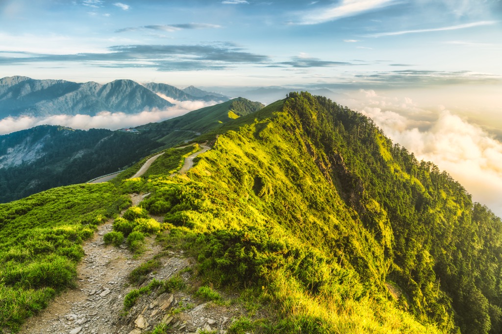
While Hehuanshan is one of the least challenging Baiyue, Qilaishan (奇萊山) ranks as one of the most treacherous. The notorious name, Black Qilai, refers to the number of climbing accidents in the past.
While Qilaishan is not one of Ruiyanxi Major Wildlife Habitat’s mountains, it lies very close to the area. Being a well-known peak, many hikers wish to traverse its rocky terrain. It's a beautiful climb with scenic landscapes and leafy foliage.
You’ll first begin to ascend Qilaishan North Peak (奇萊主山北峰) while trekking through fields of feathery silvergrass (Miscanthus sinensis) that dance in the wind. As you progress further, you’ll pass through a dense arrow bamboo (Pseudosasa japonica) situated below the summit.
Depending on the time of day, you’ll either find a sea of clouds obscuring the views or a stunning panorama of mountainous land. Qilaishan South Peak (奇萊主山南峰), Hehuanshan, Zhongyang JIanshan, and Nanhu Dashan (南湖大山) are all visible on a clear day.
You’ll then progress towards Qilaishan, where the path becomes so steep you’ll have to use rope assists to haul yourself up. As Qilaishan Hiking Trail is divided into a 3-day trek, you’ll begin your day summiting Qilaishan and watching the glowing sunrise infuse the sky.
What lies ahead of you is the most challenging part of the journey. Karoluo Cliff is a 3 km (1.8 mi) long ridgeline with razor-thin crossings. This rock wall drops drastically in some parts, which is scary to see from above.
Then you’ll make your way towards Qilaishan South Peak, a far less challenging ascent. Fields of Yushan angelica, Alishan gentian, and Yushan carnations scatter pops of pastels throughout the climb. From Qilaishan South Peak’s summit, you can follow the Central Mountain Range’s linear passage snake south into central Taiwan.
Explore the misty mountain woodlands of Basianshan National Forest, one of Taiwan’s three largest logging bases from the past. Although it's situated in Taichung City (臺中市), the coniferous wonderland lies within close range of Ruiyanxi Major Wildlife Habitat.
Considered one of Taiwan’s eight scenic spots, a trip to Basasianshan Forest is always a great idea. Surround yourself in blissful pinecone-lined trails as you hike up Malun Shan (馬崙山) maple woods and giant pine trees. Or immerse yourself in an emerald world of dense bamboo groves on the Bamboo Forest Trail. If you’re visiting during spring, don’t miss the Cherry Blossom Trail, awash with pretty pink posies.
You can also climb Basiashan (八仙山) for supreme views of Taiwan’s rugged landscape. From here, you’ll locate the nearby hills of Jilong Shan (基隆山), Tung-Mao Shan (東卯山), Wuwoweishan (屋我尾山) and Daxueshan (大雪山). On clear days, you can see Qilaishan’s peak and Yushan in the distance.
While Nantou County isn’t a bustling hub like Taiwan’s northern and western coasts, its location is convenient when exploring Taiwan’s backcountry. Nantou City (南投市) and Ren’ai Township are two places that lie close to some of Taiwan’s major scenic spots.
Taiwan’s only landlocked city is the best base for visiting Taiwan’s famous lakes, forests, and national parks. It’s also a fascinating city with speciality cuisine from its agricultural location and a range of teas.
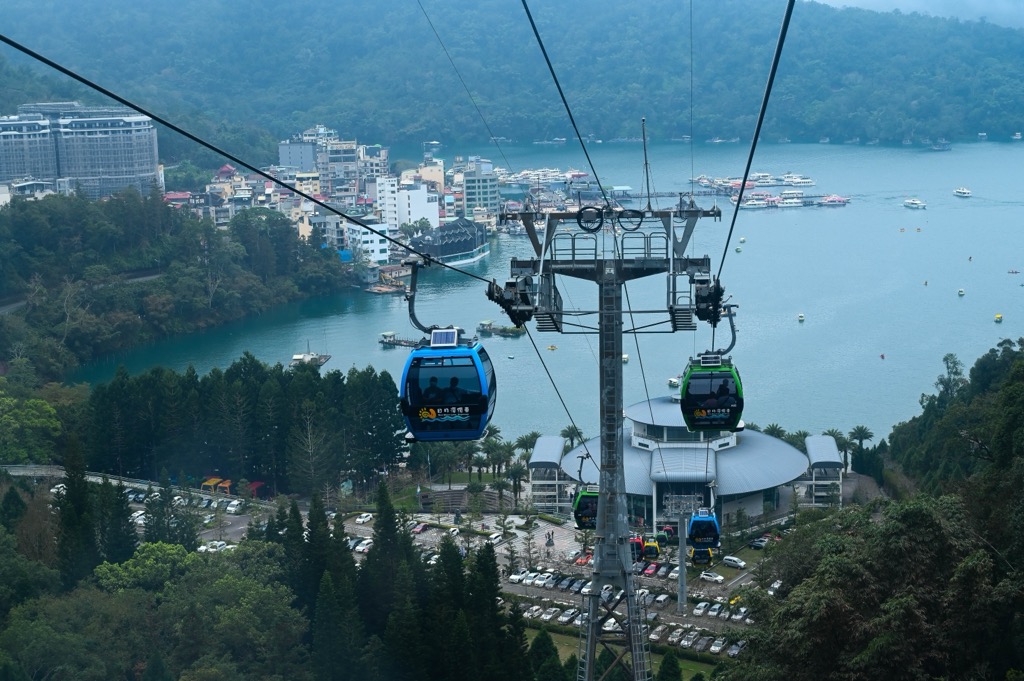
One of the first places you want to venture to is Sun Moon Lake (日月潭). On your drive there, watch the landscape change as you ascend windy roads to reach the turquoise pond. The water looks so inviting you’ll want to dive right in. However, no swimming is allowed as boats cruise along the pristine lake. Take a cruise to admire many different prospects of the mountains unfolding behind the lakeside Taiwan temples and strings of red Chinese lanterns. It’s a place full of charm and tranquility.
Another place worth visiting is Aowanda National Forest (奧萬大國家森林遊樂區), where you can wander through maple groves, hike up a mountain, and descend into a river valley to find two stunning waterfalls. In the springtime, a cherry blossom trail makes a romantic scene with its eruption of soft pink flowers. In the autumn, the maple leaves turn golden, another one of nature’s showstoppers. You can also bird watch in the high-elevation forests and cross the Aowanda Suspension Bridge to see the surge of the Wanda River flowing beneath you.
Finally, for another outdoor adventure, head to Huisan Forest Area (惠蓀林場). The hilly woodland is north of Aowanda Forest and offers a different perspective of the imposing Central Mountain Range’s passage along Taiwan’s central land. The flora brims with flourishing groves of broadleaf fig trees and temperate pines. Many researchers conduct studies in Huisan Forest due to its untouched nature, so you’ll feel away far away from the city and fully relax in the great outdoors.
Nantou County’s northernmost township is wedged between Hualien County (花蓮縣) and Taichung City, where two of Taiwan’s national parks lie. Thus, if you want to visit both Taroko National Park and Shei-Pa National Park, Ren’ai Township is the perfect location for you to stay. It also has other remarkable attractions too.
Visit Tianluanchi’s (天巒池) alpine lake, situated at 2,900 meters (9,514 ft) on Hehuanshan North Peak’s northern slope. While you have to hike the mountain to reach the mountain pond, it’s a worthwhile climb to witness such extreme beauty. The clear, still lake mirrors the blue heavens, with a dense fir forest bordering one side of the crescent-shaped pool. The rugged terrain surrounds the hill, and the views are breathtaking.
Next, head to the thundering cascade of Nenggoa Falls (能高瀑布) for one of nature’s showstoppers. This dramatic four-layered waterfall has a drop of 150 meters (492 ft). One of Taiwan’s highest rapids, you don’t have to climb to view this wonder, instead, there is a road leading to the falls with parking, after which you walk for 10 minutes. A vibrant forest of broadleaf and conifer trees hugs the hillside, while a foamy spray from the raging falls feels delightfully refreshing.
Finally, visit Taiwan’s highest elevated hot spring at 1,091 meters (3,579 ft). Soak in Lushan Hot Spring’s (廬山溫泉) simmering bicarbonate water which is known to relieve stomach pain and flush toxins out of the body. As you relax in the thermal spring, take in the dramatic mountain scenery before you. It is exceptionally beautiful in spring when cherry blossoms erupt through the undulating region.
The closest main city to Ruiyanxi Major Wildlife Habitat is Nantou City. Board the local express train (TRA) from any of Taiwan’s major cities to Nantou City. Once there, renting a car or scooter is best, as you’d save plenty of time heading directly there instead of taking a series of public transport options. It is a 104 km (65 mi) drive from Nantou City to Ruiyanxi Major Wildlife habitat.

Explore Ruiyanxi Major Wildlife Habitat with the PeakVisor 3D Map and identify its summits.