Share

Scan the QR code and open PeakVisor on your phone
Scan the QR code and open PeakVisor on your phone
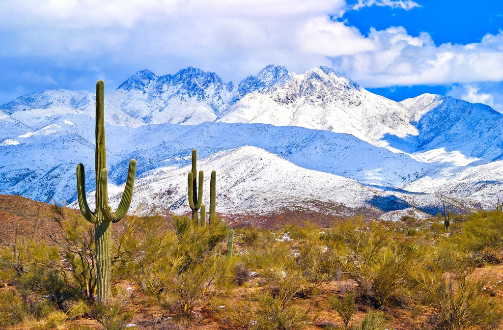
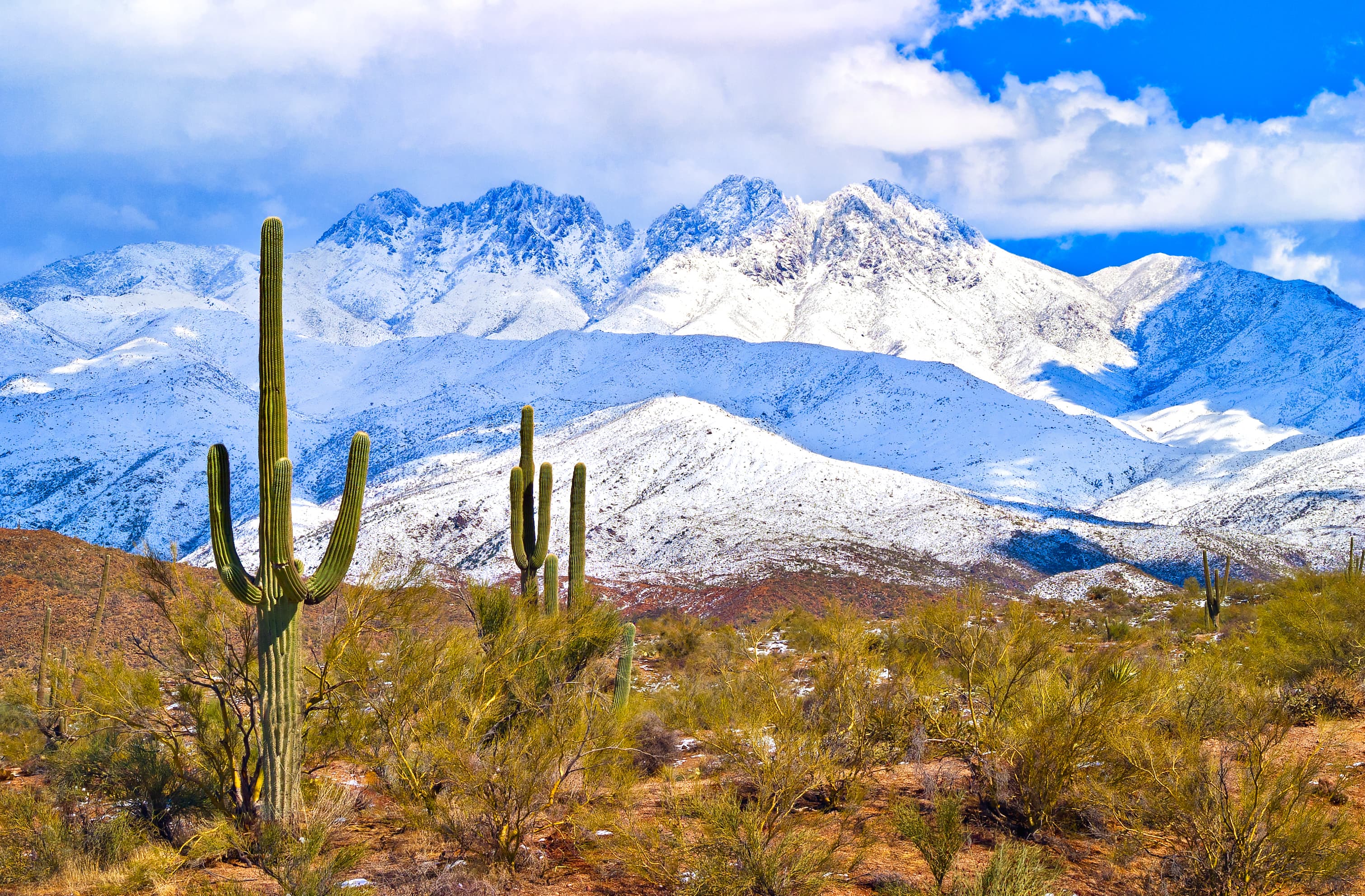
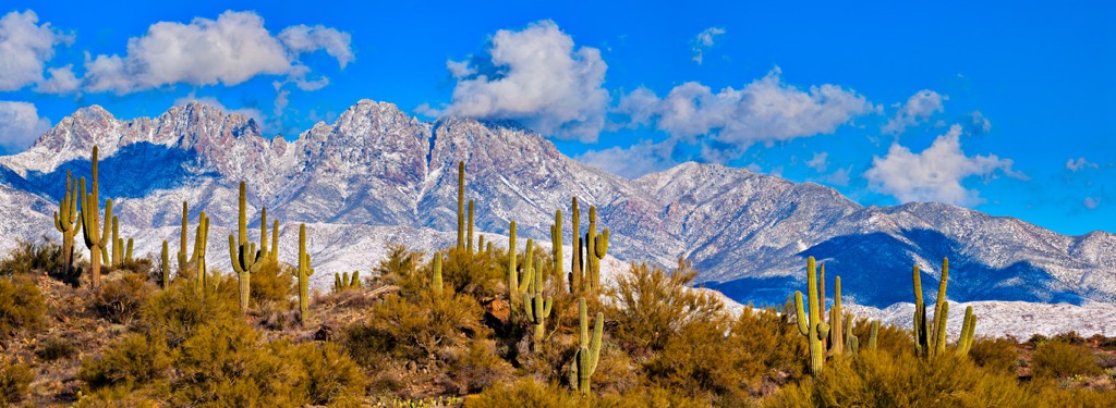
The massif of the Four Peaks Wilderness rises impressively from the surrounding desert landscape dotted with enormous saguaro cacti. Located in northeastern Arizona in the southwestern United States, the wilderness is part of Tonto National Forest and the mountains are part of the Mazatzal Mountains. Of the 18 named peaks in the wilderness, Brown’s Peak is both the tallest (7,657 ft/2,334 m) and most prominent (3,310 ft/1,009 m).
The Four Peaks Wilderness was established in 1984 and currently covers about 60,740 acres (24,581 ha) within Tonto National Forest. Located in northeastern Arizona, the peaks in this range are part of the Mazatzal Mountains and elevations range from around 1,900 ft (580 m) near Apache Lake to 7,657 ft (2,334 m) on Brown’s Peak.
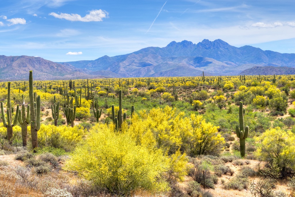
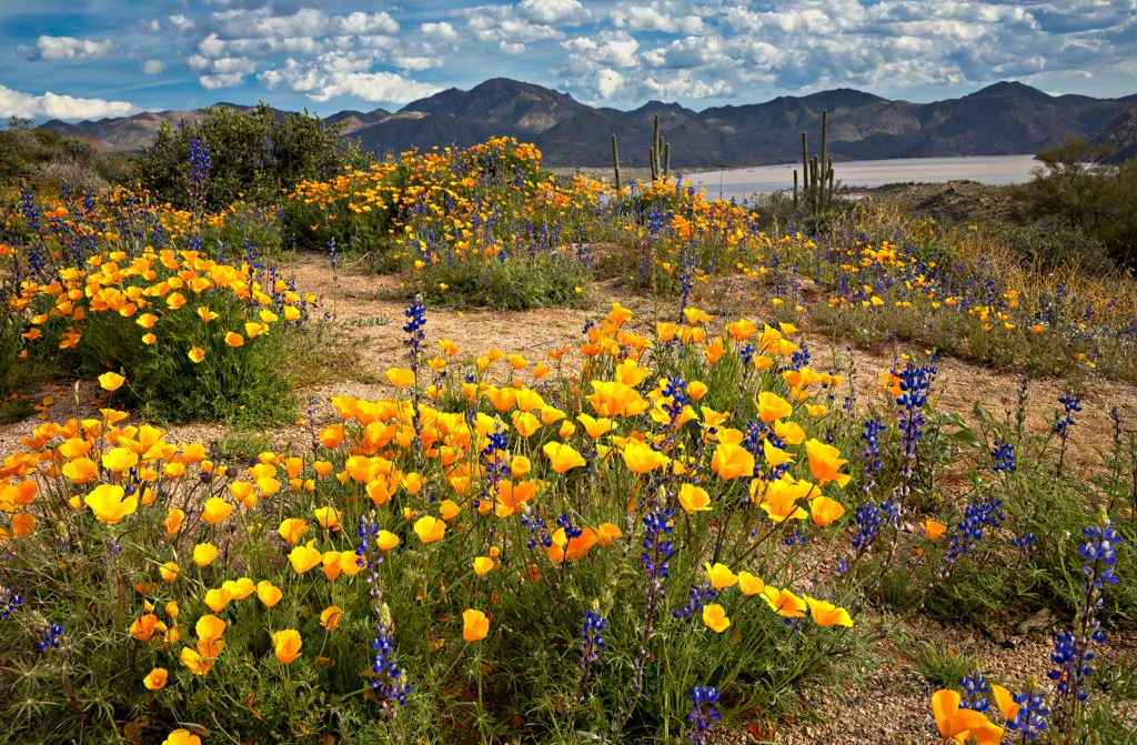
The four peaks are a well-known landmark in the region. From surrounding desert foothills where saguaro, cholla, and ocotillo thrive, the four peaks rise from the center and can be seen from miles away on a clear day. The Four Peaks Wilderness lies to the south of the Mazatzal Wilderness and Coconino National Forest.
While portions of the wilderness retain their tree cover, a man-made fire tore through the wilderness in 1996 and some areas are still in the early stages of recovery. It will take decades for the previously forested mountain sides to regrow.
The geology of the Four Peaks Wilderness tells a story that dates as far back as several billion years. The bulk of the massif that rises from the surrounding desert is composed of Precambrian granite and schists. The sheer faces near the peaks contain mainly Precambrian quartzite and shale. These exposed rocks are especially visible in Cottonwood and Boulder Canyons, as well as on Buckhorn Ridge.
South of main peaks, above Apache Reservoir, are the Painted Cliffs. Layered ash flows and volcanic tufts left behind during the Cenozoic Age comprise the cliffs. From the formation of the underlying metamorphic rock to the volcanic material of the Painted Cliffs is a difference of two to three billion years.
The wilderness houses a diverse set of habitats thanks to the rapid change in elevation from the desert foothills to the mountain peaks. The once pine-covered mountains are still recovering from a fire that tore through the wilderness in 1996. Although parts of the wilderness remain intact, damaged areas will take decades to return to their previous state.
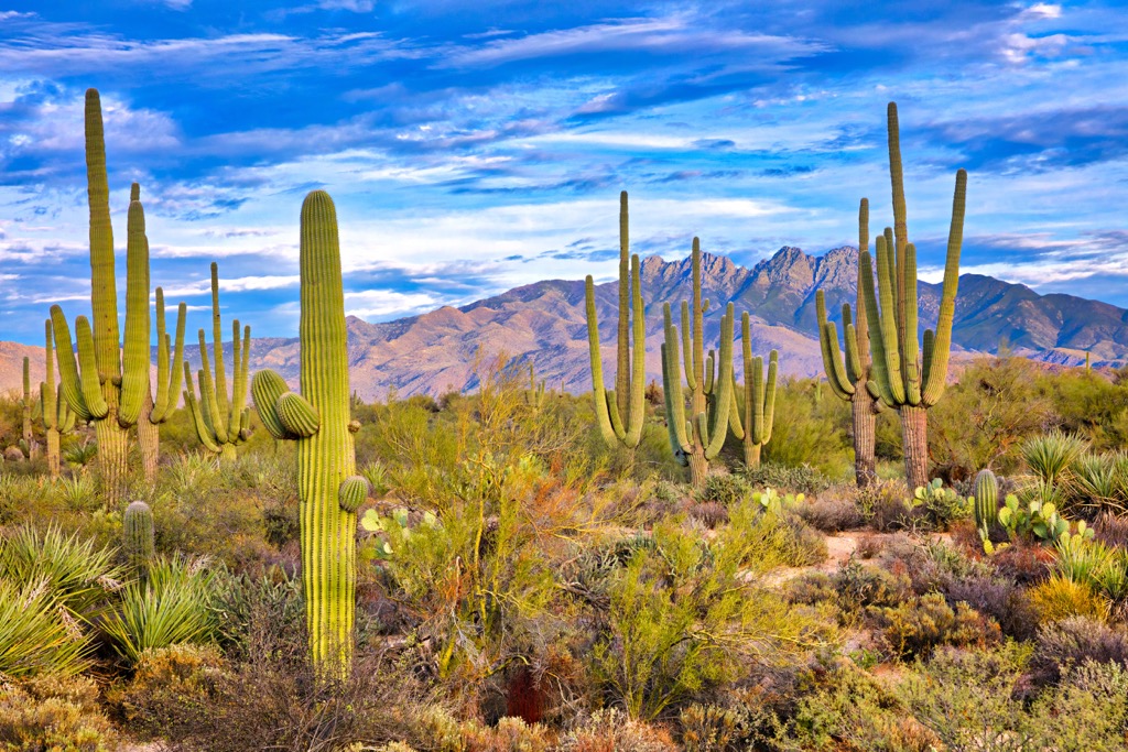
Ponderosa pine and Douglas fir grow in the highlands and a few stands of aspen are present on the north side of Brown’s Peak. Manzanita, gambel oak, and pinyon pine cover the mid-elevation zones. Beneath 4,000 ft (1,220 m), the grasslands run into the upper Sonoran Desert filled with looming saguaro cacti, ocotillo, cholla, and palo verde. Cottonwoods and sycamores thrive in canyons with water present.
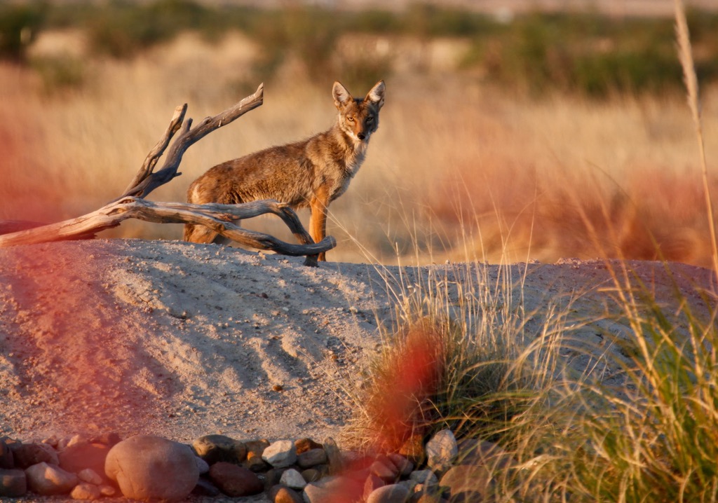
The wilderness is home to one of Arizona’s densest black bear populations. Ring-tailed cats, skunks, coyotes, deer, javelinas, and mountain lions also live within the mountains, canyons, and foothills. A few animals that visitors should keep an eye out for are rattlesnakes, scorpions, black widow spiders, centipedes, and millipedes.
Although dry and with few water sources throughout most of the year, the region experiences lightning storms and flash floods in July and August.
The area that is currently Tonto National Forest was home to several prehistoric Indian groups until the Hohokam took over around 1,000 years ago. The prehistoric groups were hunter-gatherers who made their homes in the Mazatzal Mountains and Sierra Ancha, as well as along the Salt and Verde Rivers and tributaries.
When the Hohokam took over, they quickly established large towns and built irrigation systems along the rivers. They were farmers, craftspeople, warriors, and traders. Over several centuries, they split into distinct subcultures, the best known being the Salado of Tonto Basin.
Around 600 years ago, most tribes moved out of the area due to years of drought, flooding, and conflict between groups. Their descendants today are part of the Pima, Hopi, and Zuni tribes.
Between approximately 1866 and 1886, there was significant conflict between Native Americans and the U.S. Army. It ended with the forced removal of the Apache and Yavapai to reservations at San Carlos, Fort Apache, and beyond.
Today, White Mountain and San Carlos Apache reservations lie to the east of the national forest, Tonto Apache Reservation is located inside the forest, and Fort McDowell Yavapai Reservation lies to the southwest. Local members of the Apache tribe continue today to use the forest to gather traditional plants.
After the removal of Native Americans, settlers quickly moved in. Miners and Mormon farmers came first, followed by sheep and cattle ranchers. Mining and ranching continue to be major industries in the area today.
Tonto National Forest exists because of the construction of the Roosevelt Dam. The dam was installed on the Salt River to control the water supply to Phoenix, Mesa, and Tempe in the Salt River Valley. The forest was established in 1905 to protect the Salt and Verde river watersheds. The Four Peaks Wilderness was officially created within the national forest in 1984.
Four Peaks Wilderness contains a 40 mi (64 km) trail system, although many trails are used infrequently and therefore in rough condition. Exceptions to this are the well maintained Brown’s Peak Trail, Four Peaks Trail, and Pigeon Trail. A full list of trails in the wilderness can be found on the Forest Service website.
Groups cannot exceed 15 people in the wilderness, and each group cannot have more than 15 stock animals. Water sources in the wilderness are seasonal and often impossible to find. Dispersed camping is allowed. Visitors should be aware that warmer weather increases the presence of snakes. For more information, Recreation Opportunity Guides with detailed trail information can be found at the Mesa Ranger Station.
The Brown’s Peak Trail runs 2 mi (3.2 km)1 from the Lone Pine Saddle Trailhead to where it meets with Amethyst Trail 253 near Brown’s Saddle. The elevation on the hike ranges from 5,700 ft (1,737 m) to 6,760 ft (2,060 m). It is rated as moderately difficult.
The Four Peaks Trail is 10 mi (16.1 km) long and can be accessed from Lone Pine Saddle Trailhead and Mills Ridge Trailhead. It skirts along the northern and eastern sides of the four peaks before continuing southwest along Buckhorn Ridge.
Sections of trail along the flanks of the four peaks may be steep and at times difficult to follow. There are also some difficult sections along Buckhorn Ridge. The hike spans elevations from 3,800 ft (1,158 m) to 6,600 ft (2,012 m).
Those looking for an easy hike along a well-maintained trail can take this path that measures 1.8 mi (2.9 km) each way. It has a total of only 380 ft (116 m) elevation gain and is best visited in May and October. High clearance vehicles are recommended to reach the trailhead.
Dispersed camping is allowed within the wilderness and there are established campgrounds within Tonto National Forest. The Four Peaks Wilderness is close to several large cities, as well as numerous smaller towns.
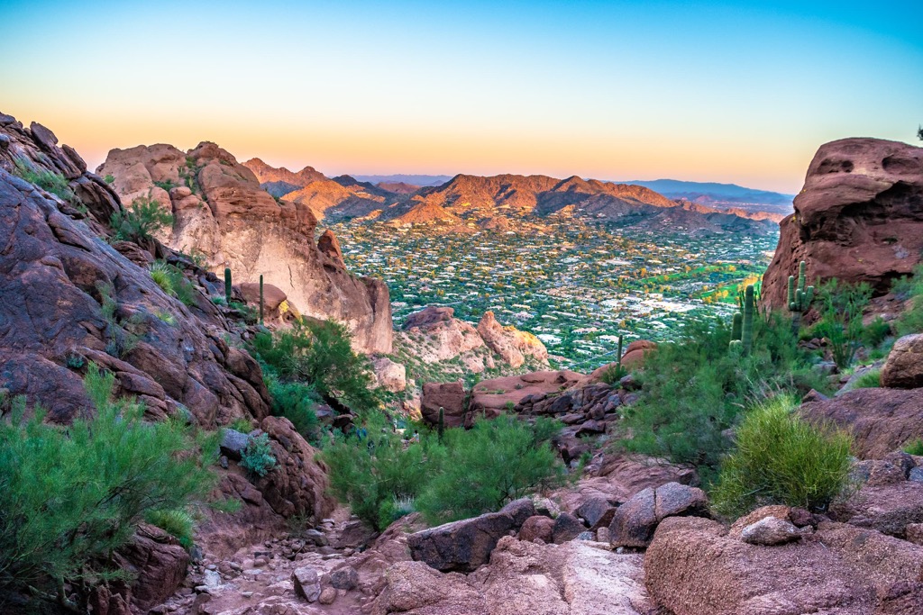
Arizona’s state capital lies 50 minutes to the southwest of the wilderness. The city has easy access to a number of popular outdoor destinations such as Camelback Mountain where the 1,200 ft (365 m) climb can be completed along Echo Canyon or Cholla trail, the Phoenix Mountains Preserve, and Papago Park, a landscape of red rock buttes crisscrossed by trails.
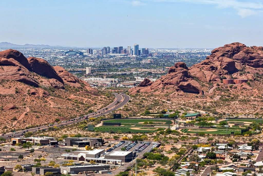
1.66 million people live in Phoenix and there is lots to do within the city. Visit the botanical gardens, the musical instruments museums, the famous architect Frank Lloyd Wright’s winter home Taliesin West, the Phoenix Art Museum, or the Heard Museum which highlights the history and culture of 22 Native American tribes from the region.
Depending on budget and location preferences, accommodation runs from campsites to hotels to guest ranches and resorts. While dining out in the city, sample some of the region’s classic southwestern and Mexican dishes. There are also international cuisines, outdoor and rooftop dining, and restaurants focused on locally sourced ingredients.
A little over two hours drive to the south of the wilderness lies Tucson, a city of 545,000 people in the middle of the Sonoran Desert. Popular activities to do around Tucson include visiting Saguaro National Park, enjoying the waterfalls at Sabino Canyon Recreation Area, or stopping by ancient Native American sites at Signal Hill and Murray Springs.
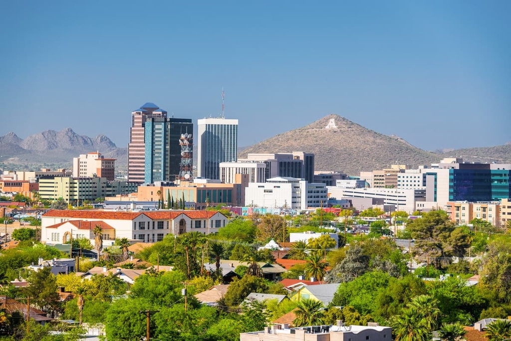
Tucson holds the distinction of being a UNESCO City of Gastronomy. Through food, the city celebrates its rich and diverse heritage from Mexican and Native American traditions. Many local ingredients are incorporated in restaurants and farmers markets let people access the array of local flavors on their own.
Whether looking for a convenient spot to stay or beautiful lodging immersed in the desert, Tucson has a range of options. One can rough it at a campsite, stay at an affordable hotel in the city, or enjoy nature and relax at a spa, guest ranch, or resort.
A 2.5 hour drive to the north, Flagstaff has a population of 73,000. It receives abundant snowfall in the winter, making it an all season’s destination. The city is also surrounded by the world’ largest contiguous ponderosa pine forest. In addition to hiking, biking, and backpacking trails, the Lava River Cave invites visitors to explore underground.
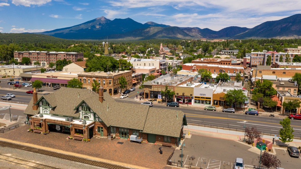
Situated on the Colorado Plateau, the region has a long and rich Native American history. The city is near Walnut Canyon National Monument and Wupatki National Monument. Those who are interested in learning more about the region’s history can stop by the Museum of Northern Arizona.
The city has a selection of accommodation available from budget and rustic to cozy or fancy. The dining scene will not disappoint if you’re looking for classic American meals, and also has more refined and diverse dining options for those looking for something other than grills, pubs, and delis.
Explore Four Peaks Wilderness with the PeakVisor 3D Map and identify its summits.