
Share

Scan the QR code and open PeakVisor on your phone
Scan the QR code and open PeakVisor on your phone
The Columbine-Hondo Wilderness is home to a stunning mountainous landscape located in the northern region of the US state of New Mexico. The wilderness consists of 7 named peaks, the tallest and most prominent of which is Gold Hill at 12,703 ft (3,872 m) in elevation and with 1,798 ft (548 m) of prominence.
The Columbine-Hondo Wilderness lies within Carson National Forest in northern New Mexico and encompasses 44,698 acres (18,089 ha) of land. The peaks in the wilderness are part of the Sangre de Cristo Mountains, which is the southernmost range of the greater Rocky Mountains.
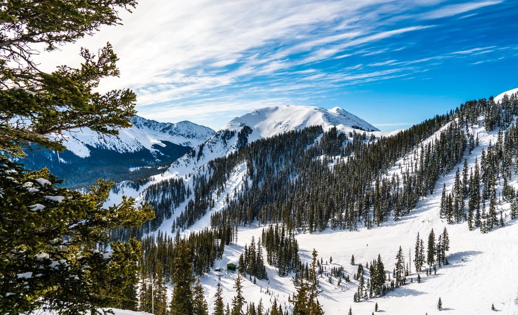
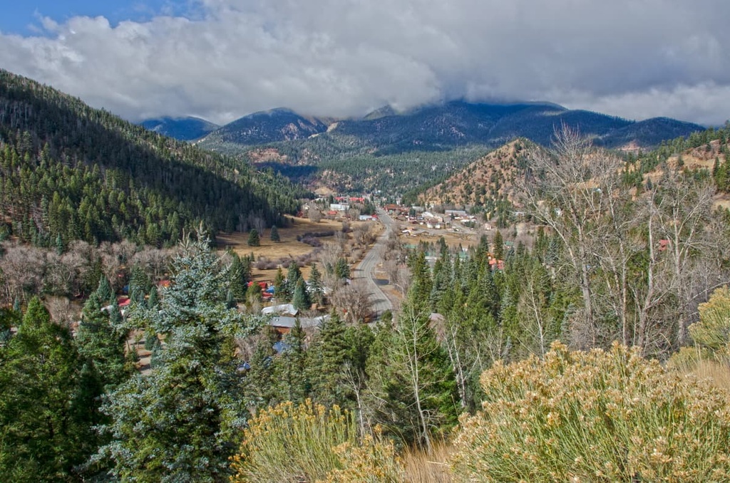
The wilderness marks one of the most rugged and mountainous landscapes within the state. Here, steep forested hillsides are met with alpine pastures, lakes, and streams. However, only three peaks in the wilderness rise above the treeline.
Elevations in the wilderness area range from 7,861 ft (2,396 m) up to the summit of Gold Hill. The Rio Hondo and Red River are major tributaries of the upper Rio Grande and both have headwaters within the Columbine-Hondo Wilderness.
An alpine tundra landscape dominates the small portions of wilderness found above the treeline. The wilderness is one of just five federally designated wilderness areas within Carson National Forest.
The northern boundary of the wilderness lies near an extinct super volcano known as Questra Caldera. The volcano is estimated to have erupted around 25 million years ago.
Other nearby areas of protected land around the Columbine-Hondo Wilderness include the Wheeler Peak Wilderness to the south, Latir Peak Wilderness to the north, and both Colin Neblett State Wildlife Area and Philmont Scout Ranch to the east.
The mountains within the Columbine-Hondo Wilderness are part of the Sangre de Cristo Mountains. These mountains are the southernmost subrange of the Southern Rocky Mountains.
Similar to the rest of the Rockies, the Sangre de Cristo Mountains formed during the Laramide orogeny. Widespread uplift occurred during this time, compacting the existing landscape. This subrange was uplifted around 20 million years ago, making it one of the youngest mountain ranges in the region.
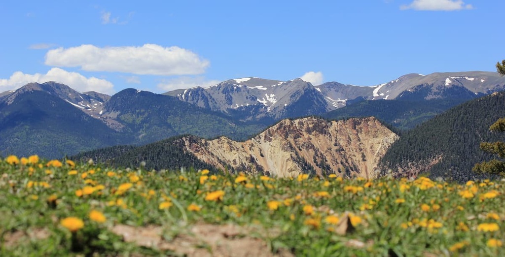
Continual folding and uplift gave rise to the rugged peaks seen throughout the wilderness and surrounding national forest to this day. The gneiss rocks in the range date back to the Precambrian, making them some of the oldest rocks found within the wilderness. Other common rocks found within the range include sandstones, dolomites, and limestones.
During the last major glaciation, the Sangre de Cristo Mountains were heavily glaciated. As the glaciers began retreating, the landscape was further carved out, leaving behind the sweeping valleys and alpine tundras that now dominate the region.
Major peaks within the Columbine-Hondo Wilderness include Gold Hill, Lobo Peak, Relica Peak, and Flag Mountain.
Despite its relatively small size, the Columbine-Hondo Wilderness is home to a wide range of flora and fauna that are commonly found in the Southern Rocky Mountains.
Much of the landscape is marked by alpine meadows and lush forests. Vegetation at lower elevations consists primarily of ponderosa pine and pinyon pine forests. The mid elevations in the wilderness are home to mixed conifers and aspens.
The top of the treeline in the Columbine-Hondo Wilderness is marked by spruce and fir forests while the alpine tundra has low growing grasses and wildflowers, including its namesake columbine.
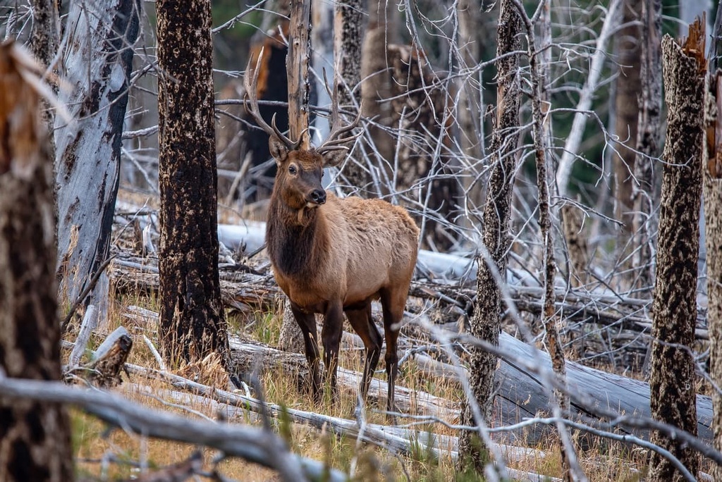
The wilderness is home to many common Rocky Mountain wildlife species. Populations of elk, mule deer, mountain lion, and black bear can be found throughout the forested landscape of the wilderness. Above the treeline, there are groups of bighorn sheep, pica, and marmots inhabiting the rugged rock fields.
The land that is now the Columbine-Hondo Wilderness has been inhabited by humans for thousands of years. The first traces of human settlement date to 11,000 years.
The region marks the traditional territory for multiple Indigenous groups including the Puebloans (particularly the Taos Pueblo), the Jicarilla Apache Nation, and the Ute (Núu-agha-tʉvʉ-pʉ̱). The Pueblo of the Four Corners region migrated to the region over 1,000 years ago.
The Taos Pueblo community marks the oldest continuously inhabited dwelling in all of North America. Parts of the surrounding wilderness were also used as hunting grounds for the nomadic Kiowa, Ute, and Apache peoples.
Spanish settlers arrived in the region during the sixteenth century and they primarily used the land for sheep grazing and agricultural purposes. The land used by Spanish settlers was forcibly taken from the Indigneous groups despite their continual resistance.
After the Mexican War of Independence in 1821, the region was placed under rule of Mexico. In 1848, the land was ceded to the United States as part of the treaty of Guadalupe Hidalgo.
Many of the trails throughout the region mark the historic routes first traveled by Indigneous people. These trails were later used and expanded by the influx of settlers who moved to the region during the New Mexico Gold Rush in the late 1800s.
The surrounding area was established as Carson National Forest in 1908 while the Columbine–Hondo Wilderness was designated as a wilderness study area in 1980. The area eventually became a designated wilderness in 2014.
The Columbine-Hondo Wilderness is home to numerous hiking trails. Here are some of the most popular hiking areas in the region:
The Columbine Trail is the most popular trail in the wilderness. This out-and-back route is 8.5 miles (13.7 km) long with 1,935 ft (590 m) of elevation gain. The trail winds through the region’s dense forest, around creeks, and across subalpine meadows before reaching a lookout that offers views of part of the wilderness.
The Gavilan Trail #60 is a steep and beautiful trail located near the Taos Ski Valley area. The route is 6.6 miles (10.6 km) long and it has 2,342 ft (714 m) of elevation gain. During the summer months, the trail offers sweeping views of the valleys, forests, wildflowers and meadows. The route can also be used for cross-country skiing during the winter.
There are numerous routes leading to the top of Lobo Peak, the second tallest peak in the wilderness. As it is one of the only peaks above the treeline, hikers can enjoy panoramic views of the wilderness from the summit.
The route to Lobo Peak via the Italianos Canyon Trail is 9.1 miles (14.6 km) long and it has 3,914 ft (1,193 m) of elevation gain. The steep trail starts on the southern side of the mountain. The Lobo Peak via Yerba Canyon Trail is a longer and slightly less steep route to the summit. This trail is 11.6 miles long (18.7 km) and it has 3,772 ft (1,150 m) of elevation gain.
The two trails are quite similar, though the Italianos Canyon Trail follows along the ridgeline before reaching the true summit.
Looking for a place to stay near the Columbine-Hondo Wilderness? Here are some of the best cities and villages to check out in the region:
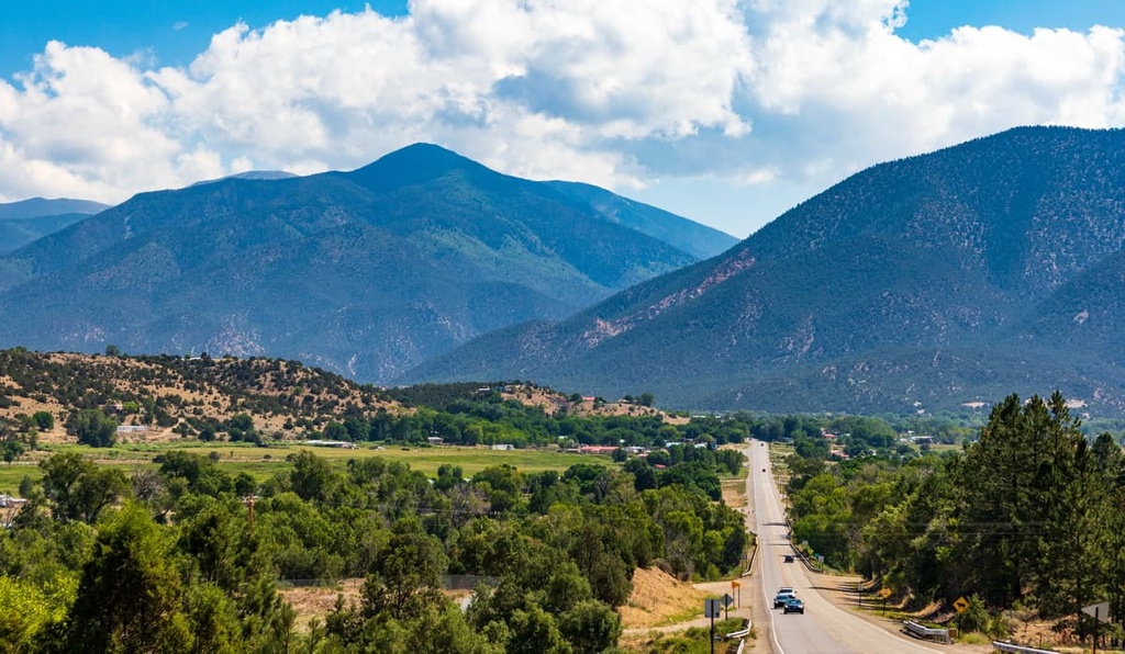
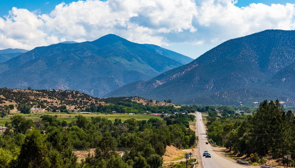
Taos is a small town that lies south of the wilderness, in the western foothills of the Sangre de Cristo Mountains. The city is home to around 6,000 people and is situated near the Taos Ski Valley.
Taos is a short drive from the Taos Pueblo World Heritage Site, which is one of the oldest continuously inhabited communities in the present-day United States
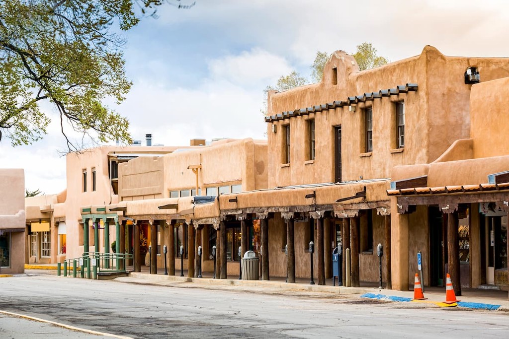
Known for being a rich cultural heritage site, Taos is home to an iconic church that’s known as St. Francisco de Asis. The city offers excellent outdoor recreation opportunities throughout the year, allowing visitors to explore some of the most stunning and rugged landscapes in the state.
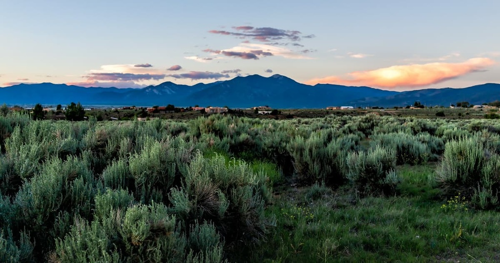
Questa is a small village located just north of the Columbine-Hondo Wilderness. This quaint village is nestled between Carson National Forest and the Rio Grande del Norte National Monument, making it a hub for the outdoors.
Questa has a population of around 1,700 people. It is also home to trails that lead into the Rio Grande Gorge. The confluence of the Rio Grande and Red River lies near the village and features a scenic lookout for visitors to enjoy.
Additionally, just outside the city lies Eagle Rock Lake, which can be used for swimming and fishing. The historic San Antonio del Rio Colorado Church is situated in the village center, offering a scenic look into the region's long history. Visitors can also check out Ocho, an event space and art gallery in the village that often features work by local artists.
Explore Columbine-Hondo Wilderness with the PeakVisor 3D Map and identify its summits.


