
Share

Scan the QR code and open PeakVisor on your phone
Scan the QR code and open PeakVisor on your phone
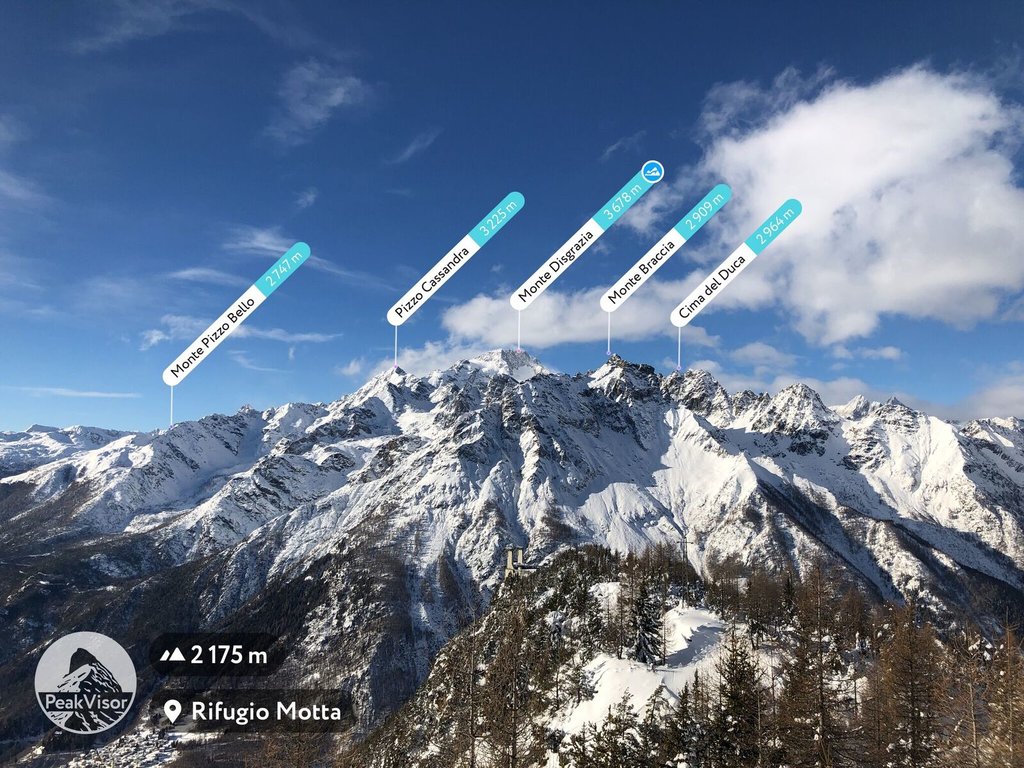
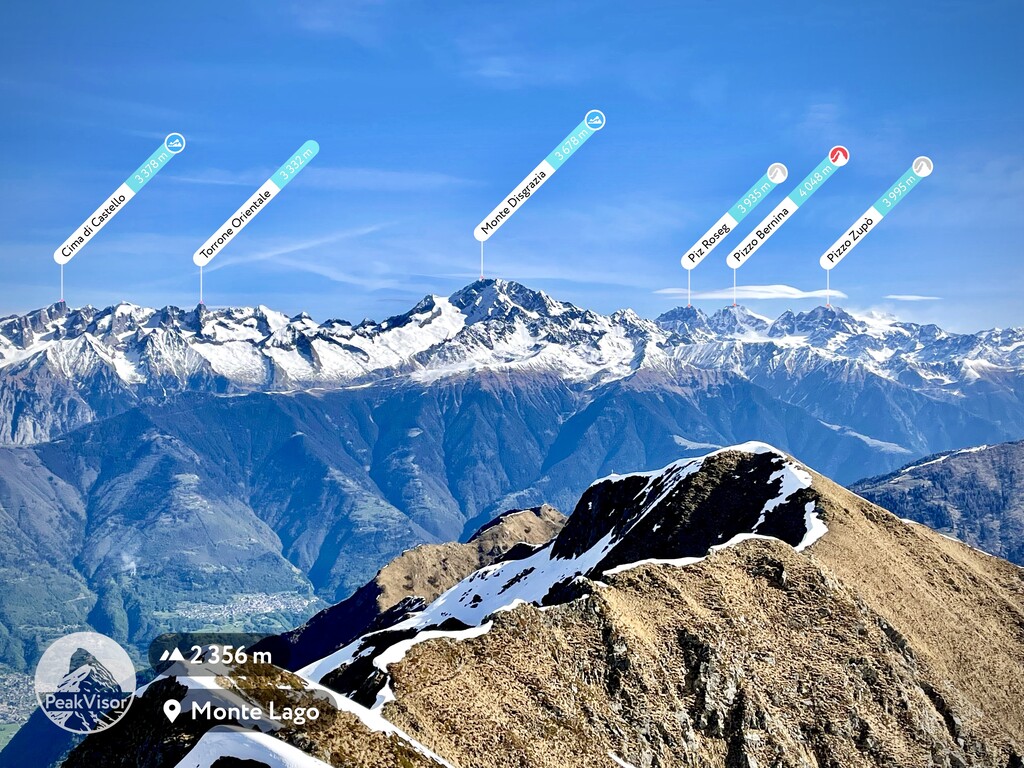
The Val Bregaglia Range is a mountain range south of the valley of the same name in the Alps between Italy and Switzerland. The main feature of the range is Piz Badile (3,308 m / 10,853 ft), one of the six great north faces of the Alps. Therefore, the range is considered one of the meccas of mountaineering in Europe, but also the leading destination for hiking because of several long marked trails, as well as short ones leading to individual points of interest. It is also famous for its highest and the most prominent point, Monte Disgrazia (3,678 m / 12,066 ft), several large glaciers and for being the neighbor of Piz Bernina (4,048 m / 13,280 ft), the highest in the Eastern Alps. In total there are 249 named mountains in Val Bregaglia.
The name of the mountain range comes from the wide and long valley to the north of it, although there are other valleys around the range as well as within it.
According to one of the two popular versions, the word Bregaglia comes from the name of the tribe Bergalei, which inhabited this part of the Alps before the arrival of the Romans and their subsequent assimilation and Latinization. According to a second version, it comes from the word Pregallia, which means "pre-Gaul". Gaul is what the Romans called almost all of Western Europe north of the Mediterranean Sea.
The name of the valley and the range in the Lombard dialect of Italian is Val Bregaja, in Italian: Monti della Val Bregaglia, and in German: Val Bargain or Bergell, or Bergeller Berge, or Bergell Alps.
The Bregaglia Range is a relatively small mountain range that lies between northern Italy and southern Switzerland.
Its natural boundaries consist of many valleys of varying sizes:
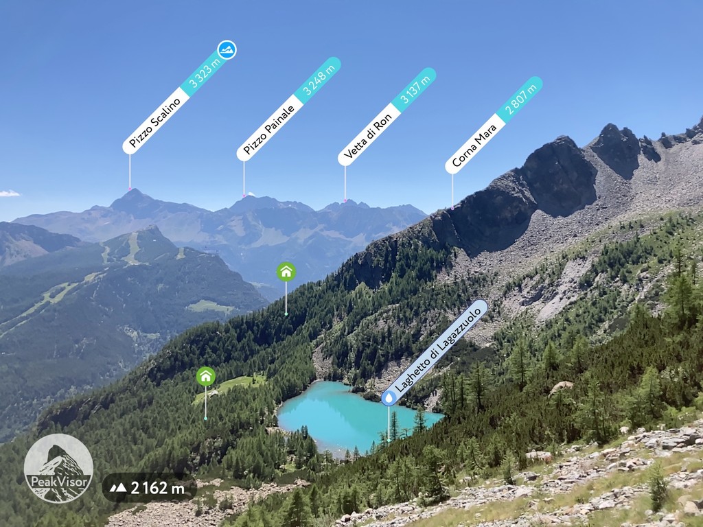
The largest of the lakes within the mountain range is Albigna Lake (Albignasee, Italian: Lago da l’Albigna) on the Swiss side.
On the administrative map, the Val Bregaglia Range is located in the municipality of Maloja in the canton of the Grisons (Graubünden) in Switzerland and the province of Sondrio in the region of Lombardy in Italy.
The easiest and fastest way to get to Val Bregaglia in Italy is to take the train from Milan, which runs along the entire right bank of Como Lake, and through all of Valchiavenna to the village of Chiavenna of the same name. The distance is 125 km (77 mi), travel time is 2 hours by car. Alternatively, you can take the train to Sondrio and bus to Chiareggio in Valmalenco.
From Switzerland, you can get here from the above-mentioned Saint Moritz, as well as from Splügen through Splügen Pass at the northern end of Valchiavenna.

The Val Bregaglia Range is composed mainly of granite, which does not differ much from the other mountain ranges in the Alps. It is much more interesting to look at it from the point of view of glaciology, the science of natural ice in all its varieties, rather than that of standard geology.
Because the range is located in an area with the highest mountains in the Eastern Alps, including their highest peak Piz Bernina (4,048 m / 13,280 ft) next door, about a hundred of its 249 named mountains are above 3,000 m (9,842 ft) and covered by glaciers.
The largest glacier is located on the highest mountain in the range, Monte Disgrazia (3,678 m / 12,066 ft). Moreover, it includes not one but at least four glaciers: the eponymous Disgrazia Glacier (Vedretta del Disgrazia), Cassandra Glacier (Ghiacciaio di Cassandra), Preda Rossa Glacier (Ghiacciaio di Preda Rossa), and Ventina Glacier (Ghiacciaio di Ventina).
In addition, the Val Bregaglia Range has two large glaciers to the west of Disgrazia: Albigna Glacier near the lake of the same name, and Forno Glacier.
In total, there are 42 glaciers in the Val Bregaglia Range, including smaller ones with a total area of 20.1 sq km (7.7 sq mi). Together with the neighboring Bernina Range with 50 glaciers with an area of 60 sq km (23.1 sq mi), they form a glacial zone of 92 glaciers with a total area of 80 sq km (30.8 sq mi).
The Val Bregaglia Range is part of the larger Bernina Range, one of the 68 main Alpine mountain ranges in the German-Austrian Alpine Club (AVE) classification. To be precise, it is number 66.
The range borders the Oberhalbstein Alps, the Albula Alps, and the Livigno Alps to the north, the Sobretta-Gavia Group to the east, and the Bergamasque Alps to the south. There are Western Alps at the western borders of the range.
According to the second most common classification of the Alps, the Italian SOIUSA, which covers the whole mountain system, the Val Bregaglia Range is also part of the Alpi del Bernina, which in turn is part of the Western Rhaetian Alps in the Central Eastern Alps in the Eastern Alps.
As you can see, the classifications are different, but more or less the same. From here, in SOIUSA the Bregaglia is bordered by approximately the same other range.
According to the same classification, the range is divided into two large subgroups: Castello and Disgrazia, containing 12 smaller subranges in total.
Among the major individual summits, besides the highest Monte Disgrazia (3,678 m / 12,066 ft), including its second peak, Monte Disgrazia Orientale (3,640 m / 11,942 ft), which also stands out for its size, and the most famous Piz Badile (3,308 m / 10,853 ft), whose north face attracts mountaineers, I would also mention the following ones, which form the backbone of the range: Cima di Castello (3,376 m / 11,076 ft), Pizzo Cengalo (3,369 m / 11,053 ft), Ago di Sciora (3,205 m / 10,515 ft), Pizzo Ligoncio (3,033 m / 9,951 ft), Piz Bacun (3,244 m / 10,643 ft), Monte del Forno (3,214 m / 10,544 ft), Cima di Rosso (3,365 m / 11,040 ft).
So there are at least 10 major summits in the Val Bregaglia Range in total, which you can use as reference points for hikes.
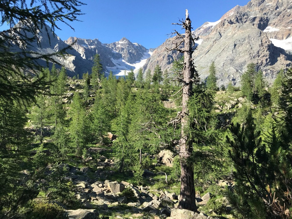
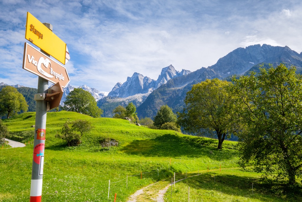
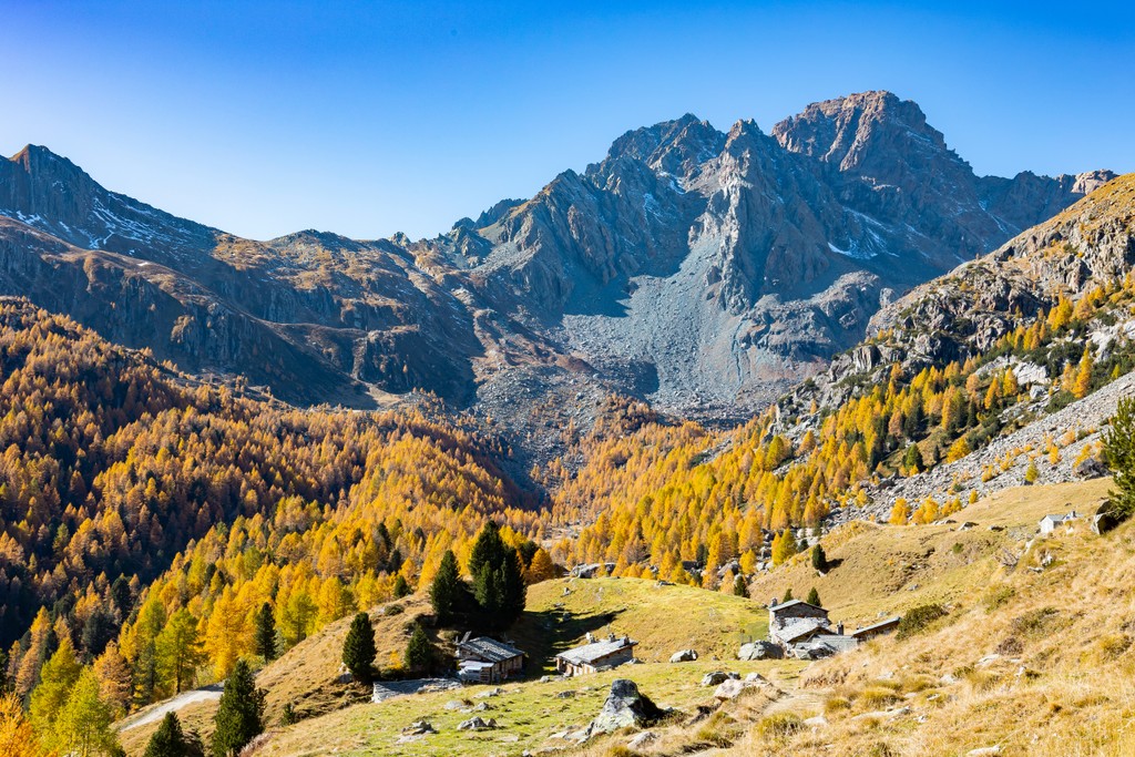
The main hiking areas of the Val Bregaglia Range are each of its aforementioned valleys without exception, making it an incredibly attractive destination for hikers. Below I’ll talk about the route to Ventina Glacier, which I hiked myself, and give a brief overview of the other main trails.
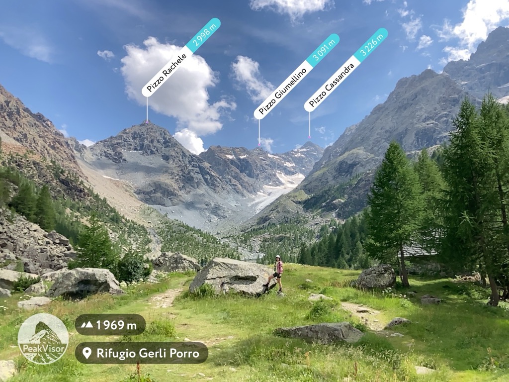
Of all the Bregaglia glaciers, Ventina Glacier is best-known thanks to the Sentiero Glaciologico Vittorio Sella. The trail, named after one of the finest Italian photographers and mountaineers, which I hiked in July 2022, leads to the glacier from the Ventina Valley from the village of Chiareggio. The distance from the village to the beginning of the glacier is 5.2 km (3.2 mi) with an elevation gain of 700 m (2,296 ft).

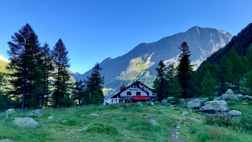
From the information boards on the trail and the signs and markings on the rocks, you can understand that this glacier is the most affected by global warming in the region, which we were able to document through photography. The first of these was taken in 1815. At that time, the glacier reached the border of the high part of the valley where today there are two mountain huts: rifugio Gerli-Porro and rifugio Ventina, in which you can spend the night on the way to the glacier. I stayed in the former and highly recommend it. The rifugio has friendly staff, comfortable rooms, a delicious local dinner, and unlimited hot water, a luxury for high-altitude mountain huts.
Subsequent photo surveys from 1884 to the present show the retreat of the glacier with distances ranging from a few tens of meters (feet) to a hundred or more meters (feet) in various years. The most dramatic one of 302 m (990 ft) in two years occurred between 1964 and 1966. All in all, the glacier has receded several kilometers (miles) over the past 130 years, with its rate of retreat increasing in recent decades.
Warning: according to various predictions, most alpine glaciers, or all of them at 3,500 m (11,482 ft) and below will disappear by 2030–50 and above this height by 2010. The melting of the glaciers markedly increases the danger of hiking on them and around them and threatens the entire outdoor industry both in the summer and winter, including ski resorts as well.
Sadly, just days after my hike to Ventina Glacier, a large chunk of Marmolada glacier (3,342 m / 10,636 ft), the Dolomites’ highest mountain, collapsed, resulting in the death of 12 people who were crossing it by one of the climbing trails and in its area at the time. The collapse was preceded by a long drought in Europe and the ensuing heat wave from Africa with temperatures as high as +10 degrees Celsius (+50 degrees Fahrenheit) at night on the Marmolada, which is a lot.
I can confirm the warnings of scientists: during my hike at Ventina Glacier, a wide turbulent river full of water ran beneath its base, as if it were a normal mountain river. The river rushes down the Val Ventina until it merges with the Mallero River, originating in Monte del Forno and flowing through the entire Valmalenco Valley via Sondrio to the larger Adda River. The presence of the river speaks of the strong melting of the ice and the danger it causes.
It is worth noting that the official trail ends well before the glacier begins, but, as I understood it, the so-called “people’s trail” leads to its very base. The glacier can also be climbed using climbing equipment. Despite the formal absence of restrictions for hiking to this glacier, Marmolada, and others, which are also unlikely to be adopted soon everywhere in the Alps, I do not recommend hiking to glaciers in the Alps and other parts of the world. And if you do go to them, pay special attention to the weather before your hike.
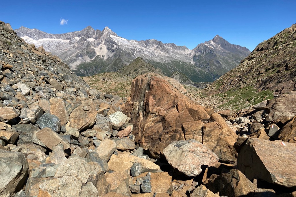
However, the route itself is just great and has many more features. In addition to the glacier, there are numerous rock outcroppings in the valley with various layers of granite in various hues, from gray to orange, that are beautifully colored at sunset. So the best time for a hike in the summer is somewhere between three or four and six-seven in the evening.
On the eastern side of the valley you will also find an old-growth forest consisting of several dozen larches, whose age varies from a few hundred years old to more than 1,000 years old. That is why they are considered the oldest trees in the entire Lombardy region. They are still living trees, but there are also dead ones, without leaves or bark. There is a special loop trail leading to them from rifugios called “Sentiero del Larice Millenario”.
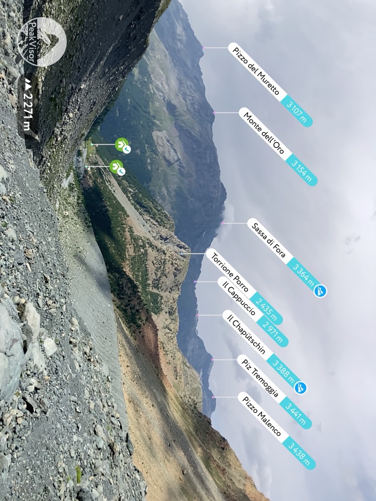
At the beginning of the trail to the larches you will also find another interesting trail leading to Mount Torrione Porro (2435 m / 7,988 ft), the top of which can be climbed via Ferrata del Torrione Porro (metal stairs and ropes in the rocks) with equipment. From the top there are even more panoramic views of the surrounding area, as well as the artificial Pirola Lake.
You can also reach the lake on foot if you continue walking upwards in the direction of the pass of Bocchel del Cane, crossing which you will reach an even more picturesque lake, Laghetto Lagazzuolo, from where you can descend back to Chiesa In Valmalenco.
The second part of the hike from the two huts in the Ventina Valley is about 12 km (7.4 mi) with an additional 500 m (1,640 ft) of elevation gain and more than 1,000 m (3,280 ft) drop. But keep in mind that it is more challenging. You’ll have to hike up huge granite boulders, many of which are larger than you, and then descend sharply down the same rocks. But it is worth it. If you have some equipment for real climbing with you, you can go to Punta Rosalba (2,808 m / 9,212 ft) in the middle of the way to see the area from the even higher point.
Among other interesting trails in the Val Bregaglia Range lasting up to 2–3 days, I would include:
There are at least four long hiking trails of 3 to 10 days within the range that will suit the multi-day hiker. Here're they are from easy to more challenging:
In total there are four incredible routes, enough for more than one trip to the region.
Unlike many areas in the Alps, the Val Bregaglia Range is not included in any of the major natural parks. However, the Riserva Naturale Pian di Spagna e Lago di Mezzola, dedicated to the lake of the same name, is located on its southwestern border.
The closest major parks to the range are Parco delle Orobie Valtellinesi as part of the Parco Regionale delle Orobie Bergamasche in Italy, and Parc Ela in Switzerland.
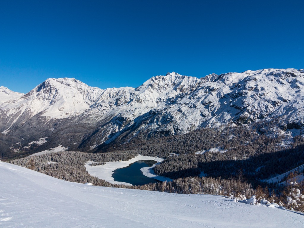
In winter, the Val Bregaglia Range is one of the best skiing and snowboarding areas in the whole Eastern Alps. There are ski resorts within the range: Valmalenco-Alpe Palù Ski Resort with 23.3 km (14.4 ) of slopes and 9 ski lifts in Sondrio, Lombardy, Italy, and Aela-Maloja Ski Resort with 3 km (1.8 mi) of slopes and 2 ski lifts in Canton of the Grisons (Graubünden), Switzerland.
Find these and other resorts in the Alps with information on open and closed ski lifts and cable cars year-round at the World Mountain Lifts section of the PeakVisor site.
Before or after the hike, go to one of the official tourist offices in one of the towns within the mountain range for more information. For example, in Chiavenna:
Consortium for Tourism Promotion of Valchiavenna
Stazione Ferroviaria Chiavenna, Piazza Caduti per la Libertà, 23022, Chiavenna, SO, Italy
Open daily from 9 am to 12:40 pm and from 2 pm to 6 pm
+39034337485
consorzioturistico@valchiavenna.com
The official tourist sites of other main valleys in the range are also useful: Bregaglia.ch, Valtellina.it, Sondrioevalmalenco.it, and Valmasino.info.
As in other parts of the Alps, the main accommodation option in the Val Bregaglia Range is the mountain huts known here as rifugios (an Italian version of "refuge"). On the Swiss side of the range, given its main language, German, you can also see the word "hütte" meaning the same.
In addition to the two aforementioned, rifugio Gerli-Porro and rifugio Ventina, the main huts of the range also include at least 10 others in the list below:
As you can see, they often bear the name of the nearest mountain. Keep this in mind when looking for a place to stay overnight.
Another helpful tip: choose weekdays over weekends and holidays if you can, as these mountains are extremely popular during the summer and winter seasons. Also: The closer the hut is to the base of the valley and the easier it is to reach, the more people will be there, although many come to them also just for dinner without an overnight stay.
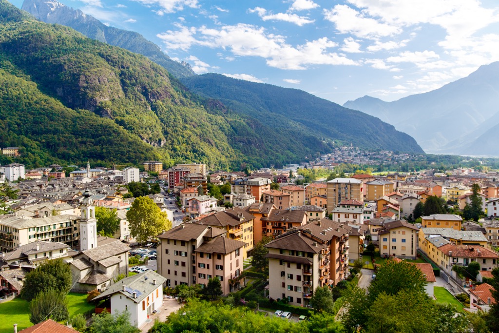
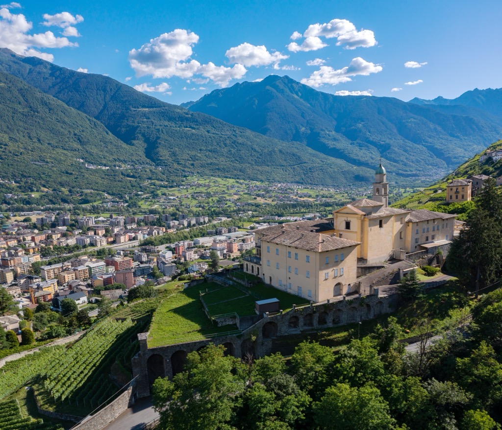
In the course of the guide, I have already named all the major towns and resorts of the Val Bregaglia Range. Here is the sum of them, with the main architectural and cultural attractions:

Explore Val Bregaglia with the PeakVisor 3D Map and identify its summits.


