
Share

Scan the QR code and open PeakVisor on your phone
Scan the QR code and open PeakVisor on your phone
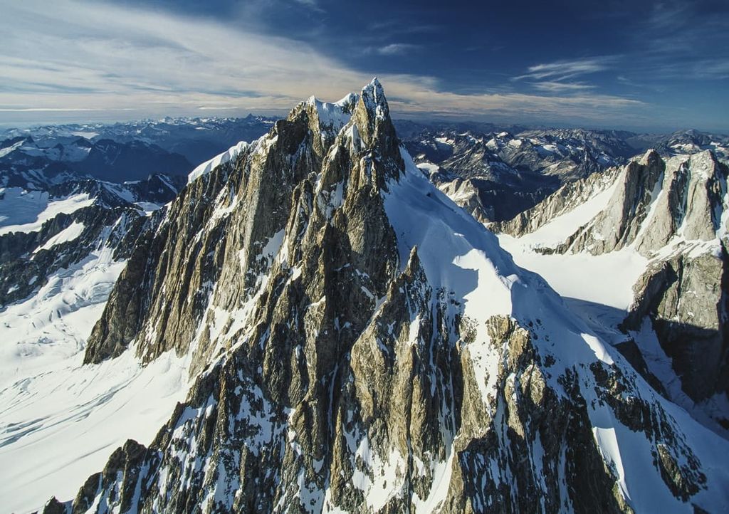
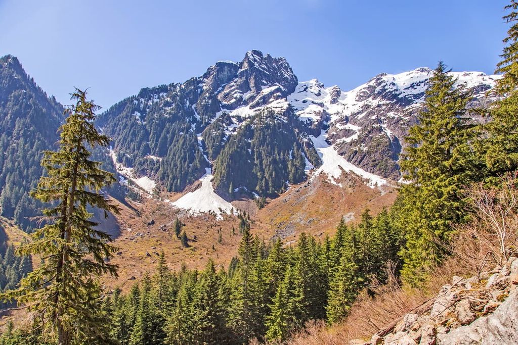
The Pacific Ranges are part of the Coast Mountains, a major chain of mountain ranges located on the west coast of British Columbia, Canada. The range extends from the Bella Coola River in the north to the Fraser River in the south. There are nearly 1,500 named peaks across over 1473 named subranges in the Pacific Ranges. The tallest and most prominent peak is Mount Waddington with 4,014 m (13,169 ft) of elevation and 3,290 m (10,794 ft) of prominence.
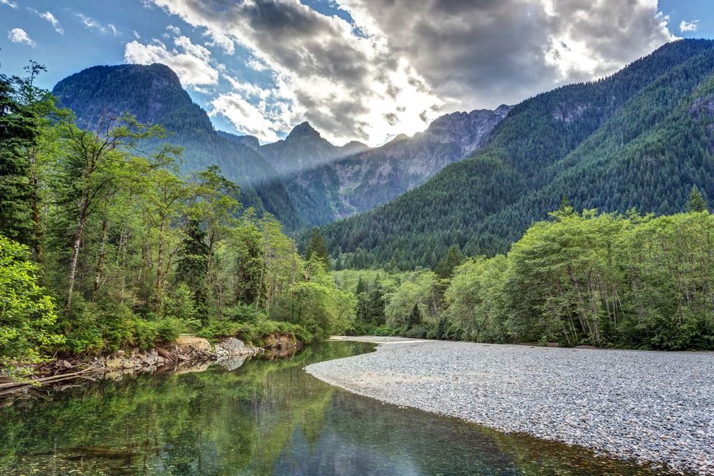
Covering the southwest corner of British Columbia, Canada, the Pacific Ranges are the southernmost ranges of the Canadian Coast Mountains. To the north are the Kitimat Ranges and Boundary Ranges of the Coast Mountains. Meanwhile, the Fraser and Thompson plateaus are located to the east.
The islands to the west of the Pacific Ranges are part of the Insular Mountains, of which the Vancouver Island Ranges are the primary range that covers Vancouver Island. The Insular Mountains also include Haida Gwaii and the Alaskan panhandle in the US state of Alaska.
There are over 30 named ranges within the Pacific Ranges and 1,468 named mountains. The Chilcotin Ranges are a major subrange that includes the Shulaps, Potato, and Camelsfoot Ranges. Marlborough Heights, Cosmos Heights, the Joffre Group, and the Place Glacier Group are other notable subranges in the Pacific Ranges.
The remaining subranges of the Pacific Ranges include Lillooet, Fannin, Britannia, Tantalus, Earle, McBride, Fitzsimmons, Spearhead, Bastion, Cantilever, Cayoosh, Cadwallader, Bendor, Dickson, Leckie, Naval Anniversary, Niut, Pantheon, Edwards, Waddington, Whitemantle, Bazalgette, Pembroke, Gatineau, Downie, Unwin, Park, Clendinning, and the Elaho Range.
The Trans-Canada Highway is the major route that runs along the south and east of the Pacific Ranges. Highway 20 is the major highway along the north end of the range. The Vancouver Metropolitan area is just to the south while the world-famous resort town of Whistler is within the Pacific Ranges.
There are dozens of provincial parks and regional parks in the Pacific Ranges, all with incredible scenery, wildlife, and recreational opportunities. The following are some of the major parks in the Pacific Ranges:

The Canadian Coast Mountains are mainly made of intrusive igneous rock along with smaller areas of foliated metamorphic rocks, faulted and folded lava, and faulted and folded sedimentary layers. The rocks of the Coast Mountains started forming from magma intrusions and layers of marine sediment during the Paleozoic and Mesozoic.
The Coast Mountains and the subranges of the Pacific Ranges formed during the Sevier orogeny, which occurred 160 to 50 million years ago. Island belts that were too large to subduct under North America were accreted (i.e., attached) to the west coast of Canada. The Foreland Belt is the terrane that formed the Continental Divide, followed by the Omineca and Intermontane belts to the west.
The Columbia Mountains were the first mountains of the Western Cordillera to form. They were followed by the Coast Mountains, starting about 100 million years ago when the Insular terrane was colliding with the west coast. As the Insular and Farallon Plates subducted off the west coast, it created a volcanic belt within the Pacific Ranges.
Tectonic collisions continued and the Rocky Mountains started forming around 75 million years ago during the Laramide orogeny. After the formation of the Western Cordillera, glaciers started forming about 2 million years ago, and there were several periods during the Pleistocene in which the west coast was covered in thousands of meters of ice.
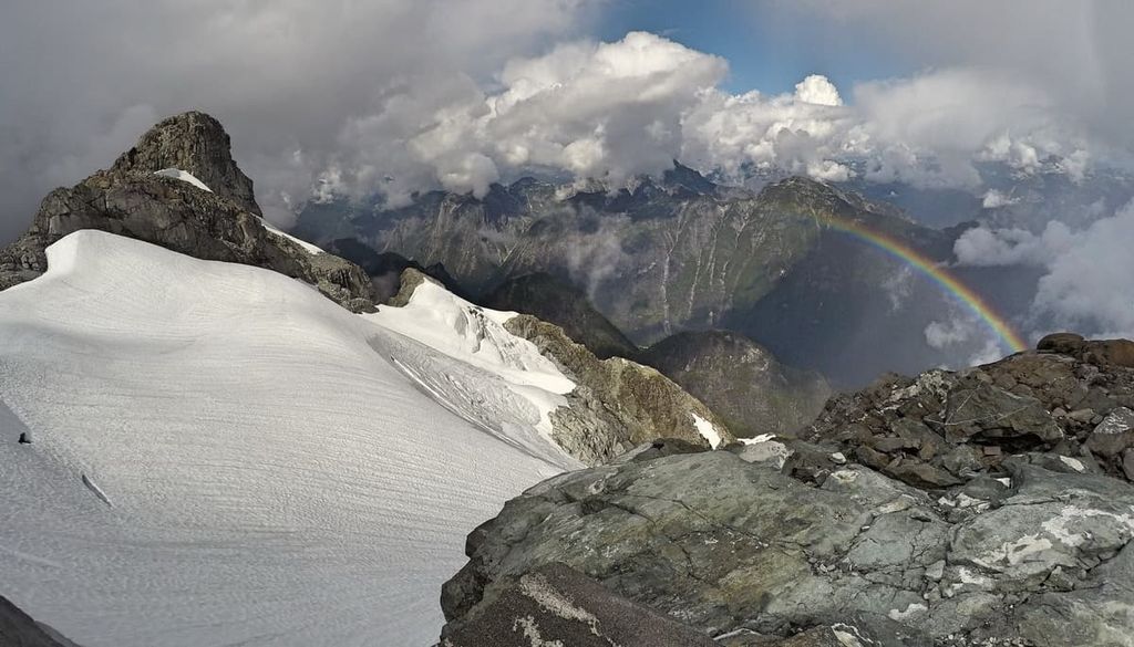
Glaciation has strongly influenced the topography of the Western Cordillera, which includes the Rockies, Columbia Mountains, the Coast Mountains, and the Insular Mountains. The fjords that dissect and indent the west coast were created from preglacial drainage lines that were further carved out by glaciers.
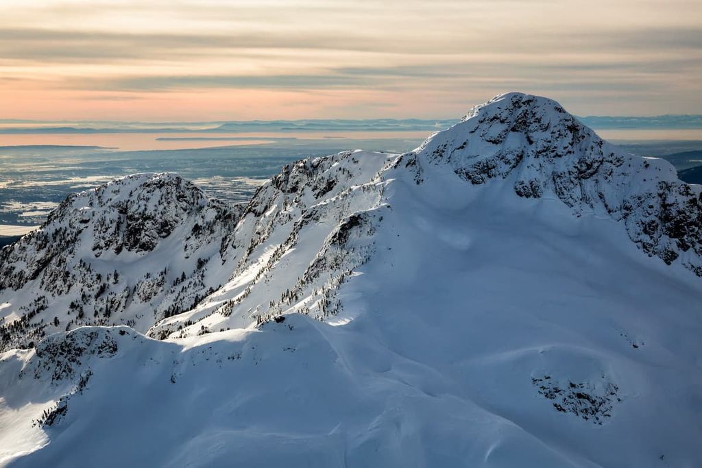
The fjords extend over 150 km (90 mi) inland and the glaciers created local relief in the Coast Mountains of 2,500 m (8,200 ft), with an additional 750 m (2,460 ft) of relief under the ocean. The glaciers also created cirques throughout the Pacific Ranges and as the glaciers receded, they left behind evidence of their passing as moraines, eskers, and kames.
There are three ecological zones in the Pacific Ranges that are characterized by their dominant plant species. The highest elevations are part of the Alpine Tundra Zone, which, along the coast, is typically communities of heather on otherwise barren peaks.
The subalpine is a thin band of the Mountain Hemlock Zone that is dominated by forests of mountain hemlock and amabilis fir. The tree line is a mosaic of meadows and scattered trees that become a dense forest at lower elevations.
Finally, the lower elevations are covered by the dense forests of the Coastal Western Hemlock Zone, which are the temperate rainforests of coastal British Columbia. The climax trees of this ecozone are western hemlock and amabilis fir; however, the old growth forests contain some of the western giants.
The coastal fringe forests are often dominated by Sitka spruce, which have adapted to the salty ocean spray that occurs throughout the coastal areas of the region. Douglas fir grows to nearly 100 m (328 ft) tall in the old growth forests and giant red cedars can reach 4 m (13 ft) in diameter. The old growth forest provides habitat for many animal species.
The Pacific Ranges are full of grizzly and black bears, elk, moose, cougars, deer, wolves, coyotes, foxes, and many more mammals. There are species of woodpeckers, owls, eagles, hawks, and many more birds that inhabit the Pacific Ranges ecosystem.
The Pacific Ranges have archaeological evidence of human habitation that dates back about 10,000 years when the glaciers that once covered the landscape started melting and receding from the region. There was a seasonal encampment near the mouth of the Fraser River that dates to that time.
The Pacific Ranges are the traditional territory of many Coast Salish nations. There are many significant cultural sites in and around the Pacific Ranges that give us insight into the lives and culture of the people that first inhabited the west coast.

At the south end of the Pacific Ranges, near Mission, British Columbia, one of North America’s oldest inhabited sites was finally given formal recognition for its cultural importance in 1992.
Known as the Hatzic Rock or Xá:ytem, this large, moss covered boulder is of significant spiritual importance to the Sto:lo people. Upon detailed archaeological examination, the site was verified as having been inhabited by an Indigenous peoples approximately 5,000 years ago.
Furthermore, the Musqueam traditionally had their main winter village at the mouth of the Fraser River, a tradition that they and their ancestors kept for 4,000 years. Other villages were in the areas that are now Stanley Park, Kitsilano, and the False Creek area. The abundance of resources allowed for complex societies to form which allowed for the development of class systems, with a ruling class and commoners, as well as a culture rich with art and ceremony.
The Spanish were the first Europeans to officially visit the coast of the Lower Mainland and the Pacific Ranges in 1791. However, one theory suggests that Sir Francis Drake was the first European to reach the Pacific Northwest while sailing for England as a secret part of his circumnavigation of the world between 1577 and 1580.
In 1792, Captain George Vancouver met with a Spanish expedition, at which time, together they further traveled through the Georgia Strait and the Pacific Northwest in general. Later, in 1808, Simon Fraser made the first recorded European overland expedition to the Pacific Coast via the river that now bears his name.
In 1862, Europeans began to settle the south end of the Pacific Ranges and the west coast of mainland British Columbia. Sawmills and forestry were a major industry in the region during the nineteenth century, when many of the ancient forests were cut down to provide lumber for the Royal Navy, among other industries.
The population of Vancouver grew exponentially after the railway arrived in 1887, connecting the western and eastern coasts of what is now Canada. Due to the railway, the city’s population had grown from 1,000 people in 1887 to 120,000 by 1911, surpassing the province’s capital of Victoria in population and economic importance.
It wasn’t long before people began to recognize the incredible natural beauty of the Pacific Ranges. By the early twentieth century lodges and resorts were being constructed along the railway lines through the mountains.
These early resorts and lodges were the beginning of the famous resort town of Whistler and the accompanying ski hill. In 2010, Whistler was host to the alpine events of the Vancouver Winter Olympics.

The Pacific Ranges are known for their incredible beauty, which includes from the ice-clad mountains to the lush forests filled with giant cedar, Sitka spruce, and Douglas fir. The following are some of the popular hiking areas in the Pacific Ranges:
Named for the twin peaks of Mount Blanshard near the park’s western border, Golden Ears Provincial Park was actually originally part of Garibaldi Provincial Park.
As one of the largest parks in British Columbia, Golden Ears Provincial Park has extensive trails for hiking and horseback riding. Other activities are climbing on Alouette Mountain or the Golden Ears, cycling, and water sports. Alouette Lake is popular for swimming, canoeing, windsurfing, water-skiing, and fishing.
Some of the trails that are worth hiking are the difficult trails such as the Golden Ears Trail, Evans Peak Trail, and the Alouette Mountain Trail. Some easy and moderate hikes are the East Canyon Trail, Lower and Upper Gold Creek Falls, the Gold Creek Lookout, and Alder Flats.
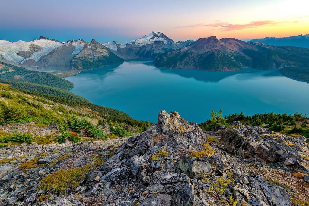
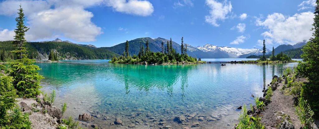
Located just 70 km (42 mi) from Vancouver, Garibaldi Provincial Park is named for one of its most iconic peaks—Mount Garibaldi. The park has scenic vistas, abundant wildlife, rugged mountains, shimmering lakes and rivers, and 90 km (54 mi) of hiking trails.
Some of the top recommended hikes of the park include the Garibaldi Lake Trail, Panorama Ridge, Elfin Lakes, and Wedgemount Lake. Some of the most popular peaks to summit in the park include Mount Weart, Wedge Mountain, Mount Price, Mamquam Mountain, and Overlord Mountain.
Located about 95 km (57 mi) to the west of Lillooet and 150 km (90 mi) north of Whistler, South Chilcotin Mountains Provincial Park has rugged beauty that is distinct from the other regions of the Pacific Ranges. Historically, the area has been used for grazing sheep and cattle in the mid twentieth century as well as mining from the early 1900s.
The rounded peaks of the Chilcotin Ranges and the mountains of the park are evidence of the intense glaciation that occurred in the region during the Pleistocene. There are over 200 km (120 mi) of hiking trails in the park, with many historical ties to mining trails as well as trails popular with the growing number of commercial guiding companies offering year-round experiences in the park.
Some of the incredible multi-day trails to enjoy in the region include treks to Lizard Lake and Spruce Lake. Trigger Lake and Spruce Lake can be hiked in a long day, or over a couple of days, whereas Graveyard Cabin and the Open Heart Trail are moderate day hikes.

Located in a remote area of the Chilcotin, Ts’il?os Provincial Park is situated approximately 250 km (150 mi) to the north of Vancouver. It has two main campgrounds to accommodate visitors to the park.
Ts’il?os, or Mount Tatlow, is the peak that dominates the park. The area is of cultural and spiritual importance to the Xeni Gwet’in and there are archaeological and burial sites within the park.
There are many backcountry destinations within Ts’il?os Provincial Park; however, there are no official or maintained trails in the park to follow. Two of the popular informal trails are the multi-day trek along the Tchaiakazan Valley over Spectrum Pass to Dorothy Lake and the Tullin Trail, which leads up Tullin Mountain.
The park has waterfalls, stunning rivers, and creeks to discover as well as rocky ridges to hike. There are climbing opportunities at the south end of Chilko Lake, as well as the lake to enjoy a lengthy paddle in a canoe or kayak.
Located at the north end of the Pacific Ranges and spanning into the Kitimat Ranges, Tweedsmuir Provincial Park is one of the largest of the hundreds of British Columbia’s provincial parks. The most popular activities in the park are fishing, hiking, camping, horseback riding, and canoeing the Turner Lake Chain.
Some of the most popular hikes include the Rainbow Range Trail, Hunlen Falls, Rosemary Pass, the Mount Marvin Loop, and the Valley Loop Trail. Other destinations are Molly and Echo Lakes, the Big Rock Viewpoint, and Ptarmigan Lake.

The Pacific Ranges are full of some of the most spectacular landscapes, waterfalls, rivers, and wilderness areas in Canada. The following are some of the popular destination cities and towns in the range.
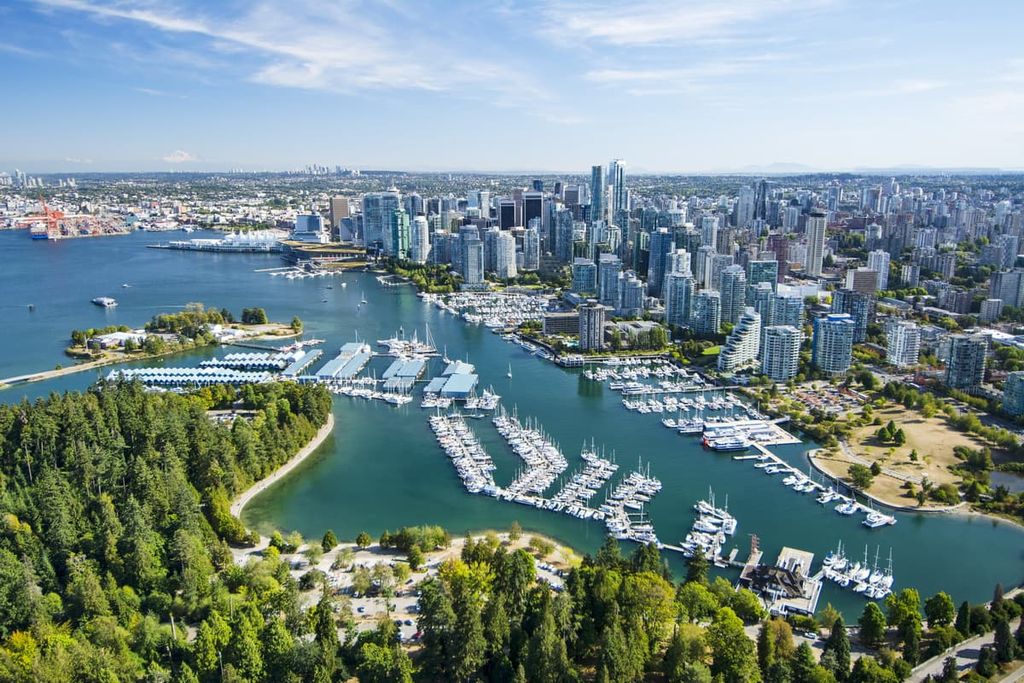
Located at the south end of the Pacific Ranges, along the Fraser River, Vancouver is among the youngest cities in the province. The first settlement in what is now Vancouver was built in 1862. Vancouver is now the largest city in British Columbia, and it is a popular film location for many movies and tv series.
While in Vancouver, there are many cultural attractions to check out, including libraries, museums, performing arts, art galleries, and a vibrant nightlife with many young bands getting their big break on Vancouver stages.
If you’d like to get out into nature but you don’t have time to leave the city, Stanley Park is one of North America’s largest urban parks. If you do have the time, the following are some of the popular hikes around Vancouver: St. Marks Summit, Quarry Rock, the Grouse Grind, Pacific Spirit Regional Park, Burnaby Lake Park, and the Norvan Falls Trail.
Additionally, some of the amazing provincial parks that are easily accessible from the Lower Mainland include Mount Seymour Provincial Park, Garibaldi Provincial Park, Golden Ears Provincial Parks, and Pinecone Burke Provincial Park.
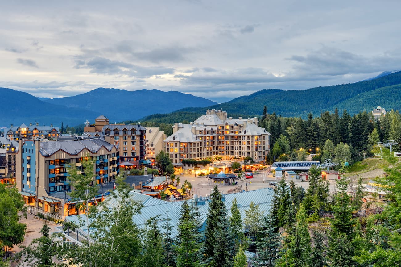
Whistler is a resort community located in the southern Pacific Ranges, about 121 km (72 mi) from Vancouver. Over two million people visit Whistler every year, primarily for alpine skiing and snowboarding during the winter; however, downhill and mountain biking are also popular at the Whistler Blackcomb Resort.
Resort skiing and cycling are popular activities in the town and there are also many great trails in the area to hike. Hikes to Garibaldi Lake, Black Tusk, Panorama Ridge, the Ancient Cedars Trail, and Cheakamus Lake are all popular trails. Additionally, one hike that you don’t want to miss is the short hike to the train wreck at the south end of town.
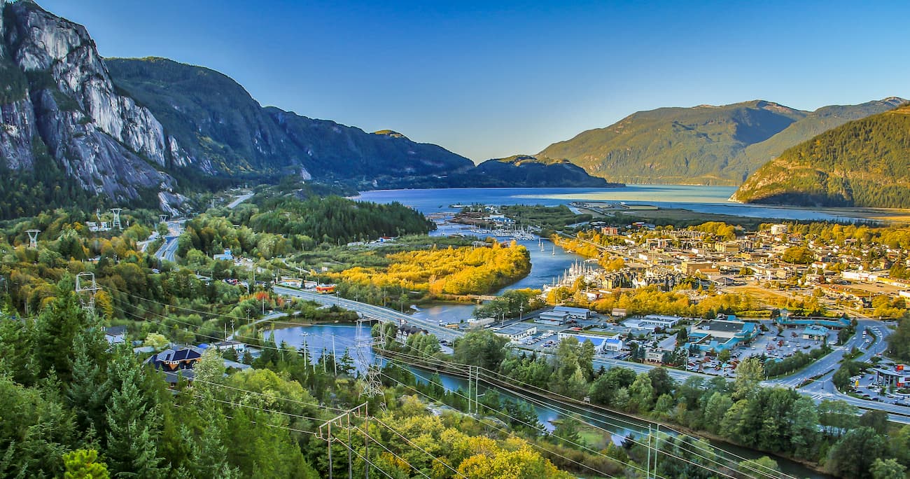
Located at the north end of Howe Sound on the Sea to Sky Highway in British Columbia, Squamish is a popular destination for tourists in search of outdoor adventure and recreation. Indeed, climbing is a popular sport around Squamish and there are some well renowned climbing areas within the city limits.
Climbing attractions include the granite massif called the Stawamus Chief, with over 300 climbing routes, as well as Shannon Falls, Murrin Park, The Malamute, and the Smoke Bluffs, all of which contain an additional 1,500 routes. Additionally, the area is home to over 2,500 bouldering problems that are published in local guidebooks.
Squamish is also popular for windsurfing and kiteboarding, ultra trail running, visiting Shannon Falls, river-rafting on the Squamish and Elaho Rivers, snowmobiling, hiking, mountaineering, and backcountry skiing. It’s also a popular place to visit, if you want to view the bald eagles in the community of Brackendale, which has one of North America’s largest populations of bald eagles.
Explore Pacific Ranges with the PeakVisor 3D Map and identify its summits.


ultra
glacier
4000ers-canada
11ers-bc
fred-beckey-great-peaks
canada-sampler
british-columbia-ultras
ultra
glacier
4000ers-canada
11ers-bc
fred-beckey-great-peaks
canada-sampler
british-columbia-ultras
ultra
glacier
swbc-high-peaks
gunn-scrambles
british-columbia-ultras
ultra
glacier
gunn-scrambles
british-columbia-ultras
ultra
swbc-high-peaks
gunn-scrambles
british-columbia-ultras

