
Share

Scan the QR code and open PeakVisor on your phone
Scan the QR code and open PeakVisor on your phone
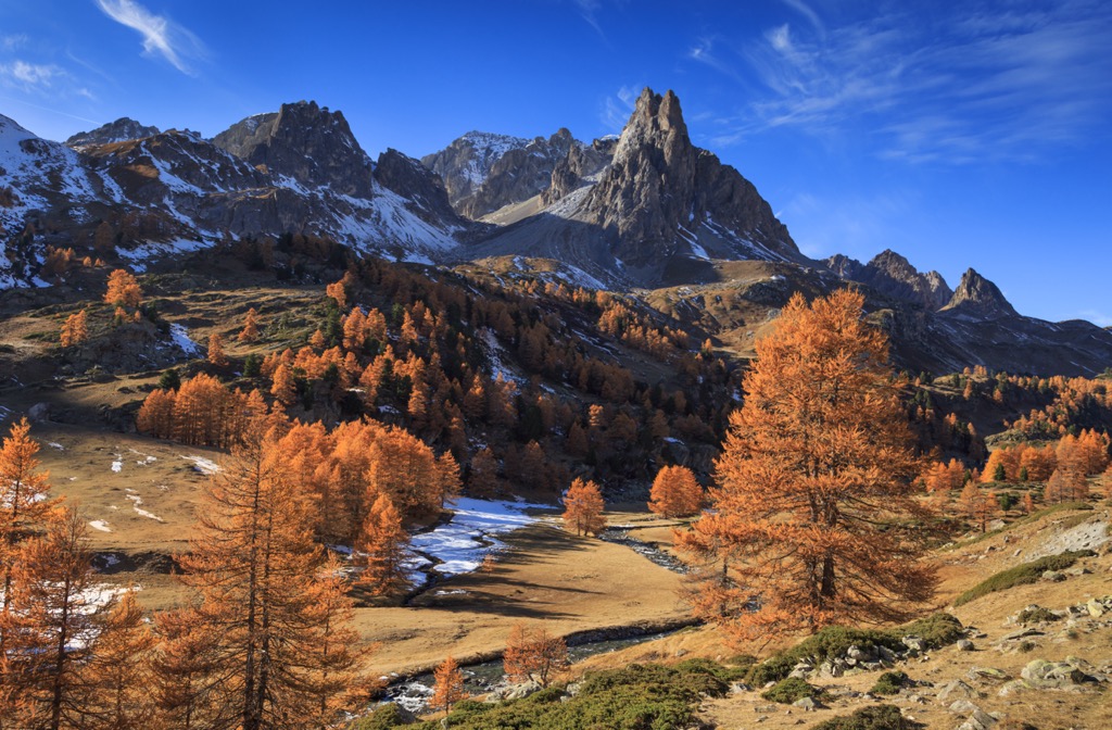
The Massif des Cerces is a mountain range in the Western Alps of Southeastern France. The massif forms the northern boundary of Provence-Alpes-Côte D'Azur and skirts the border with Italy - the eastern face of Mont Chaberton is in Italy. The Grand Galibier (3229 m / 10,593 ft) is the tallest peak, while Mont Chaberton (3131 m / 10,272 ft) is the most prominent (1,281 m / 4,205 ft). Valloire and Briançon are the two closest towns.
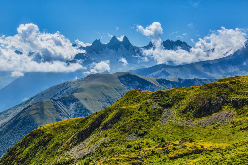
The Massif des Cerces is a mountainous region on the border of France and Italy in the Western Alps. On the French side, it is in the Hautes-Alpes and Savoie departments.
Other mountain ranges bound the region: the Massif de la Vanoise to the north, the Massif du Mont-Cenis to the northeast, the Alpes Cottiennes to the east, the Massif du Queyras and Écrins to the south, and the Massif d'Arvan-Villards to the west. The range is demarcated by the Arc River in the Maurienne Valley to the north and the Guisane River to the south.
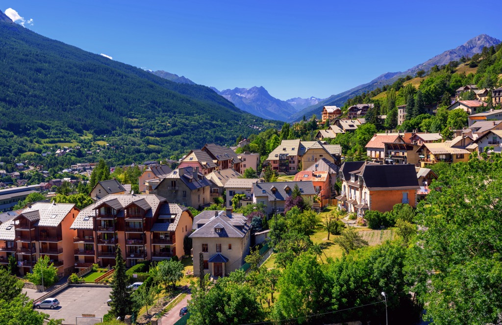
None of the valleys are significantly populated. Valmeinier is a purpose-built megaresort with about 10,000 beds, making it the largest settlement around the Massif. Valloire and Valfréjus are smaller, traditional villages with ski resorts. The Nevache Valley has several hamlets and a cross-country ski center but no ski resorts.
The Alpine Orogeny, which occurred between 64 and 2.5 million years ago, created the European Alps (as well as many other ranges throughout Europe and Asia). The orogeny resulted from the African and Indian plates colliding with the Eurasian plate, forcing the crust upwards. In many places, the orogeny is ongoing - namely, the Himalayas, because the Indian plate has only recently collided with Eurasia and continues to exert force on the crust. Even at a few tens of millions of years old, the Alps are still young, hence the towering, jagged peaks and low valleys.
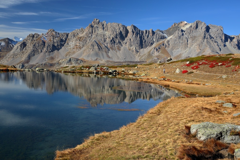
Glaciation has, to some extent, shaped every valley in the Alps. Glaciers have ebbed and flowed over the past 2.5 million years. No significant glaciers remain in the Massif des Cerces, but the major valleys - such as the Nevache - are the product of glaciation. Additionally, many lakes in the alpine region result from old glaciers.

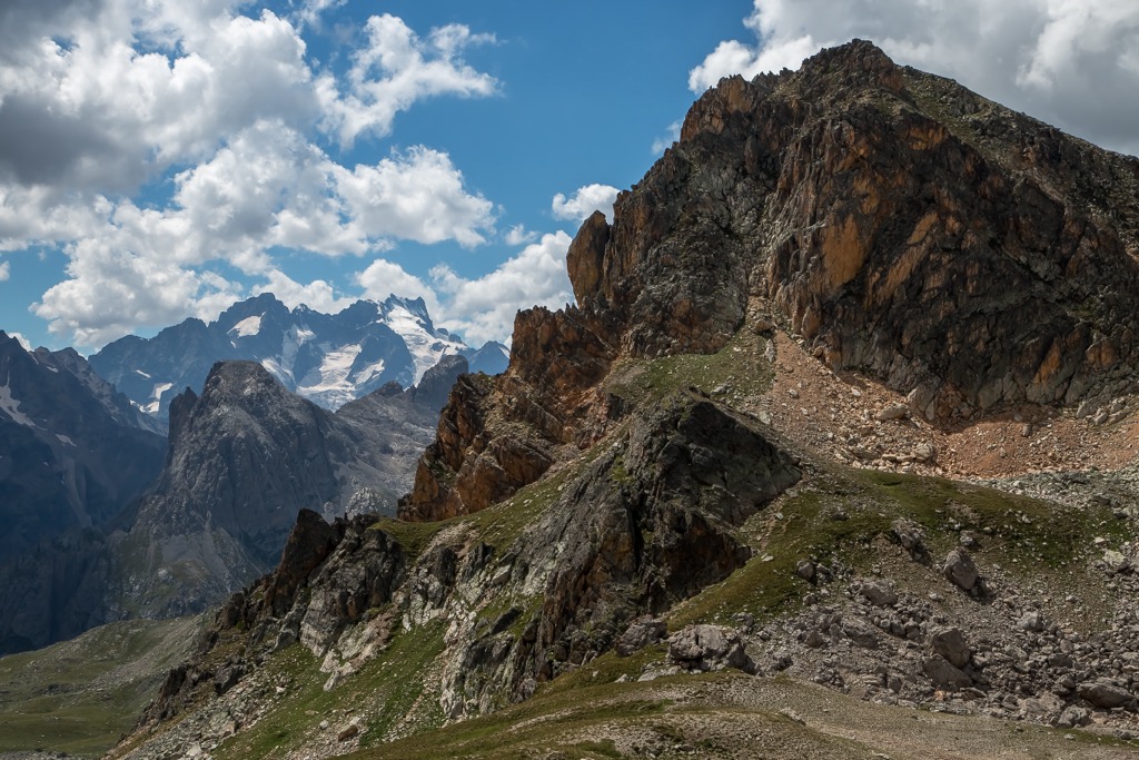
Like many medium-sized massifs in the Alps, the Massif des Cerces is partly crystalline (quartzite) and partly calcareous (limestone). Unlike the taller massifs like the Écrins and Mont Blanc, Cerces is not comprised of granite.
The tallest peaks in the massif are:
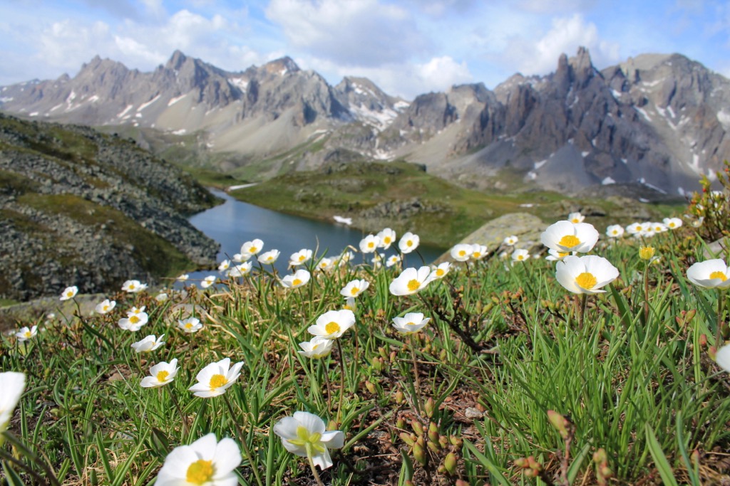
Two main eco-regions exist on the Massif: vast Larch forests and high-alpine tundra.
These old-growth larch forests and alpine meadows of the Massif des Cerces are enchanted. Here, you will find chamois, ibex, wolves, lynx, golden eagles, bearded vultures, tawny vultures, owls, rock ptarmigan, tetras, ermines, hares, foxes, squirrels, marmots, and many other animals. Black crows, a.k.a. Alpine Chough, soar amongst the rocky spires and peaks.
The region is home to more than 2,500 plant species. Well-known species include edelweiss, blue thistle, and génépi (used to make a hard liquor called a ‘digestif’). Wildflowers are rampant throughout the meadows, especially where livestock graze and fertilize the ground.
However, the most remarkable plant is the larch (meleze, in French) tree, which dominates the forested terrain throughout the region. The larch is a pine tree that loses its needles in the winter, creating a radius of highly acidic soil and preventing other plants from growing. This gives the forests a cathedral-like ambiance - and makes for excellent tree skiing.
Anatomically modern humans probably arrived around 40,000 years ago. However, limited evidence of these early pioneers exists. Celtic tribes settled in this part of the Alps, followed by Roman conquerors. After the fall of Rome, the farming villages of Cerces faced plague, famine, and religious wars.
The 17th century brought more stability and prosperity to the region. Farming remains a primary economic driver of the area, though three small ski resorts now operate. The area remains very rural and undeveloped.
In the 20th century, the Massif saw the development of three ski areas: Valloire - Galibier, Montgènevre, and Valfréjus. Valloire - Galibier is a massive, linked megaresort, while Valfréjus is much smaller. Montgènevre is also a purpose-built resort.
In 2016, six French Foreign Legionnaires died in an avalanche near the village of Valfréjus and its accompanying ski area. During the exercise, while five to six skiers were near Col du Petit Argentier, a large cornice fall triggered a massive avalanche. The cornice, roughly 100 meters wide, broke off a ridge and led to several branches of snow that engulfed 13 skiers in a steep valley section measuring about 400 meters wide. In total, 18 downstream skiers were affected by the avalanche, either being buried or shaken. The remaining company members stayed at the foot of the slope near the Pas du Roc peak and were able to rescue 12 of the victims.

One of the easier trails in the region, this footpath follows the river through the Clarée Valley. It’s a 3.5 km (2.2 mi) out-and-back with little elevation gain, though beautiful scenery won’t disappoint.
With 648 m (2125 ft) of elevation gain over 12.1 km (7.5 mi), this hike is medium difficulty by the standards of the French Alps. Check out two lakes and many surrounding peaks, including the Pointe des Cerces. It’s unlikely to be clear of snow until June. Access this trail from the Valloire side of the Galibier Pass.

This 21.4 km (13.3 mi) loop circumnavigates the entire Pointe des Cerces (3097 m / 10,160 ft). You also pass the Lac des Cerces and Lac du Grand Ban, like the previous hike on the list. However, you access this loop from the hamlet of Laval at the top of the Nevache Valley (a totally different entry). You are less likely to encounter people here. The Refuge des Drayères is a great place to the night near the start of the loop.
Montgenèvre Ski Resort is on the French border with Italy and at the tip of the Massif des Cerces. Technically, the Col du Montgenèvre, which splits the ski resort, delineates the massif’s boundary. The main feature is the namesake Col du Montgenèvre pass of 1,860 m (6,102 ft) and its surrounding mountains with many slopes and freeride descents in an uncrowded setting. Enjoy epic views of one of the most prominent peaks in the Hautes-Alpes, Mont Chaberton (3,131 meters / 10,272 ft).
Montgenèvre is also the only French resort connected to one of the most extensive ski areas in Europe and the world. The Via Lattea (“The Milky Way”) includes the Italian resorts of Claviere, Sestriere, Sauze d’Oulx, San Sicario, and Pragelato, with more than 400 km of slopes and 70 ski lifts. Montgenèvre itself has 110 km (68 mi) of slopes and 30 ski lifts. The Montgenèvre (Via Lattea) season is generally from early December to mid-April. The resort’s advantageous geographic location makes it one of the snowier resorts in the Alps.
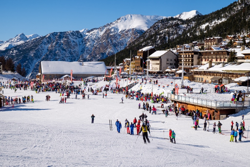
Valloire - Galibier is a vast skiing domain with extensive and diverse ski terrain. The resort has two base areas: Valloire is the traditional village, while Valmeinier is a purpose-built megaresort (the two are linked). The ski terrain is perched amidst the towering peaks of Grand Galibier (3229 m / 10,593 ft) & Mont Thabor (3178 m / 10,426 ft). With three major peaks, the resort offers something for everyone in typical French style.
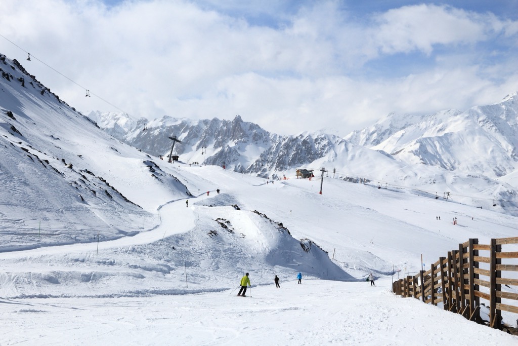
The skiing and snowboarding terrain is expansive, covering over 160km of trails with 30 lifts and 1,320m of skiable vertical, predominantly on north-facing slopes. With 90% of the trails rated beginner or intermediate, the resort is an ideal location for those who enjoy groomed cruisers. Like most French resorts, the lifts also provide excellent backcountry access to the surrounding peaks.
Unlimited backcountry skiing also exists within the Massif des Cerces. The two most notable spots are accessible from the southern (Briançon) side.
Right in the heart of the Massif des Cerces beneath Mont Thabor and Pointe Cerces, the Vallée de la Clarée is an excursion worthy of a separate guide altogether. This quiet and secluded valley is nestled just north of Montgenèvre and Briançon and is dotted with tiny villages. Nevache is the last commune before the road tapers off into historic farmsteads that now serve as summer getaways and refuges. It is as outstanding in the summer as in the winter.
There is a lifetime of backcountry skiing options in this valley. The best place to start with just a day or two to explore is the Refuge Buffère. Located on a bench at 2,000 m (6,564 ft) at the foot of the north-facing slopes of the Nevache Valley, the Buffère provides cozy beds and hearty meals. The hut is surrounded only by mountains and wilderness 400 m (1,312 ft) above Nevache. You must book early to stay at the Buffère for an extended period or on a specific date. However, there are often random days with availability. It is 53 euros per night.

Similarly to Montgenèvre, the Nevache Valley catches snow from multiple directions and usually has a good base. Moreover, the diversity of aspects and terrain within the valley will ensure that skiing is possible under almost any circumstance. However, the terrain most easily accessible from the Buffère is north-facing — great for powder but not so great for corn. Tree skiing abounds in the lower elevations of the valley, and the alpine zone consists of everything from mellow slopes to big faces and couloirs.
While you will encounter other people in the valley, the Nevache is undoubtedly more of a ‘hidden gem’ than the Col du Lautaret.
The Col du Lautaret (2,058 m / 6,751 ft) is a mountain pass on the north side of the Parc Nationale des Ecrins on the French 1091 highway. The pass is the main route between Briançon and all points west and offers easy access to a considerable diversity of alpine skiing. The top is about a 25-minute drive from Briançon.
Technically, only the routes on the north side of the pass toward the Pic Blanc du Galibier are within the Massif des Cerces; the south side is considered the Massif des Écrins. Notably, the Col du Galibier is also considered a dividing line between the Southern and North French Alps.
“The easy road access to such varied all aspects and all levels of terrain is more than rare. The fact that the touring season stretches from early November to mid-May most years is exceptional”, says Per As, La Grave mountain guide, on why the Col du Lautaret is his favorite place to ski touring.
Driving over the col, it may seem like the whole place is tracked out. The truth is that there are plenty of lines remaining out of sight. Nevertheless, Lautaret is no secret; the easy access routes can be littered with people. Undoubtedly, it’s the most crowded backcountry skiing domain in the region.
Briançon, the highest city in France, sits at an altitude of 1,326 meters at the convergence of five valleys. This city is a mecca for mountain enthusiasts and tourists coming to see the astonishing Old Town. With incredible access to climbing and skiing, many high mountain guides are based here.
The original settlement was fortified by French military architect Vauban in the 18th century. This central Old Town is now a UNESCO World Heritage Site, recognized for its remarkable fortifications built between the 18th and 20th centuries. A tour will take you through the Vauban citadel, the fortified castle, and the surrounding forts, including Salettes, Trois Têtes, and Randouillet.
Architecture enthusiasts can explore the 18th-century collegiate church of Notre Dame, the 14th-century Cordeliers church, old houses lining the steep, narrow streets, and the charming Place d'Armes square surrounded by pretty, colorful Provence-style facades, fountains, and sundials.
Briançon has since sprawled over a wide swath of the surrounding valleys. The base villages of the Serre Chevalier ski area extend to the northwest, while Montgenèvre branches off to the northeast. The newer constructions are not particularly sightly compared to the Old Town, but Briançon still has charm. Even though it has access to an excellent ski resort and climbing and is rich in history, Briançon has remained affordable.
Valloire is at the foot of the renowned Col du Galibier and dates back to the 11th century. The village comprises 17 hamlets ranging from 1400 - 1800 m (4,593 - 5,905 ft) and is home to approximately 1,300 full-time inhabitants.
The village’s vibe is tranquil, laid-back, and relaxed. Don’t expect much in the way of services or entertainment here, but the mountain access is on point.
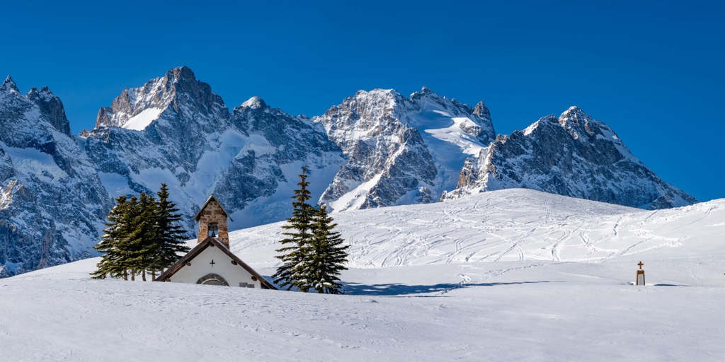
During summer, the valley hosts 135 km of marked hiking trails and 11 mountain biking paths suitable for all levels. Accessible natural attractions include the Cerces and Rochilles blue mountain lakes, the majestic Telegraph forest, and the alpine valleys of Neuvachette and Valloirette. At the foot of the Col du Galibier, Valloire is enshrined by a prestigious circle of mountains, including the Aiguilles d'Arves, Cerces, Thabor peaks, and the Écrins and Vanoise Parks. The Galibier, famous for being a challenging route in the Tour de France, is also a geographical boundary between the Southern and Northern Alps.
In winter, Valloire turns into a wonderland with 150 km of slopes for all levels, and cross-country ski, snowshoe, and pedestrian trails. The village hosts an annual international snow sculpting and ice competition, where an international set of sculptors create masterpieces from huge snow blocks.

Explore Massif des Cerces with the PeakVisor 3D Map and identify its summits.


