
Share

Scan the QR code and open PeakVisor on your phone
Scan the QR code and open PeakVisor on your phone
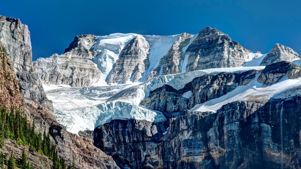
The Columbia Icefield is the largest icefield in the Rocky Mountains and it is one of the most accessible expanses of glacial ice in North America. There are 22 named peaks in the Columbia Icefield region, of which Mount Columbia is the tallest with 3,747 m (12,290 ft) of elevation and 2,380 m (7,806 ft) of prominence. Mount Columbia is the tallest mountain in Alberta and is only second to Mount Robson for elevation and prominence in the Rocky Mountains.
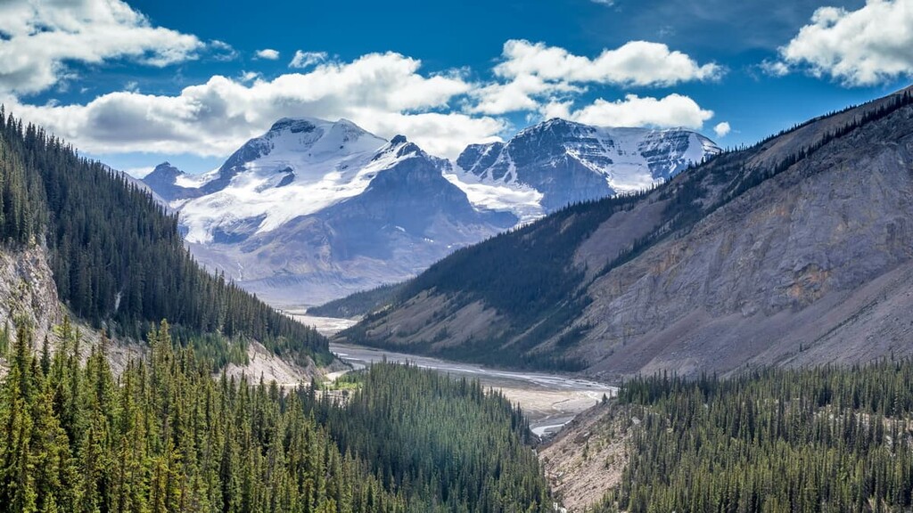
Located along the Alberta and British Columbia border, the Columbia Icefields are about 100 km (60 mi) south of Jasper, Alberta and 185 km (111 mi) north of Banff. Furthermore, the Columbia Icefield is situated along the Icefields Parkway (Highway 93) and it is the northern end of Banff National Park and the southern end of Jasper National Park.
As a mountain range, the Columbia Icefield covers about 775 square kilometers (300 square miles); however, the actual ice of the icefields covers only about 250 square kilometers (97 square miles).
The tourist main destination at the Columbia Icefield is the Icefield Discovery Centre. The Discovery Centre is located 100 km (60 mi) to the south of the town of Jasper, which is about an hour and fifteen-minute drive down the Icefield Parkway. Meanwhile, Banff townsite is 185 km (111 mi) south of the Columbia Icefield, which is about a two hour and fifteen-minute drive on the parkway.
There are 22 named peaks in the Columbia Icefield, the tallest of which is Mount Columbia. Mount Columbia is also the second tallest of the famed 11,000ers of the Canadian Rockies. The 11,000ers are the 54 mountains of the Canadian Rockies that are over 11,000 feet. The Columbia Icefield is home to 11 of the 11,000ers, making it a popular destination for mountaineers.
The parent range of the Columbia Icefield is called the Columbia Icefield Area. Other ranges within the Columbia Icefield Area include Kitchen Range, Vertebrae Range, Bush-Prattle Divide, and the Winston Churchill Range, the latter of which boasts massive peaks.
While Mount Robson is the tallest mountain in the Canadian Rockies, Mount Columbia of the Columbia Icefield is the second tallest. Mount Columbia is also located on the Continental Divide, which serves as the southern part of the border between Alberta and British Columbia. North Twin Peak (3684 m / 12,083 ft) is in the Columbia Icefield and it is the tallest mountain that’s wholly contained within Alberta.
The Columbia Icefield is part of Banff and Jasper National Parks. The White Goat Wilderness Area is located to the east of the icefield while Cummins Lake Provincial Park and Hamber Provincial Park are located to the west of the Columbia Icefield in British Columbia.
The rocks of the Columbia Icefield started forming over 500 million years ago as marine sediment compacted on the floor of a shallow sea that once covered much of modern-day Alberta. Before the collision of the North American plate with the tectonic plates under the Pacific Ocean, Alberta was actually located in the coastal regions of North America.
Ancient tectonic plates called the Farallon plate and Kula plate began to slide under the North American plate about 200 million years ago. The Kula plate subducted under present-day Canada and the North American plate gathered the volcanic island into its landmass, gaining the coastal land that is now British Columbia.
The formation of the Rocky Mountains occurred during an event called the Laramide orogeny. This mountain building event occurred partly due to the subduction of the Kula Plate under the North American Plate. The Rocky Mountains started forming about 75 million years ago and were forming until about 40 million years ago, when the Kula Plate and North American Plate stopped their collision.
The discrepancies between the tall, granite mountains of the Rocky Mountains in the United States and the shorter, limestone mountains of the Canadian Rockies is due to the differences in how the Farallon and Kula plates slid under the continent.
The Farallon plate slid under the United Stated at a low angle of subduction; therefore, it created significant continental lifting of the bedrock of the North American plate. On the other hand, the Kula plate subducts at a steep angle, so the Canadian Rockies are primarily composed of thrusted sedimentary sheets with minimal continental uplift.
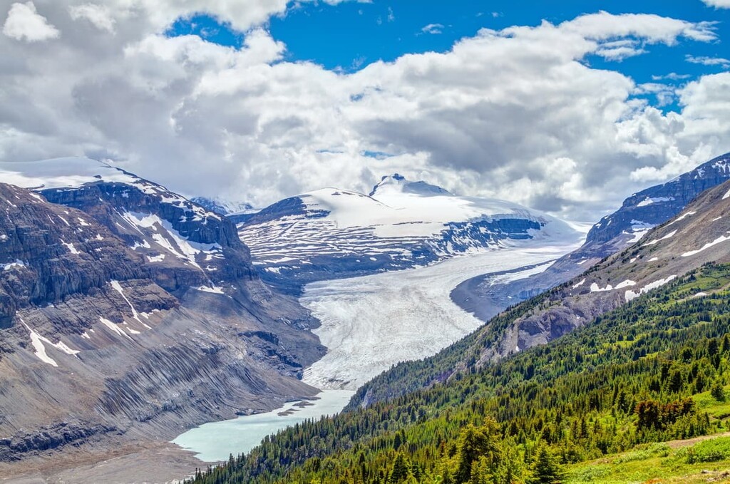
The mountains of the Columbia Icefield are generally made of thick slabs of limestone and dolomite that cracked and were then stacked on top of the younger Cretaceous sandstone and shale. The glaciation of the Pleistocene created the topography of the mountains in the icefield and the most recent glacial maximum has yet to retreat from the mountain range.
The Columbia Icefield started forming during the Illinoisan period, some 238,000 to 126,000 years ago, during the Pleistocene. The icefield stopped advancing between 75,000 and 62,000 years ago; however, evidence shows that it advanced again 20,000–11,000 years ago. The most recent advance coincides with the final time in which Asia and North America were connected by the Bering land bridge.
While there are recorded “mini-ice-ages” or, more technically, periods of maximum glacial extent, within the last several thousand years, most of the glaciers in Banff National Park and Jasper National Park are retreating. The 7 meters (23 feet) of annual precipitation that the glaciers receive help maintain the outflow to the major rivers of the North Saskatchewan River, Athabasca River, and the Columbia River.
As the largest icefield in the Rocky Mountains, the Columbia Icefield features a unique ecological makeup. While much of the landscape is typical of the alpine ecology found throughout the Rocky Mountains, there are some unique flora and fauna found in the general icefield region.
The icefield is a hostile environment and very few animals and plants inhabit the glaciers. Snow algae is the only flora to grow on the glaciers and snow. It is a red alga that looks like spilled watermelon juice in the snow, and it grows upon old snow that is rich with dust particles.
All other plants may grow close to the snow and glaciers; however, except snow algae, no plants grow on the ice. Lichen, sedges, and heath are the common plants that inhabit the alpine areas around the icefield.
Bighorn sheep are regulars on the glaciers of the Columbia Icefield, while mountain goats prefer the rocks of the alpine peaks and cliffs. Caribou, which don’t normally inhabit alpine ecosystems, inhabit the Columbia Icefield. Moose are uncommon but you can sometimes see evidence of their passing.
A fascinating phenomenon occurs that allows the rosy finch to thrive upon the glacier. Insects will be blown onto the icefield on air currents from British Columbia. Moths, bugs, and beetles can cover the ice at 10,000 feet above sea level and are the primary food source for rosy finches in the icefield area.
As an area becomes glaciated, the glaciers will destroy all the flora from the area and generally make it inhospitable for wildlife to live in the region. The glacier will scour the mountains and create a new environment that is barren of soil and organic material. However, there is a process of plant succession that nature follows to amend the rocky environment changing it, in time, to a thriving ecosystem
After the glaciers retreat, lichen is the first plant to inhabit the rugged terrain. Following the lichen, small plants such as yellow dryas and river beauty will begin to grow and create organic soil for further plant development. Grasses, sedges, and flowers fill in shortly after a glacier retreats.
With time, spruce, shrubby cinquefoil, and sweetvetch willow will begin to grow in the pockets of organic soil that the previous plants helped create. It is only after hundreds of years of the small plant communities slowly breaking down the rocks and creating soil that forests of subalpine fir, dense stands of willow, and heather meadows will grow.
The Columbia Icefield has a human history that is unique compared to the rest of the mountain ranges and most places throughout North America. Typically, human history in the Rocky Mountains started 8,000 to 12,000 years ago; however, that is not the case with the Columbia Icefield.
There are no indications of First Nations inhabiting the ice fields in the recent past. There is no archaeological evidence of ancient people using the area for any purpose, nor are there any known oral histories or stories that pertain to the Columbia Icefield. It is possible that J. Norman Collie and his associates truly discovered the Columbia Icefield in 1898, or, at the very least, that he was one of the first people to travel on the icefield.
Collie wrote the following of his August 18, 1898, discovery: “The view that lay before us in the evening light was one that does not often fall to the lot of modern mountaineers. A new world spread at our feet: to the westward stretched a vast ice-field probably never before seen by the human eye, and surrounded by entirely unknown, unnamed, and unclimbed peaks.”
Collie and his climbing partners were searching for the mythical, giant peaks of Mount Hooker and Mount Brown. These were to be among the tallest peaks in the Rocky Mountains and North America, measuring between 4575 m and 5183 m (15,000 ft and 17,000 ft) tall as reported by David Douglas in 1827.
Douglas’s encounter with the giant mountains was in 1827 as he was crossing the Athabasca Pass. Upon reaching the highest part of the Athabasca Pass, Douglas decided to climb the tallest adjacent mountain. Upon doing so, he named it Mount Brown in honor of botanist R. Brown, Esq. Douglas proceeded to name a nearby mountain of similar height as Mount Hooker, after his expedition’s sponsor.
At the time of his crossing, Douglas did not know the height of the Athabasca Pass (it is 1,753 m / 5,751 ft) and was later erroneously told that the pass was 11,000 ft (3354 m). As such, his incorrect calculations were taken as a matter of record in the production of contemporary maps and the errors were perpetuated for over a century.
Previous to the Collie expedition, Arthur Philemon Coleman searched for Hooker and Brown in 1884, and in fact made four expeditions in total searching for the mythical giants. While he did not discover the giants, he travelled the Continental Divide between Banff and Jasper, mapping and following the route that would later become the scenic Icefield Parkway (Highway 93).
A discussion of tall mountains in the Rocky Mountains seems incomplete without a mention of Konrad Cain. Cain visited the icefield in 1923 and led the first ascents on Twins Tower and Mount Saskatchewan. In 1927, AJ Ostheimer and companions spent 63 days in the Columbia Icefield walking over 1,000 km (600 mi) and ascending 30 peaks, 25 of which were first ascents.
To further open the Columbia Icefield to the wonder and amazement of the world, in 1932, Cliff White, Joe Weiss, and Russell Bennet climbed Snow Dome and then skied down it. The 3,000 m (9,800 ft) descent from the summit lasted 50 km (31mi) and became the longest continuous ski run at that point in Canadian history.
By the 1940s, the single lane gravel road between Banff and Jasper was completed, which made it easier for people to get to the Columbia Icefield. During World War II, British and Americans practiced mountain warfare on the Glaciers of the Columbia Icefield. The 87th Infantry Regiment of the 10th Mountain Division of the US Army spent two months on the icefield testing an over-snow vehicle.
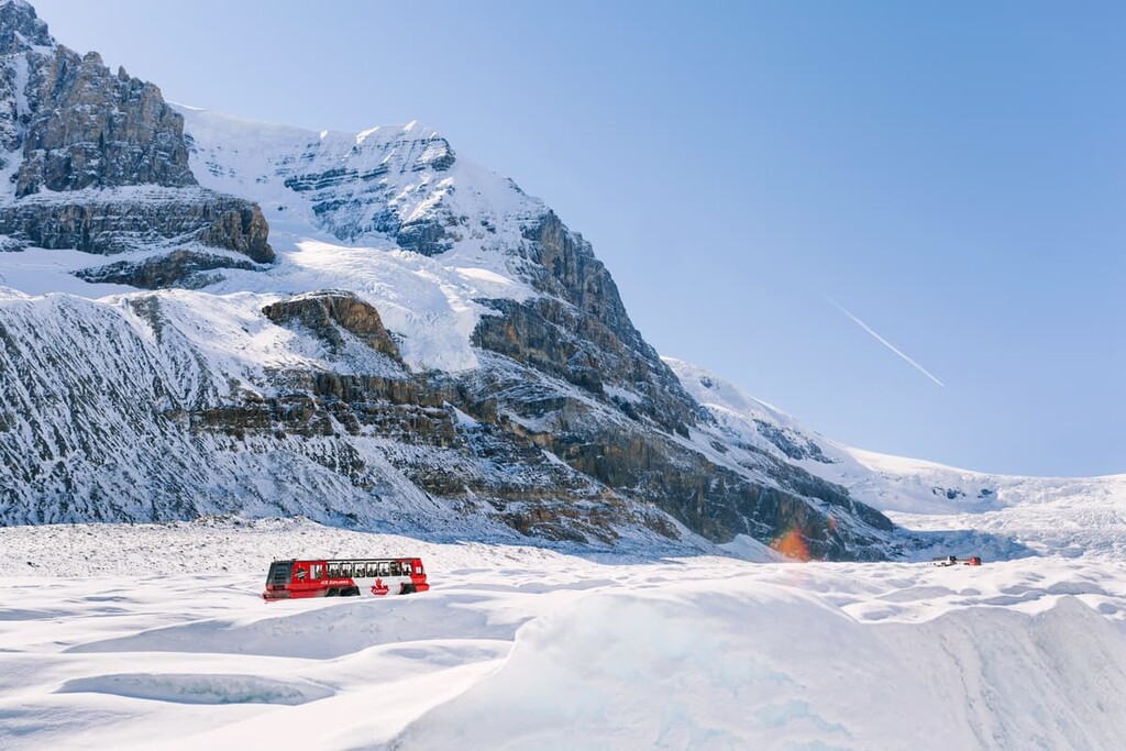
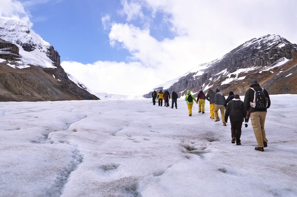
Snowmobile tours of the Columbia Icefield started in the 1950s. This has led to the development of snow-coaches, which are busses with monster truck tires that are designed to travel onto the glacier with guests for a tourist experience. Touring the glacier in one of these snow-coaches is one of the more popular attractions while visiting the icefield.
The accomplishments of the early mountaineering pioneers in the Columbia Icefield played a role in generating worldwide interest in the Canadian Rockies. Mountaineers and skiers still attempt the classic routes the pioneers first recorded.
The Columbia Icefield is among the most accessible glaciers in North America and it also has 11 of the 50 tallest mountains in the Canadian Rockies. These two facts have created a unique blend of visitors to the area.
Most of the visitors to the Columbia Icefield have never seen a glacier up close and there are adventures to be had which will give wonderful experiences. The other visitors have likely been on glaciers before and are looking to summit one or more of the tempting peaks in the area.
The following are some of the adventures and attractions to enjoy in the Columbia Icefield.
The Icefield Discovery Centre has boutiques, tour departures, restaurants, exhibits, and a hotel. While the gift shops offer the typical fare of Canadiana merchandise, the exhibits teach the history of the region and how glaciers work. There is even a scale model of the Columbia Icefield to help understand the size of the icefield.
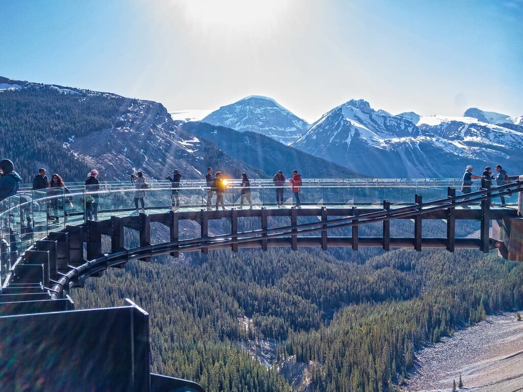
There is the option of staying the evening in the Glacier View Inn, which occupies the top floor of the Discovery Centre, or you can just spend the day wandering around the area. Tours leave from the center throughout the day or the Athabasca Glacier, as do shuttles to the Glacier Skywalk.
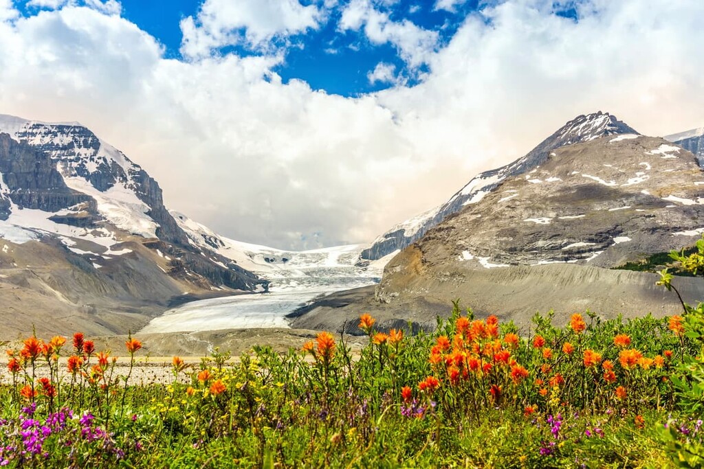
There are two short trails that start from the Icefield Discovery Centre, one of which leads through the scree field in front of the glacier, while the other leads to the toe of the Athabasca Glacier. Both hikes are short, however, the forefield of the glacier can often be wet and muddy.
Stay on the trail to preserve your shoes as well as the vegetation that is attempting to take hold on the barren landscape. The short hike to the toe of the Athabasca Glacier is one of the few ways to touch the glacier without paying for a guided tour.
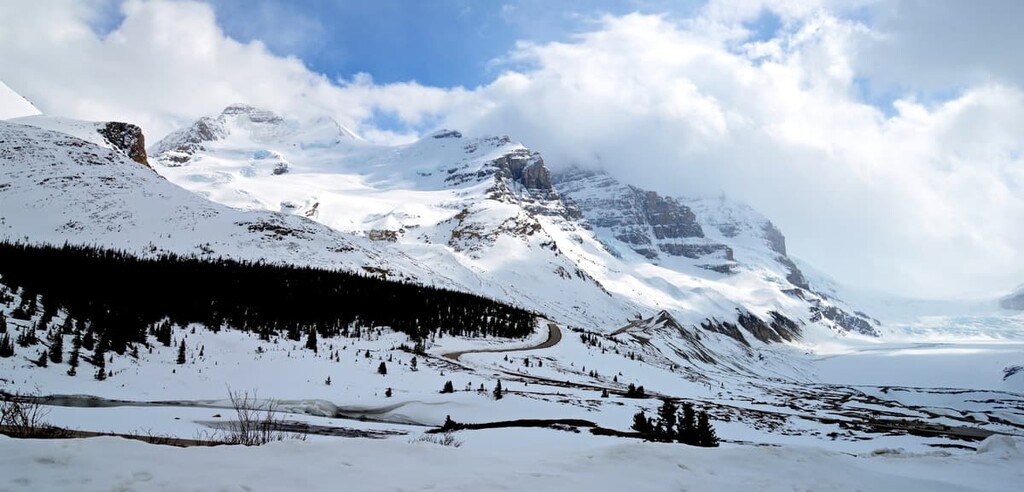
The Wilcox Pass trail is highly recommended as a must-do while visiting the icefield. The trailhead is 3 km (1.8 mi) south of the Icefield Discovery Centre at the Wilcox Creek Campground. The trail is about 5 km (3 mi) to the pass with 409 m (1,342 ft) of elevation gain.
Starting at an elevation of 2040 m (6,691 ft), this trail begins at a higher elevation than many trails in the Rocky Mountains finish at. Within a short distance, the trail is above the tree line and Parks Canada has placed a set of iconic red Adirondack chairs at a fantastic lookout for you to enjoy.
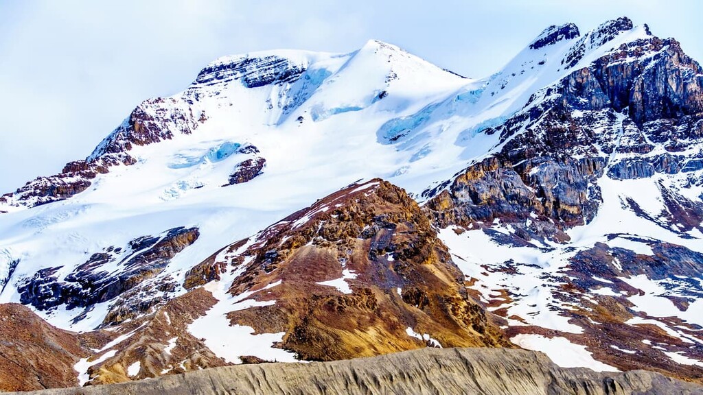
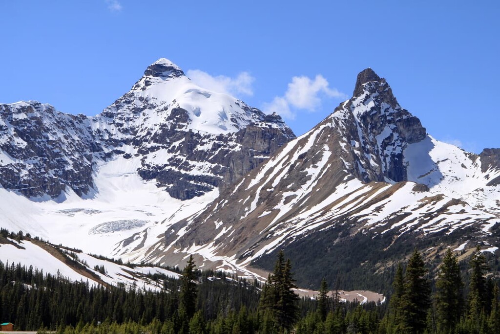
The trail continues up to Wilcox Pass and 1.2 km (0.7 mi) past the pass, you’ll find the Wilcox Pass Lookout. From here you can admire the Athabasca glacier and the mountains that make up the eastern edge of the Columbia Icefield with Mount Athabasca and Snow Dome dominating the western skyline .
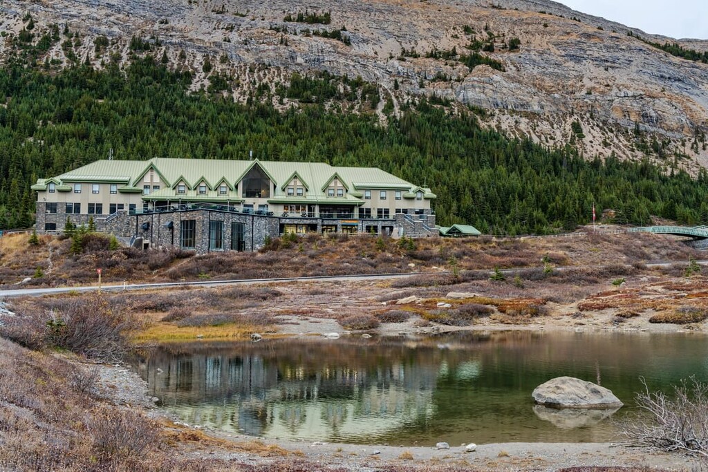
While the Columbia Icefield is one of North America’s most accessible icefields and glaciers, there are no cities or major towns nearby. However, there are some incredible towns in the national parks that the icefield occupies as well as Canada’s only glacier view hotel.
The Glacier View Lodge is the first and only glacier view hotel in Canada. It offers luxury stays that allow guests to experience the glaciers in a relaxed and unhurried environment. The rooms are cozy and comfortable and offer either glacier or mountain views.
There are restaurants that serve fine foods and stay-packages that include private access to the glacier in the morning and private access to the glacier skywalk in the evening. If the skies are clear, the opportunity for stargazing is unrivaled. Alternatively, guests can enjoy a selection of other evening entertainment activities at the lodge.
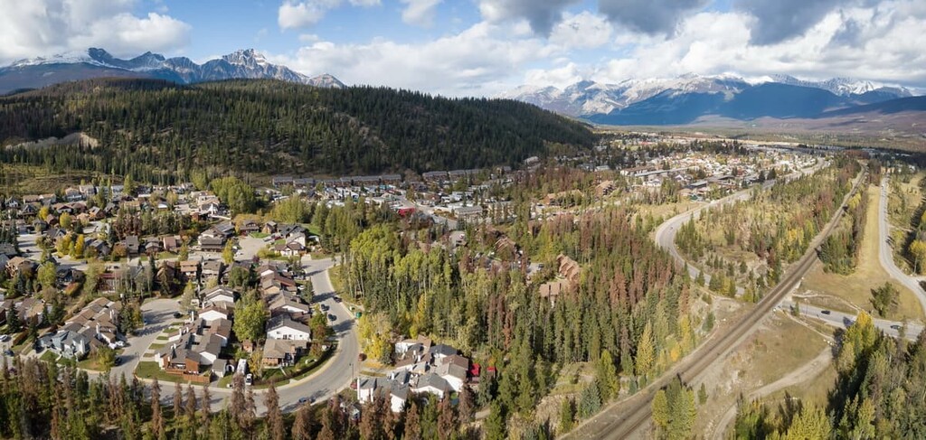
About 100 km (60 mi) to the north of the Columbia Icefield is the town of Jasper, Alberta. The town of Jasper was established as Jasper House in 1813 as a fur trade outpost. In 1913, the town was relocated to its current site and is the commercial center for Jasper National Park, which was established in 1907.
Jasper is much like the picturesque Town of Banff, to the south; however, Jasper is on a smaller scale. What the town lacks in size it certainly makes up for in the adventures and sights that are available within the town and in the surrounding Jasper National Park.
Some of the popular destinations from Jasper include the beautiful Maligne Lake, the Columbia Icefield, the stunning Athabasca Falls, as well as countless hikes and trails around the town. While it gets busy in the summer, Jasper is not as busy as the national parks to the south.
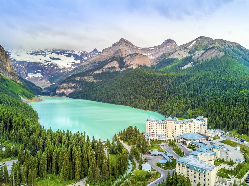
Lake Louise is situated about 100 km (60 mi) to the south of the Columbia Icefield and about 100 km (60 mi) to the north of the Banff townsite in Banff National Park. It wasn’t until 1940 that the Icefields Parkway was completed, allowing motor travel between Lake Louise and Jasper.
The Icefields Parkway started as a single lane gravel road and was later upgraded to a multilane paved highway. The drive along the parkway is one of the most scenic drives in the world. While the town of Lake Louise is barely more than a collection of hotels and restaurants it is an amazing basecamp from which to explore the most picturesque and stunning landscapes in the Canadian Rockies.

Explore Columbia Icefield with the PeakVisor 3D Map and identify its summits.


ultra
glacier
11ers-bc
11ers-ca-rockies
canada-sampler
british-columbia-ultras
alberta-ultras
ultra
glacier
11ers-bc
11ers-ca-rockies
canada-sampler
british-columbia-ultras
alberta-ultras

