
Share

Scan the QR code and open PeakVisor on your phone
Scan the QR code and open PeakVisor on your phone
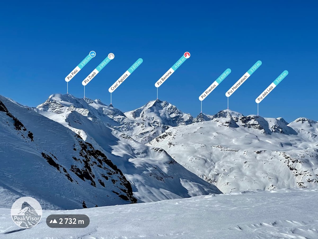
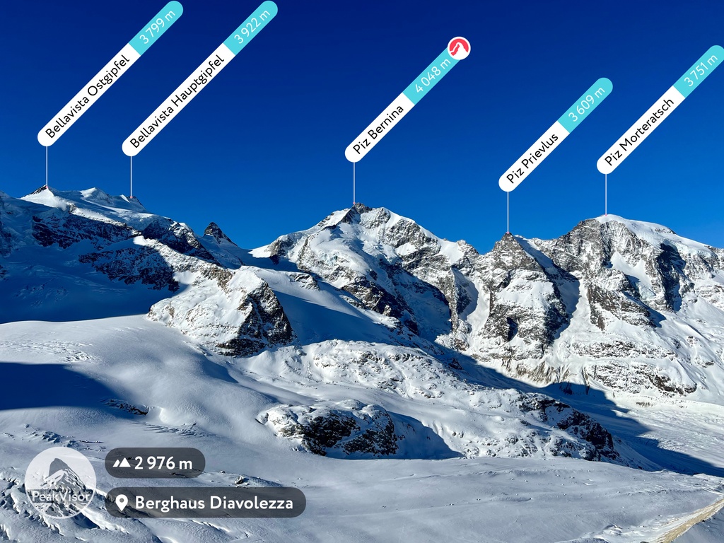
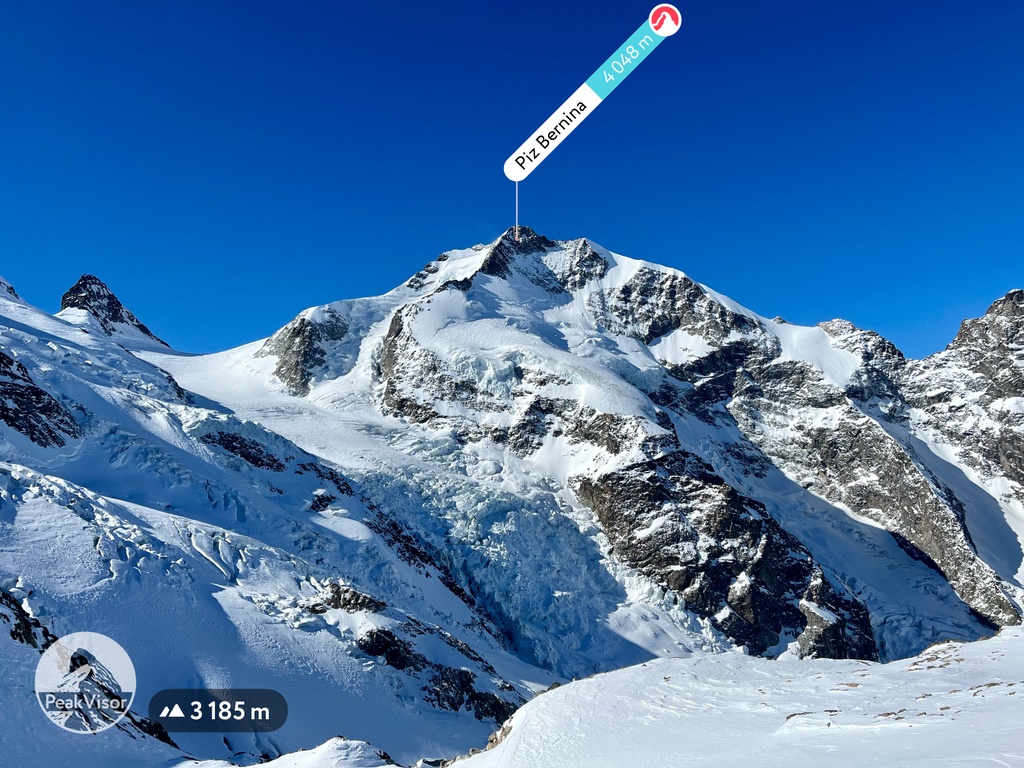
The Bernina Range is the main mountain range in the Eastern Alps located between Italy and Switzerland. The main feature of the range is Piz Bernina (4,048 m / 13,280 ft), its highest and the most prominent mountain and the only four-thousander in this part of the Alps with many glaciers. The range is also known thanks to the Bernina Pass (2,328 m / 7,638 ft), and the Bernina Express train going through it and other high mountain passes, part of the Rhaetian Railway UNESCO World Heritage Site. In total there are 221 named mountains in the Bernina Range.
The name of the mountain range comes from the name of its highest peak, Piz Bernina (4,048 m / 13,280 ft). The meaning of the word "Bernina" itself is not clear, but it has been universally used in the region since the Middle Ages. For example, it could be the surname, the place, and so on.
The range is also known as Bernina Alps in English. The name in Italian is Alpi del Bernina or Massiccio del Bernina (its main sub-range), in German: Bernina-Alpen or Berninagruppe.
The Bernina Range is a relatively small mountain range located in the Eastern Alps, on the border between southeastern Switzerland and northern Italy. In the former, it belongs to the municipalities of Maloja (with capital Samedan) and Bernina (Poschiavo) in the canton of Grisons (Graubünden), one of the 26 large regions of Switzerland, in the latter to the province of Sondrio in the Lombardy region, one of the 20 Italian regions.
In addition to the mountain peaks and glaciers, which I will describe below, the main features of the Bernina landscape are valleys, passes, and lakes, as well as one man-made feature, the Rhaetian Railway—UNESCO World Heritage Site.
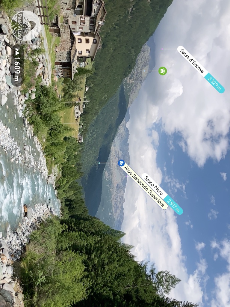
The mountain range is bounded on the west by the vast Valmalenco Valley, as well as by the small Val Fex, a side-valley of the larger Engadine Valley (Oberengadin), which forms the northern boundaries of the range. There is also another inner valley on the north—Roseg Valley (Val Roseg).
To the east, the range is bordered by two large valleys: Val Bernina and Val Poschiavo.
The southern borders are formed by the huge Valtellina, from which the Val Fontana Valley also branches inside the range.
In total, there are 8 large and small valleys around and inside it.
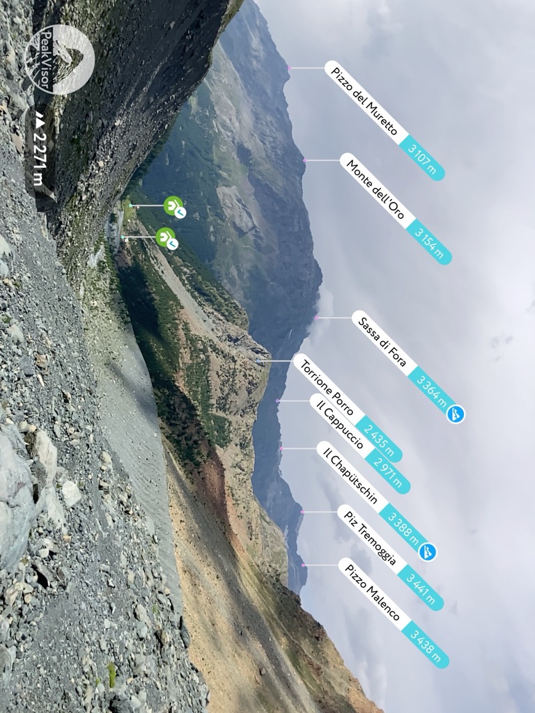
No doubt, the namesake Bernina Pass (2,328 m / 7,638 ft) is the most famous pass of the range. It has its name because it lies just a few kilometers (miles) east of Piz Bernina. However, although it is the most famous, it is not the only one and the highest. There are over a dozen passes, both road such as Bernina itself or Maloja Pass (1,809 m / 5,935 ft) and high mountain passes, which you can cross only by foot, including, Muretto Pass (2,557 m / 8,389 ft) or Tremoggia Pass (3,021 m / 9,912 ft).
Read more about hiking from one country to another in a guide to Switzerland, there are about 10 different points to do it.
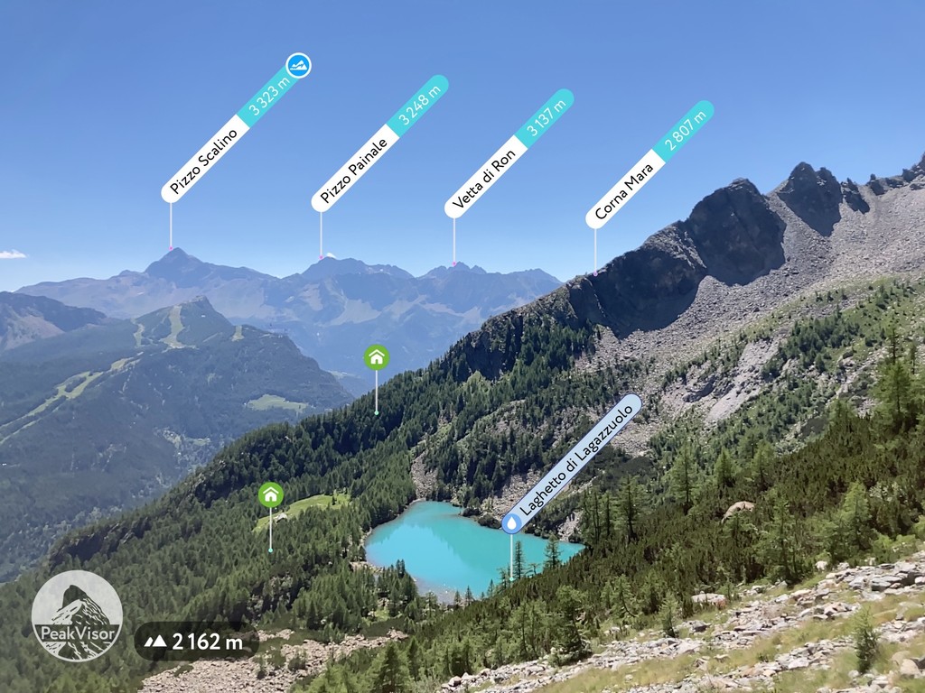
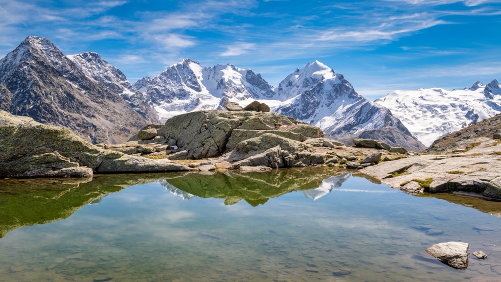
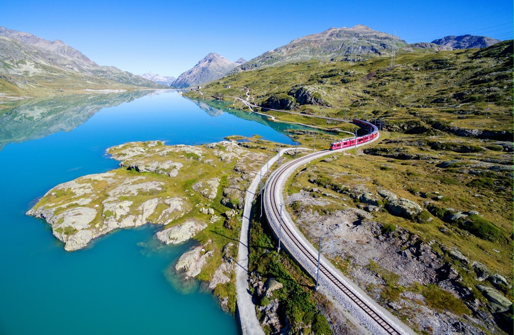
There are many picturesque lakes in the Bernina Range, ranging from the high mountain lake as Lago Bianco ("White Lake") and Lej Nair (“Black Lake”), and Lej Pitschen on Bernina Pass, which you will see from the Bernina Express train to the larger bodies of water on the borders of the range: Lago di Poschiavo, Sils Lake, Silvaplana Lake, Lej da Vadret, Palü Lake, and others.
There are also several artificial lakes created by the construction of hydroelectric power plants, such as Bacino di Campo Moro and Bacino di Alpe Gera near the Fellaria Glacier, probably the most famous in the range.
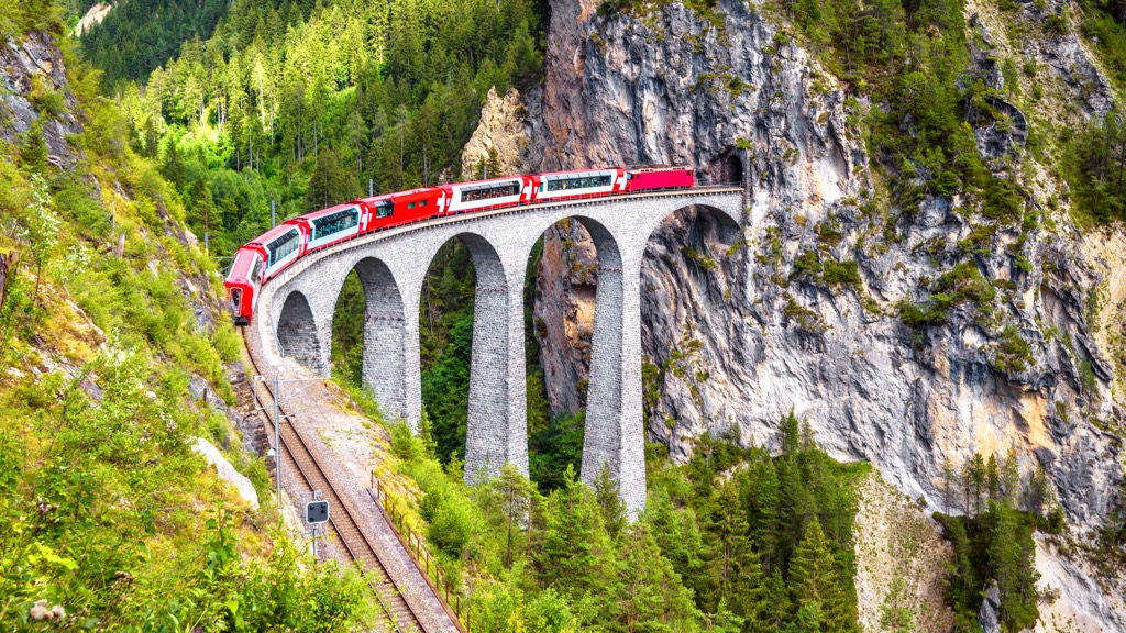
The Swiss Bernina Railway, opened in 1904 as part of the larger Rhaetian Railway, is the main man-made attraction of the range, which is a UNESCO World Heritage Site under the precise name of Rhaetian Railway in the Albula / Bernina Landscapes. It is the highest railway crossing in Europe with 2,253 m (7,392 ft)—just above Bernina Pass, but only the third in Switzerland after Gornergrat (3,090 m / 10,138 ft) and Jungfrau (3,454 m / 11,332 ft), which are dead-end railways.
In the words of UNESCO itself, the reason for including the road in the list is as follows: “It constitutes an outstanding technical, architectural and environmental ensemble and embodies architectural and civil engineering achievements, in harmony with the landscapes through which they pass.” So I agree. It is just outstanding.
The road passes through Bernina Pass and connects the famous spa resort of St. Moritz in the Engadin valley with the Italian town of Tirano in Valtellina via the Val Poschiavo.
There is the world-famous Bernina Express train with panoramic windows from which you can see the scenery, which goes by the road three times a day in summer and winter. You can start either in Switzerland or in Italy. It’s also interesting that in Tirano, the train runs right through its streets. If it were not for the iconic red color of its carriages, it could be mistaken for a streetcar.
The travel time on the described route is only 2 hours and 30 minutes, but you can continue through Switzerland to enjoy other scenic routes by transferring to other local railroads.
The ticket price for Bernina Express in 2022 is 58 euros per person in 2nd class, which consists of two parts: 32 euros for the ticket itself and 26 euros for the obligatory reservation of a seat in the carriage. The cost of a 1st class ticket is about 80–100 euros. Tickets can be purchased on the railroad’s website at the link above.
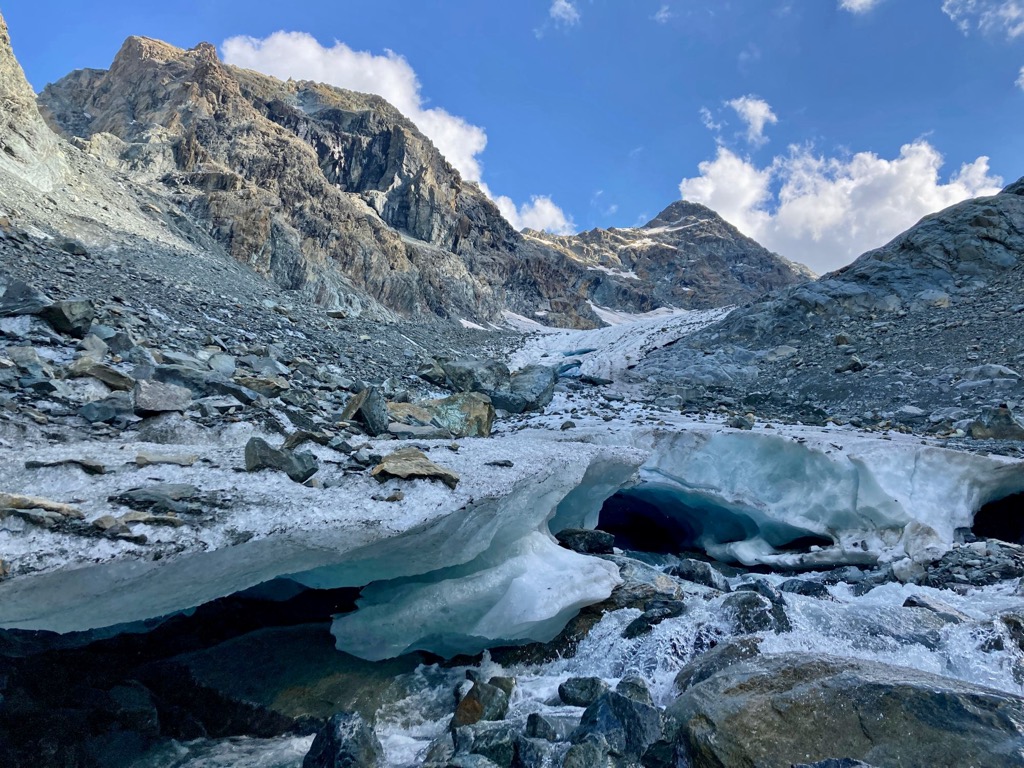
The Bernina Range is composed mainly of granite, which does not differ much from the other ranges in the Alps. However, there are some important exceptions. For example, Piz Bernina, consists of diorites and gabbros. Anyway, it is much more interesting to look at it from the point of view of glaciology, the science of natural ice in all its varieties, rather than that of standard geology.
Because the range is located in an area with the highest mountains in the Eastern Alps, about a hundred of its 221 named mountains are above 3,000 m (9,842 ft) and covered by glaciers, starting from the same Bernina peak, which is just surrounded by them.
The largest glacier in the Bernina Range is Morteratsch Glacier. Its area is 5.3 sq km (2 sq mi). It belongs to the mountain of the same name, Piz Morteratsch (3,751 m / 12,306 ft). Its length is about 5.8 km (2.2 mi) according to 2016 measurements, but it was 7 km (4.3 mi) in 1973.
Like all other glaciers in the Alps and around the world, it melts at an incredible rate. With this in mind, be extremely careful when hiking on and around glaciers, and better yet, refrain from doing so in future years. To big regret, tragedies on the Marmolada Glacier in the Dolomites in July 2022 show a real danger to life. The same applies to winter recreation.
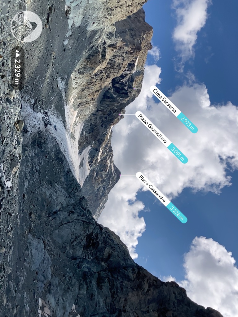
The Bernina's other largest and most famous glaciers are located in non-sequential proximity to Morteratsch. These include five other examples, which belongs mostly to the mountains of the same names:
It is important to note also that all of the above-mentioned glaciers are located on the Swiss side of the range. They can be reached by hiking and mountaineering. The most famous and relatively easily accessible glacier on the Italian side is the Fellaria Glacier on the Sasso Rosso (3,488 m / 11,443 ft). It can be accessed on foot from Valmalenco.
In total, there are 50 glaciers in the Bernina Range, including smaller ones with a total area of 61 sq km (23.5 sq mi). Together with the neighboring Val Bregaglia Range with 42 glaciers with an area of 20 sq km (7.7 sq mi), they form a glacial zone of 92 glaciers with a total area of 80 sq km (30.8 sq mi).
The Bernina Range is one of the 68 main Alpine mountain ranges in the German-Austrian Alpine Club (AVE) classification. To be precise, it is number 66.
The range borders the Oberhalbstein Alps, the Albula Alps, and the Livigno Alps to the north, the Sobretta-Gavia Group to the east, and the Bergamasque Alps to the south. There are Western Alps at the western borders of the range
According to the second most common classification of the Alps, the Italian SOIUSA, which covers the whole mountain system, the Bernina Range is part of the Western Rhaetian Alps in the Central Eastern Alps in the Eastern Alps.
As you can see, the classifications are different, but more or less the same. From here, in SOIUSA the Bernina is bordered by approximately the same other ranges.
According to the same classification, the Bernina is divided into two large sub-ranges: the Bernina Range proper (Catena Bernina-Scalino: Massiccio del Bernina and Gruppo dello Scalino) and the neighboring Val Bregaglia Range (Monti della Val Bregaglia), which is part of it but is also identified as a separate one in a broader sense.
As for the most important individual mountains that make up the backbone of the range, I have already mentioned them about glaciers. However, Piz Bernina deserves more attention. I will also note that it is the only four-thousander in the Eastern Alps, including its second peak, La Spedla (4,018 m / 13,182 ft), also known as the “shoulder”. It is also the fifth-most prominent peak in the Alps (2,231 m / 7,319 ft).
The mountain is so high that it can be seen far beyond its location in many other mountain ranges of the Alps to the south and north. For example, its edge can even be seen from my home valley of Imagna in the Bergamo Prealps, as I was able to confirm with PeakVisor when I pointed my phone camera at the mountain while in Laghetto del Pertús, neat the small pass of the same name, a place called the "panoramic balcony of Lombardy".
How fat is it from that place? The distance from the nearest village, Corna Imagna, to the Chiesa di Valmalenco in the valley of the same name is 121 km (75 mi) if you drive in an arc along the eastern shore of Como Lake. But of course, in a straight line, it is less, which you can also find out with the application.
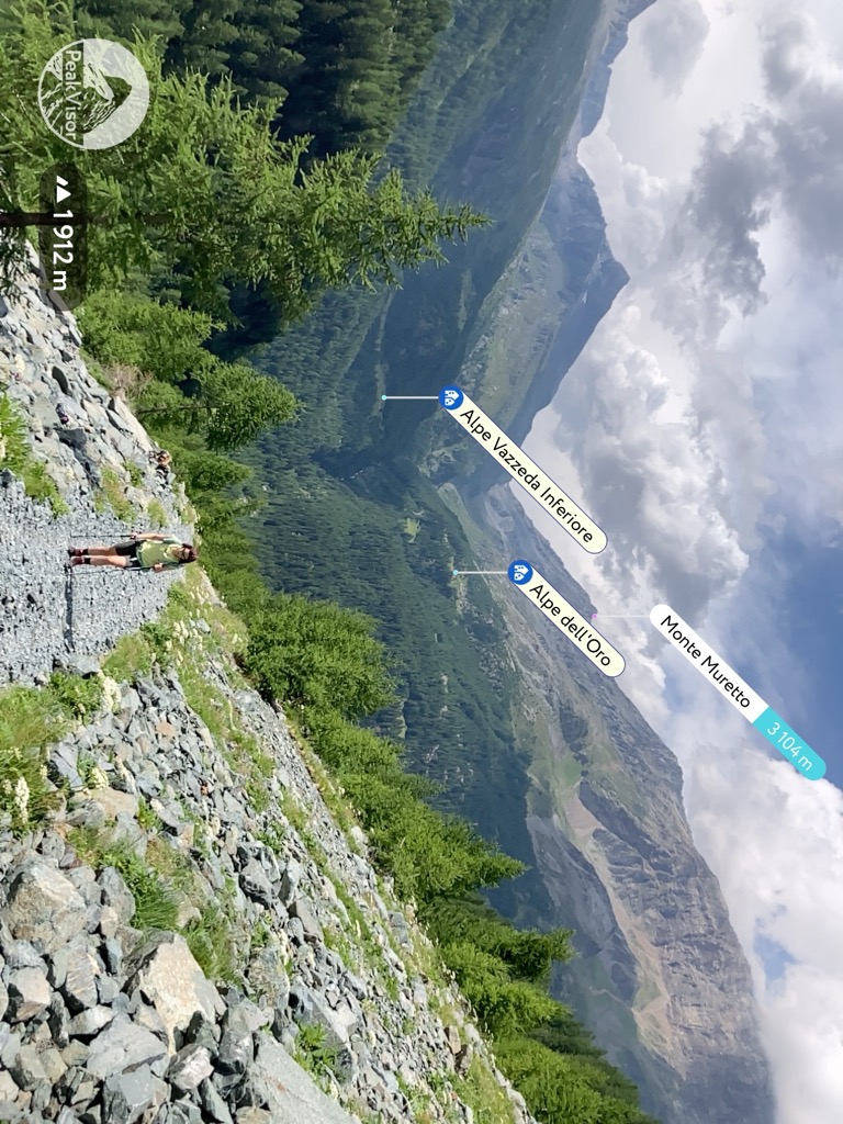
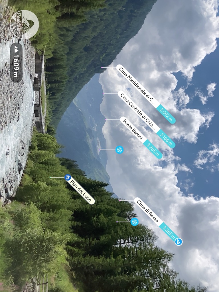
The main hiking areas of the Bernina Range are each of its aforementioned valleys without exception, making it an incredibly attractive destination for hikers. You can hike deep into the range from either Switzerland or Italy, or you can hike through the mountains following one of the long multi-day hut-to-hut trails.
Given that my experience hiking the range was from Valmalenco, I would recommend this particular valley to those who will be exploring Bernina from Italy. Among the three main short individual routes, I would note the following:
Throughout the valley, there is also the famous route called Alta Via della Valmalenco сovering the whole valley. The length of the whole route is 110 km (68 mi) in 8 stages, so about half goes through the Bernina Range.
The even longer Alta Via della Valtellina runs along the entire valley of the same name to the south of the range. The length of the route is 530 km (329 mi) in 25 stages.
As for natural parks, there are none on the territory of the Bernina Range. The nearest ones in Switzerland are Parc Ela and Swiss National Park, in Italy—Parco delle Orobie Valtellinesi as part of the Parco Regionale delle Orobie Bergamasche. The latter has a great route to Pizzo Meriggio (2,358 m / 7,736 ft), from the top of which you have a panoramic view from a distance of the whole Bernina Range.
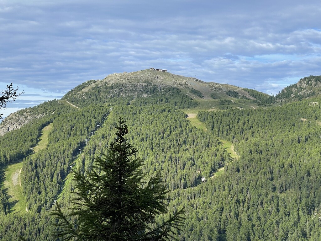
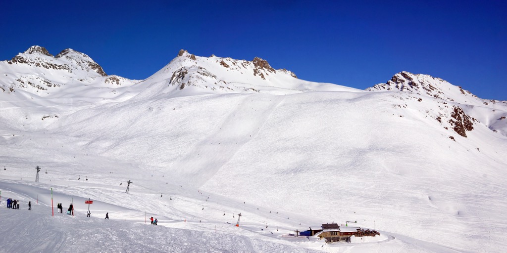
In winter, the Bernina Range is one of the best skiing and snowboarding areas in the whole Eastern Alps. On its territory there are 6 ski resorts, including both large and well-known, as well as small local, namely:
Find these and other resorts in the Alps with information on open and closed ski lifts and cable cars year-round at the World Mountain Lifts section of the PeakVisor site.
Before or after the hike, go to one of the official tourist offices in one of the towns within the mountain range for more information. In St. Moritz and Sondrio, two largest cities of the range in Switzerland and Italy, these are the following:
Consorzio Turistico Sondrio e Valmalenco
Terminale STPS, Via Tonale, 13, 23100, Sondrio, Italy
+39 0342 219246
St. Moritz Tourist Information
Via Maistra 12, 7500, St. Moritz, Switzerland
+41818373333
The official tourist sites of other main valleys in the range are also useful: Valtellina.it, Sondrioevalmalenco.it, Engadin.ch, and Valposchiavo.ch.
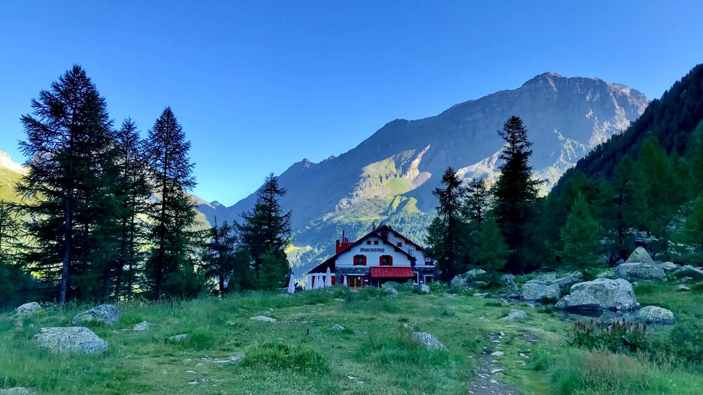
As in other parts of the Alpine mountain system, the main accommodation option in the Bernina Range is the mountain huts known here as rifugios (an Italian version of "refuge"). On the Swiss side of the range, given its main language, German, you can also see the words "hütte" or "chamanna" meaning the same.
So the main huts on the Italian side of the range are the following: rifugio Marco e Rosa, rifugio Carate Brianza, rifugio Marinelli Bombardieri, rifugio Roberto Bignami, and others. On the Swiss side: Bovalhütte, chamanna da Coaz, chamanna da Boval, chamanna da Tschierva, and others. But there are tens of them in each country.
If you have been to such huts before, you know how they work. If not, expect to spend the night in a shared or more rarely a private room with dinner and breakfast for about 50–100 euros per day. Showers are usually charged separately. The more popular the place, the more people there will be, whose numbers also increase on weekends and holidays.
As has become already clear, the largest cities and resorts of the Bernina Range are located on its northern and southern borders. In Switzerland, it is the world-famous SPA and ski resort St. Moritz, in Italy it is Sondrio, the largest city of the namesake province.
The main town in the Valmalenco Valley in the west of the range is the eponymous village of Chiesa di Valmalenco (The Church of Valmalenco). To the east is Poschiavo also in the valley of the same name. The Bernina Range is also accessible from Val Bregaglia via Chiavenna ("chiave"—key in Italian) at its entrance, which is connected by rail to Milan, running along the eastern shore of Como Lake.
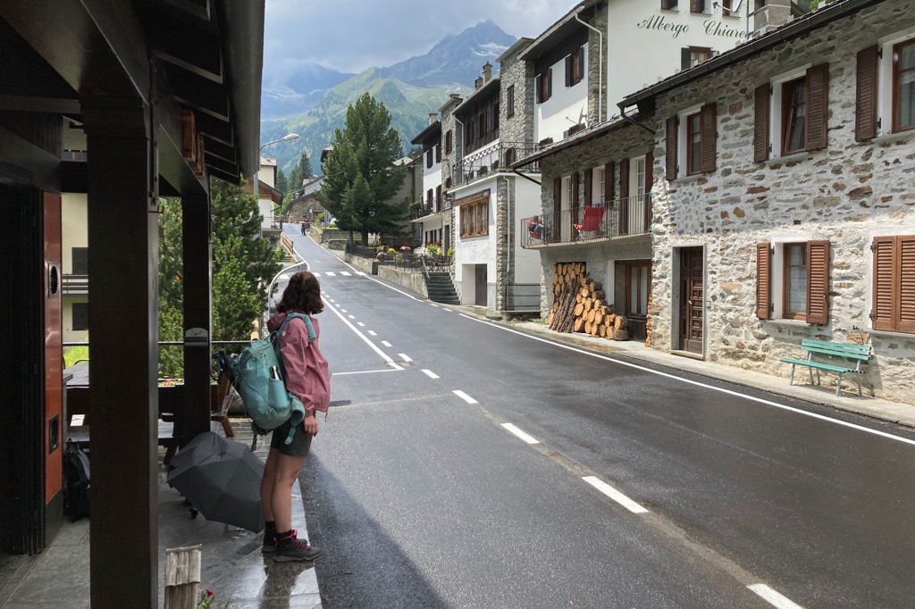
Each of these villages appears to be a typical Alpine settlement with characteristic architecture at its core mixed with classic Italian buildings to the south of the range. The most interesting thing, in my opinion, is to observe this very mixture rather than individual buildings, monuments and other sites, even if they are outstanding.
The official tourist websites of St. Moritz and Sondrio: Stmoritz.com and Visitasondrio.it.

Explore Bernina Range with the PeakVisor 3D Map and identify its summits.


top50
ultra
glacier
alps-4000ers
italy-ultras
switzerland-ultras
top50
ultra
glacier
alps-4000ers
italy-ultras
switzerland-ultras

