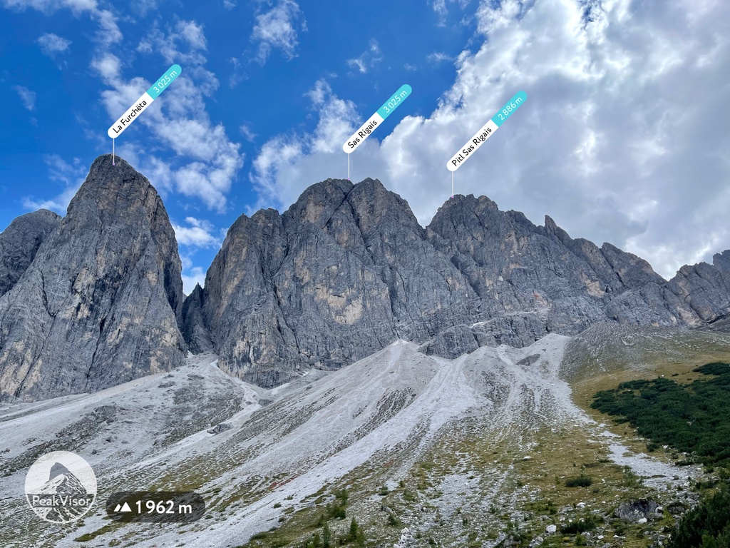
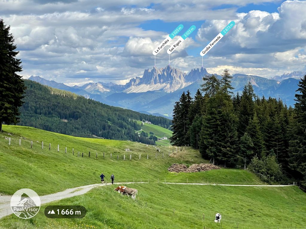
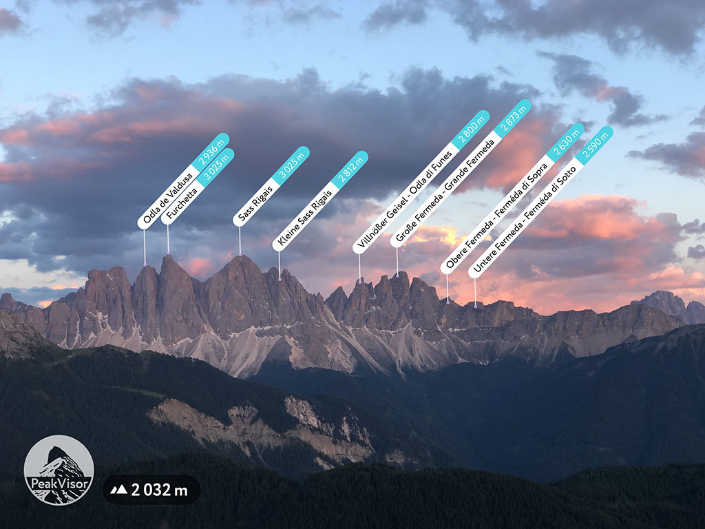
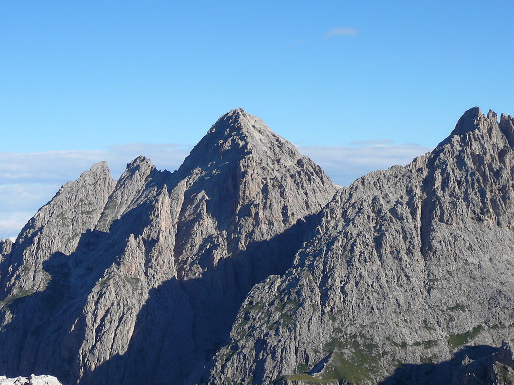
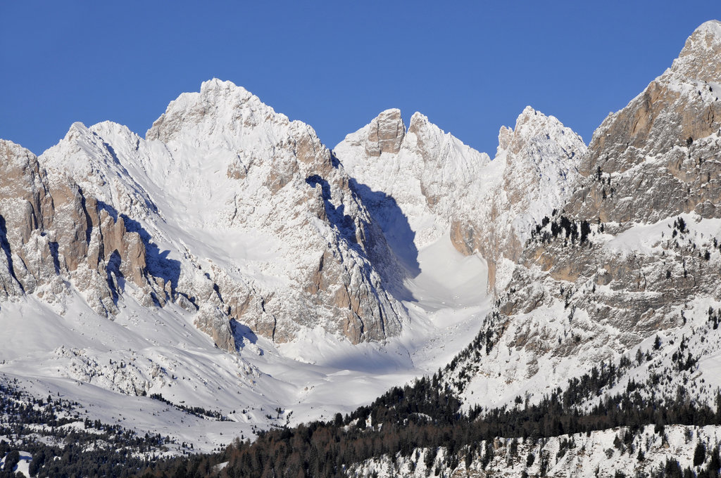
Sass Rigais (3,025 m) is a mountain of the northwestern Dolomites in South Tyrol, northern Italy. Along with the nearby Furchetta, which is exactly the same height and only 600m away, it is the highest peak of the Geisler group. Sass Rigais offers hikers one of few Dolomites' three-thousanders the entire crossing from one side of the mountain to the other. The Via ferrata Villnössersteig is categorized between a B and C difficulty and the trail Sass Rigais steig is rated C. A crucifix is located at the summit.
The nearest mountain hut is Glatsch Alm - Malga Glatsch located 1 991m/6 533ft undefined of the summit.
By elevation Sas Rigais is
# 46 out of 2113 in the Dolomites # 2 out of 39 in the Geislergruppe # 2 out of 82 in Parch Natural Pöz-Odles - Naturpark Puez-Geisler - Parco Naturale Puez-Odle # 21 out of 801 in the West Dolomites
By prominence Sas Rigais is
# 2 out of 39 in the Geislergruppe # 90 out of 2178 in South Tyrol # 3 out of 82 in Parch Natural Pöz-Odles - Naturpark Puez-Geisler - Parco Naturale Puez-Odle # 38 out of 801 in the West Dolomites
We use GPS information embedded into the photo when it is available.
3D mountains overlay
Adjust mountain panorama to perfectly match your photos because recorded by camera photo position might be imprecise.
Move tool
Rotate tool
Zoom
More customization
Choose which peak labels should make into the final photo and what photo title should be.
Next
Photo Location
Satellitte
Flat map
Relief map
Latitude
Longitude
Altitude
OR
Latitude
°'''
Longitude
°'''
Apply
Register Peak
Peak Name
Latitude
Longitude
Altitude
Register
Teleport
PeakVisor
This 3D model of Sagarmatha National Park in Nepal was made using the PeakVisor app topographic data. The mobile app features higher precision models worldwide, more topographic details, and works offline. Download PeakVisor maps today.
Download OBJ model
PeakVisor
The download should start shortly. If you find it useful please consider supporting the PeakVisor app.
PeakVisor for iOS and Android
Be a superhero of outdoor navigation with state-of-the-art 3D maps and mountain identification in the palm of your hand!