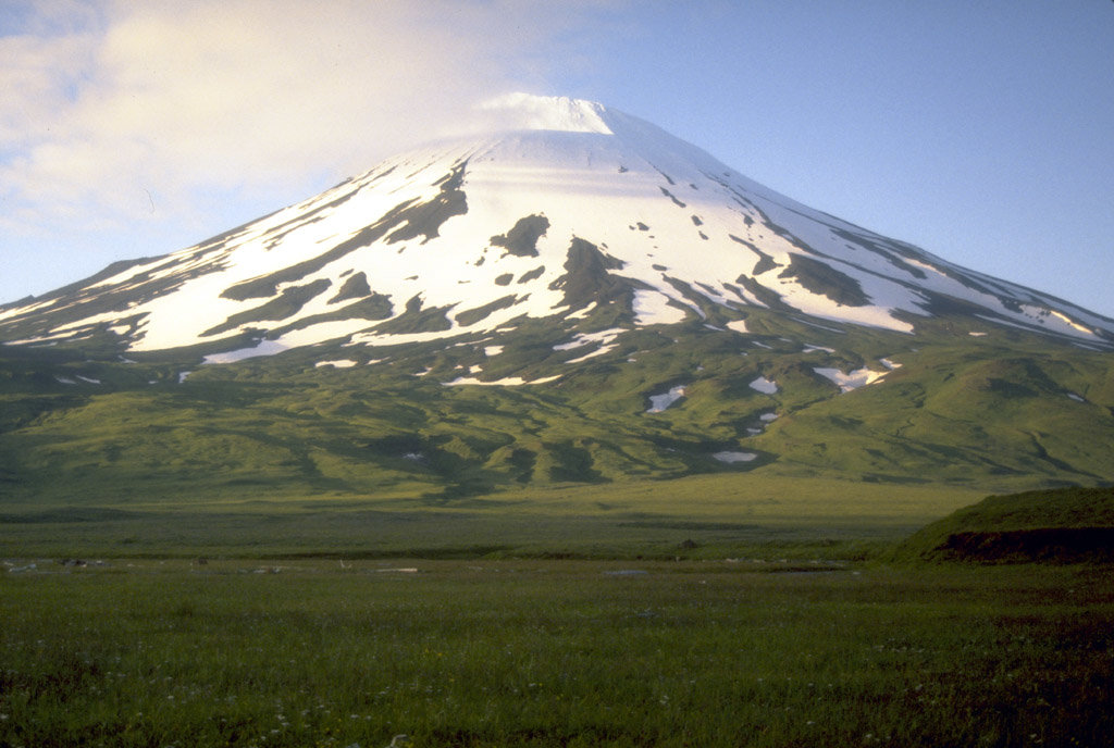
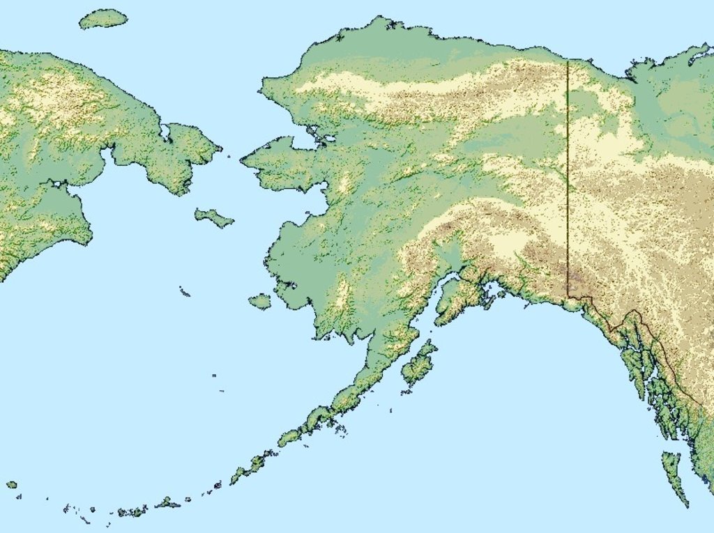
Mount Vsevidof ( or ) is a stratovolcano in the U.S. state of Alaska. Its summit is the highest point on Umnak Island, one of the eastern Aleutian Islands. Its symmetrical cone rises abruptly from its surroundings. Its most recent eruption was caused by an earthquake on March 9, 1957. The mountain erupted on March 11, 1957, and the eruption ended the next day.
Its name comes from Russian and means "is seen from everywhere".
By elevation Mount Vsevidof is
# 16 out of 297 in the Aleutian Range
By prominence Mount Vsevidof is
# 26 out of 3806 in Alaska # 46 out of 91437 in USA # 10 out of 1793 in Unorganized Borough # 5 out of 297 in the Aleutian Range
We use GPS information embedded into the photo when it is available.
3D mountains overlay
Adjust mountain panorama to perfectly match your photos because recorded by camera photo position might be imprecise.
Move tool
Rotate tool
Zoom
More customization
Choose which peak labels should make into the final photo and what photo title should be.
Next
Photo Location
Satellitte
Flat map
Relief map
Latitude
Longitude
Altitude
OR
Latitude
°'''
Longitude
°'''
Apply
Register Peak
Peak Name
Latitude
Longitude
Altitude
Register
Teleport
PeakVisor
This 3D model of Sagarmatha National Park in Nepal was made using the PeakVisor app topographic data. The mobile app features higher precision models worldwide, more topographic details, and works offline. Download PeakVisor maps today.
Download OBJ model
PeakVisor
The download should start shortly. If you find it useful please consider supporting the PeakVisor app.
PeakVisor for iOS and Android
Be a superhero of outdoor navigation with state-of-the-art 3D maps and mountain identification in the palm of your hand!