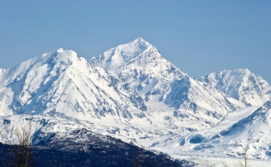
Mount Marcus Baker is the highest peak of the Chugach Mountains of Alaska. It is located approximately 75 miles (121 km) east of Anchorage. This peak is very prominent because of its proximity to tidewater and is only 12 miles (19 km) north of the calving face of Harvard Glacier. When ranked by topographic prominence, Mount Marcus Baker is one of the top 75 peaks in the world.
Mount Marcus Baker was originally called "Mount Saint Agnes"; according to Bradford Washburn, James W. Bagley of the USGS named it after his wife Agnes, adding the "Saint" in hopes of making the name stick. The name was later changed to honor a cartographer and geologist named Marcus Baker.
The peak was first climbed on June 19, 1938 by a party led by famed explorer Bradford Washburn; the climb took almost two months owing to weather delays. Today's standard route is the North Ridge. Despite being much lower in elevation than Denali, Marcus Baker is a similarly serious ascent, due to the remoteness of the peak and the resulting length of the approach and climb. Actually, a number of noted climbers have perished or sustained permanent injury in attempting to summit the peak as climbing conditions can change rapidly as storms arise. In early 1988, a State of Alaska Fish and Game biologist, 28-year-old Sylvia Jean Lane, succumbed to hypothermia as a two-day storm separated her from the two others in the climbing party attempting to dash to the top in a winter ascent.
By elevation Mount Marcus Baker is
# 49 out of 3806 in Alaska # 3 out of 205 in Matanuska-Susitna # 1 out of 575 in the Chugach Mountains # 11 out of 847 in the South-Central Alaska
By prominence Mount Marcus Baker is
# 6 out of 3806 in Alaska # 8 out of 91437 in USA # 1 out of 205 in Matanuska-Susitna # 1 out of 575 in the Chugach Mountains # 2 out of 847 in the South-Central Alaska
We use GPS information embedded into the photo when it is available.
3D mountains overlay
Adjust mountain panorama to perfectly match your photos because recorded by camera photo position might be imprecise.
Move tool
Rotate tool
Zoom
More customization
Choose which peak labels should make into the final photo and what photo title should be.
Next
Photo Location
Satellitte
Flat map
Relief map
Latitude
Longitude
Altitude
OR
Latitude
°'''
Longitude
°'''
Apply
Register Peak
Peak Name
Latitude
Longitude
Altitude
Register
Teleport
PeakVisor
This 3D model of Sagarmatha National Park in Nepal was made using the PeakVisor app topographic data. The mobile app features higher precision models worldwide, more topographic details, and works offline. Download PeakVisor maps today.
Download OBJ model
PeakVisor
The download should start shortly. If you find it useful please consider supporting the PeakVisor app.
PeakVisor for iOS and Android
Be a superhero of outdoor navigation with state-of-the-art 3D maps and mountain identification in the palm of your hand!