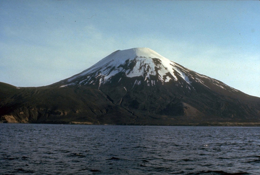
The undissected stratovolcano of Amukta volcano makes up most of nearly circular, 7.7-km-wide Amukta Island (Amuux̂tax̂ in Aleut). It is the westernmost of the Islands of Four Mountains chain. The cone, about 5.8 km in basal diameter and topped by a 0.4 km wide summit crater, appears on synthetic-aperture radar imagery to be built upon a 300+ meter high, east-west trending arcuate ridge. Extensions of that ridge on the southwest and east sides of the island indicate an older caldera approximately 6 km in diameter and open to the sea on the south side. No hot springs or fumaroles have been reported from Amukta. Sekora (1973, p. 29) reports the presence of a cinder cone near the northeastern shore of the island.
By elevation Mount Amukta is
# 71 out of 297 in the Aleutian Range
By prominence Mount Amukta is
# 79 out of 1793 in Unorganized Borough # 33 out of 297 in the Aleutian Range
We use GPS information embedded into the photo when it is available.
3D mountains overlay
Adjust mountain panorama to perfectly match your photos because recorded by camera photo position might be imprecise.
Move tool
Rotate tool
Zoom
More customization
Choose which peak labels should make into the final photo and what photo title should be.
Next
Photo Location
Satellitte
Flat map
Relief map
Latitude
Longitude
Altitude
OR
Latitude
°'''
Longitude
°'''
Apply
Register Peak
Peak Name
Latitude
Longitude
Altitude
Register
Teleport
PeakVisor
This 3D model of Sagarmatha National Park in Nepal was made using the PeakVisor app topographic data. The mobile app features higher precision models worldwide, more topographic details, and works offline. Download PeakVisor maps today.
Download OBJ model
PeakVisor
The download should start shortly. If you find it useful please consider supporting the PeakVisor app.
PeakVisor for iOS and Android
Be a superhero of outdoor navigation with state-of-the-art 3D maps and mountain identification in the palm of your hand!