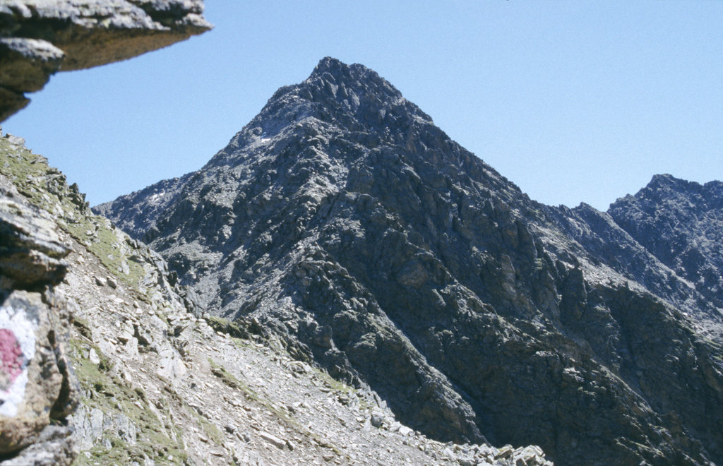
The Hochreichkopf (3,010 m (AA)) is a mountain in the northwestern part of the Stubai Alps in the Austrian state of Tyrol. Its broad summit lies between the Niederreichjoch and Hochreichjoch cols east of and above the Ötztal valley.
The easiest waymarked route runs from the Schweinfurter Hut to the east taking 3½ hours to get to the top via the Hochreichjoch col (2,912 m). Alternatively the peak may also be ascended from the south. This route was the one taken by the first climbers and runs from Kühtai over the Niederreichscharte to the Hochreichscharte col, where it meets the route coming from the east. For this variation about 4½ hours should be allowed. The crossing of the west flank of the summit between the Niederreichjoch and Hochreichjoch requires sure-footedness.
There's a trail leading to the summit.
By prominence Hochreichkopf is
# 13 out of 749 in the Stubai Alps # 31 out of 956 in Bezirk Imst # 40 out of 1937 in the Eastern Rhaetian Alps
We use GPS information embedded into the photo when it is available.
3D mountains overlay
Adjust mountain panorama to perfectly match your photos because recorded by camera photo position might be imprecise.
Move tool
Rotate tool
Zoom
More customization
Choose which peak labels should make into the final photo and what photo title should be.
Next
Photo Location
Satellitte
Flat map
Relief map
Latitude
Longitude
Altitude
OR
Latitude
°'''
Longitude
°'''
Apply
Register Peak
Peak Name
Latitude
Longitude
Altitude
Register
Teleport
PeakVisor
This 3D model of Sagarmatha National Park in Nepal was made using the PeakVisor app topographic data. The mobile app features higher precision models worldwide, more topographic details, and works offline. Download PeakVisor maps today.
Download OBJ model
PeakVisor
The download should start shortly. If you find it useful please consider supporting the PeakVisor app.
PeakVisor for iOS and Android
Be a superhero of outdoor navigation with state-of-the-art 3D maps and mountain identification in the palm of your hand!