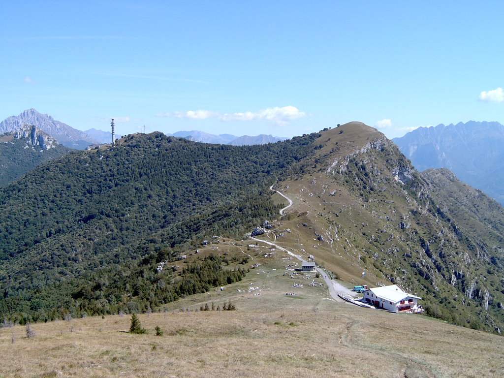
Monte Cornizzolo (Insubric Curnisciöö) is a mountain situated between the province of Como and the province of Lecco, Lombardy, northern Italy, particularly in the territory of the village of Canzo.
The peak reaches 1,241 metres in altitude. It houses the Maria Consigliere hut, open every Sunday throughout the year, at 1,100 metres above sea level. Mount Cornizzolo is well known amongst hang gliding and paragliding fans, because it has got a launch camp available almost all year.
An element of historical interest is the Abbey of San Pietro al Monte, an 11th-century building which is located in a little valley on the mountain. It's a holy mountain, seat of Pre-Celtic (e.g. the Coppelle: cult of Water), Celtic (e.g. the Cepp da l'Angua: cult of Anguana), Roman (e.g. the Fons Sacer: cult of Mars) and Christian worships. There are, at the foot of the mountain: the Shrine of Saint Miro, the Chapel of Saint Michael at Lazzaretto, the Chapel of Our Lady of the Seven Sorrows, La Santa, the Church of Saint Francis, the Church of the Saints Vitus and Modest, the Monastery of Saint Calocero, the Church of Saint Nazarus, the Church of Saint Andrew at Isella, the Pilgrims' House, the Church of Saint Steven, the Chapel of Our Lady of Caravaggio, the Monastery of Barnabite Fathers, the Church of Saint Lorence, the Shrine of Our Lady of the Snow, the Church of the Holy Spirit, the Church of Saint Antony, the Church of Saint Martin, the Church of Saint Thomas, and many other religious buildings.
The company Holcim is going to add another quarry, next to the Abbey, destroying the 500 "casotte" traditional construction.
We use GPS information embedded into the photo when it is available.
3D mountains overlay
Adjust mountain panorama to perfectly match your photos because recorded by camera photo position might be imprecise.
Move tool
Rotate tool
Zoom
More customization
Choose which peak labels should make into the final photo and what photo title should be.
Next
Photo Location
Satellitte
Flat map
Relief map
Latitude
Longitude
Altitude
OR
Latitude
°'''
Longitude
°'''
Apply
Register Peak
Peak Name
Latitude
Longitude
Altitude
Register
Teleport
PeakVisor
This 3D model of Sagarmatha National Park in Nepal was made using the PeakVisor app topographic data. The mobile app features higher precision models worldwide, more topographic details, and works offline. Download PeakVisor maps today.
Download OBJ model
PeakVisor
The download should start shortly. If you find it useful please consider supporting the PeakVisor app.
PeakVisor for iOS and Android
Be a superhero of outdoor navigation with state-of-the-art 3D maps and mountain identification in the palm of your hand!