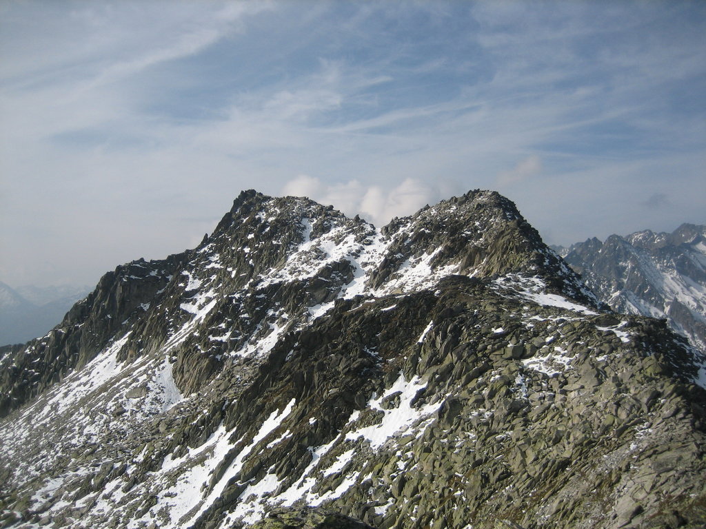
The Chrüzlistock is a mountain of the Glarus Alps, located north of Sedrun on the border between the Swiss canton of Graubünden and Uri. The southern unnamed summit has an elevation of 2,717 metres (8,914 ft) and the northern summit, which is the named peak and is located on the cantonal border, has an elevation of 2,709 metres (8,888 ft).
It derives its name from the historic pass at its northeastern hillside, the Chrüzlipass.
The Chrüzlistock is, along with Piz Vatgira and Pizzo dell'Uomo, one of the main peaks traversed by the Gotthard Base Tunnel. The tunnel runs below the summit Chrüzlistock, or more precisely, just east of it.
The nearest mountain hut is Schutzhütte Val Milar located 1 463m/4 801ft SW of the summit.
By prominence Chrüzlistock is
# 46 out of 812 in the Glarus Alps # 43 out of 594 in Uri # 47 out of 412 in Surselva
We use GPS information embedded into the photo when it is available.
3D mountains overlay
Adjust mountain panorama to perfectly match your photos because recorded by camera photo position might be imprecise.
Move tool
Rotate tool
Zoom
More customization
Choose which peak labels should make into the final photo and what photo title should be.
Next
Photo Location
Satellitte
Flat map
Relief map
Latitude
Longitude
Altitude
OR
Latitude
°'''
Longitude
°'''
Apply
Register Peak
Peak Name
Latitude
Longitude
Altitude
Register
Teleport
PeakVisor
This 3D model of Sagarmatha National Park in Nepal was made using the PeakVisor app topographic data. The mobile app features higher precision models worldwide, more topographic details, and works offline. Download PeakVisor maps today.
Download OBJ model
PeakVisor
The download should start shortly. If you find it useful please consider supporting the PeakVisor app.
PeakVisor for iOS and Android
Be a superhero of outdoor navigation with state-of-the-art 3D maps and mountain identification in the palm of your hand!