Burroughs Mountain is on the northeast slope of Mount Rainier above Glacier Basin. It was named for John Burroughs, the naturalist, who visited the mountain several times. The mountain was first called John Burroughs Mountain. Burroughs was born near Roxbury, New York, in April 1837, and died in 1931. He wrote extensively about his travels and was associated with the conservation movement. He became a well known "character" and is best remembered for his "Nature Essay."
Burroughs Mountain is a high ridge formed from an ancient lava flow. Its three summit plateaus get progressively higher. The mountain, located within Mount Rainier National Park, is notable for alpine tundra, with plants typically seen at much higher latitudes. The tundra ground cover hugs the barren rocky plateau and has a short growing season because snow covers the ridge for much of the year in the harsh alpine climate. The unique fragile alpine tundra can be easily destroyed by people walking off the established trail.
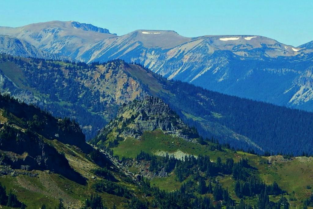
The mountain is a popular hiking destination with grand close-up views of the Emmons Glacier, Winthrop Glacier, Inter Glacier, Fryingpan Glacier, Little Tahoma Peak, and views in all directions because most of the trail is above tree line. The trail starts at the Sunrise Historic District and loops up to First Burroughs Mountain (elevation 7160 feet) and Second Burroughs Mountain (elevation 7402 feet). Third Burroughs Mountain (7828 feet) is off-trail and about another mile beyond Second Burroughs. The loop trail is about 6.2 miles and part of this loop trail includes a short section of the Wonderland Trail. Access is limited by snow closing the Sunrise Road much of the year, and even more by ice blocking the trail above Frozen Lake. July, August, and September are the months when the Sunrise Road is seasonally open for vehicle traffic.
There's a hiking trail (T1) called Burroughs Mountain Trail leading to the summit. 3rd Burroughs Mountain is one of the 2 peaks along the Burroughs Mountain Trail.
By elevation 3rd Burroughs Mountain is
# 35 out of 286 in Pierce County # 35 out of 160 in Mount Rainier National Park
By prominence 3rd Burroughs Mountain is
# 55 out of 286 in Pierce County # 40 out of 160 in Mount Rainier National Park
We use GPS information embedded into the photo when it is available.
3D mountains overlay
Adjust mountain panorama to perfectly match your photos because recorded by camera photo position might be imprecise.
Move tool
Rotate tool
Zoom
More customization
Choose which peak labels should make into the final photo and what photo title should be.
Next
Photo Location
Satellitte
Flat map
Relief map
Latitude
Longitude
Altitude
OR
Latitude
°'''
Longitude
°'''
Apply
Register Peak
Peak Name
Latitude
Longitude
Altitude
Register
Teleport
PeakVisor
This 3D model of Sagarmatha National Park in Nepal was made using the PeakVisor app topographic data. The mobile app features higher precision models worldwide, more topographic details, and works offline. Download PeakVisor maps today.
Download OBJ model
PeakVisor
The download should start shortly. If you find it useful please consider supporting the PeakVisor app.
PeakVisor for iOS and Android
Be a superhero of outdoor navigation with state-of-the-art 3D maps and mountain identification in the palm of your hand!