What can be more crucial for the success of your outdoor adventures than finding a convenient trailhead? Oftentimes, a mistakenly chosen trailhead or being forced to use another parking lot at the last minute causes us huge problems. In order to fight these inconveniences and further enrich the hiking experience of the PeakVisor users, we introduce the “Trailhead Finder” feature. Now, for every mountain, lake, viewpoint we will show nearby parking lots and cable car stations so that nothing can spoil your trip.
Alex Honnold on a16z podcast on Human Performance said that the journey is more important than the destination and we can’t agree more. A summit panorama might be a highlight of an adventure but the true gem is the journey itself. Let's put it another way - you can enjoy one summit many times taking a new route! Trailhead Finder will help you find a perfect alternative to the route you have already completed.
Monte Zerbion is a prominent mountain overlooking the eastern end of the Aosta Valley featuring a perfect 360 view covering almost the entire valley with such alpine celebrities as Mont Blanc, Matterhorn, and the Monte Rosa massif. While there are only two walkable ridges reaching the summit, the trailheads to reach those ridges are located in three valleys. Choosing the right starting point might be a tough call. In fact, I succeeded only on the second try. On the first go, I turned around shortly after reaching the northern ridge due to adverse weather conditions and being way too late already to finish the trail.
If only I had PeakVisor back then, I would have known the estimated duration, the elevation gain, the distance for my itinerary. I would have even known that there’s another parking area in another valley which is much closer to the summit! No regrets though, this failure inspired our team to work out a new feature.
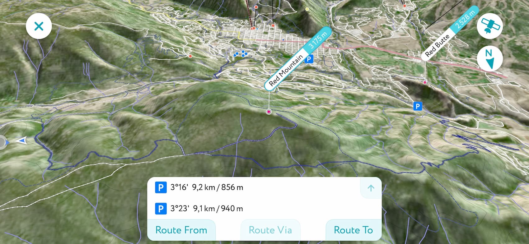
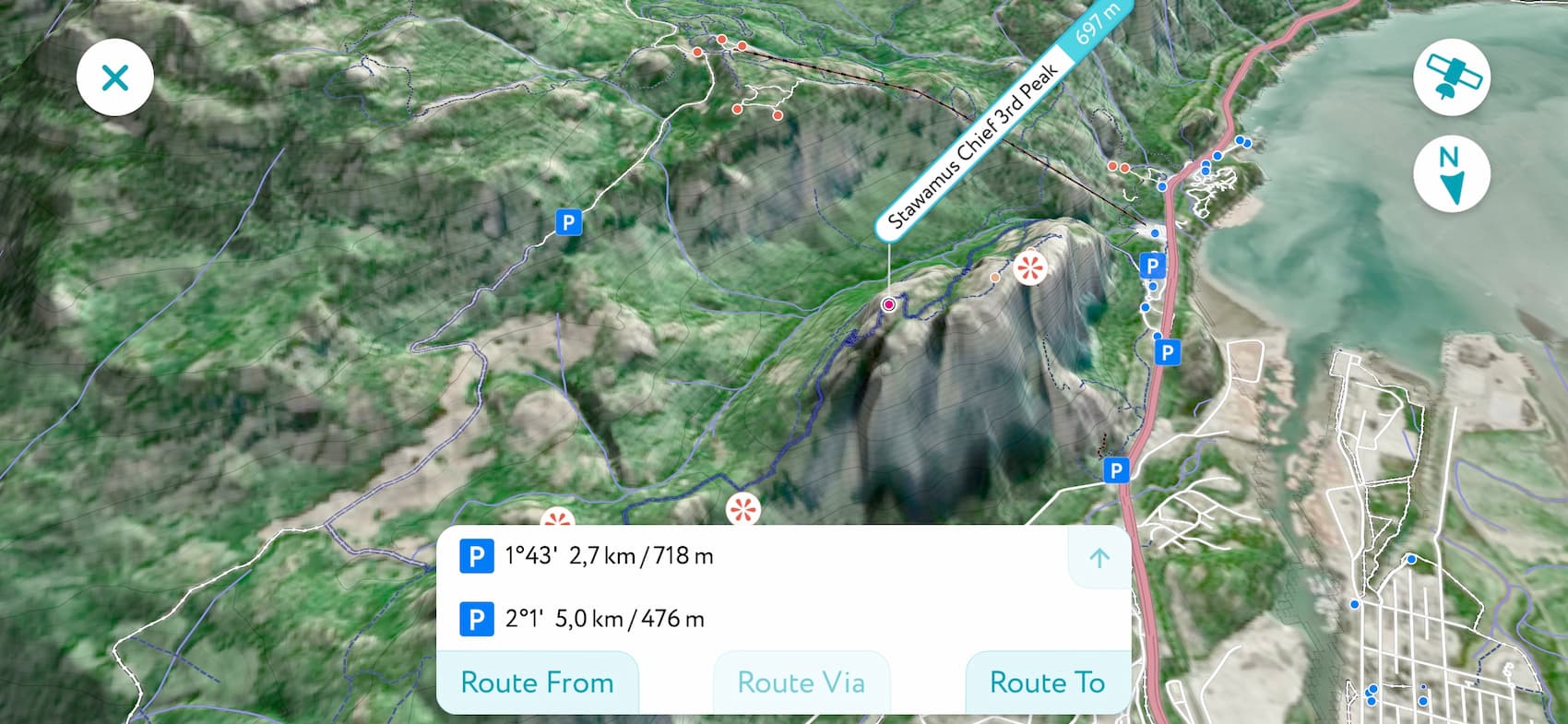
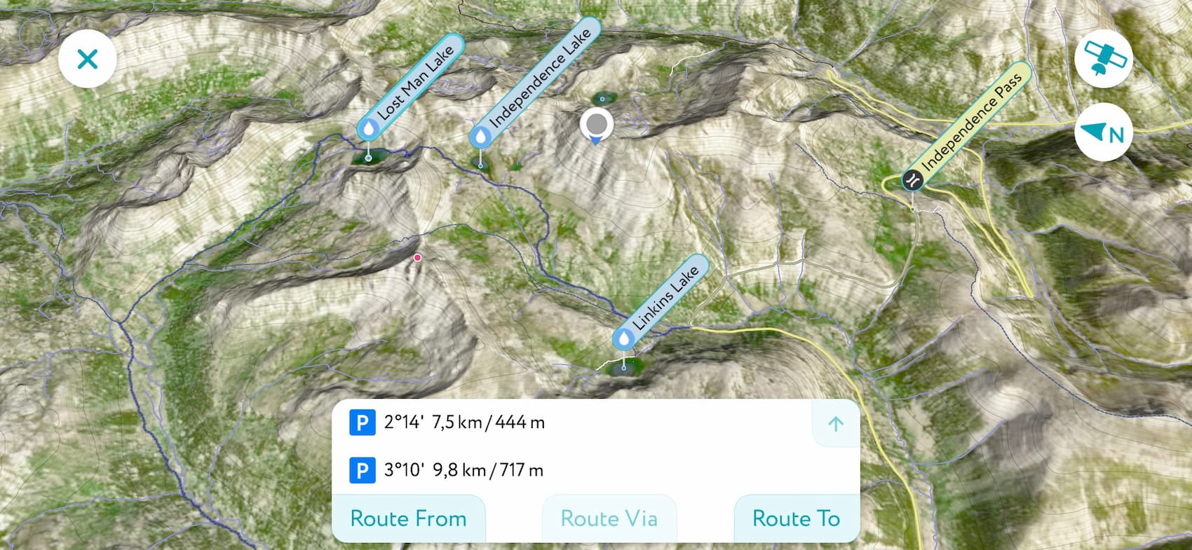
In order to see trailhead options in the app, just tap on the Directions button of any object on the map like in the screenshot below:
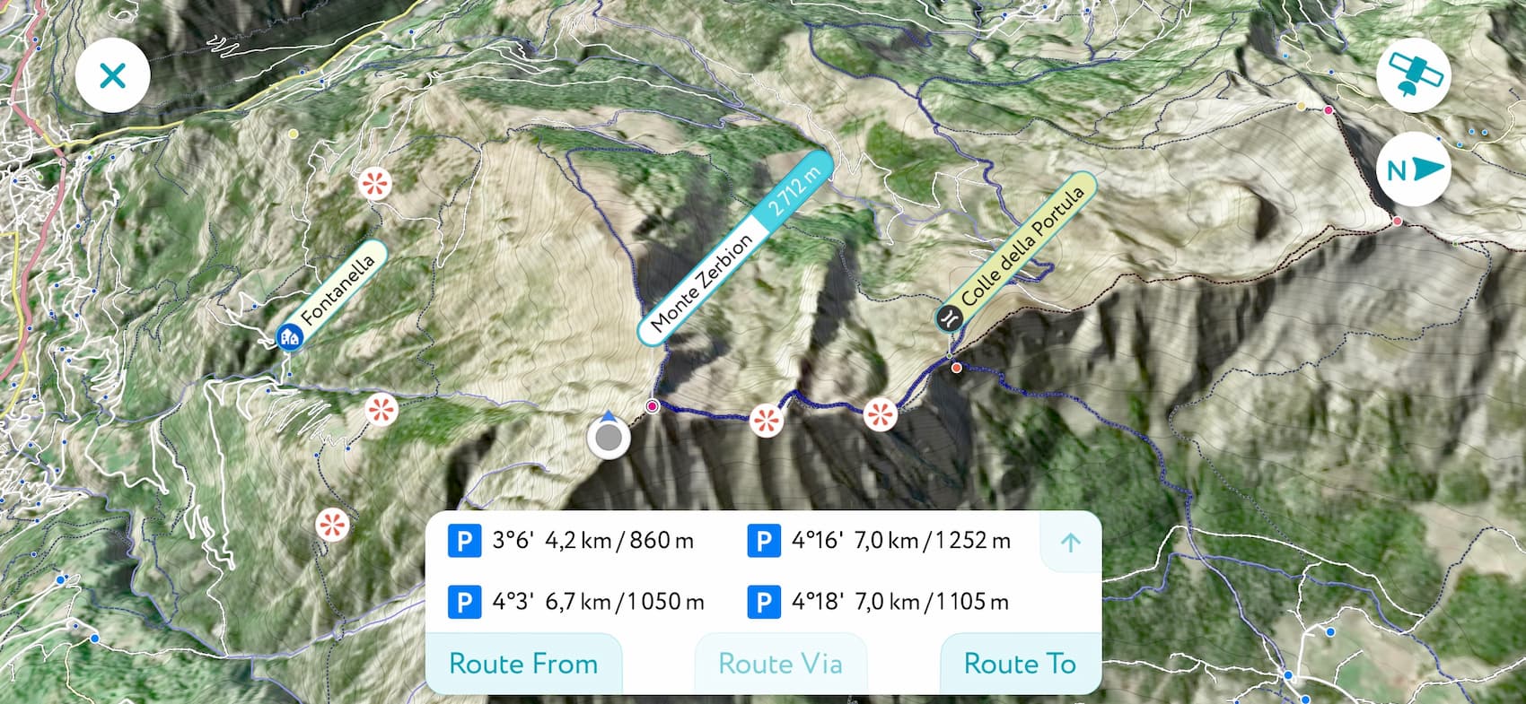
Here the app shows 4 major trailhead options for Monte Zerbion, they all start from parking areas (there is no particular cable car nearby). You can quickly see all of them in the 3D Map, as well as their timing, distance, and elevation gain.
Try the Trailhead Finder to plan your next adventure and find the best route. PeakVisor route finding skills will impress you!