
Oftentimes standing on the edge of a cliff, a mountaintop, or a panoramic viewpoint you wonder of the endless hiking possibilities around. Wouldn’t it be nice to have a superpower to visualise a path blended into the epic landscape? It might be the trail you are going to undertake later or the one you just did. The new version of PeakVisor using the Augmented Reality shows hiking trails not only in the 3D map but in your camera view as well.
In this article, we will walk you through the amazing landscapes and the trails of Engelberg and Melchsee-Frutt in Switzerland where we have tested hiking trails in Augmented Reality. Along the way we will show you how the trails look like in the PeakVisor app and how you could use this feature to better plan your hikes, to visualise your adventures, and to navigate outdoors.
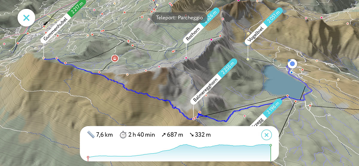
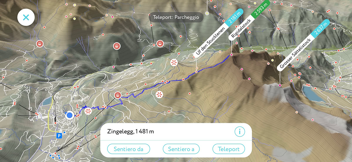
Trails routing capabilities were introduced several months ago and many hikers have been using them to map their hikes, plan adventures, and navigate. In order to make a route, open the 3D maps by double tapping on the compass, and choose a destination and a starting point. For example, the trail from the parking at Melchsee Frutt to Gummenhubel looks like this:
Melchsee Frutt is an attractive spot for hikers, as the road to the parking place is open until the snow settles in and the cable car begins operation. If you exit from the 3D map back to the camera view you’ll see the route in an augmented view. It is like highlighting the trail as it is seen from your current point of view.
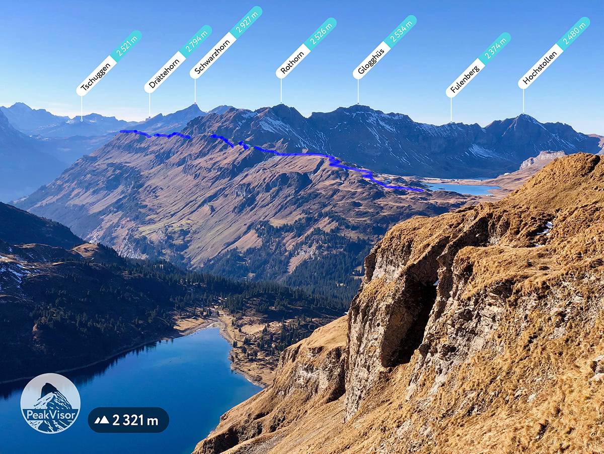
The final stretch of the trail towards Gummenhubel:
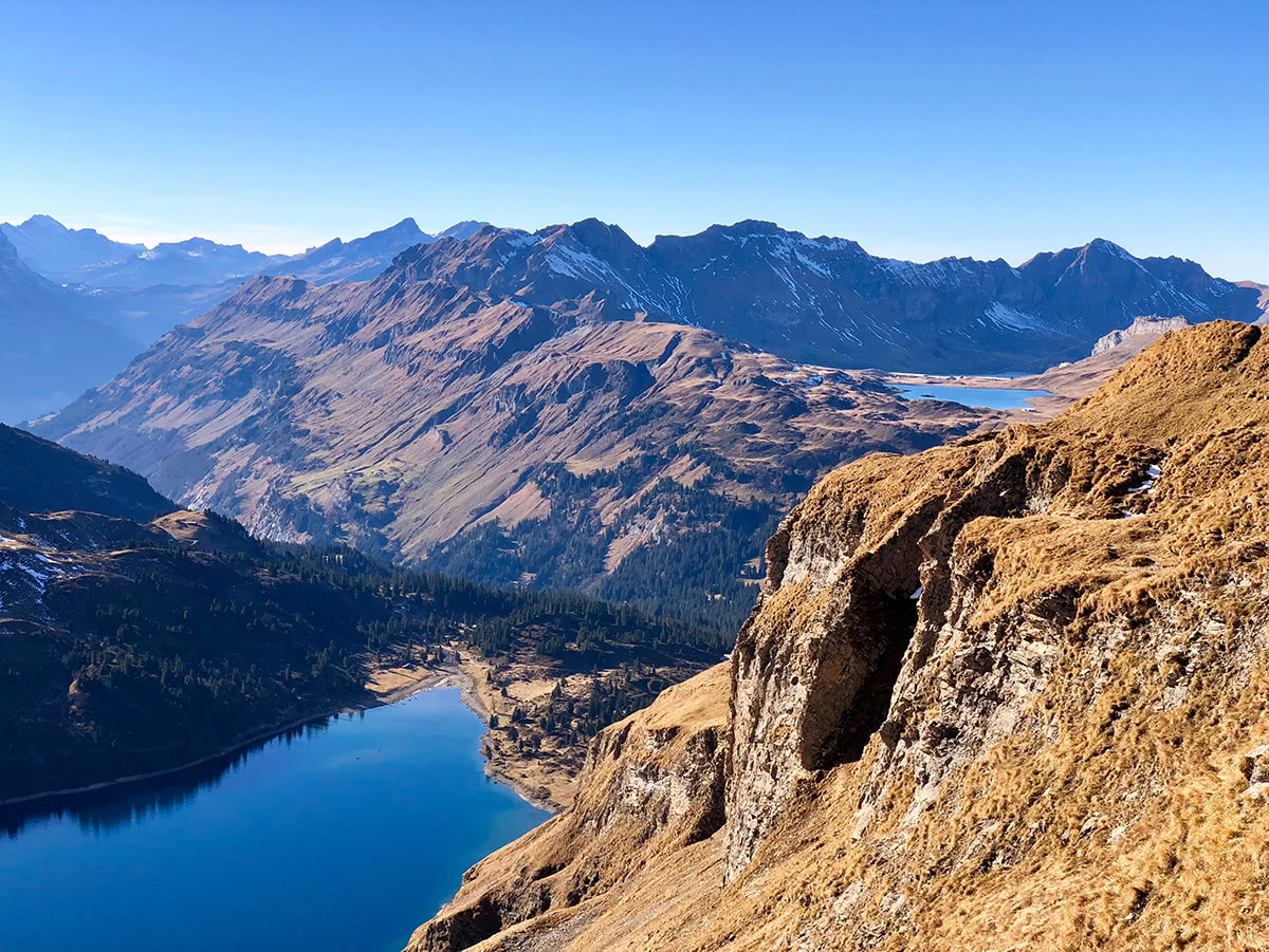
And this is how this trail looks like from Gummenhubel.
By visualising hiking trails in the camera view you can immediately understand where and how the route will take you!
We have run another test in Engelberg which features some cable cars open all year round. Having spent one day there, we were lucky to identify fantastic opportunities for future hikes. For example, just have a look at this epic hike from a parking lot in Engelberg to the summit of Rigidalstock.
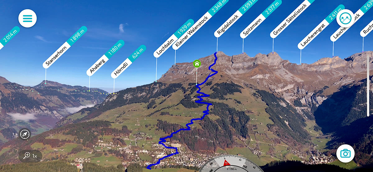
Try teleporting to the summit of Rigidalstock, the views are stunning.
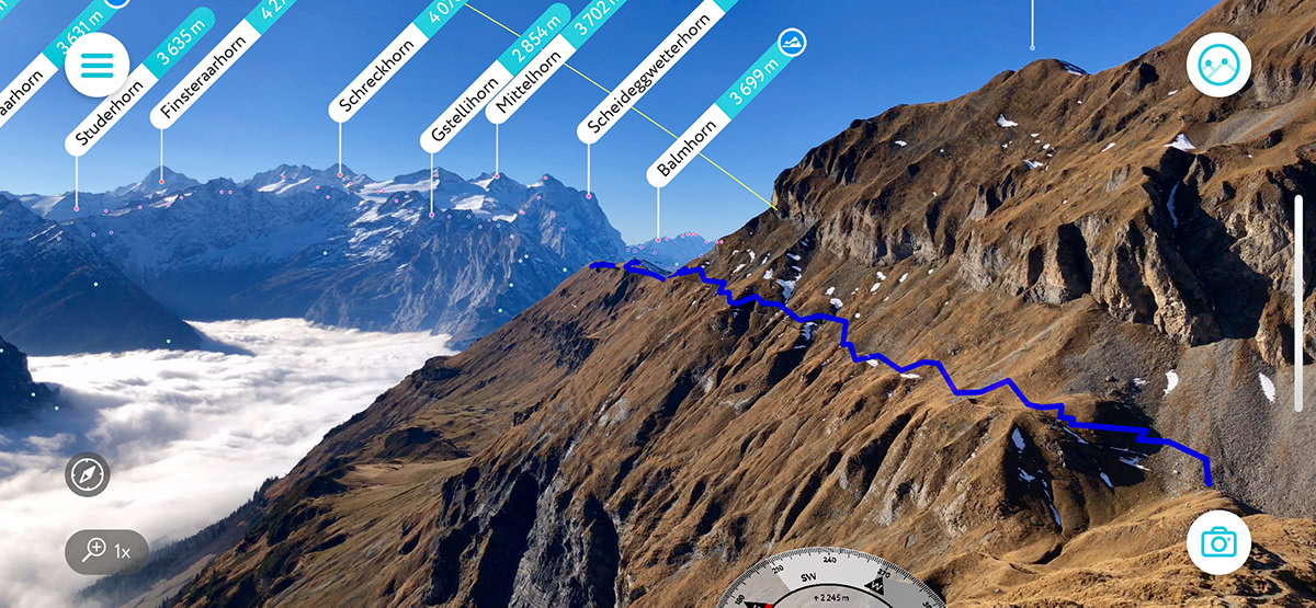
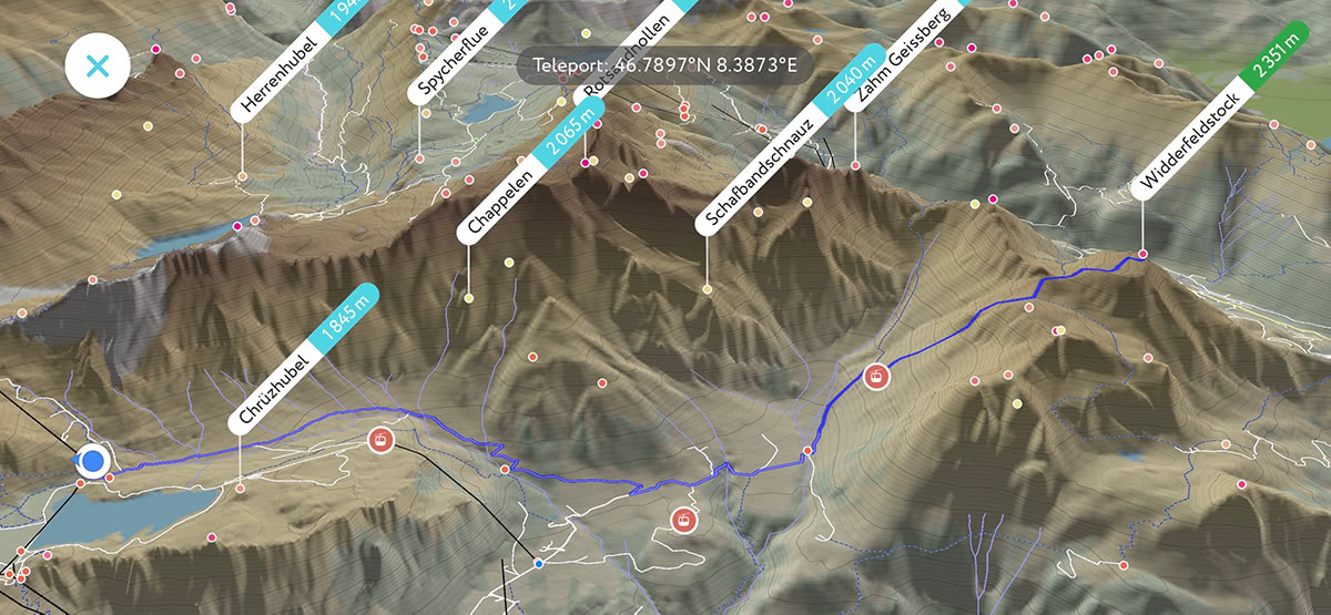
Here is another not less epic hiking opportunity. The trail from Truebsee to Widderfeldstock.
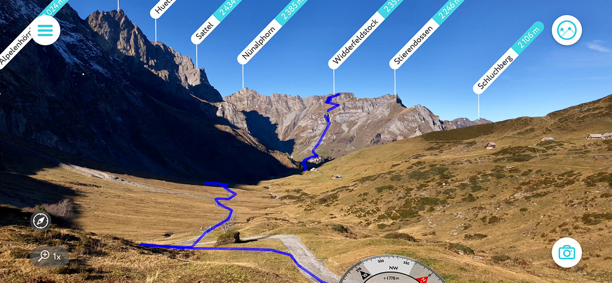
From this point of view, it is a great illustration that trails to the top often have downturns, the same way as the life does. To get to the top you might need to get to the bottom first.
This way trail visualisation helps you to find new hiking opportunities and answers the question what that trail over there is. Also, it might be especially rewarding to look at the photo of the trail before and after the hike!
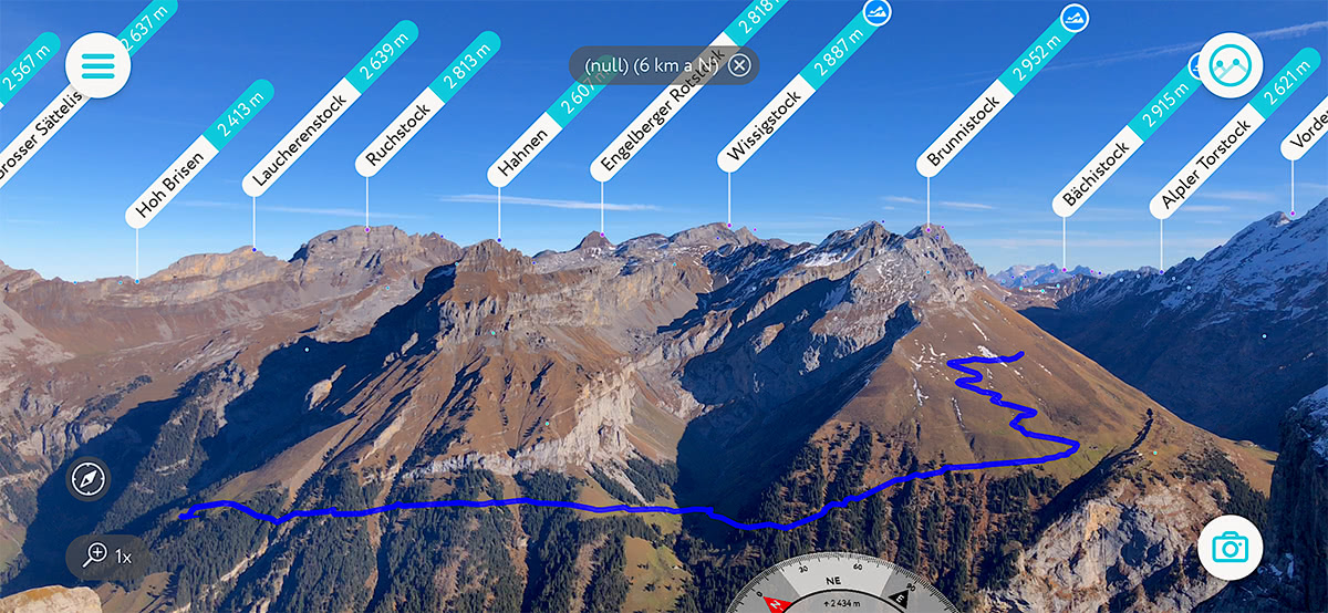
Here is one more panoramic trail above Engelberg we liked:
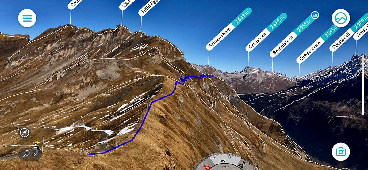
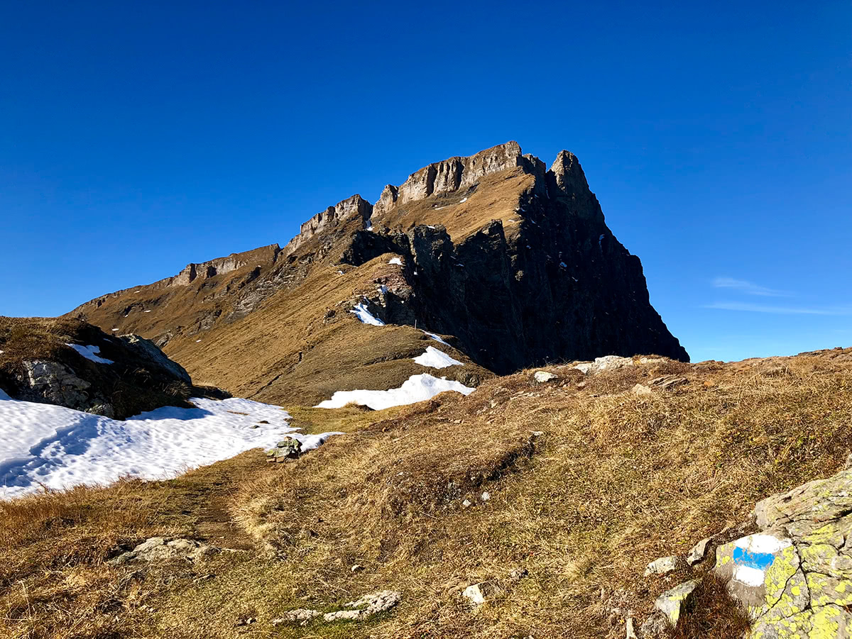
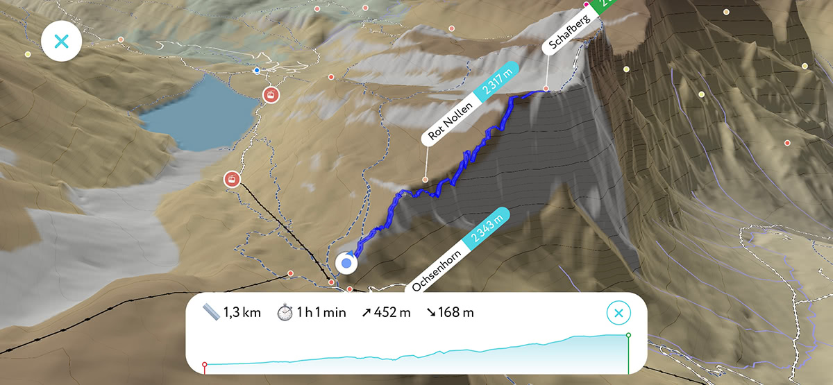
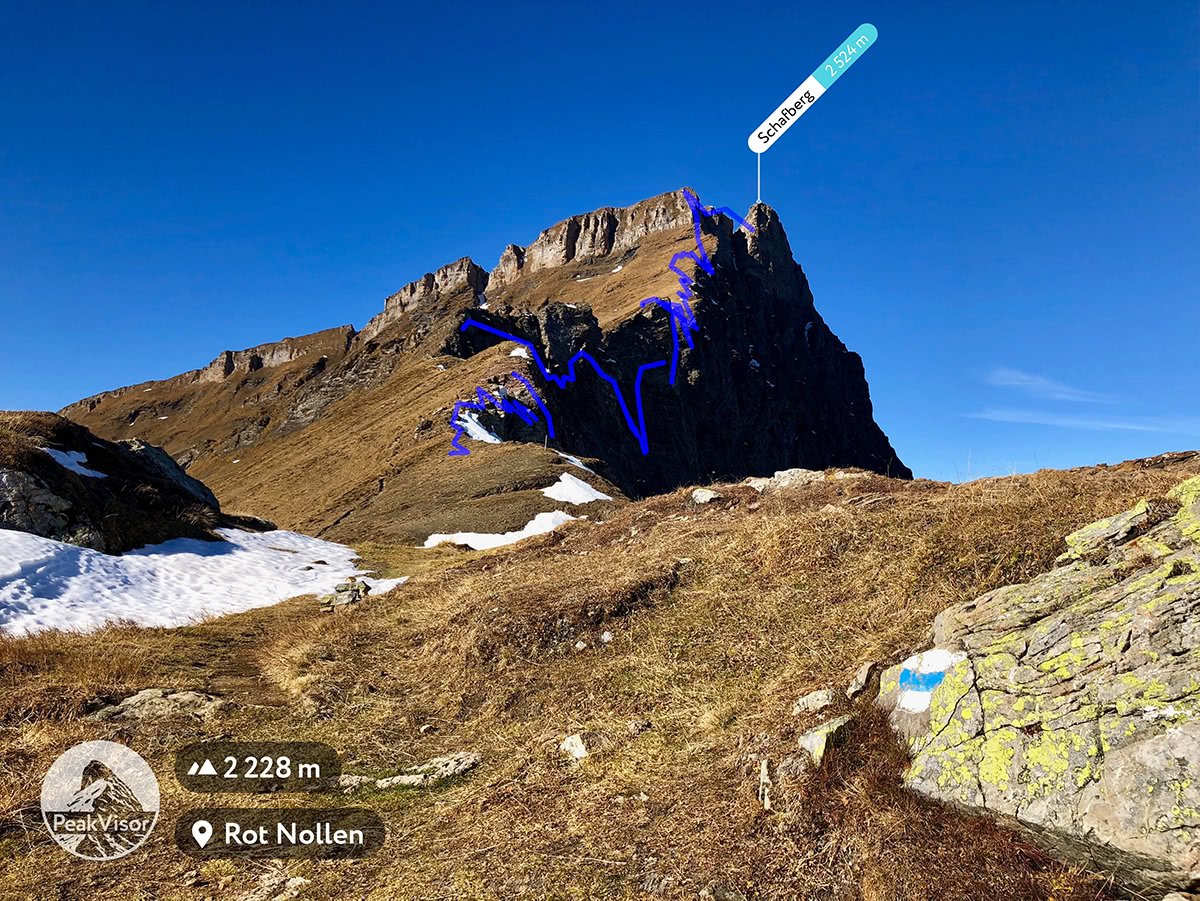
We had one interesting observation when visualising a tough alpine trail from Jochpass to Schafberg and further to Graustock. It is not ideal and there’s a huge room for improvement but you quickly grasp the idea that the chasm walk is “rough”, also the white-blue-white stripes of alpine trail indication say the same thing.
We hope that these updates urge you to go into the mountains and hike a trail. We can’t wait to see and hear about your adventures. Please send us your mountain photos with or without trails at peakvisor@routes.tips, but first of all, have tons of fun outdoors!