
The very first version of PeakVisor appeared in the Apple App Store back in late 2016. This month, we’re celebrating our first major anniversary. The app is now 5 years old, and what could be a better present than a new giant step forward in app functionality with a powerful product upgrade?
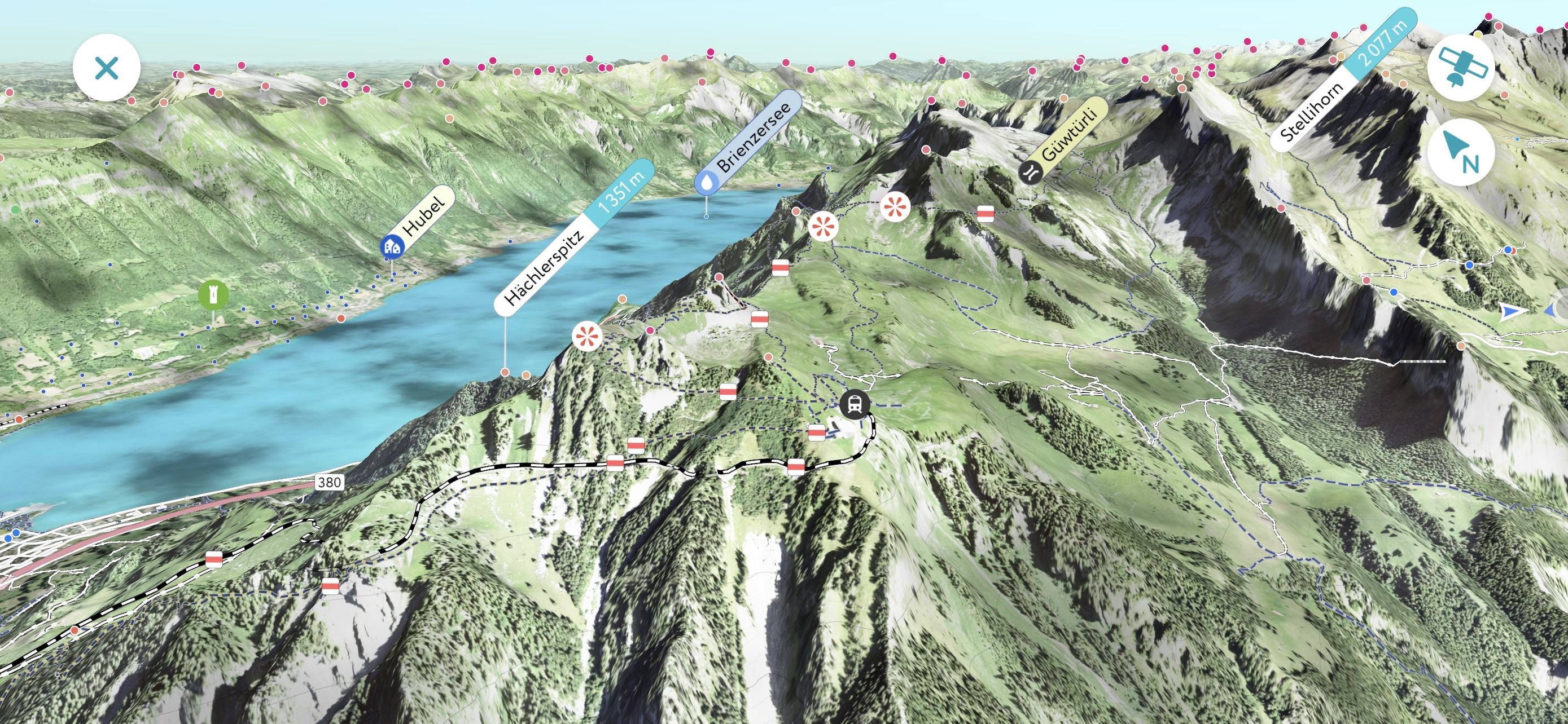
The 5th anniversary version of PeakVisor features a brand new graphics engine that’s capable of rendering satellite imagery of unmatched quality. You can easily identify everything from cars to trees while exploring an area in 3D for your next adventure.
Additionally, this latest release now lets you scroll much farther than you were previously able to without the need to teleport to reload PeakVisor’s maps. The scroll distance is now about 30 miles (50 km). After that, you’ll have to use the teleport in order to load a new area in high precision imagery. But pretty soon, you’ll be able to scroll from the Alps to the Appalachians and then to the Andes with ease.
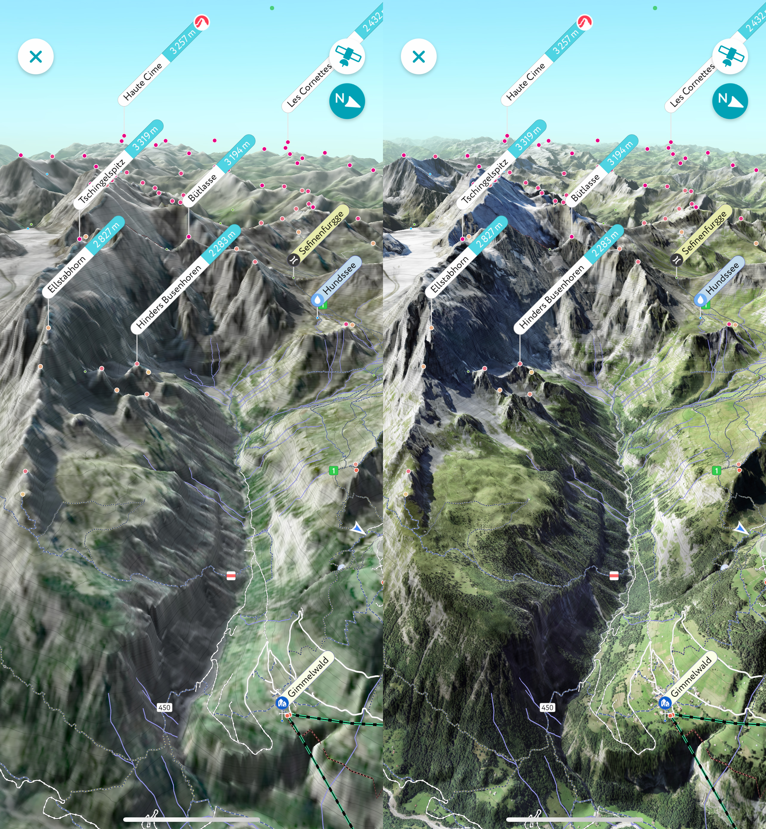
Take a look at the old and new 3D Maps as they’re compared side by side. Previously, the minimum map scale was about 30 feet (10 m) per pixel. Now it’s down to just 3 feet (1 m) per pixel.
Interestingly, these major improvements are available not only for the fancy new iPhone models but for most of the popular Apple devices from the previous years. In fact, the impact of these new improvements is even more significant on older devices.
Processing whole world satellite imagery that contains every tree on the planet is an incredibly challenging task. Right now, we’ve already published high-precision maps for the US and Switzerland. Other European countries and Taiwan will be available very soon. After that, we’ll work on releasing updated maps for the rest of the world.
Please try this newest version and let us know how it goes. Would you like to see anything improved? Did you find it useful? Send us an email at peakvisor@routes.tips, we appreciate any feedback and are set on making our app even better.