Since ancient times people have been identifying their location and direction by some landmarks supplemented with the observation of the position of celestial bodies. The very first compass was invented in China more than 2000 years ago. Interestingly, it wasn’t used for navigation back then, but to harmonize dwellings according to feng shui principles. Nowadays, almost every mobile phone has a compass that lets you easily identify the direction in an instant. But how precise it is?
The sensor responsible for the compass data in mobile phones is called magnetometer as it measures Earth’s magnetic field. The complexities are numerous for this hardware. It should measure magnetic field having an incredibly small form factor, operating inside a metal box, with many strong electromagnetic fields around. Luckily, humans not that often rely solely on mobile phone compass.
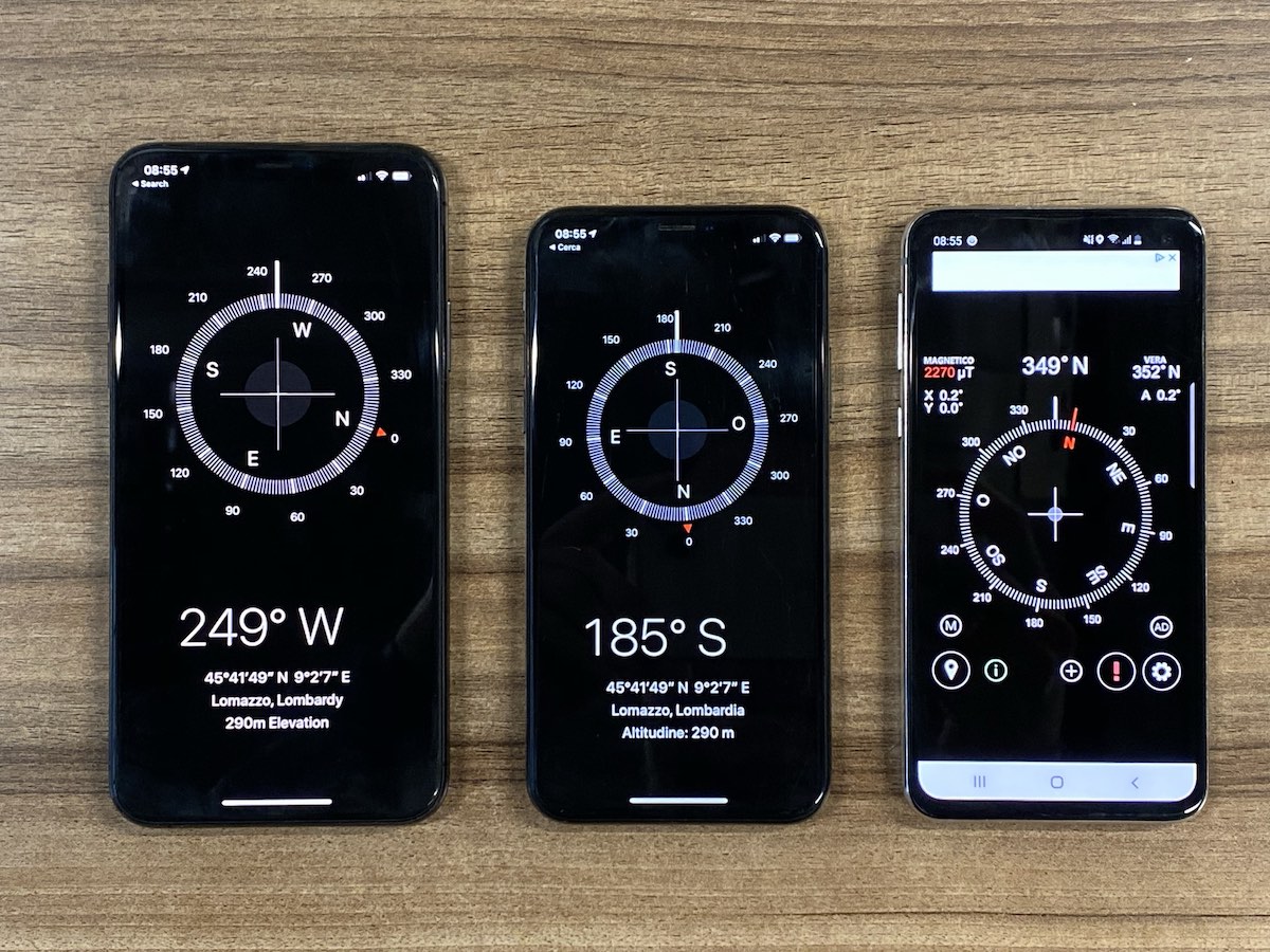
Apparently, oftentimes mobile phone magnetometer precision is about 5 degrees. That’s more than enough to evaluate your heading in the map app. But that’s an enormous bias when it comes to Augmented Reality applications. The difference in azimuth between two landmarks e.g. mountain summits might be just a fraction of a degree! The situation is getting worse when there are strong external magnetic fields or when the temperature is out of the sensor’s comfort zone. It is not that rare to see compass readings drift at a constant pace making the north seemingly run around your phone. Some phones are more inclined to provide very distorted data for compass, the north arrow is constantly wobbling +/- 10 degrees.
For this very reason, many outdoor Augmented Reality apps had to ask users to adjust the compass manually. In PeakVisor app, outdoor enthusiasts had to position mountain panorama over camera image so we could compensate compass bias in the app. At the same time, technologies like Apple ARKit help eliminating compass drift by using visual data. Briefly, they coordinate visual changes coming from a camera with sensors reading and understand when sensors data gets wrong.
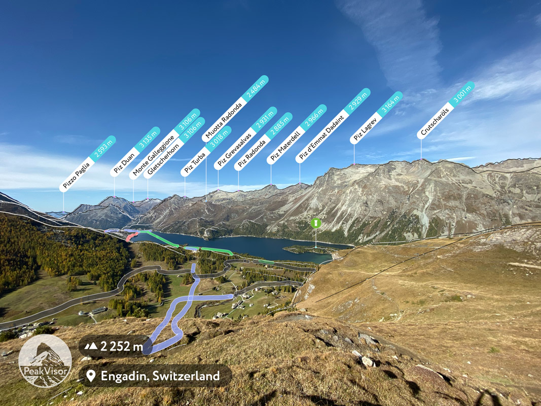
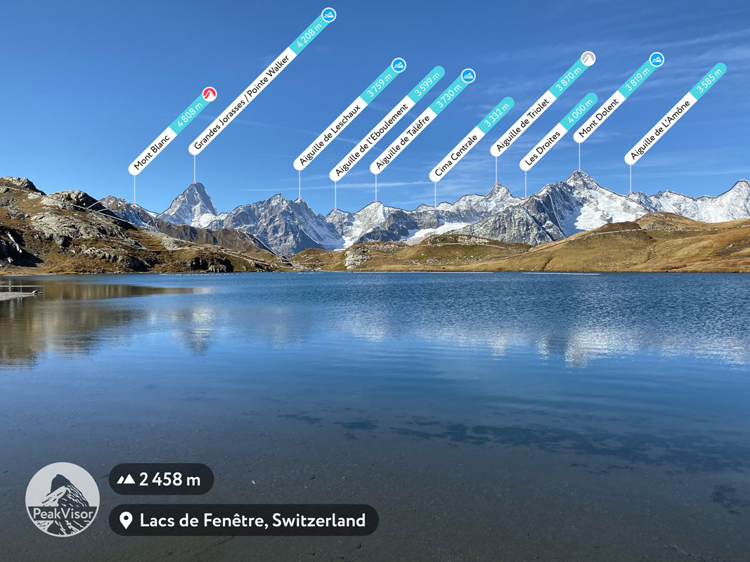
A mountainous landscape itself has a lot of information about cardinal directions. In fact, mountain silhouettes are unique enough to identify true North as precisely as with the help of celestial bodies and complex equipment to measure angles. But that can be taken to the next level, seeing enough mountain silhouettes at the same time one could precisely evaluate one’s own location without GPS!
PeakVisor uses mountains in plain sight to automatically adjust compass bias and thus eliminates the inconvenient and confusing process of manual adjustment. By evaluating cardinal directions this way in the PeakVisor app, we achieve “several pixels” precision which is oftentimes significantly better than 1 degree! It is effectively the best mobile phone compass to date. This “magic” became possible thanks to the latest improvements in technologies like CoreML, Artificial Intelligence, and Apple’s Neural Engine. The only alternative to achieve such precision is a bulky professional-grade magnetometer which isn’t convenient to carry while exploring the wild elements and carrying an already heavy backpack.