
It takes some time and effort to plan an exciting hiking adventure. Flat maps might be misleading in terms of the big input required to estimate the complexity of the hike, but PeakVisor Mountain Explorer comes in handy when it gets to planning any mountain endeavour.
Let’s say we are planning a scale to Matterhorn summit. That’s a great deal of hiking. The trail looks like this:
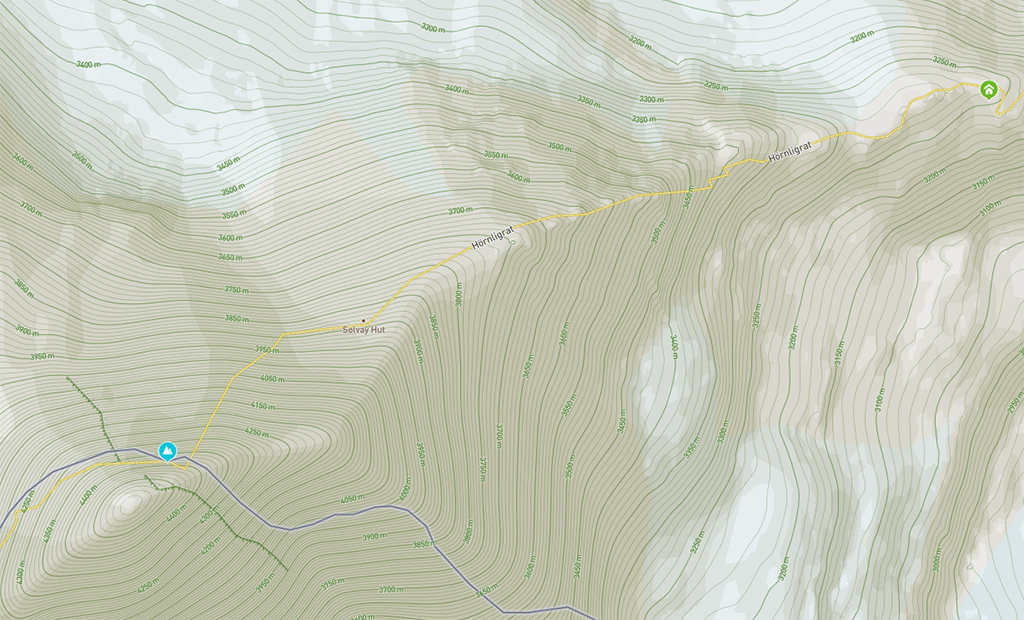
Pretty straightforward, huh? But in fact it is very demanding. Matterhorn is the most difficult classics in the Alps. The climb and descent is done exclusively over rocks and ice, and it requires outstanding fitness and experience in rock climbing with and without crampons. The normal route is via Hörnligrat and is only suitable for well-trained mountaineers accompanied by a mountain guide.
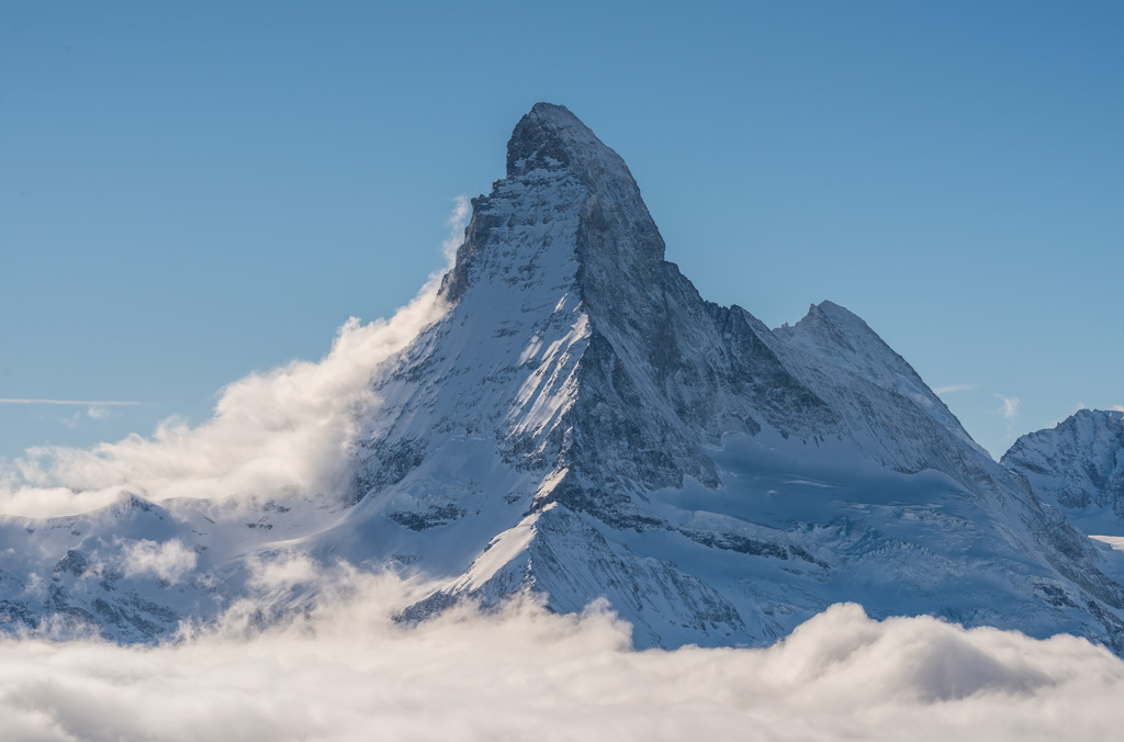
But if you take a look at this trail from another mountain it would be quite obvious that the hike would turn into a climb. The photo was taken from Unterrothorn summit. Here’s how the trail looks like in real.
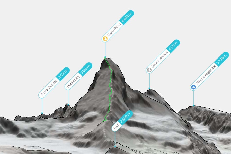
It is time to get into the secrets. There’s a hidden feature in PeakVisor Mountain Explorer. It allows you to render any trail in 3D on real landscape! So now you can evaluate the difficulty of the climb correctly.
How to see a trail in 3D
- Locate Mountain Explorer to a viewpoint from where you’d like to see the trail. You can use mountain search, teleport to a mountain in a 3D panorama, or, simply, drag the current position on the map.
- Press Control + Shift + Z and choose a file with the trail data. It might take several seconds for it to appear.
In order to render the trail in 3D you need a GPX or TCX file with the trail. These two are the most common formats. For example, the Strava app allows exporting them.
If you don’t have a trail and can’t find it on forums where mountaineers publish their trails then you might like to know that pretty soon we are going to make it possible to route trails between two locations. Everything within the Mountain Explorer! Or, by the time you are reading this the routing feature may already be available! Feel free to drop us a line, we’d love to talk to fellow hikers and mountaineers.