
Just like rivers, mountains are often natural boundaries between countries and administrative regions. In the mountains more often than not state borders go along mountain ridges and summits. All over the world you could notice centuries old border stones which were used for indicated a border, usually with a year inscribed. We find something especially thrilling walking the ridges and state borders at the same time. What could be more exciting than having your left leg in Switzerland and the right leg in Italy?!
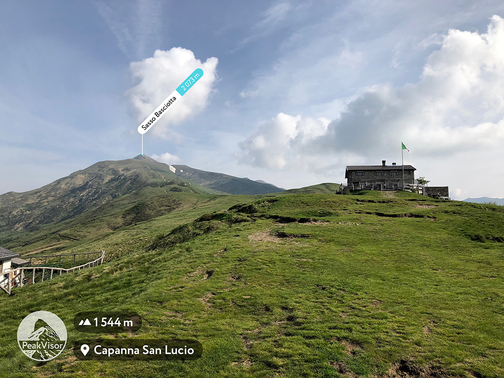
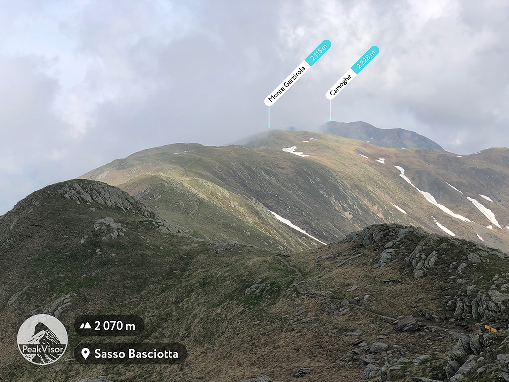
This is exactly the case of the epic ridge hike in Lugano Prealps from San Lucio Pass through Sasso Basciotta, Monte Garzirola, Cima del Vallone, and dozens of others, all the way to Monte Marmontana and Monte Torresella. Along the way you are accompanied by Italian trail markers, state border stones, and Swiss trail markers. In some places you can even notice remains of barbwire reminding you that travels weren’t always free to flee wherever they wanted.
In order to support you and make your hikes more informative PeakVisor provides information on administrative division for every peak possible. And we have almost a million of them in PeakVisor. So, you could easily find which country or countries a peak belongs to. At least in the cases when there are no disputes, unlike the Italy vs. France battle whether the border goes through the summit of Mont Blanc or not.
Having analyzed thousands of administrative regions we provide detailed mountain information about every meaningful area. You could easily find out the amount of named mountains in the area, top 10 highest and top 10 most prominent summits. For example, there are 28,138 named mountains in Italy and 9,942 named peaks in Switzerland. But you could climb higher into 2,959 mountains of Lombardy, astounding 215 of them are in the province of Como alone. All the knowledge of Mountain Explorer is at your service!
The map in the Mountain Explorer shows borders and trails as well, so you can find the best border trail with scenic views. For your inspiration, here is our pick of state border trails with thrilling landscapes on both sides.
Swiss - Italian Border
San Lucio pass - Monte Garzirola - Monte Marmontana.
Passo dello Stelvio
Dreisprachenspitze - Piz Cotschen.
Tyrol
Helm (Monte Elmo) - Hornischegg (Monte Arnese) - Hollbrucker Spitze (Cima di Pontegrotta) - all the way to Große Kinigat (Monte Cavallino).
It is one of the longest border trails which follows Austrian - Italian border. Both sides are Tyrol, and South Tyrol is famous for the Dolomites mountains. The trailhead at the summit of Helm (Monte Elmo) is reachable by a cable car from the village of Sexten.
Tripoint
A trail to the Peč / Ofen / Monte Forno.
In all the languages it means the “oven”. You are free to pick any combination between Italy, Austria, and Slovenia in order to choose the trail. But at the top you need an extra gymnastics exercise to have three countries touched at the same time! So welcome to play Twister!
Melosa Pass
Monte Pietravecchia - Monte Saccarello - Monte Bertrand - Punta Marguareis.
Another long trail from almost the seaside all the way up to Punta Marguareis - the highest point of the Ligurian Alps. The trail follows French-Italian border with small deviations.