
Share

Scan the QR code and open PeakVisor on your phone
Scan the QR code and open PeakVisor on your phone
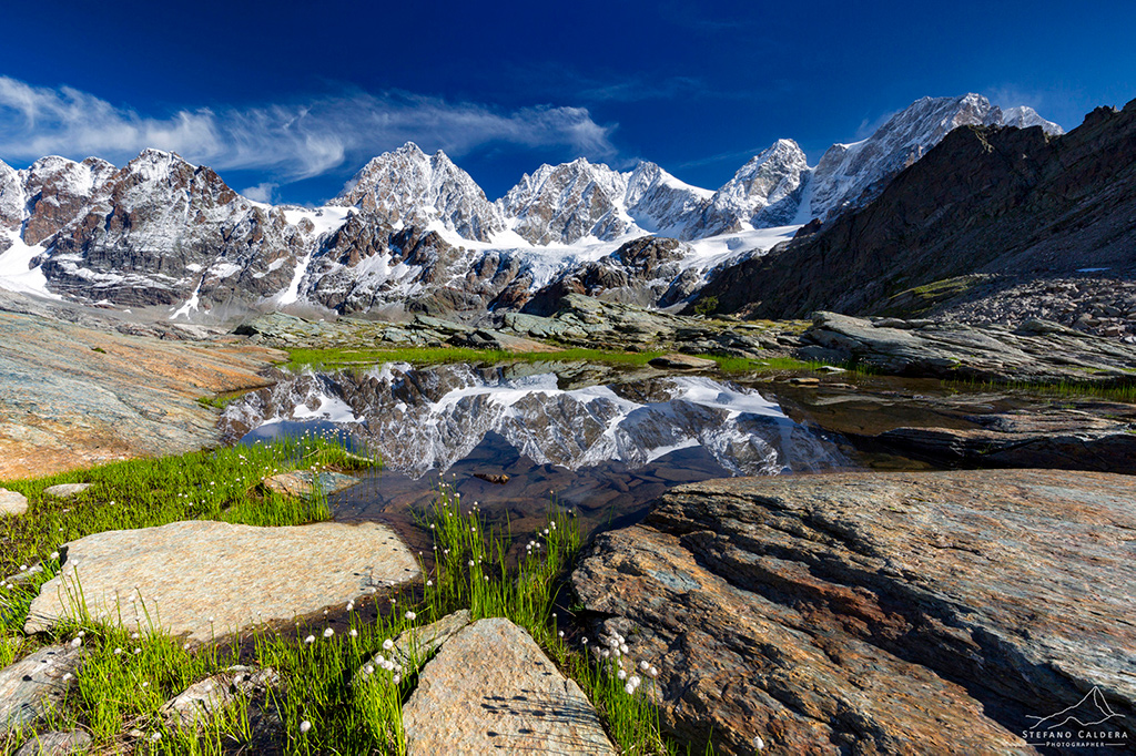
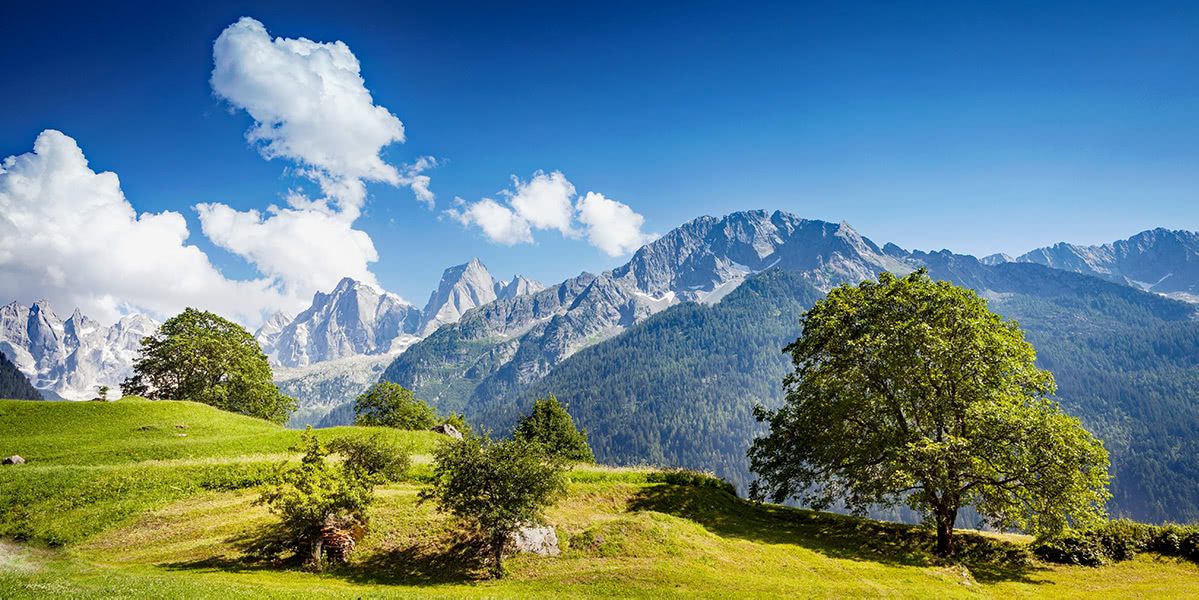
Grisons (Graubünden in German language) is the easternmost canton of Switzerland. Covering 7,105 square kilometres it is also the largest one. Interestingly, Grisons is the only trilingual canton. There are three official languages in this area - Swiss German, Italian, and Romansh. The latter is one of the descendant languages of the spoken Latin language of the Roman Empire. There are 2,094 named mountains in Grisons canton. The highest and the most prominent mountain is Piz Bernina, the easternmost alpine 4000er. There are many “Piz” mountains in here, as it means “Peak” in the Romansh language.
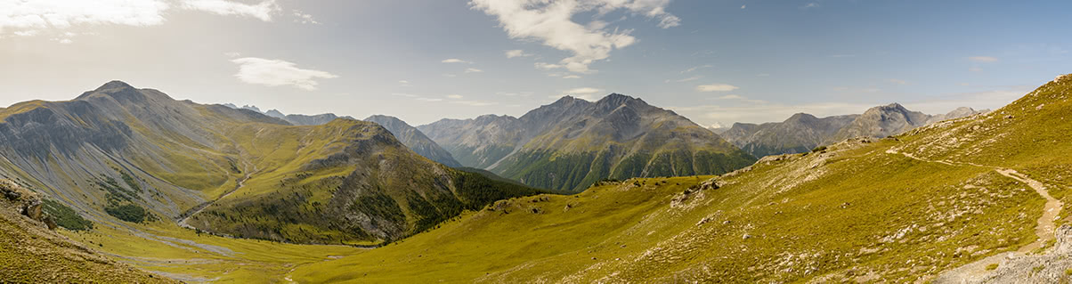
There are two major Alpine ranges in the canton:
Oftentimes Grisons is considered to be the wildest of Swiss cantons. It is home to the unique features:
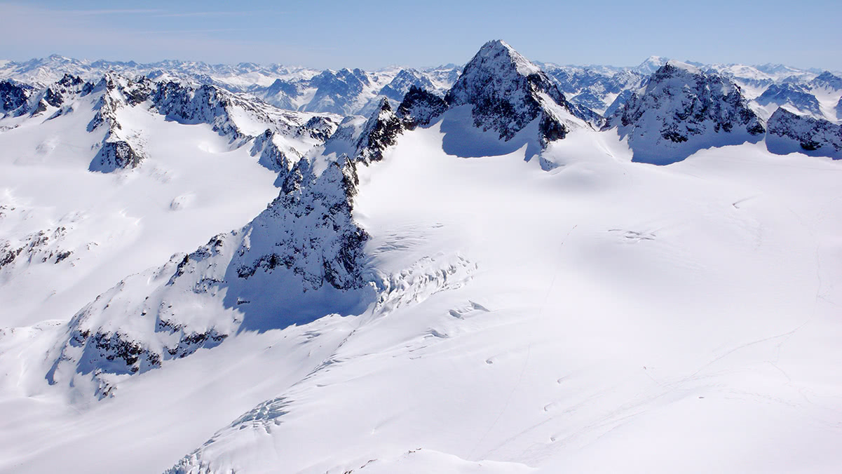
Swiss National Park panorama
Another important highlight of this region and UNESCO World Heritage Site is called “Rhaetian Railway in the Albula / Bernina Landscapes”. It travels 145 km and links the town of Tirano (1,822m) in Italy with famous St. Moritz (1,822m) via the Bernina Pass (2,253m at the highest point). Thinking of postcard quality photos of Switzerland one can’t skip viaducts of Grisons. For example this spiral viaduct in Brusio is close to Italian border.
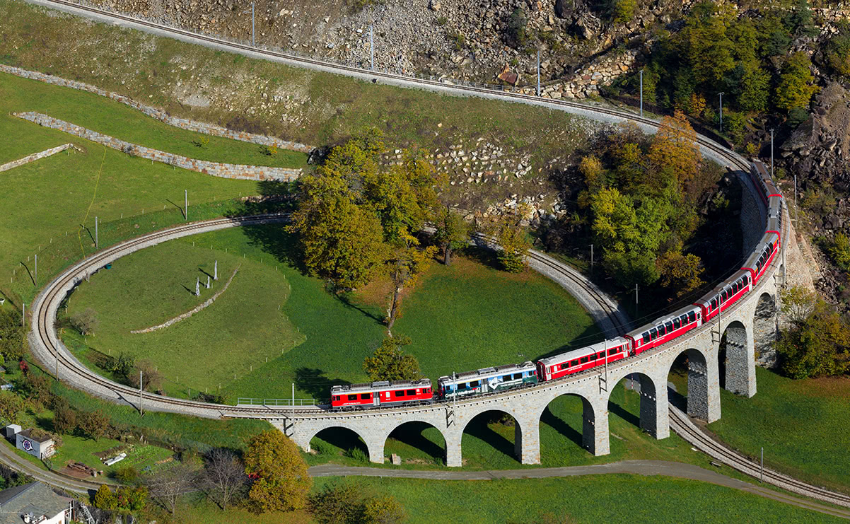
Brusio Spiral Viaduct
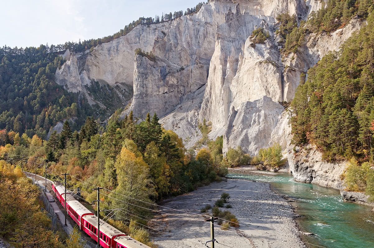
Glacier express is the slowest express train in the world, it takes 8 hours to get from St. Moritz to Zermatt. It passes through probably the world most famous Landwasser Viaduct and the Rhine Gorge, Switzerland’s very own Grand Canyon.
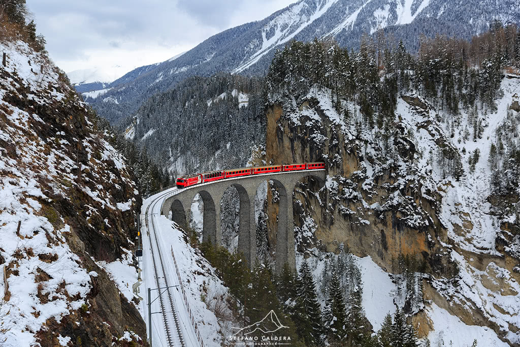
Landwasser Viaduct
Swiss writer Johanna Spyri as a child spent several summers near Chur, the capital of the canton. The mountainous setting she later used in her novels, especially the world famous Heidi.
Taking into account the large alpine area and natural diversity of Grisons, it is safe to assume that a passionate outdoors enthusiast needs at least one week to cover the highlights and the most impressive trails.
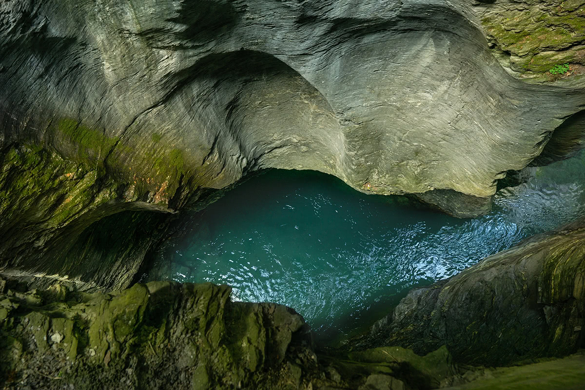
A little known place of exceptional beauty is lake Cauma near the village of Flims. Its emerald waters, alpine scenery, and recreational facilities make this place ideal for a family walk. A short hike from the lake leads to a panoramic observation deck high above the Rhine gorge.
Rhine Gorge
The Beverin Nature Park encircles Piz Beverin (with the elevation of 2,998m it is the highest in the park). The most interesting features in the park are deep frightening canyons (the Viamala and Roffla gorges) and preserved alpine village scenery. Those in search for unobstructed panoramic views can scale Piz Beverin.
Viamala Gorge
Park Ela is the largest Swiss nature park. Due to vast territory there’s a wide variety of hiking trails and excursions available. One of the most popular destinations in the park is the high-altitude plateau Alp Flix. Famous for biodiversity and idyllic alpine landscapes Alp Flix is a perfect setting for a hike. A vast network of hiking trails allows everyone to find an ideal trail of desired skill level.
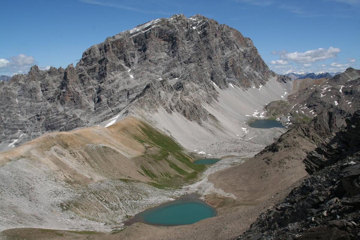
One of the highlights of the region is Matterhorn-resembling prominent peak called Piz Platta (see the photo below).
The River Inn (En in Romansh) flows from the headwaters at triple watershed at Lunghin pass until it reaches Austria 100 km downstream. The valley along the river is called Engadin or Engadine (from Romansch: the Valley of the Inn people) and it forms a wide stripe on the canton’s southern border with Italy. Interestingly, the Inn subsequently flows into the Danube which makes it the only Swiss river to drain into the Black Sea.
This 100-km long valley is split into two parts: more famous and more developed Upper Engadine and wilder and less urbanized Lower Engadine. First, hikers usually start with the Upper Engadine highlights.
One of the biggest gems of Engadine is the easternmost 4000er of the Alps - Piz Bernina. It is a spectacular massif from every angle and it alone deserves several days of exploring.
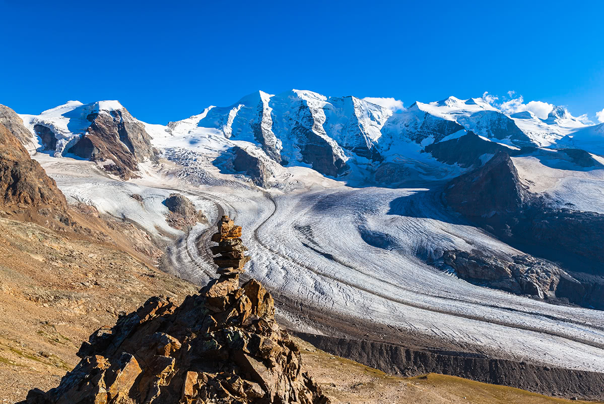
A view from Munt Pers at the Bernina Group’s Piz Palu and massive Morteratsch glacier
Apart from the world well known red alpine train with the same name (Bernina Express) the place boasts of amazing cable cars with alluring names in Romansch language: Lagalb (white lake) and Diavolezza (she-devil). Piz Lagalb offers a spectacular view over the whole Bernina Group. At the same time, Diavolezza provides a much closer look into the heart of the group and its glaciers. Munt Pers view in the photo above is less than an hour hike from the Diavolezza top station with a mere 300m elevation gain.
Maloja is a tiny locality in the very beginning of the Engadine. Maloja pass links Val Bregaglia with the Engadine valley. The place is well known for being an inspiration and home to Italian painter Segantini who is famous for his large landscapes of the Alps (check out our article “Art in the Mountains” for more details). Segantini's house with the atelier is at Maloja.
Art-inspired hikers could follow the Segantini path - a walk on the traces of Segantini. The trail goes through the places related to the artist: the lookout tower, the marmites of the giants which were the setting for the painting "La vanità" (The vanity), and the tomb of the Segantini family.
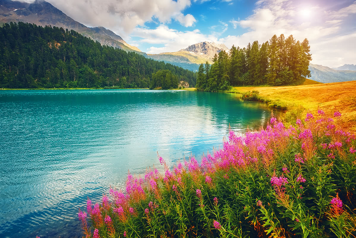
Lake Champfèr
Another trail of particular geographic interest from Maloja leads to Lunghin Pass with a possible extension to Piz Lunghin. There is a three-way watershed at Lunghin Pass:
The trail from Maloja to Piz Lunghin, is 5-km long with 1-km elevation gain and it takes almost 3 hours.
Lunghin Pass. Photo by Schölla Schwarz [CC BY 3.0], via Wikimedia Commons
A hike to the ice tongue of Morteratsch Glacier is an easy one but of very high naturalistic interest and rich in spectacular views. It takes just 50 minutes from the Morteratsch railway station (there’s a parking area nearby) and it is advised for families. Along the trail there are 16 posts which inform about the retreating glacier.
Those looking for a more challenging destination and a better vantage point on the glacier could hike to Chamanna da Boval. The trail from the same railway station is slightly more than 5-km long with 720-m elevation gain and it takes 2 hours and a half one way.
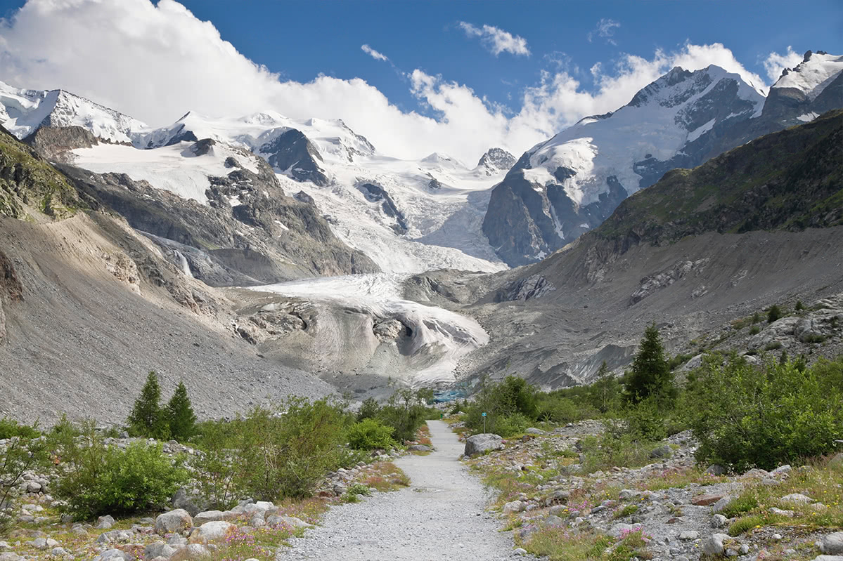
Trail to Morteratsch glacier. Photo by Ximonic (Simo Räsänen) [CC BY-SA 3.0], via Wikimedia Commons
A highly popular scenic trail starts from Muottas Muragl top station and first leads to the high-altitude pristine alpine lake Lej Muragl at the foot of Piz Vadret and Piz Muragl. The next stage is the hike to Chamanna Segantini mountain hut for a lunch with a view over the high peaks of the Bernina Group. The final part of the journey is the descent to the Alp Languard chairlift station which runs down to Pontresina. From there you can take a bus to Punt Muragl if you happen to have left a car at the parking lot.
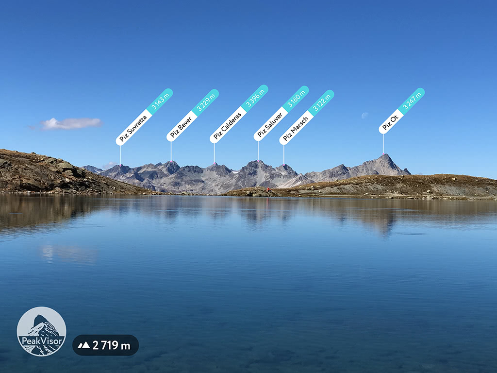
3,055m tall Piz Nair is the highest summit reachable with a cable car from Sankt Moritz. Boasting of the abundance of spectacular views in all directions Piz Nair is worth a visit anyway. But instead of descending with the same cable car one can undertake a day-long excursion. Descend to Lej Suvretta at Suvretta Pass and then traverse Fuorcla Suvretta to reach the Bever Valley. From there you can descend to Chamanna Jenatsch at the foot of Piz Jenatsch and Piz Calderas, an ideal place for a well-earned delicious lunch. Having replenished the energy you’ll be ready for a long descend along the Beverin river to the village of Bever. Due to significant elevation difference (from 3,055m down to 1,700m) this excursion is interesting for a gradual change from unearthly rocky landscape to grassy Alpine pastures and then to larch woods.
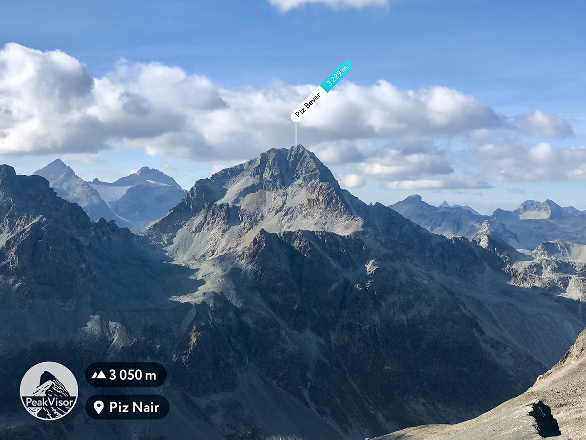
Piz Bever as it is seen from Piz Nair
Much wilder and less developed Lower Engadine is famous for Swiss National Park, natural spas (t.g. Engadin Bad Scuol), Tarasp Castle (a Swiss heritage site of national significance), and the so-called Lower Engadine Dolomites.
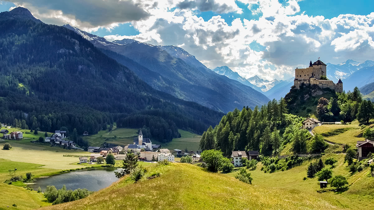
Tarasp Castle
The main city Scuol, nested between the peaks of the Silvretta Alps range constituting natural border between Switzerland and Austria, and the Sesvenna Alps range (oftentimes referred to as Lower Engadine Dolomites), reminding majestic Italian peaks.
The major peaks of the Silvretta Alps range are Silvrettahorn, Piz Linard, and Piz Buin. Those are the peaks which inspired Hemingway’s “An Alpine Idyll” short story.
The Sesvenna Alps range is totally different. Those are very jagged and densely forested peaks. Piz Sesvenna and Piz Lischana are the major mountains of this range.
Swiss National Park is located in the Engadine but due to its naturalistic importance deserves a dedicated section. The core idea of the park was to allow the unhindered development of nature without human interference. Now, more than 110 years later, we are just in the beginning of seeing how the Alps would look like without people. There are 80 kilometers of hiking paths and nature trails for various levels of skills in the park.
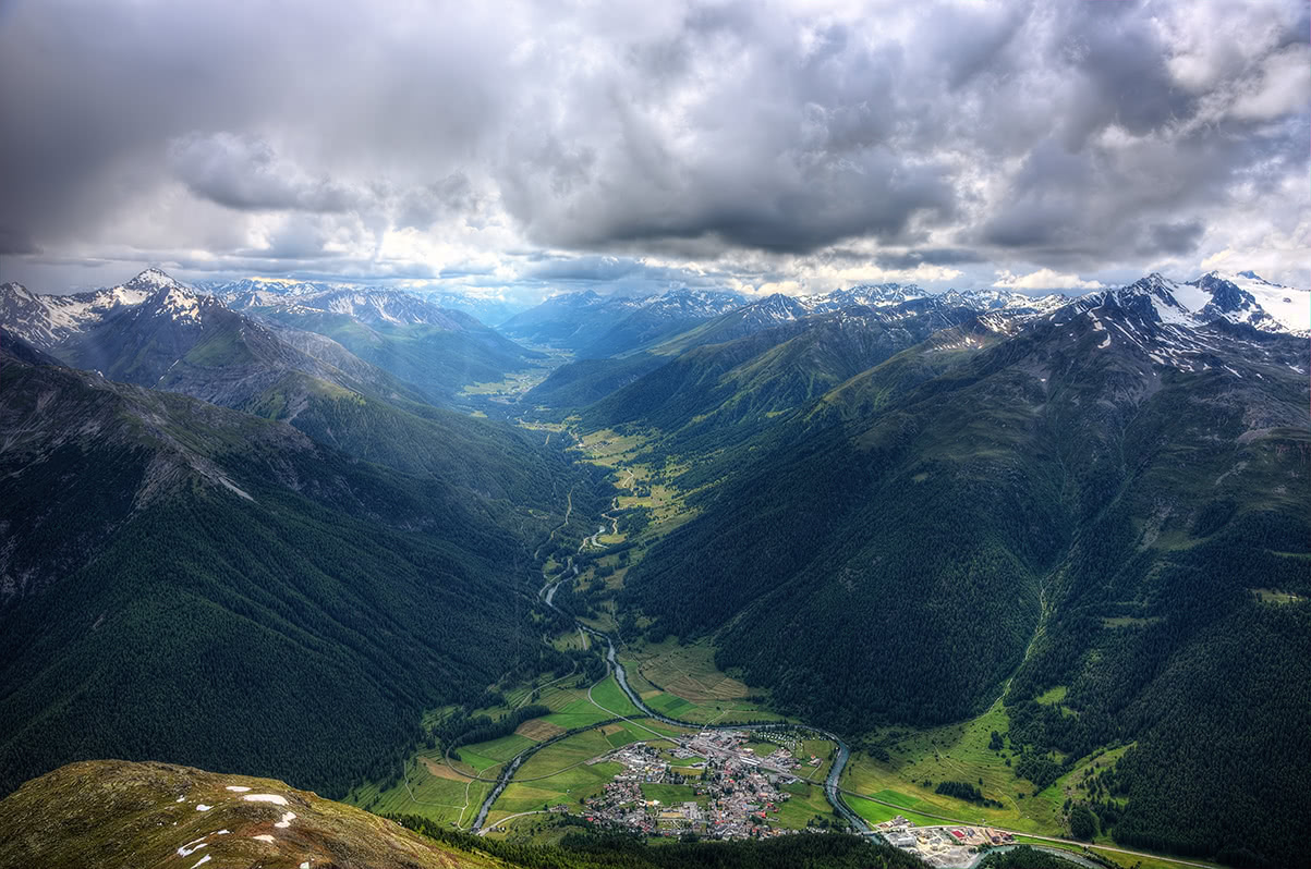
The village of Zernez
One of the most scenic hikes in the park is a demanding trail to Munt Baselgia (a view towards Zernez and the Upper Engadine valley in the photo above). From the summit of Munt Baselgia, visitors can enjoy a panoramic view of the town of Zernes down below and the Macun plateau of lakes. Instead of returning the same route to Zernez one can extend the hike towards Macun lakes and descent to the small town of Lavin with regular trains to Zernez.
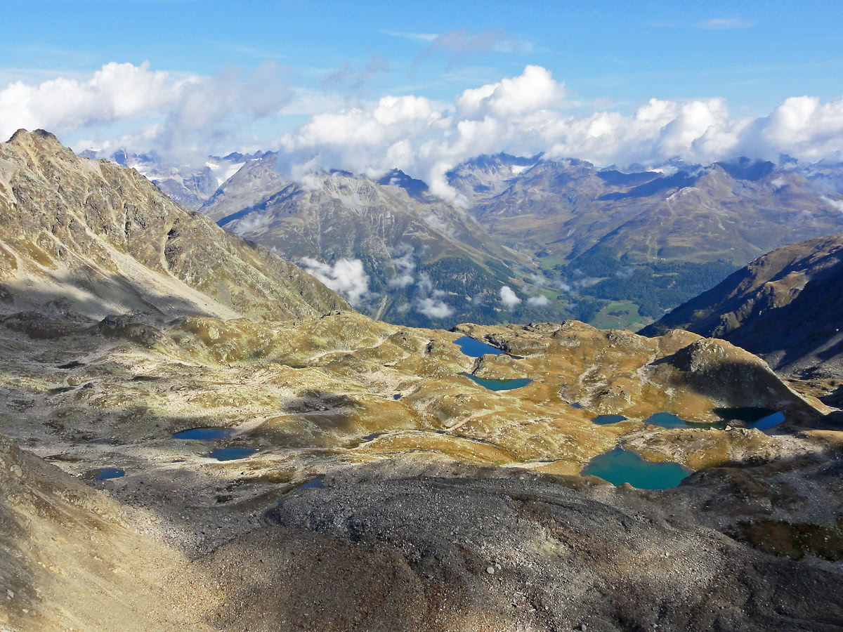
Macun lakes as seen from Munt Baselgia
A view from Alp la Schera towards Livigno lake and towering Cima Paradiso, Pizzo Murtaruo, and Piz dal Diavel
The trail to the summit of Munt la Schera is one of the most spectacular treks in the Swiss National Park. One of the trailheads is at the Swiss border control parking area. It takes less than 3 hours and 800 meters of elevation gain to reach the summit. Somewhat near the middle of the trail there’s spectacular Alp la Schera (see the photo above).
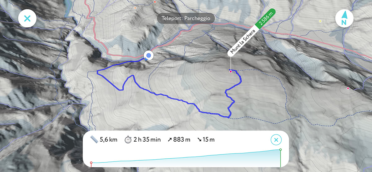
3D map of the trail to Munt la Schera summit in the PeakVisor app
Besides Munt la Schera, the only peak lying completely within the Park that is accessible to visitors is Piz Quattervals. The trail starts from Chamanna Cluozza and it takes about 4 hours and 1400m of elevation gain to reach the summit. Being the highest mountain of the Swiss National Park Piz Quattervals offers unbeatable views of surrounding mountains. Majestic Ortles, Piz Bernina and Piz Palu of Bernina Group, and Piz Kesch just to name a few of the most prominent.
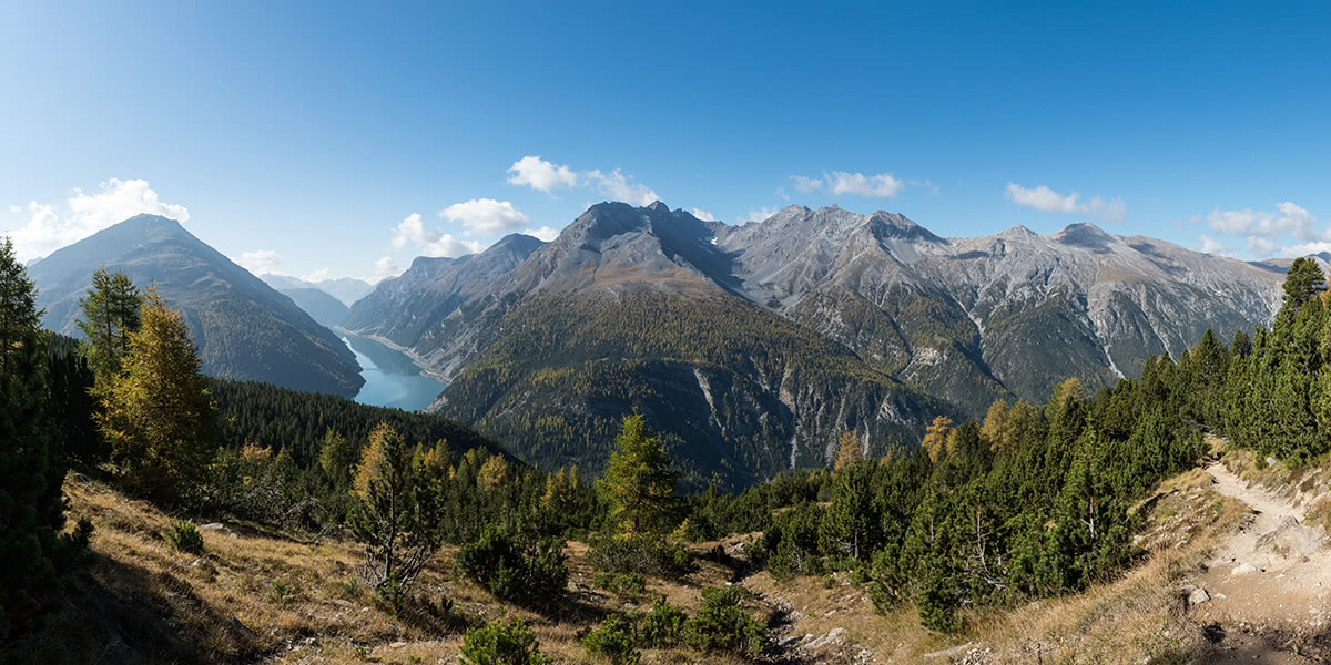
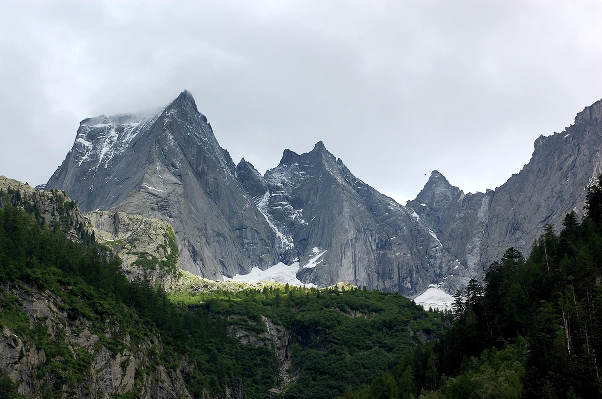
Val Bregaglia view with Pizzo Badile, Sciore, and Piz Cengalo in the background
Val Bregaglia is a relatively small valley approximately 25 km long. It is located between Maloja Pass and Chiavenna in Italy where the valley joins Spluga Valley. The most famous mountains framing the valley are granite giants Piz Badile and Piz Cengalo. In fact, Piz Badile north-east face is considered one of the six great north faces of the Alps!
Piz Badile. Photo by Biovit [CC BY-SA 3.0], via Wikimedia Commons
Probably the best trail to appreciate the beauty of these granite giants is the trail from the small Swiss village of Soglio up to ancient alpine dwellings of Tombal, Plan Vest, Bruscia, Cadrin, especially in the evening when the valley and granite faces are lit with the warm sunset light.
Another highlight of the valley is the Acquafraggia waterfalls. Located just beside the main valley road the waterfalls create a scenic landscape appreciated by locals and travelers alike. There are several trails near the waterfalls to appreciate them from several angles.
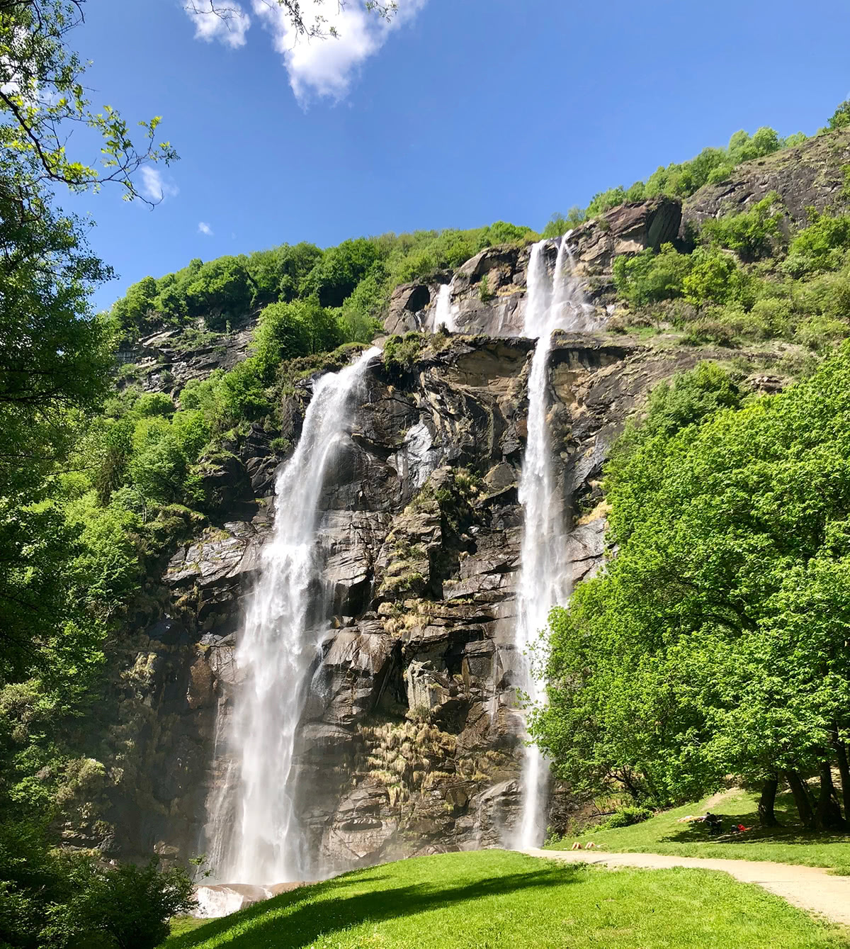
Acquafraggia Waterfalls
One of the biggest ski resorts Davos Klosters on the eastern edge of canton and Switzerland as a whole offers a variety of hiking trails.
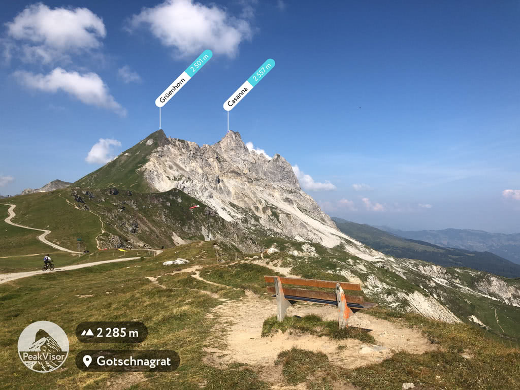
Arguably the best way to become acquainted with Davos Klosters area is to take a panoramic walk from Gotschnagrat to Weissfluh. It is the highest vantage point easily accessible with the help of a cable car and it allows unobstructed 360 views in the very center of the Western Rhaetian Alps. Another hidden gem of this place is a view on rainbow slopes of the mountains (see the photo below).
Heading southeast from Klosters one could take a long and demanding hike to Silvrettahutte at the foot of Silvrettahorn and even reach the ice tongue of the glacier.
Finally, there’s a network of hiking trails starting from Madrisa top cable car station around the mighty and rocky Madrisahorn. A popular destination is a pass near the Rätschenhorn. From there depending on the skills and time available one could even cross to Austria.
Those interested in the history of the mountains, in geology, or at least curious how these wonderful landscapes appeared can’t miss the Unesco World Heritage Site - Swiss Tectonic Arena Sardona. There are many trails in the area. The most popular two are probably these:
For skiing and snowboarding enthusiasts, there are more than 60 ski resorts in Grisons (Graubünden), which are located throughout the canton. Given the large number of resorts, their size, and location in the highest mountains of the Eastern Alps with Piz Bernina (4,049 m / 13,284 ft) at the top of the list, this is one of the main areas for skiing in the Swiss Alps.
The largest ski resort in Grisons (Graubünden) is Silvretta Arena (Ischgl, and Samnaun) with more than 230 km (143 mi) of slopes and more than 40 ski lifts, which are partly located in Tyrol in Austria.
Other major areas for skiing in Grisons (Graubünden) with more than 50 km (31 mi) of slopes and more than 5 ski lifts each include the following in descending order of size:

The main ski resort near Chur, the capital of the canton west of a bit more known Davos, is Brambrüesch/Dreibündenstein-Chur with more than 20 km (12 mi) of slopes and more than 5 ski lifts.
Check the Grisons (Graubünden) ski resorts map as well as the larger Switzerland ski resorts map in the World Mountain Lifts section of the site. It includes information about open ski lifts / slopes in Grisons (Graubünden) in real-time with opening dates and hours. There are also year-round cable cars, funiculars, cog railways, aerial tramways, and all other types of mountain lifts.
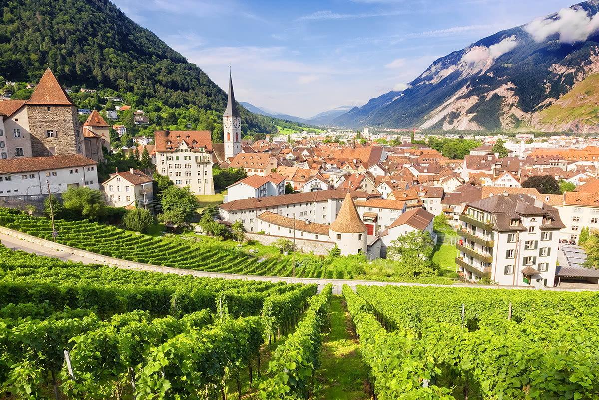
Chur is the capital of Grisons and, being inhabited since 3000 BC, it is the oldest city in Switzerland. Right from the old town of Chur, the Brambrüesch cable car ascends to a plateau with trails, panoramic views and winter ski slopes. The trails to Fulhorn and Fulenberg start there and offer exceptional panoramic views of several valleys and numerous peaks, including Parpaner Rothorn, Aroser Rothorn, Parc Ela’s Lenzerhorn, Piz Beverin (the highest peak of Beverin Park).
Sankt Moritz is the town of exceptional importance in the history of mountain tourism, mountain art, and winter sports. This fashionable mountain resort located at the core of Upper Engadine Valley has been attracting the world's rich, titled and famous for more than a century. Among celebrities who adored Sankt Moritz were Alfred Hitchcock (who had his honeymoon here), Vivien Leigh, Claudia Schiffer, Kate Moss and Robert De Niro, just to name a few.
Sankt Moritz is considered to be the birthplace of winter tourism when in 1864, Johannes Badrutt, the owner of the new Kulm Hotel St. Moritz invited guests to stay during the winter. Spending winter in the mountains and enjoying winter activities was something hardly imaginable. His marketing proposition was astounding, he promised not to charge the guests for the stay If they failed to enjoy the winter while staying at his hotel. Luckily, those first tourists truly enjoyed their time in Sankt Moritz and the whole industry of winter tourism was born. Later in 1878, in the saloon of the same Kulm Hotel the very first electric bulb in Switzerland was lit up. Now, 140 years later, visitors can still see it.
Switzerland hosted Olympic Winter Games twice, and both times Sankt Moritz was chosen as the venue. Also it served twice as a location for James Bond films, "The Spy Who Loved Me" and "A View to Kill."
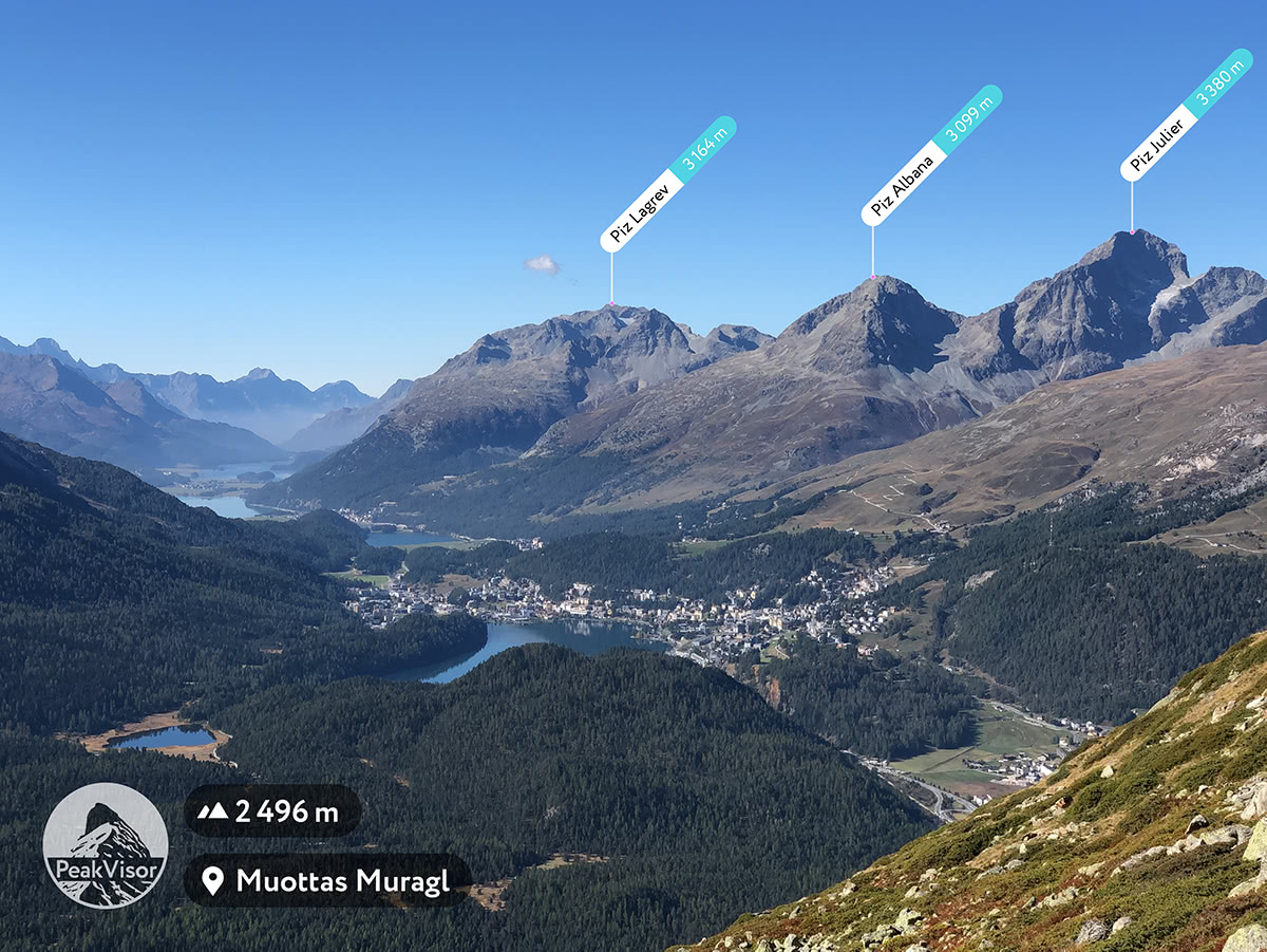
Upper Engadine lakes, Sankt Moritz and the peaks: Piz Lagrev, Piz Albana, Piz Julier
Famous for hosting the World Economic Forum (WEF), an annual meeting of global political and business elites, Davos is also one of Switzerland's biggest ski resorts. In summertime vast area around Davos becomes a hiker’s paradise.
Davos in summertime
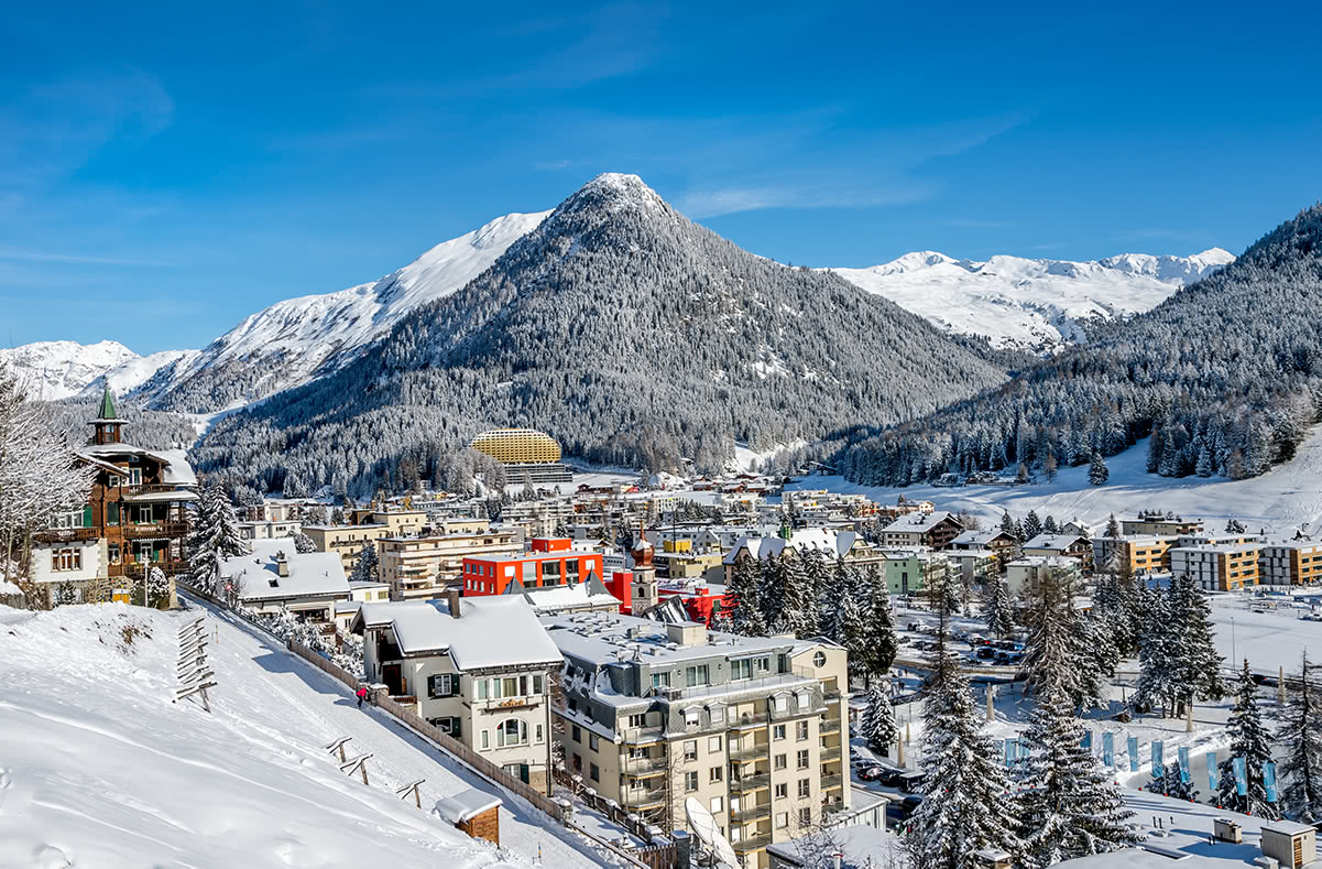
Davos in wintertime
Explore Grisons with the PeakVisor 3D Map and identify its summits.


top50
ultra
glacier
alps-4000ers
italy-ultras
switzerland-ultras
top50
ultra
glacier
alps-4000ers
italy-ultras
switzerland-ultras


